කැනරි දූපත්
කැනරි දූපත් Canarias (ස්පාඤ්ඤ) | |
|---|---|
ස්පාඤ්ඤයේ ස්වාධීන ප්රජාව සහ යුරෝපීය සංගමයේ පිටත කලාපය | |
| නිල ගීය: "කැනරිවරුන්ගේ ගීය" | |
 ස්පාඤ්ඤය තුළ කැනරි දූපත් (රතු) පිහිටීම | |
| රට | ස්පාඤ්ඤය |
| අගනුවර | සැන්ටා කෲස් ඩි ටෙනරීෆ් (විධායක සහ ව්යවස්ථාදායක) සහ ලාස් පල්මාස් ඩි ග්රාන් කැනරියා (විධායක සහ අධිකරණ) ඛණ්ඩාංක: 28°0′N 15°45′W / 28.000°N 15.750°W |
| විශාලතම city | ලාස් පල්මාස් ඩි ග්රාන් කැනරියා |
| Demonym(s) | කැනරියානු ජනතාව canario/-a (ස්පාඤ්ඤ භාෂාව) |
| Area | |
• මුළු | 7,493 km2 (2,893 sq mi) (ස්පාඤ්ඤයෙන් 1.88%; 13 වැනි) |
| Population | |
• 2021 estimate | 2,172,944[1] (8 වෙනි) |
• Density | 290/km2 (751.1/sq mi) |
| GDP (nominal) | 2022 estimate |
• Total | යූරෝ බිලියන 49.020[2] |
• Per capita | යූරෝ 22,303 |
| වේලා කලාපය | UTC (WET) |
• Summer (DST) | UTC+1 (WEST) |
| ISO 3166 කේතය |
|
| වඩාත්ම ජනාකීර්ණ දූපත | ටෙනරීෆ්[3] |
| නිල භාෂාව | කැනරියානු ස්පාඤ්ඤ |
| ස්වයං පාලන ප්රඥප්තිය | 2018 නොවැම්බර් 7 |
| පාර්ලිමේන්තුව | කැනරියානු පාර්ලිමේන්තුව |
| නියෝජිත සම්මේලනය (ස්පාඤ්ඤය) | 15 (350 න්) |
| ස්පාඤ්ඤ සෙනෙට් සභාව | 14 (265 න්) |
| මානව සංවර්ධන දර්ශකය (2021) | 0.871[4] very high * 15th |
| වෙබ් අඩවිය | gobiernodecanarias.org/principal/ |
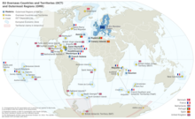
කැනරි දූපත් (/kəˈnɛəri/, ස්පාඤ්ඤ: Canarias, ස්පාඤ්ඤ: [kaˈnaɾjas]), අවිධිමත් ලෙස කැනරි ලෙසද හැඳින්වේ, ස්පාඤ්ඤ කලාපයක්, ස්වයං පාලන ප්රජාවක් සහ අත්ලාන්තික් සාගරයේ දූපත් සමූහයකි. අප්රිකානු ප්රධාන භූමියට ඔවුන්ගේ ආසන්නතම ස්ථානයේ, ඔවුන් මොරොක්කෝවට සහ බටහිර සහරාවට බටහිර දෙසින් කිලෝමීටර් 100 (සැතපුම් 62) පිහිටා ඇත. ඔවුන් ස්පාඤ්ඤයේ ස්වාධීන ප්රජාවන්ගේ දකුණු කෙළවරයි. මෙම දූපත් වල ජනගහනය මිලියන 2.2 ක් වන අතර යුරෝපීය සංගමයේ වඩාත්ම ජනාකීර්ණ විශේෂ ප්රදේශය වේ.[5][6]
ප්රධාන දූපත් හත නම්, විශාලතම සිට කුඩාම ප්රදේශය දක්වා, ටෙනරීෆ්, ෆුර්ටෙවෙන්ටුරා, ග්රාන් කැනරියා, ලැන්සාරෝට්, ලා පල්මා, ලා ගොමෙරා සහ එල් හියරෝ වේ. අනෙකුත් එකම ජනාකීර්ණ දූපත වන්නේ ලා ග්රේසියෝසා වන අතර එය පරිපාලනමය වශයෙන් ලැන්සාරෝට් මත රඳා පවතී. මෙම දූපත් සමූහයට ඇලග්රන්සා, ඉස්ලා ඩි ලොබොස්, න්ටානා ක්ලාරා, රොක් ඩෙල් ඔස්ටේ සහ රොක් ඩෙල් එස්ටේ ඇතුළු බොහෝ කුඩා දූපත් සහ දූපත් ඇතුළත් වේ. එයට ගරාචිකෝ සහ අනගා ඇතුළු පාෂාණ ගණනාවක් ඇතුළත් වේ. පුරාණ කාලයේ, දූපත් දාමය බොහෝ විට හඳුන්වනු ලැබුවේ "වාසනාවන්ත දූපත්" ලෙසිනි.[7] කැනරි දූපත් යනු ස්පාඤ්ඤයේ දකුණු දිග කලාපය වන අතර මැකරෝනීසියාවේ විශාලතම සහ වඩාත්ම ජනාකීර්ණ දූපත් සමූහය වේ.[8] ඔවුන්ගේ පිහිටීම නිසා, කැනරි දූපත් ඓතිහාසිකව අප්රිකාව, උතුරු ඇමරිකාව, දකුණු ඇමරිකාව සහ යුරෝපය යන මහාද්වීප හතර අතර සම්බන්ධකයක් ලෙස සැලකේ.[9]
2023 දී, කැනරි දූපත් වල ජනගහනය 2,236,013 ක් වූ අතර,[10] ඝණත්වය වර්ග කිලෝමීටරයට 299 කි. එය ස්පාඤ්ඤයේ හත්වන වඩාත්ම ජනාකීර්ණ ස්වයං පාලන ප්රජාව බවට පත් කරයි. ජනගහනය වැඩි වශයෙන් සංකේන්ද්රණය වී ඇත්තේ අගනුවර දූපත් දෙකෙහි ය: 43% පමණ ටෙනරීෆ් දූපතේ සහ 40% ක් ග්රාන් කැනරියා දූපතේ.
කැනරි දූපත්, විශේෂයෙන් ටෙනරීෆ්, ග්රාන් කැනරියා, ෆුර්ටෙවෙන්චුරා සහ ලැන්සාරෝට්, ප්රධාන සංචාරක ගමනාන්තයක් වන අතර, 2023 දී මිලියන 16කට අධික නරඹන්නන් පිරිසක් පැමිණ ඇත.[11] මෙයට හේතුව ඔවුන්ගේ වෙරළ, උපනිවර්තන දේශගුණය සහ වැදගත් ස්වභාවික ආකර්ෂණ ස්ථාන, විශේෂයෙන්ම ග්රාන් කැනරියා හි මාස්පලෝමා සහ ටෙනරීෆ් හි ලෝක උරුම අඩවියක් වන ටෙයිඩ් කන්දයි. ටයිඩ් කන්ද ස්පාඤ්ඤයේ උසම කඳු මුදුන වන අතර සාගර පත්ලේ ඇති එහි පාදමේ සිට මනිනු ලබන ලෝකයේ 3 වන උසම ගිනිකන්ද වේ.[12] මුහුදු මට්ටමේ දී තාක්ෂණික වශයෙන් නිවර්තන දේශගුණය සඳහා දේශගුණය සඳහා ප්රමාණවත් තරම් උණුසුම් ගිම්හාන සහ ශීත ඍතුව මෙම දූපත් සතු වේ.[13] වර්ෂාපතන ප්රමාණය සහ සමුද්ර මධ්යස්ථ මට්ටම පිහිටීම සහ උන්නතාංශය අනුව වෙනස් වේ. මෙම දූපත් සමූහයට හරිත ප්රදේශ මෙන්ම අර්ධ කාන්තාරද ඇතුළත් වේ. දූපත් වල උස් කඳු තාරකා විද්යාත්මක නිරීක්ෂණ සඳහා වඩාත් සුදුසු වන්නේ ඒවා උෂ්ණත්ව ප්රතිලෝම ස්ථරයට ඉහළින් පිහිටා ඇති බැවිනි. එහි ප්රතිඵලයක් වශයෙන්, මෙම දූපත් සමූහයට වෘත්තීය තාරකා විද්යා නිරීක්ෂණාගාර දෙකක් ඇත: ටෙනරීෆ්හි ටීඩේ නිරීක්ෂණාගාරය සහ ලා පල්මා හි රොක් ඩි ලොස් මුචචෝස් නිරීක්ෂණාගාරය.[14]
1927 දී කැනරි දූපත් පළාත පළාත් දෙකකට බෙදා ඇත. 1982 දී කැනරි දූපත් වල ස්වාධීන ප්රජාව පිහිටුවන ලදී. සැන්ටා කෲස් ඩි ටෙනරීෆ් සහ ලාස් පල්මාස් ඩි ග්රාන් කැනරියා නගර ඒකාබද්ධව දූපත් වල අගනුවර වේ.[15][16][17] එම නගර පිළිවෙලින් සැන්ටා කෲස් ඩි ටෙනරීෆ් සහ ලාස් පල්මාස් යන පළාත්වල අගනුවර ද වේ. ලාස් පල්මාස් ඩි ග්රාන් කැනරියා 1910 ගණන්වල කෙටි කාලයක් හැර, 1768 සිට කැනරි වල විශාලතම නගරය වේ.[18] 1833 ස්පාඤ්ඤයේ භෞමික අංශය සහ 1927 අතර, සැන්ටා කෲස් ඩි ටෙනරීෆ් කැනරි දූපත් වල එකම අගනුවර විය. 1927 දී, කැනරි දූපත් වල අගනුවර නගර දෙකක් අතර බෙදා ගන්නා බවට නියෝගයක් මගින් නියෝග කරන ලද අතර, මෙම විධිවිධානය අද දක්වාම පවතී.[16][19] කැනරි දූපත් වල තුන්වන විශාලතම නගරය වන්නේ ටෙනරීෆ්හි තවත් ලෝක උරුම අඩවියක් වන සැන් ක්රිස්ටෝබල් ඩි ලා ලගුනා වේ.[20][21][22]
රුවල් යුගයේදී, පවතින ඊසානදිග වෙළඳ සුළං අල්ලා ගැනීම සඳහා දකුණු දිගට යාත්රා කළ ඇමරිකාවේ ස්පාඤ්ඤ යටත් විජිත සමයේ ස්පාඤ්ඤ ගැලියන් සඳහා මෙම දූපත් ප්රධාන නැවතුම්පොළ විය.[23][24]
නිරුක්තිය
[සංස්කරණය]ඉස්ලාස් කැනරියාස් යන නම ව්යුත්පන්න වී ඇත්තේ කැනරියා ඉන්සියුලේ යන ලතින් නාමයෙන් වන අතර, එහි තේරුම "බල්ලෝ දූපත්" යන්නයි, සමහර විට භික්ෂු මුද්රා හෝ මුහුදු බල්ලන් බහුලව සිටි නිසා විය හැකිය, මෙම දූපත් වලින් එකක පැරණි නම වන කැනරියා - අනුමාන වශයෙන් ග්රාන් කැනරියා. ඉතිහාසඥ ප්ලිනි ද එල්ඩර්ට අනුව, කැනරියා දූපතේ "ඉතා විශාල ප්රමාණයේ සුනඛයන් විශාල ප්රමාණයක්" අඩංගු විය.[25] සුනඛයන් සමඟ ඇති සම්බන්ධය දූපත් වල කබායෙහි ඔවුන්ගේ නිරූපනය තුළ රඳවා ඇත.
වෙනත් න්යායන් අනුමාන කරන්නේ මෙම නම පැමිණෙන්නේ මොරොක්කෝ ඇට්ලස් හි ජීවත් වන නුකරි බර්බර් ගෝත්රයෙන් වන අතර එය රෝම මූලාශ්රවල කැනරි ලෙස නම් කර ඇත, නමුත් ප්ලිනි නැවතත් සුනඛයන් සමඟ මෙම යෙදුමේ සම්බන්ධය සඳහන් කරයි.[26]
දූපත් වල නම කැනරි පක්ෂියාගෙන් උපුටා ගත් එකක් නොවේ; ඒ වෙනුවට කුරුල්ලන්ට නම් කර ඇත්තේ දූපත් වලිනි.
දූපත්
[සංස්කරණය]බටහිර සිට නැගෙනහිරට කැනරි දූපත් වන්නේ එල් හියර්රෝ, ලා පල්මා, ලා ගොමෙරා, ටෙනරීෆ්, ග්රාන් කැනරියා, ෆුර්ටෙවෙන්ටුරා, ලැන්සාරෝට් සහ ලා ග්රේසියෝසා ය. ලැන්සාරෝට් වලට උතුරින් චිනිජෝ දූපත් සමූහය ට අයත් මොන්ටානා ක්ලාරා, ඇලග්රාන්සා, රොක් ඩෙල් එස්ටේ සහ රොක් ඩෙල් ඔස්ටේ යන දූපත් වේ. ෆුර්ටෙවෙන්චුරා හි ඊසාන දෙසින් පිහිටා ඇත්තේ ලෝබෝස් දූපතයි. කැනරි දූපත් වල කුඩා යාබද පාෂාණ මාලාවක් ඇත: ටෙනරීෆ්හි රොක්ස් ද අනගා, ගරාචිකෝ සහ ෆැස්නියා, සහ එල් හියර්රෝ හි සැල්මෝර් සහ බොනැන්සා.
- කැනරි දූපත්
-
එල් හියර්රෝ
-
ලා පල්මා
-
ලා ගොමෙරා
-
ටෙනරීෆ්
-
ග්රාන් කැනරියා
-
ෆුර්ටෙවෙන්ටුරා
-
ලැන්සාරෝට්
එල් හියරෝ
[සංස්කරණය]එල් හියරෝ, බටහිර දෙසින් පිහිටි දූපත, වර්ග කිලෝමීටර 268.71 (වර්ග සැතපුම් 103.75) ආවරණය කරයි. එය ප්රධාන දූපත් වලින් දෙවන කුඩාම වන අතර ජනගහනය 10,798 කින් අඩුය. 2000 දී මුළු දිවයිනම ජෛවගෝලයේ රක්ෂිතයක් ලෙස ප්රකාශයට පත් කරන ලදී. එහි අගනුවර වැල්වර්ඩේ වේ. ෆෙරෝ ලෙසද හැඳින්වෙන එය කලක් ලෝකයේ බටහිර දෙසින් පිහිටි භූමිය විය. ටොලමි වැනි පුරාණ යුරෝපීය භූගෝල විද්යාඥයන් දිවයින දේශාංශයේ ප්රධාන මධ්යාංශකය ලෙස හඳුනාගෙන ඇත. එය ග්රීන්විච් හරහා ගමන් කරන තැනැත්තා විසින් විස්ථාපනය කරන තෙක් 19 වන සියවස දක්වාම පැවතුනි.[27][28]
ෆුර්ටෙවෙන්චුරා
[සංස්කරණය]ෆුර්ටෙවෙන්චුරා, වර්ග කිලෝමීටර 1,660 (වර්ග සැතපුම් 640) ක පෘෂ්ඨයක් සහිත, දූපත් සමූහයේ දෙවන විශාලතම දූපත වේ. එය යුනෙස්කෝව විසින් ජෛවගෝල රක්ෂිතයක් ලෙස ප්රකාශයට පත් කර ඇත. එය වඩාත් ඛාදනය වෙමින් පවතින පැරණිතම දූපත් වේ. එහි උසම ස්ථානය වන්නේ මීටර 807 (අඩි 2,648) ක උසකින් යුත් බ්රැම්බල් කඳු මුදුනයි. එහි අගනුවර පුවර්ටෝ ඩෙල් රොසාරියෝ ය.
ග්රාන් කැනරියා
[සංස්කරණය]
ග්රාන් කැනරියා හි 846,717 වැසියන් සිටී. 377,203 වැසියන් සිටින අගනුවර වන ලාස් පල්මාස් ඩි ග්රාන් කැනරියා වඩාත්ම ජනාකීර්ණ නගරය වන අතර කැනරි වල අගනුවර තත්ත්වය සැන්ටා කෲස් ඩි ටෙනරීෆ් සමඟ බෙදා ගනී. ග්රාන් කැනරියා හි මතුපිට වර්ග ප්රමාණය වර්ග කිලෝමීටර 1,560 (වර්ග සැතපුම් 600) කි. රොක් නුබ්ලෝ 1,813 මීටර (අඩි 5,948) සහ පිකෝ ඩි ලාස් නීව්ස් ("හිම මුදුන") 1,949 මීටර (6,394 අඩි) දිවයිනේ මධ්යයේ පිහිටා ඇත. දිවයිනේ දකුණේ මාස්පලෝමාස් කඳු (ග්රාන් කැනරියා) ඇත.
ලා ගෝමර
[සංස්කරණය]ලා ගෝමර (අවිධිමත් ලෙස 'ඉස්ලා කොලොම්බිනා' ලෙස හැඳින්වේ) වර්ග කිලෝමීටර 369.76 (වර්ග සැතපුම් 142.77 ) ක භූමි ප්රමාණයකින් යුක්ත වන අතර 21,136 ජනගහනයක් සහිත දෙවන අඩුම ජනගහනය සහිත දූපත වේ. එය යුනෙස්කෝව විසින් ජෛවගෝල රක්ෂිතයක් ලෙස ප්රකාශයට පත් කර ඇත. භූ විද්යාත්මකව එය දූපත් සමූහයේ පැරණිතම එකකි. පරිවාරක අගනුවර සැන් සෙබස්තියන් ඩි ලා ගෝමරා වේ. ගරාජෝනේ ජාතික වනෝද්යානය දිවයිනේ පිහිටා ඇත.
ලැන්සාරෝට්
[සංස්කරණය]ලැන්සරෝට් යනු නැගෙනහිර දෙසින් පිහිටි දූපත වන අතර දූපත් සමූහයේ පැරණිතම එකක් වන අතර එය මෑත කාලීන ගිනිකඳු ක්රියාකාරකම් පිළිබඳ සාක්ෂි පෙන්වා ඇත. එය වර්ග කිලෝමීටර 845.94 (වර්ග සැතපුම් 326.62 ) ක මතුපිටක් ඇති අතර, චිනිජෝ දූපත් සමූහය හි යාබද දූපත් ඇතුළුව 149,183 වැසියන්ගේ ජනගහනයක් ඇත. අගනුවර අර්රෙසිෆ් හි වැසියන් 56,834 සිටී.
චිනිජෝ දූපත් සමූහය
[සංස්කරණය]
චිනිජෝ දූපත් සමූහයට ලා ග්රේසියෝසා, ඇලග්රැන්සා, මොන්ටානා ක්ලාරා, රොක් ඩෙල් එස්ටේ සහ රොක් ඩෙල් ඔස්ටේ යන දූපත් ඇතුළත් වේ. එහි වර්ග කිලෝමීටර 40.8 වර්ග සැතපුම් 15.8 ) ක පෘෂ්ඨයක් ඇති අතර, 658 වැසියන් සමඟ ලා ග්රේසියෝසා පමණක් ජනාකීර්ණ වේ. වර්ග කිලෝමීටර 29 (වර්ග සැතපුම් 11 ) සහිත ලා ග්රේසියෝසා යනු චිනිජෝ දූපත් සමූහය හි විශාලතම දූපත වන අතර කැනරි හි කුඩාම ජනාවාස දූපත වේ.
ලා පල්මා
[සංස්කරණය]වර්ග කිලෝමීටර 708.32 (වර්ග සැතපුම් 273.48) ක ප්රදේශයක් ආවරණය කරමින් 81,863 වැසියන් සිටින ලා පල්මා, සම්පුර්ණයෙන්ම ජෛවගෝල රක්ෂිතයකි. අවසන් වරට 1971 දී ටෙනෙගුයියා ගිනි කන්ද පුපුරා ගියද, දිගු කලක් එය ගිනිකඳු ක්රියාකාරිත්වයේ සලකුනු නොපෙන්වයි. 2021 සැප්තැම්බර් 19 වන දින, දිවයිනේ කම්බ්රේ වීජා ගිනිකඳු පුපුරා ගියේය.[29] එය කැනරි වල දෙවන උසම දූපත වන අතර, මීටර 2,423 (අඩි 7,949) හි පිහිටි රොක් ඩි ලොස් මුචචෝස් එහි උසම ස්ථානය වේ. දිවයිනේ සිටින අය "සැන්ටා කෲස්" ලෙස හඳුන්වන සැන්ටා කෲස් ඩි ලා පල්මා එහි අගනුවරයි.
ටෙනරීෆ්
[සංස්කරණය]
ටෙනරීෆ් යනු එහි වර්ග ප්රමාණය වර්ග කිලෝමීටර 2,034 (වර්ග සැතපුම් 785) වන අතර එය කැනරි දූපත් වල වඩාත් පුළුල් දූපත වේ. 904,713 වැසියන් සමඟ, එය දූපත් සමූහයේ සහ ස්පාඤ්ඤයේ වඩාත්ම ජනාකීර්ණ දූපත වේ. දූපත් වල ප්රධාන නගර දෙකක් එහි පිහිටා ඇත: අගනුවර, සැන්ටා කෲස් ඩි ටෙනරීෆ් සහ ලෝක උරුම අඩවියක් වන සැන් ක්රිස්ටෝබල් ඩි ලා ලගුනා. දිවයිනේ දෙවන නගරය වන සැන් ක්රිස්ටෝබල් ඩි ලා ලගුනා, කැනරි දූපත් හි පැරණිතම විශ්ව විද්යාලය වන ලා ලගුනා විශ්ව විද්යාලයේ නිවහන වේ. එහි මීටර 3,715 (අඩි 12,188) ස්පාඤ්ඤයේ උසම කඳු මුදුන වන අතර ලෝක උරුම අඩවියකි. 1977 මාර්තු 27 වන දින බෝයිං 747 යානා දෙකක් එකිනෙක ගැටීමෙන් පුද්ගලයන් 583 දෙනෙකු මිය ගිය ගුවන් සේවා ඉතිහාසයේ දරුණුතම ගුවන් අනතුර සිදුවූ ස්ථානය ටෙනරීෆ් ය.
ලා ග්රේසියෝසා
[සංස්කරණය]ග්රේසියෝසා දූපත නොහොත් සාමාන්යයෙන් ලා ග්රේසියෝසා යනු ස්පාඤ්ඤයේ කැනරි දූපත් වල පිහිටි ගිනිකඳු දූපතක් වන අතර එය ලැන්සරෝට් දූපතට උතුරින් කිලෝමීටර 2 (සැතපුම් 1.2) දුරින් එල් රියෝ සමුද්ර සන්ධිය හරහා පිහිටා ඇත. එය කැනරි හොට්ස්පොට් විසින් පිහිටුවන ලදී. දිවයින චිනිජෝ දූපත් සමූහය සහ චිනිජෝ දූපත් සමූහ ස්වභාවික උද්යානයේ (Parque Natural del Archipiélago Chinijo) කොටසකි. එය පරිපාලනය කරනු ලබන්නේ ටෙගුයිස් මහ නගර සභාව විසිනි. 2018 හි, ලා ග්රේසියෝසා ස්පාඤ්ඤ සෙනෙට් සභාව විසින් අටවන කැනරි දූපත ලෙස ප්රකාශයට පත් කරන ලදී,[30][31][32] එය කැනරියානු පරිපාලනය විසින් පිළිගෙන නැත. එය පරිපාලනමය වශයෙන් ලැන්සරෝට් දිවයින මත රඳා පවතී. මිනිසුන් 700ක් පමණ සිටින ප්රධාන දූපත් අතරින් කුඩාම සහ අඩුම ජනාකීර්ණ එය වේ.
දත්ත
[සංස්කරණය]භෞතික භූගෝලය
[සංස්කරණය]


ටෙනරීෆ් යනු දූපත් සමූහයේ විශාලතම හා වඩාත්ම ජනාකීර්ණ දූපතයි. 865,070 වැසියන් සිටින ග්රාන් කැනරියා, කැනරි දූපත් හි දෙවන වැඩිම ජනාකීර්ණ දූපත වන අතර ටෙනරීෆ් (වැසියන් 966,354) සහ මැජෝර්කා (වැසියන් 896,038)ට පසුව ස්පාඤ්ඤයේ තුන්වන වැඩිම ජනගහනයක් සහිත දූපත වේ.[තහවුරු කර නොමැත] දූපත් සමූහයේ දෙවන විශාලතම සහ පිහිටා ඇත අප්රිකානු වෙරළේ සිට කිලෝමීටර 100 (සැතපුම් 62) කි.
මෙම දූපත් අසෝර්ස්, කේප් වර්ඩ්, මැඩෙයිරා සහ සාවේජ් දූපත් සමග මැකරෝනීසියාව පරිසර කලාපය සාදයි.[33] කැනරි දූපත් යනු මැකරෝනීසියා කලාපයේ විශාලතම සහ වඩාත්ම ජනාකීර්ණ දූපත් සමූහයයි.[8] මෙම දූපත් සමූහයට විශාල සහ කුඩා දූපත් හතක් ඇත, ඒවා සියල්ලම ගිනිකඳු සම්භවයක් ඇත.[34]
ඊසානදිග වෙළඳ සුළං සම්බන්ධයෙන් දූපත් වල පිහිටීම අනුව, දේශගුණය මෘදු හා තෙත් හෝ ඉතා වියළි විය හැක. දේශීය විශේෂ කිහිපයක් ලෝරිසිල්වා වනාන්තර සාදයි.
කැනරි දූපත් සමූහයේ තනි තනි දූපත් වලට වෙනස් ක්ෂුද්ර ක්ලයිමට් ඇත. මෙම දූපත් සමූහයට බටහිර දෙසින් පිහිටි එල් හියරෝ, ලා පල්මා සහ ලා ගෝමර වැනි එම දූපත් තෙත් කැනරි ධාරාවේ බලපෑමට ලක්වන දේශගුණයක් ඇත. ඔවුන් පහළ මට්ටමේ පවා හොඳින් වෘක්ෂලතා වන අතර උපනිවර්තන ලෝරිසිල්වා වනාන්තරවල පුළුල් පත්රිකා ඇත. අප්රිකානු වෙරළ දෙසට නැඟෙනහිර දෙසට ගමන් කරන විට, ධාරාවේ බලපෑම අඩු වන අතර, දූපත් වඩ වඩාත් ශුෂ්ක වේ. ෆුර්ටෙවෙන්චුරා සහ ලැන්සරෝට්, අප්රිකානු ප්රධාන භූමියට ආසන්නතම දූපත්, ඵලදායී ලෙස කාන්තාර හෝ අර්ධ කාන්තාර වේ.
ග්රාන් කැනරියා මාස්පලෝමාස් සහ රොක් නුබ්ලෝ වැනි විවිධ භූ දර්ශන සඳහා "කුඩා මහාද්වීපයක්" ලෙස හැඳින්වේ. ටෙනරීෆ් හි උතුර තෙත් අත්ලාන්තික් සුළඟේ බලපෑම යටතේ පිහිටා ඇති අතර එය හොඳින් වෘක්ෂලතාදිය වේ. ප්ලේයා ඩි ලාස් ඇමරිකාව සහ ලොස් ක්රිස්ටියානොස් සංචාරක නිකේතන අවට දිවයිනේ දකුණ ශුෂ්කයි. දිවයින මුහුදු මට්ටමේ සිට මීටර් 4,000 (අඩි 13,000) පමණ උසකින් යුක්ත වේ. උන්නතාංශයේදී, සිසිල් සාපේක්ෂ තෙත් දේශගුණයක් තුළ, ආවේණික පයින් පයිනස් කැනරියෙන්සිස් වනාන්තරවල වර්ධනය වේ. කැනරි අයිලන්ඩ් පයින් සහ ඩ්රැගන් ගස වැනි කැනරි දූපත් වල ඇති බොහෝ ශාක විශේෂ, ඩ්රැකේනා ඩ්රැකෝ ආවේණික වන අතර, සබින් බර්තෙලොට් සහ පිලිප් බාර්කර් වෙබ් විසින් L'Histoire Naturelle des Îles Canaries (1835-50) හි සඳහන් කර ඇත.[35]
දේශගුණය
[සංස්කරණය]දේශගුණය උණුසුම් උපනිවර්තන/නිවර්තන සහ සාමාන්යයෙන් ශුෂ්ක වන අතර, මුහුදෙන් සහ ගිම්හානයේදී වෙළඳ සුළං මගින් මධ්යස්ථ වේ.[36] ක්ෂුද්ර ක්ලයිමට් ගණනාවක් පවතින අතර වර්ගීකරණය ප්රධාන වශයෙන් අර්ධ කාන්තාරයේ සිට කාන්තාරය දක්වා විහිදේ. කැනරි දූපත් වල බහුතරයක් උණුසුම් කාන්තාර දේශගුණයක් (BWh) සහ උණුසුම් අර්ධ කාන්තාර දේශගුණයක් (BSh) Köppen පද්ධතිය තුළ ඇති අතර, එය අර්ධ වශයෙන් සිසිල් කැනරි ධාරාව නිසා ඇති විය.[37] සාගරයේ බලපෑමට ලක්වන උපනිවර්තන තෙත් දේශගුණයක් ලා ගොමෙරා, ටෙනරීෆ් සහ ලා පල්මා යන දූපත් මැද පිහිටා ඇති අතර එහිදී ලෝරිසිල්වා වලාකුළු වනාන්තර වර්ධනය වේ.[38]
| Climate data for Santa Cruz de Tenerife 35m (1981–2010) | |||||||||||||
|---|---|---|---|---|---|---|---|---|---|---|---|---|---|
| Month | Jan | Feb | Mar | Apr | May | Jun | Jul | Aug | Sep | Oct | Nov | Dec | Year |
| Mean daily maximum °C (°F) | 21.0 (69.8) |
21.2 (70.2) |
22.1 (71.8) |
22.7 (72.9) |
24.1 (75.4) |
26.2 (79.2) |
28.7 (83.7) |
29.0 (84.2) |
28.1 (82.6) |
26.3 (79.3) |
24.1 (75.4) |
22.1 (71.8) |
24.6 (76.3) |
| Daily mean °C (°F) | 18.2 (64.8) |
18.3 (64.9) |
19.0 (66.2) |
19.7 (67.5) |
21.0 (69.8) |
22.9 (73.2) |
25.0 (77.0) |
25.5 (77.9) |
24.9 (76.8) |
23.4 (74.1) |
21.3 (70.3) |
19.4 (66.9) |
21.5 (70.7) |
| Mean daily minimum °C (°F) | 15.4 (59.7) |
15.3 (59.5) |
15.9 (60.6) |
16.5 (61.7) |
17.8 (64.0) |
19.5 (67.1) |
21.2 (70.2) |
21.9 (71.4) |
21.7 (71.1) |
20.3 (68.5) |
18.4 (65.1) |
16.6 (61.9) |
18.4 (65.1) |
| Average rainfall mm (inches) | 31.5 (1.24) |
35.4 (1.39) |
37.8 (1.49) |
11.6 (0.46) |
3.6 (0.14) |
0.9 (0.04) |
0.1 (0.00) |
2.0 (0.08) |
6.8 (0.27) |
18.7 (0.74) |
34.1 (1.34) |
43.2 (1.70) |
225.7 (8.89) |
| Average rainy days (≥ 1.0 mm) | 8.0 | 7.2 | 6.9 | 5.5 | 2.9 | 0.9 | 0.2 | 0.8 | 2.7 | 6.1 | 8.8 | 9.4 | 59.4 |
| Mean monthly sunshine hours | 178 | 186 | 221 | 237 | 282 | 306 | 337 | 319 | 253 | 222 | 178 | 168 | 2,887 |
| Source: Agencia Estatal de Meteorología[39] | |||||||||||||
| Climate data for Gran Canaria Airport 24m (1981–2010) | |||||||||||||
|---|---|---|---|---|---|---|---|---|---|---|---|---|---|
| Month | Jan | Feb | Mar | Apr | May | Jun | Jul | Aug | Sep | Oct | Nov | Dec | Year |
| Mean daily maximum °C (°F) | 20.8 (69.4) |
21.2 (70.2) |
22.3 (72.1) |
22.6 (72.7) |
23.6 (74.5) |
25.3 (77.5) |
26.9 (80.4) |
27.5 (81.5) |
27.2 (81.0) |
26.2 (79.2) |
24.2 (75.6) |
22.2 (72.0) |
24.2 (75.6) |
| Daily mean °C (°F) | 18.1 (64.6) |
18.4 (65.1) |
19.3 (66.7) |
19.5 (67.1) |
20.5 (68.9) |
22.2 (72.0) |
23.8 (74.8) |
24.6 (76.3) |
24.3 (75.7) |
23.1 (73.6) |
21.2 (70.2) |
19.3 (66.7) |
21.2 (70.2) |
| Mean daily minimum °C (°F) | 15.3 (59.5) |
15.6 (60.1) |
16.2 (61.2) |
16.3 (61.3) |
17.3 (63.1) |
19.2 (66.6) |
20.8 (69.4) |
21.6 (70.9) |
21.4 (70.5) |
20.1 (68.2) |
18.1 (64.6) |
16.5 (61.7) |
18.2 (64.8) |
| Average precipitation mm (inches) | 25 (1.0) |
24 (0.9) |
13 (0.5) |
6 (0.2) |
1 (0.0) |
0 (0) |
0 (0) |
0 (0) |
9 (0.4) |
16 (0.6) |
22 (0.9) |
31 (1.2) |
151 (5.9) |
| Average precipitation days (≥ 1 mm) | 3 | 3 | 2 | 1 | 0 | 0 | 0 | 0 | 1 | 2 | 4 | 5 | 22 |
| Mean monthly sunshine hours | 184 | 191 | 229 | 228 | 272 | 284 | 308 | 300 | 241 | 220 | 185 | 179 | 2,821 |
| Source: World Meteorological Organization (UN),[40] Agencia Estatal de Meteorología[41] | |||||||||||||
| Climate data for San Cristóbal de La Laguna (1981–2010) 632 m – Tenerife North Airport | |||||||||||||
|---|---|---|---|---|---|---|---|---|---|---|---|---|---|
| Month | Jan | Feb | Mar | Apr | May | Jun | Jul | Aug | Sep | Oct | Nov | Dec | Year |
| Mean daily maximum °C (°F) | 16.0 (60.8) |
16.7 (62.1) |
18.2 (64.8) |
18.5 (65.3) |
20.1 (68.2) |
22.2 (72.0) |
24.7 (76.5) |
25.7 (78.3) |
24.9 (76.8) |
22.5 (72.5) |
19.7 (67.5) |
17.1 (62.8) |
20.5 (68.9) |
| Daily mean °C (°F) | 13.1 (55.6) |
13.4 (56.1) |
14.5 (58.1) |
14.7 (58.5) |
16.1 (61.0) |
18.1 (64.6) |
20.2 (68.4) |
21.2 (70.2) |
20.7 (69.3) |
18.9 (66.0) |
16.5 (61.7) |
14.3 (57.7) |
16.8 (62.2) |
| Mean daily minimum °C (°F) | 10.2 (50.4) |
10.0 (50.0) |
10.7 (51.3) |
10.9 (51.6) |
12.0 (53.6) |
14.0 (57.2) |
15.7 (60.3) |
16.6 (61.9) |
16.5 (61.7) |
15.2 (59.4) |
13.3 (55.9) |
11.5 (52.7) |
13.0 (55.4) |
| Average rainfall mm (inches) | 80 (3.1) |
70 (2.8) |
61 (2.4) |
39 (1.5) |
19 (0.7) |
11 (0.4) |
6 (0.2) |
5 (0.2) |
16 (0.6) |
47 (1.9) |
81 (3.2) |
82 (3.2) |
517 (20.2) |
| Average rainy days (≥ 1.0 mm) | 11 | 10 | 10 | 10 | 7 | 4 | 3 | 3 | 5 | 10 | 10 | 12 | 95 |
| Mean monthly sunshine hours | 150 | 168 | 188 | 203 | 234 | 237 | 262 | 269 | 213 | 194 | 155 | 137 | 2,410 |
| Source: Agencia Estatal de Meteorología[42] | |||||||||||||
| Climate data for Tenerife South Airport 64m (1981–2010) | |||||||||||||
|---|---|---|---|---|---|---|---|---|---|---|---|---|---|
| Month | Jan | Feb | Mar | Apr | May | Jun | Jul | Aug | Sep | Oct | Nov | Dec | Year |
| Mean daily maximum °C (°F) | 21.7 (71.1) |
22.0 (71.6) |
23.1 (73.6) |
23.1 (73.6) |
23.9 (75.0) |
25.4 (77.7) |
27.7 (81.9) |
28.4 (83.1) |
27.9 (82.2) |
26.8 (80.2) |
24.8 (76.6) |
22.8 (73.0) |
24.8 (76.6) |
| Daily mean °C (°F) | 18.4 (65.1) |
18.5 (65.3) |
19.3 (66.7) |
19.5 (67.1) |
20.4 (68.7) |
22.1 (71.8) |
24.0 (75.2) |
24.7 (76.5) |
24.5 (76.1) |
23.4 (74.1) |
21.5 (70.7) |
19.7 (67.5) |
21.4 (70.5) |
| Mean daily minimum °C (°F) | 15.2 (59.4) |
15.0 (59.0) |
15.6 (60.1) |
16.0 (60.8) |
17.0 (62.6) |
18.8 (65.8) |
20.2 (68.4) |
21.1 (70.0) |
21.1 (70.0) |
20.0 (68.0) |
18.2 (64.8) |
16.5 (61.7) |
17.9 (64.2) |
| Average rainfall mm (inches) | 16.6 (0.65) |
19.9 (0.78) |
14.7 (0.58) |
7.4 (0.29) |
1.1 (0.04) |
0.1 (0.00) |
0.1 (0.00) |
1.3 (0.05) |
3.6 (0.14) |
11.9 (0.47) |
26.3 (1.04) |
30.3 (1.19) |
133.3 (5.23) |
| Average rainy days (≥ 1.0 mm) | 1.8 | 2.2 | 1.9 | 1.1 | 0.3 | 0.0 | 0.0 | 0.2 | 0.6 | 1.6 | 1.9 | 3.5 | 15.1 |
| Mean monthly sunshine hours | 193 | 195 | 226 | 219 | 246 | 259 | 295 | 277 | 213 | 214 | 193 | 195 | 2,725 |
| Source: Agencia Estatal de Meteorología[41] | |||||||||||||
| Climate data for La Palma Airport 33m (1981–2010) | |||||||||||||
|---|---|---|---|---|---|---|---|---|---|---|---|---|---|
| Month | Jan | Feb | Mar | Apr | May | Jun | Jul | Aug | Sep | Oct | Nov | Dec | Year |
| Mean daily maximum °C (°F) | 20.6 (69.1) |
20.7 (69.3) |
21.2 (70.2) |
21.6 (70.9) |
22.6 (72.7) |
24.1 (75.4) |
25.5 (77.9) |
26.3 (79.3) |
26.6 (79.9) |
25.5 (77.9) |
23.5 (74.3) |
21.8 (71.2) |
23.3 (74.0) |
| Daily mean °C (°F) | 18.1 (64.6) |
18.0 (64.4) |
18.5 (65.3) |
18.9 (66.0) |
20.0 (68.0) |
21.7 (71.1) |
23.1 (73.6) |
23.9 (75.0) |
24.0 (75.2) |
22.8 (73.0) |
20.9 (69.6) |
19.3 (66.7) |
20.8 (69.4) |
| Mean daily minimum °C (°F) | 15.5 (59.9) |
15.3 (59.5) |
15.7 (60.3) |
16.2 (61.2) |
17.4 (63.3) |
19.2 (66.6) |
20.7 (69.3) |
21.4 (70.5) |
21.3 (70.3) |
20.2 (68.4) |
18.3 (64.9) |
16.7 (62.1) |
18.2 (64.7) |
| Average rainfall mm (inches) | 49 (1.9) |
57 (2.2) |
33 (1.3) |
19 (0.7) |
7 (0.3) |
2 (0.1) |
1 (0.0) |
1 (0.0) |
12 (0.5) |
41 (1.6) |
70 (2.8) |
80 (3.1) |
372 (14.5) |
| Average rainy days | 5 | 4 | 4 | 3 | 1 | 0 | 0 | 0 | 2 | 5 | 7 | 8 | 40 |
| Mean monthly sunshine hours | 141 | 146 | 177 | 174 | 192 | 188 | 222 | 209 | 187 | 175 | 140 | 138 | 2,106 |
| Source: Agencia Estatal de Meteorología[43] | |||||||||||||
භූ විද්යාව
[සංස්කරණය]
ප්රධාන දූපත් හතක්, එක් කුඩා දූපතක් සහ කුඩා දූපත් කිහිපයක් මුලින් ගිනිකඳු දූපත් වූ අතර ඒවා කැනරි හොට්ස්පොට් විසින් පිහිටුවන ලදී.[44] කැනරි දූපත් ස්පාඤ්ඤයේ නූතන යුගයේ ගිනිකඳු පිපිරීම් වාර්තා වූ එකම ස්ථානය වන අතර සමහර ගිනි කඳු තවමත් සක්රීයයි (එල් හයිරෝ, 2011).[45] කැනරි දාමයේ වැනි ගිනිකඳු දූපත් බොහෝ විට ව්යසනකාරී සුන්බුන් හිම කුණාටු සහ නාය යෑම් නිසා ඇති වන කඳු බෑවුම් සහිත සාගර කඳු සහිත වේ.[46] 2021 දී ලා පල්මා හි ගිනිකඳු කඳු වැටියක් වන කම්බ්රේ වීජා හිදී මෙම දූපත් දාමයේ නවතම පිපිරීම සිදු විය.[47]
ටෙනරීෆ් හි පිහිටි ටීඩේ ගිනි කන්ද ස්පාඤ්ඤයේ උසම කන්ද වන අතර ගිනිකඳු සාගර දූපතක පෘථිවියේ තුන්වන උසම ගිනි කන්ද වේ.[48] ලා ගෝමර හැර අනෙකුත් සියලුම දූපත් පසුගිය වසර මිලියන ගණන තුළ ක්රියාකාරී වී ඇත. ඒවායින් හතරක්, ලැන්සාරෝට්, ටෙනරීෆ්, ලා පල්මා සහ එල් හියරෝ, යුරෝපීය සොයාගැනීමේ සිට පිපිරීම් පිළිබඳ ඓතිහාසික වාර්තා ඇත.[49] අත්ලාන්තික් සාගරය විවෘත කිරීම හා සම්බන්ධ ජුරාසික් සාගර කබොලෙන් දූපත් නැඟී ඇත. දිය යට මැග්මැටිස්වාදය ක්රිටේසියස් යුගයේදී ආරම්භ වූ අතර අද දක්වාම පවතී. වත්මන් දූපත් මයෝසීන යුගයේදී සාගර මතුපිටට ළඟා විය. මෙම දූපත් වරක් විශාල අප්රිකානු ඇල්පයින් පද්ධති අංශයේ කොටසක් වන ඇට්ලස් කඳුකර පළාතේ සුවිශේෂී භෞතික විද්යාත්මක අංශයක් ලෙස සලකනු ලැබුවද, දැන් එය මැග්මැටික් උණුසුම් ස්ථානයකට සම්බන්ධ යැයි පිළිගෙන ඇත.[50]
2011 ගිම්හානයේදී, එල් හියර්රෝට යටින් අඩු පරිමාණයේ භූමිකම්පා මාලාවක් ඇති විය. මේවාට ඊසාන-නිරිත දිග රේඛීය ප්රවණතාවක් තිබුණි. ඔක්තෝම්බර් මාසයේදී රෙස්ටිංගා නගරයට දකුණින් කිලෝමීටර් 2ක් (සැතපුම් 1 1⁄4ක්) පමණ දුරින් මුහුද යට පිපිරීමක් සිදු විය. මෙම පිපිරීමෙන් වායූන් සහ පිම්ම නිපදවන ලද නමුත් කිසිදු පුපුරන සුළු ක්රියාකාරකමක් වාර්තා නොවීය.[51]
පහත වගුවේ එක් එක් දූපත්වල උසම කඳු පෙන්වයි:

| කන්ද | උන්නතාංශය | දිවයින | |
|---|---|---|---|
| මීටර් | අඩි | ||
| ටයිඩ් | 3,715 | 12,188 | ටෙනරීෆ් |
| රොක් ඩි ලොස් මුචචෝස් | 2,426 | 7,959 | ලා පල්මා |
| පිකෝ ඩි ලාස් නීව්ස් | 1,949 | 6,394 | ග්රාන් කැනරියා |
| පිකෝ ඩි මල්පාසෝ | 1,501 | 4,925 | එල් හයිරෝ |
| ගරාජෝනේ | 1,487 | 4,879 | ලා ගෝමර |
| පිකෝ ඩි ලා සර්සා | 812 | 2,664 | ෆුර්ටෙවෙන්චුරා |
| පෙනාස් ඩෙල් චාචේ | 670 | 2,200 | ලැන්සරෝට් |
| අගුජා ග්රෑන්ඩ් | 266 | 873 | ලා ග්රේසියෝසා |
| කල්දේරා ද ඇලග්රන්සා | 289 | 948 | ඇලග්රාන්සා |
| කල්දේරා ද ලොබොස් | 126 | 413 | ලෝබෝස් |
| ලා මරියානා | 256 | 840 | මොන්ටානා ක්ලාරා |
ස්වභාවික සංකේත
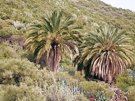
[සංස්කරණය]කැනරි දූපත් හා සම්බන්ධ නිල ස්වාභාවික සංකේත වන්නේ සෙරීනස් කැනරියා (කැනරි) සහ ෆීනික්ස් කැනරියන්සිස් පාම් ය.[56]
ජාතික උද්යාන
[සංස්කරණය]
ස්පාඤ්ඤයේ ජාතික වනෝද්යාන දහතුනෙන් හතරක්ම කැනරි දූපත් වල පිහිටා ඇති අතර එය වෙනත් ස්වාධීන ප්රජාවකට වඩා වැඩිය. මෙයින් දෙකක් යුනෙස්කෝ ලෝක උරුම අඩවි ලෙස නම් කර ඇති අතර අනෙක් දෙක ජෛවගෝල රක්ෂිතයේ කොටසකි. උද්යාන පහත වේ:[57]
| උද්යානය | දූපත | ප්රමාණය | නම් කිරීමේ වර්ෂය | යුනෙස්කෝ තත්ත්වය |
|---|---|---|---|---|
| කල්දේරා ඩි ටැබුරියන්ටේ ජාතික වනෝද්යානය | ලා පල්මා | වර්ග කිලෝමීටර 46.9 (වර්ග සැතපුම් 18.11) | 1954 | 2002 සිට ලා පල්මා ජෛවගෝල රක්ෂිතයේ කොටසකි |
| ගරාජෝනේ ජාතික වනෝද්යානය | ලා ගෝමර | වර්ග කිලෝමීටර 39.86 (වර්ග සැතපුම් 15.39) | 1981 | 1986 සිට ලෝක උරුම අඩවිය |
| ටයිඩ් ජාතික වනෝද්යානය | ටෙනරීෆ් | වර්ග කිලෝමීටර 189.9 (වර්ග සැතපුම් 73.32) | 1954 | 2007 සිට ලෝක උරුම අඩවිය |
| ටිමන්ෆායා ජාතික වනෝද්යානය | ලැන්සරෝට් | වර්ග කිලෝමීටර 51.07 (වර්ග සැතපුම් 19.72) | 1974 | 1993 සිට ලැන්සරෝට් ජෛවගෝල රක්ෂිතයේ කොටසක් |
ටයිඩ් ජාතික වනෝද්යානය කැනරි දූපත් වල පැරණිතම සහ විශාලතම ජාතික වනෝද්යානය වන අතර ස්පාඤ්ඤයේ පැරණිතම ජාතික වනෝද්යානයයි. ටෙනරීෆ් දූපතේ භූගෝලීය මධ්යස්ථානයේ පිහිටා ඇති එය ස්පාඤ්ඤයේ වැඩිපුරම නරඹන ජාතික වනෝද්යානයයි. 2010 දී, එය යුරෝපයේ වැඩිම පිරිසක් නරඹන ජාතික වනෝද්යානය බවට පත් වූ අතර ලොව පුරා දෙවන ස්ථානයට පත් විය.[52][53] උද්යානයේ විශේෂත්වය වන්නේ ටයිඩ් ගිනි කන්දයි. මීටර 3,715 ක උන්නතාංශයක (අඩි 12,188 ),[58] එය ස්පාඤ්ඤයේ උසම උන්නතාංශය වන අතර එහි පාදමේ සිට පෘථිවියේ තුන්වන විශාලතම ගිනි කන්ද වේ. 2007 දී ටයිඩ් ජාතික වනෝද්යානය ස්පාඤ්ඤයේ ලෝක උරුම 12 න් එකක් ලෙස ප්රකාශයට පත් කරන ලදී.
දේශපාලනය
[සංස්කරණය]

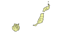

පාලනය
[සංස්කරණය]ප්රාදේශීය විධායක ආයතනය වන කැනරි දූපත් පාර්ලිමේන්තුවේ ප්රධානත්වය දරන්නේ කැනරි දූපත් වල වත්මන් සභාපති ප්රනාන්දු ක්ලැවිජෝ බැට්ල් (කැනරියන් සභාගය) විසිනි. ප්රාදේශීය ව්යවස්ථාදායකයේ සාමාජිකයන් වන කැනරි දූපත් පාර්ලිමේන්තුවට තේරී පත් වූ ව්යවස්ථාදායකයන් 70 ක් ඇත. අවසාන ප්රාදේශීය මැතිවරණය පැවැත්වුණේ 2023 මැයි මාසයේදීය.
මෙම දූපත් වලට ස්පාඤ්ඤ සෙනෙට් සභාවේ ආසන 14ක් ඇත. මෙයින් ආසන 11ක් සෘජුවම තේරී පත් වන අතර, ග්රාන් කැනරියා සඳහා 3, ටෙනරීෆ් සඳහා 3, සහ ලැන්සාරෝට් (ලා ග්රේසියෝසා ඇතුළුව), ෆුර්ටෙවෙන්ටුරා, ලා ගෝමර සහ එල් හයිරෝ සඳහා 1 බැගින්. අනෙක් 3 ප්රාදේශීය ව්යවස්ථාදායකය විසින් පත් කරනු ලැබේ.[59]
දේශපාලන භූගෝලය
[සංස්කරණය]කැනරි දූපත් වල ස්වතන්ත්ර ප්රජාවට පළාත් දෙකක් (පළාත්) ඇත, ලාස් පල්මාස් සහ සැන්ටා කෲස් ඩි ටෙනරීෆ්, එහි අගනුවර වන ලාස් පල්මාස් ඩි ග්රාන් කැනරියා සහ සැන්ටා කෲස් ඩි ටෙනරීෆ් ස්වයං පාලන ප්රජාවේ අගනුවර වේ. ප්රධාන දූපත් හතෙන් සෑම එකක්ම පාලනය වන්නේ කැබිල්ඩෝ ඉන්සියුලර් නම් දූපත් සභාවක් මගිනි. සෑම දිවයිනක්ම කුඩා නගර සභාවලට (මුනිසිපියෝ) බෙදා ඇත. ලාස් පල්මාස් මහ නගර සභා 34කට බෙදී ඇති අතර සැන්ටා කෲස් ඩි ටෙනරීෆ් මහ නගර සභා 54කට බෙදා ඇත.[60]
කැනරි වල ජාත්යන්තර මායිම මොරොක්කෝ-ස්පාඤ්ඤ සබඳතා වලදී මතභේදාත්මක ය. 2022 දී එක්සත් ජාතීන් විසින් කැනරි දූපතේ භෞමික ජලය මොරොක්කෝ වෙරළ ලෙස ප්රකාශයට පත් කරන ලද අතර මොරොක්කෝව කැනරි දූපත් ප්රකාශ කරන කැනරි භෞමික ජලය සහ බටහිර සහරා ජලය ලෙස ගෑස් සහ තෙල් ගවේෂණයට අවසර ලබා දී ඇත.[61] මොරොක්කෝවේ නිල ස්ථාවරය වන්නේ කැනරි දූපත් විශාල වශයෙන් ස්වයං පාලනයක් භුක්ති විඳින බැවින්, භෞමික සීමාවන් සම්බන්ධ ජාත්යන්තර නීති ස්පාඤ්ඤයට කැනරි වල භූමිය මත පදනම්ව මුහුදු පත්ල මායිම්වලට හිමිකම් කීමට අවසර නොදෙන බවයි. ඇත්ත වශයෙන්ම, ස්පාඤ්ඤ කලාපයේ සෑම එකක්ම යුරෝපීය ප්රජාවට සමාන තත්වයක් ඇති ස්වාධීන ප්රජාවක් ලෙස සලකනු ලබන බැවින්, දූපත් කිසිදු විශේෂ ස්වයං පාලනයක් භුක්ති විඳින්නේ නැත. මුහුදේ නීතිය යටතේ, භෞමික ජලය හෝ සුවිශේෂී ආර්ථික කලාපයක් (EEZ) ලබා දී නොමැති එකම දූපත් වන්නේ මිනිස් වාසයට සුදුසු නොවන හෝ තමන්ගේම ආර්ථික ජීවිතයක් නොමැති දූපත් වන අතර එය එසේ නොවේ.[62]
කැනරියානු ජාතිකවාදය
[සංස්කරණය]කැනරි ජාතික කොන්ග්රසය (CNC) සහ කැනරි දූපත් වල ජනප්රිය පෙරමුණ වැනි ස්වාධීන ගැති දේශපාලන පක්ෂ කිහිපයක් තිබේ. ස්වාධීන පාර්ලිමේන්තුවේ හෝ කැබිල්ඩෝස් පරිවාරක යන දෙකෙහිම කිසිදු පැවැත්මක් නොමැතිව ඔවුන්ගේ මහජන සහයෝගය නොවැදගත් ය.[තහවුරු කර නොමැත] Centro de Investigaciones Sociológicas විසින් 2012 අධ්යයනයක දී, ජාතික අනන්යතාවය ගැන විමසූ විට, කැනරි දූපත් වල ප්රතිචාර දැක්වූවන්ගෙන් බහුතරයක් (53.8%) තමන් ස්පාඤ්ඤ සහ කැනරියානුවන් ලෙස සමාන ලෙස සැලකූ අතර ඉන් පසුව 24% ක් ස්පාඤ්ඤයට වඩා කැනරියානුවන් යැයි සලකති. ප්රතිචාර දැක්වූවන්ගෙන් 6.1%ක් තමන් කැනරියානුවන් පමණක් ලෙස සැලකූ අතර 7%ක් තමන් ස්පාඤ්ඤ ජාතිකයන් පමණක් ලෙස සැලකූහ.[63]
ආරක්ෂාව
[සංස්කරණය]භූමිය ආරක්ෂා කිරීම ස්පාඤ්ඤ සන්නද්ධ හමුදාවන්ගේ වගකීමයි. යුද හමුදාව, නාවික හමුදාව, ගුවන් හමුදාව සහ සිවිල් ආරක්ෂක බළකායේ කොටස් භූමිය තුළ පිහිටා ඇත.
ඉතිහාසය
[සංස්කරණය]පුරාණ සහ පූර්ව හිස්පැනික් කාලය
[සංස්කරණය]
මිනිසුන් පැමිණීමට පෙර, කැනරි වල යෝධ කටුස්සා (ගල්ලෝටියා ගොලියත්), ටෙනරීෆ් සහ ග්රාන් කැනරියා යෝධ මීයන්,[64] සහ යෝධ කැස්බෑවන්, භූචෙලෝන් බර්චර්ඩි සහ භූචෙලෝන් වල්කනිකා ඇතුළු ප්රාග් ඓතිහාසික සතුන් වාසය කළහ.
වර්තමානයේ කැනරි දූපත් ලෙස හැඳින්වෙන මුල් ජනාවාස සම්පූර්ණයෙන්ම පැහැදිලි නැතත්, භාෂාමය, ජානමය සහ පුරාවිද්යාත්මක විශ්ලේෂණවලින් පෙනී යන්නේ ආදිවාසී ජනයා අවම වශයෙන් වසර 2,000 කට පෙර, සමහර විට 3,000 කට පෙර කැනරි දූපත් වල ජීවත් වූ බවත්, ඔවුන් පොදු සම්භවයක් බෙදාගත් බවත්ය. ආසන්න උතුරු අප්රිකානු වෙරළ තීරයේ බර්බර්වරුන් සමඟ.[65][66][67] කුඩා බෝට්ටු කිහිපයක් යොදා ගනිමින්, නැඟෙනහිර දෙසින් පිහිටි ලැන්සාරෝට් සහ ෆුර්ටෙවෙන්චුරා යන දූපත්වලට ගොඩ බැසීමෙන් දූපත් වෙත ළඟා වීම සිදු වන්නට ඇත. මෙම කණ්ඩායම් සාමූහිකව ගුවන්චේස් ලෙස හඳුන්වනු ලැබූ නමුත් ගුවන්චේස් යනු ටෙනරීෆ් හි ආදිවාසී වැසියන් සඳහා පමණක් නම් කර ඇත.[68]
ලාස් පල්මාස් ඩි ග්රාන් කැනරියා විශ්ව විද්යාලයේ 2024 අධ්යයනයකට අනුව, ක්රි.පූ. 1 වන සියවසේ සිට ක්රි.ව. 1 වන සියවස දක්වා කාලය තුළ රෝමානුවන් විසින් දිවයින් ප්රථම වරට යටත් විජිතකරණය කළ බවට පුරාවිද්යාත්මක සාක්ෂි තිබේ. ක්රි.ව. 1 සහ 3 වැනි සියවස් අතර කාලය තුළ ප්රථම වරට පැමිණි ස්පාඤ්ඤ ආක්රමණයේ දී දූපත් වල වාසය කළ මිනිසුන්ගේ වාඩිලෑම සමඟ අතිච්ඡාදනය නොවීය.[69][70]

හෝසේ ෆරුජියා විස්තර කරන පරිදි, 'ආදිවාසී කැනරියානුවන් ප්රධාන වශයෙන් ජීවත් වූයේ මුහුදු මට්ටමේ සිට මීටර 300 සිට 500 දක්වා (අඩි 1,000 සිට 1,600 දක්වා) වෙරළ ආසන්නයේ, ස්වාභාවික ගුහාවල ය. මෙම ගුහා සමහර විට හුදකලා වූ නමුත් වඩාත් සුලභ ජනාවාස ඇති අතර ඒ අසල සුසාන ලෙන් ඇත.[71] පිඟන් මැටි, මිනිස් රූප, මසුන් ඇල්ලීම, දඩයම් කිරීම සහ ගොවිතැන් මෙවලම්, ශාක කෙඳි ඇඳුම් සහ යාත්රා මෙන්ම ගුහා සිතුවම්වල කෞතුක වස්තු තුළින් දෘෂ්යමාන පොහොසත් සංස්කෘතියක් පුරාවිද්යාත්මක කටයුතු මගින් අනාවරණය කර ගෙන ඇත. ග්රාන් කැනරියා හි ලොමෝ ඩි ලොස් ගැටෝස් හි වසර 1,600 කට පෙර සිට 1960 දශකය දක්වා අල්ලාගෙන සිටි ස්ථානයක්, වටකුරු ගල් ගෙවල්, සංකීර්ණ සුසාන ස්ථාන සහ ඒ ආශ්රිත කෞතුක වස්තු සොයාගෙන ඇත.[72] දිවයින පුරා විසිරී ඇති ලිබිකෝ-බර්බර් අක්ෂර සෙල්ලිපි දහස් ගණනක් ඇති අතර ඒවා බොහෝ වාග් විද්යාඥයින් විසින් පුළුල් ලෙස ලේඛනගත කර ඇත.[73][74]
ස්වදේශික කැනරියානුවන්ගේ සමාජ ව්යුහය "බොහෝ දූපත් වල මාතෘ පරම්පරාවේ සම්භවයක් ඇති ක්රමයක් වන අතර, කාන්තා රේඛාව හරහා උරුමය සම්ප්රේෂණය විය. සමාජ තත්ත්වය සහ ධනය පාරම්පරික වූ අතර සමාජ පිරමීඩයේ පුද්ගලයාගේ ස්ථානය තීරණය කරන ලදී. රජු, රජුගේ ඥාතීන්, පහළ වංශාධිපතියන්, දුෂ්ටයන්, ප්ලෙබියානුවන් සහ අවසානයේ අලුගෝසුවන්, මස් කපන්නන්, එම්බාම් කරන්නන් සහ සිරකරුවන්". ඔවුන්ගේ ආගම ඉර හඳ මෙන්ම කඳු වැනි ස්වභාවික ලක්ෂණ ද කේන්ද්ර කරගත් සජීවවාදී විය.[71]
ගවේෂණය
[සංස්කරණය]ෆිනීෂියානුවන්, ග්රීකවරුන් සහ කාර්තජීනියානුවන් විසින් මෙම දූපත් සංචාරය කර ඇත. සීසර් ඔගස්ටස්ගේ නුමිඩියානු අනුගාමිකයෙකු වූ II ජුබා රජු බටහිර ලෝකය සඳහා දූපත් සොයා ගැනීමේ ගෞරවය හිමි වේ. ප්ලිනි ද එල්ඩර්ට අනුව, ජුබා දූපත් ජනාවාස නොමැති බව සොයා ගත් නමුත්, "කුඩා ගල් විහාරයක්" සහ "ගොඩනැගිලිවල සලකුණු කිහිපයක්" සොයා ගන්නා ලදී.[75] ක්රි.ව. පළමුවන සියවසේ මුල් භාගයේදී දැන් බටහිර මොරොක්කෝවේ මොගදෝර්හි ඩයි නිෂ්පාදන මධ්යස්ථානය නැවත විවෘත කිරීමට ජුබා නාවික හමුදාවක් පිටත් කර යවන ලදී.[76] එම නාවික හමුදාවම පසුව කැනරි දූපත් වල ගවේෂණයකට යවන ලද අතර, මොගදෝර් ඔවුන්ගේ මෙහෙවර කඳවුර ලෙස භාවිතා කර ඇත.[තහවුරු කර නොමැත]
රෝමවරුන් විසින් තනි තනි දූපත් සඳහා ලබා දී ඇති නම් නින්ගුආරියා හෝ නිවාරියා (ටෙනරීෆ්), කැනරියා (ග්රාන් කැනේරියා), ප්ලූවියාලියා හෝ ඉන්වේල් (ලැන්සරෝට්), ඔම්බ්රියන් (ලා පල්මා), ප්ලැනේෂියා (ෆුර්ටෙවෙන්චුරා), ඉයුනෝනියා හෝ ජූනෝනියා (එල් හයිරෝ) සහ කප්රාරියා (ලා ගෝමර) වේ.[77]
14 වන ශතවර්ෂයේ සිට, මැජෝර්කා, පෘතුගාලය සහ ජෙනෝවා යන රටවලින් නැවියන් විසින් බොහෝ සංචාරයන් සිදු කරන ලදී. ලැන්සෙලෝටෝ මැලෝසෙල්ලෝ 1312 දී ලැන්සරෝට් හි පදිංචි විය. මේජර්කන්ස් 1350 සිට 1400 දක්වා පැවති දූපත් වල බිෂොප්වරයෙකු සමඟ දූත මෙහෙවරක් ආරම්භ කළේය.

කැස්ටිලියානු ආක්රමණය
[සංස්කරණය]1402 දී, දූපත් වල කැස්ටිලියානු යටත් විජිතකරණය ආරම්භ වූයේ ප්රංශ ගවේෂකයන් වන ජීන් ද බෙතන්කෝර්ට් සහ ගාඩිෆර් ඩි ලා සාලේ, කැස්ටිල්හි III වන හෙන්රිගේ වංශාධිපතියන් සහ ලැන්සාරෝට් වෙත ගිය ගවේෂණ සමඟිනි. එතැන් සිට ඔවුන් ෆුර්ටෙවෙන්චුරා (1405) සහ එල් හියර්රෝ යටත් කර ගැනීමට ගියහ. මෙම ආක්රමණ ස්වදේශික කැනරියානුවන්ගේ බලවත් ප්රතිරෝධය හේතුවෙන් සියවසකට වැඩි කාලයක් පැවති "ආදිවාසී ජනගහනය සහ කැස්ටිලියානුවන් අතර ම්ලේච්ඡ සංස්කෘතික හා මිලිටරි ගැටුම්" විය.[66] මහාචාර්ය මොහොමඩ් අධිකාරි විසින් දූපත් අත්පත් කර ගැනීම ගුවන්චේස් ජන සංහාරයක් ලෙස අර්ථ දක්වා ඇත.[78][79]
බෙතන්කෝට් කැනරි දූපත් වල රජු යන පදවි නාමය ලබා ගත් නමුත් තවමත් III වන හෙන්රි රජු ඔහුගේ අධිපතියා ලෙස පිළිගත්තේය. සමහර දූපත් වල ආදිවාසීන්ගේ ප්රතිරෝධය අනුව එය සරල හමුදා ව්යාපාරයක් නොවීය. ප්රභූවරුන්ගේ විශේෂ අවශ්යතා (දූපත් අත්පත් කර ගැනීම හරහා ඔවුන්ගේ ආර්ථික හා දේශපාලන බලය ශක්තිමත් කිරීමට අධිෂ්ඨාන කර ගත්) ප්රාන්තවල, විශේෂයෙන් භෞමික ව්යාප්තිය මධ්යයේ සහ ක්රියාවලියක යෙදී සිටි කැස්ටිල් සමඟ ගැටෙන බැවින් එය දේශපාලනිකව ද නොවීය. වංශවත් අයට එරෙහිව ඔටුන්න ශක්තිමත් කිරීම.[80][page needed]
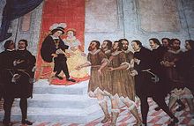
ඉතිහාසඥයින් කැනරි දූපත් අත්පත් කර ගැනීමේ කාල පරිච්ඡේද දෙකක් වෙන්කර හඳුනා ගනී:
වංශාධිපති ආක්රමණය (conquista señorial): මෙයින් අදහස් කරන්නේ වංශාධිපතියන් විසින් ඔවුන්ගේම ප්රයෝජනය සඳහා සහ කැස්ටිල් ඔටුන්නෙහි සෘජු සහභාගීත්වය නොමැතිව සිදු කරන ලද මුල් ජයග්රහණයි, එය හුදෙක් උදාර ජයග්රාහකයා අතර වාසල ගිවිසුම් වෙනුවට යටත් කර ගැනීමේ අයිතිය සහ ඔටුන්න ලබා දුන්නේය. 1402 සිට 1405 දක්වා කාලය තුළ ජීන් ද බෙතන්කෝට් (මුලින්ම නෝමැන්ඩි සිට පැමිණි) සහ ගාඩිෆර් ඩි ලා සාලේ විසින් සිදු කරන ලද බෙටන්කුරියන් හෝ නෝමන් ආක්රමණය ලෙස හැඳින්වෙන මුල් අවධියක් මෙම කාල පරිච්ඡේදය තුළ කෙනෙකුට හඳුනාගත හැකිය, එය 1402 සහ 1405 අතර ලන්සාරෝට්, එල් හියරෝ දූපත් සහ ෆුර්ටෙවෙන්චුරා සම්බන්ධ කර ඇත. පසුකාලීන අදියර කැස්ටිලියානු ආක්රමණය ලෙස හඳුන්වනු ලබන අතර, මිලදී ගැනීම්, පැවරුම් සහ විවාහයන් හරහා කලින් යටත් කරගත් දූපත් අත්පත් කරගත් කැස්ටිලියානු වංශාධිපතීන් විසින් සිදු කරන ලද අතර 1450 දී පමණ ලා ගොමෙරා දූපත ද සංස්ථාගත කරන ලදී.
රාජකීය ආක්රමණය (conquista realenga): මෙය 1478 සහ 1496 අතර ජයග්රහණය නිර්වචනය කරයි, කතෝලික රාජාණ්ඩුවන්ගේ පාලන සමයේදී කැස්ටිල් ඔටුන්න විසින් සෘජුවම සිදු කරන ලද අතර, ඔවුන් තවමත් යටත් කර නොගත් දූපත් අත්පත් කර ගැනීමට සන්නද්ධව සහ අර්ධ වශයෙන් මුදල් යෙදවූහ: ග්රාන් කැනරියා, ලා පැල්මා සහ ටෙනරීෆ්. මෙම ජයග්රහණයේ අදියර 1496 වර්ෂයේදී අවසන් වූ අතර, ටෙනරීෆ් දූපතේ ආධිපත්යය සමඟින් මුළු කැනරියානු දූපත් සමූහයම කැස්ටිල් ඔටුන්න යටතේ පාලනය විය.

බෙතන්කෝට් ඩි ලා ගෝමර දූපතේ කඳවුරක් පිහිටුවා ගත් නමුත්, දිවයින සම්පූර්ණයෙන්ම යටත් කර ගැනීමට වසර ගණනාවක් ගත වනු ඇත. ලා ගෝමර සහ ග්රාන් කැනරියා, ටෙනරීෆ් සහ ලා පල්මා හි ස්වදේශිකයන් සියවසකට ආසන්න කාලයක් කැස්ටිලියානු ආක්රමණිකයන්ට ප්රතිරෝධය දැක්වූහ. 1448 දී, මැසියොට් ඩි බෙතන්කෝට් විසින් ලැන්සරෝට් හි අධිපතිත්වය පෘතුගාලයේ හෙන්රි නැවිගේටර් කුමරුට විකුණුවා, එය ස්වදේශිකයන් හෝ කැස්ටිලියානුවන් විසින් පිළිගත්තේ නැත. කැනරි දූපත් පෘතුගීසි පාලනය යටතේ පවතින බවට පස්වන නිකලස් පාප් වහන්සේ තීන්දු කළද, අර්බුදය පෘතුගීසීන්ගේ අවසාන නෙරපා හැරීමත් සමඟ 1459 දක්වා පැවති කැරැල්ලක් දක්වා වර්ධනය විය. 1479 දී, පෘතුගාලය සහ කැස්ටිල් අත්ලාන්තික් සාගරයේ පාලනය සම්බන්ධයෙන් කැස්ටිල් සහ පෘතුගාලය අතර ආරවුල් සමථයකට පත් කරන ලද ඇල්කොවාස් ගිවිසුමට අත්සන් කරන ලදී. මෙම ගිවිසුම මගින් කැනරි දූපත් වල කැස්ටිලියානු පාලනය පිළිගත් නමුත් අසෝරස්, මැඩෙයිරා සහ කේප් වර්ඩ් දූපත් පෘතුගීසි සන්තකයේ ඇති බව තහවුරු කරන ලද අතර, සොයා ගත හැකි අත්ලාන්තික් සාගරයේ තවත් දූපත් හෝ ඉඩම් සඳහා පෘතුගීසි අයිතිය ලබා දුන්නේය.
කැස්ටිලියානුවන් දිගටම දූපත් වල ආධිපත්යය දැරූ නමුත් භූ විෂමතාවය සහ ස්වදේශික ගුවන්චේස් හි ප්රතිරෝධය හේතුවෙන්, 1496 දී ටෙනරීෆ් සහ ලා පල්මා අවසානයේ ඇලන්සෝ ෆර්නැන්ඩස් ද ලුගෝ විසින් යටත් කරන තෙක් ඔවුන්ට සම්පූර්ණ පාලනයක් ලබා ගැනීමට නොහැකි විය. මෙහි ප්රතිඵලයක් ලෙස "යුද්ධය, වසංගත සහ වහල්භාවය හේතුවෙන් ස්වදේශික පූර්ව-හිස්පැනික් ජනගහනය ඉක්මනින් අඩු විය".[81] කැනරිවරුන් කැස්ටිල් රාජධානියට ඇතුළත් කරන ලදී.
යටත් කර ගැනීමෙන් පසුව සහ වහල්භාවය හඳුන්වා දීමෙන් පසුව
[සංස්කරණය]
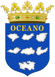
ආක්රමණයෙන් පසුව, තනි බෝග වගාව මත පදනම්ව, කැස්ටිලියානුවන් නව ආර්ථික ආකෘතියක් පැනවූහ: පළමු උක්; පසුව වයින්, එංගලන්තය සමඟ වෙළඳාමේ වැදගත් භාණ්ඩයක්. ග්රාන් කැනරියා 1480 මාර්තු 6 වන දින කැස්ටිල් ඔටුන්න විසින් යටත් කර ගන්නා ලද අතර 1496 දී ටෙනරීෆ් යටත් කර ගන්නා ලද අතර, ඒ සෑම එකක්ම තමන්ගේම ආණ්ඩුකාරයෙකු විය. කැනරි දූපත් වල රොසෙලා ටින්ක්ටෝරියා බහුලව පැවතීම ජීන් ඩි බෙතන්කෝට් දූපත් අත්පත් කර ගැනීමේදී ඔහුට ලාභ චේතනාවක් ලබා දුන් බවට අනුමාන කිරීම් තිබේ. සායම් සෑදීම සඳහා ලයිකන සියවස් ගණනාවක් තිස්සේ භාවිතා කර ඇත. මෙයට ඕර්සෙයිල් ලෙසද හඳුන්වන ආර් ටින්ක්ටෝරියා වලින් ලබාගත් රාජකීය දම් වර්ණ ඇතුළත් වේ.[82]

දූපත් වගා කිරීමේ බලාගාරයක් බවට පරිවර්තනය කිරීමේ ස්පාඤ්ඤ කිරීටයේ අරමුණට වඩා විශාල ශ්රම බලකායක් අවශ්ය විය. මෙය සාක්ෂාත් කරගනු ලැබුවේ ස්වදේශික කැනරියානුවන් පමණක් නොව උතුරු සහ උප-සහාරා අප්රිකාවෙන් බලහත්කාරයෙන් රැගෙන ගිය අප්රිකානුවන් විශාල සංඛ්යාවක් වහල්භාවයේ ම්ලේච්ඡ ක්රියාවක් මගිනි.[83] අත්ලාන්තික් කලාපයේ පළමු වහල් වගාවන් මැඩෙයිරා, කේප් වර්ඩ් සහ කැනරි දූපත් හරහා වූ අතර, එය ආදිවාසී ජනගහනයක් සිටි කැනරි දූපත් පමණක් වන අතර එබැවින් අලුතින් අත්පත් කර ගැනීමට වඩා ආක්රමණය විය.[84]
මෙම කෘෂිකාර්මික කර්මාන්තය බොහෝ දුරට උක් මත පදනම් වූ අතර කැස්ටිලියානුවන් විසින් උක් නිෂ්පාදනය සඳහා විශාල භූමි ප්රදේශයක් පරිවර්තනය කරන ලද අතර, වහල් කම්කරුවන් විසින් සීනි සැකසීම සහ නිෂ්පාදනය සඳහා පහසුකම් සපයන ලදී.[85] සැන්ටා කෲස් ඩි ටෙනරීෆ් සහ ලාස් පල්මාස් ඩි ග්රාන් කැනරියා යන නගර ස්පාඤ්ඤ වෙළෙන්දන්ට මෙන්ම ජයග්රාහකයින්ට සහ මිෂනාරිවරුන්ට නව ලෝකයට යන ගමනේදී නැවතුම් ස්ථානයක් බවට පත්විය. මෙම වෙළඳ මාර්ගය දිවයිනේ කැස්ටිලියානු සමාජ අංශ වෙත විශාල ධනයක් ගෙන ආ අතර ඉක්මනින්ම යුරෝපය පුරා වෙළෙන්දන් සහ වික්රමාන්විතයන් ආකර්ෂණය විය. ධනය වර්ධනය වීමත් සමඟම, වහල්භාවයට පත් අප්රිකානු කම්කරුවන්ට ඔවුන්ගේ නිවෙස්වල සේවකයන් වැනි දූපත් වල ධනවත් කැස්ටිලියානුවන් සඳහා ගෘහාශ්රිත භූමිකාවන් අවමන් කිරීමට බලකෙරිණි.[86]
ග්රාන් කැනරියා හි ෆින්කා ක්ලැවිජෝ ගේ සුසාන භූමියේ සිට මෙම වහල් සේවකයන්ගෙන් සමහරෙකුගේ ඇටසැකිලි පිළිබඳ පර්යේෂණයන් පෙන්වා දී ඇත්තේ 'ෆින්කා ක්ලැවිජෝ හි තැන්පත් කර ඇති සියලුම වැඩිහිටියන් කොඳු ඇට පෙළ මත සැලකිය යුතු ආතතියක් ඇති කරන පුළුල් ශාරීරික ක්රියාකාරකම්වල නිරත වූ' බවයි. නිර්දය වෙහෙස මහන්සි වී වැඩ කිරීම, ලොව පුරා වෙනත් උක් වගාවන්හි වහල් ජනයා සමඟ දක්නට ලැබෙන ශාරීරික අසාමාන්යතා වලට සමානය.[81] ස්පාඤ්ඤ ප්රභූ පැලැන්තියට ධනය සැපයීම සඳහා ෆින්කා ක්ලැවිජෝ හි වහල්භාවයට පත් වූවන් විසින් සිදු කරන ලද ශාරීරික වෙහෙස පිළිබඳ මෙම සොයාගැනීම් බ්රිතාන්ය ලේඛක රැල්ෆ් හොයිට් විසින් අස්ථියට සමීපව යන කාව්යයකට ආභාසය ලබා දී ඇත.[87]
උත්පාදනය කරන ලද විශාල ධනයේ ප්රතිඵලයක් ලෙස, මෙම කාර්යබහුල, සමෘද්ධිමත් කාල පරිච්ඡේදය තුළ ලා පල්මා හි විශිෂ්ට මාලිගා සහ පල්ලි ඉදිකරන ලදි. එල් සැල්වදෝර් පල්ලිය 16 වන සියවසේ ගෘහ නිර්මාණ ශිල්පය පිළිබඳ දිවයිනේ හොඳම උදාහරණ වලින් එකක් ලෙස පවතී. සිවිල් ගෘහ නිර්මාණ ශිල්පය කැසාස් ඩි ලොස් සැන්චෙස්-ඔචන්ඩෝ හෝ කැසා ක්වින්ටානා වැනි ආකාරවලින් නොනැසී පවතී.
කැනරිවරුන්ගේ ධනය මුහුදු කොල්ලකරුවන්ගේ සහ පුද්ගලික ප්රහාරවලට ආරාධනා කළේය. ඔටෝමාන් තුර්කි අද්මිරාල් සහ පුද්ගලික කෙමාල් රීස් 1501 දී කැනරිවලට ඇතුළු වූ අතර මුරාත් රීස් එල්ඩර් 1585 දී ලැන්සාරෝට් අල්ලා ගත්තේය.
දරුණුතම ප්රහාරය එල්ල වූයේ 1599 ලන්දේසි කැරැල්ලේදීය. පීටර් වැන් ඩර් ඩෝස් විසින් අණ දෙන ලද නැව් 74 කින් සහ මිනිසුන් 12,000 කින් යුත් ලන්දේසි බලඇණියක් ලාස් පල්මාස් ඩි ග්රාන් කැනරියා අගනුවරට පහර දුන්හ (නගරයේ ග්රාන් කැනරියා හි වැසියන් 8,545 න් 3,500 ක් සිටියහ). ලන්දේසීන් වරාය ආරක්ෂා කළ කැස්ටිලෝ ඩි ලා ලූස් වෙත පහර දුන්හ. කැනරියානුවන් නගරයෙන් සිවිල් වැසියන් ඉවත් කළ අතර, කැස්ටිලෝ යටත් විය (නමුත් නගරය නොවේ). ලන්දේසීන් රට අභ්යන්තරයට ගෙන ගිය නමුත් කැනරියානු අශ්වාරෝහක ඔවුන්ව නගරය අසල පිහිටි තමරාසයිට් වෙත ආපසු ගෙන ගියහ.
ඉන්පසු ලන්දේසීන් නගරය වටලා එහි සියලු ධනය භාර දෙන ලෙස ඉල්ලා සිටියහ. ඔවුන්ට බැටළුවන් 12 ක් සහ පැටවුන් 3 ක් ලැබුණි. කෝපයට පත් ලන්දේසීන් සැන්ටා බ්රිගිඩා ගම්මානයේ නවාතැන් ගෙන සිටි කැනරිවරුන්ගේ කවුන්සිලයට පහර දීමට සොල්දාදුවන් 4,000 ක් යැවීය. කැනරියානු සොල්දාදුවන් තුන්සියයක් ලන්දේසීන් මොන්ටේ ලෙන්ටිස්කාල් ගම්මානයේ සැඟවී සිටි අතර, 150 දෙනෙකු මරා දමා ඉතිරි අයට පසුබැසීමට බල කෙරුනි. ලන්දේසීන් ලාස් පල්මාස් ඩි ග්රාන් කැනරියා වෙත අවධානය යොමු කර එය පුළුස්සා දැමීමට උත්සාහ කළහ. ලන්දේසීන් ග්රාන් කැනරියා හි දකුණු වෙරළ තීරයේ මාස්පලෝමාස්, ලා ගෝමෙරා හි සැන් සෙබස්තියන් සහ ලා පල්මා හි සැන්ටා කෲස් කොල්ලකෑමට ලක් වූ නමුත් අවසානයේ ලාස් පල්මාස් වටලෑම අත්හැර දමා ඉවත් විය.
1618 දී උතුරු අප්රිකාවේ සිට පැමිණි බාර්බරි මුහුදු කොල්ලකරුවන් වහලුන් ලෙස විකිණීම සඳහා වහලුන් 1000ක් රැගෙන ලැන්සාරෝට් සහ ලා ගෝමර වෙත පහර දුන්හ.[88] තවත් කැපී පෙනෙන ප්රහාරයක් සිදු වූයේ 1797 ජූලි 25 වන දින හොරටියෝ නෙල්සන් යටතේ බ්රිතාන්ය බලඇණියක් විසින් සැන්ටා කෲස් ඩි ටෙනරීෆ් ප්රහාරයට ලක් වූ විටය. බ්රිතාන්යයන් පලවා හරින ලද අතර මිනිසුන් 400 ක් පමණ අහිමි විය. නෙල්සන්ගේ දකුණු අත අහිමි වූයේ මේ සටනේදීය.
18 සිට 19 වන සියවස දක්වා
[සංස්කරණය]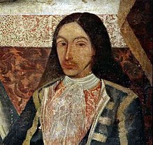
දූපත්වල සීනි මත පදනම් වූ ආර්ථිකය ස්පාඤ්ඤයේ කැරිබියන් ජනපදවලින් දැඩි තරගයකට මුහුණ දුන්නේය. 19 වන ශතවර්ෂයේ අඩු සීනි මිල නිසා දූපත් වල දැඩි අවපාතයක් ඇති විය. මෙම කාලය තුළ දිවයිනේ ආර්ථිකය ප්රබෝධමත් කරමින් නව මුදල් බෝගයක් වන කොහොඹ (කොචිනිල්ලා) වගාවට පැමිණියේය. මෙම කාලය තුළ කැනරියානු-ඇමරිකානු වෙළඳාම වර්ධනය වූ අතර, කොචීනල්, උක් සහ රම් වැනි කැනරියානු නිෂ්පාදන වෙරක්රූස්, කැම්පේචේ, ලා ගුවාරා සහ හවානා වැනි ඇමරිකානු වරායන්හි අලෙවි කරන ලදී.[89]
18 වන ශතවර්ෂයේ අවසානය වන විට, කැනරි දූපත් වැසියන් හවානා, වෙරක්රුස් සහ සැන්ටෝ ඩොමින්ගෝ,[90] සැන් ඇන්ටෝනියෝ, ටෙක්සාස්[91] සහ ලුසියානාහි ශාන්ත බර්නාඩ් පැරිෂ්[92][93] වැනි ස්පාඤ්ඤ ඇමරිකානු ප්රදේශ වෙත සංක්රමණය වී ඇත. මෙම ආර්ථික දුෂ්කරතා 19 වැනි සහ 20 වැනි සියවසේ මුල් භාගයේදී, මූලික වශයෙන් ඇමරිකාවට විශාල වශයෙන් සංක්රමණය වීමට හේතු විය. 1840 සහ 1890 අතර කැනරි දූපත් වැසියන් 40,000ක් පමණ වෙනිසියුලාව වෙත සංක්රමණය විය. එසේම, කැනරියානුවන් දහස් ගණනක් පුවර්ටෝ රිකෝ වෙත සංක්රමණය වූ අතර එහිදී ස්පාඤ්ඤ රාජාණ්ඩුවට හැඟුණේ කැනරියානුවන් ස්පාඤ්ඤයේ ප්රධාන භූමියෙන් පැමිණෙන අනෙකුත් සංක්රමණිකයන්ට වඩා දූපත් ජීවිතයට හොඳින් අනුගත වනු ඇති බවයි. පුවර්ටෝ රිකෝ හි හැටිලෝ නගරයේ මස්කාරාස් උත්සවය වැනි ගැඹුරින් මුල් බැසගත් සම්ප්රදායන්, පුවර්ටෝ රිකෝ හි තවමත් සංරක්ෂණය කර ඇති කැනරියානු සංස්කෘතියේ උදාහරණයකි. එලෙසම, දහස් ගණන් කැනරියානුවන් කියුබාවේ වෙරළට සංක්රමණය විය.[94] 1898 ස්පාඤ්ඤ-ඇමරිකානු යුද්ධය අතරතුර, ස්පාඤ්ඤ ජාතිකයන් විසින් ඇමරිකානු ප්රහාරයකට එරෙහිව දූපත් ශක්තිමත් කළ නමුත් එවැනි සිදුවීමක් සිදු නොවීය.
රොමෑන්තික යුගය සහ විද්යාත්මක ගවේෂණ
[සංස්කරණය]
සිරේරා සහ රෙන් (2004)[95] 1770-1830 කාලය තුළ විවිධ ගවේෂණ හෝ මුහුදු ගමන් දෙකක් වෙන්කර හඳුනා ගනී, ඔවුන් එය "රොමෑන්තික යුගය" ලෙස හඳුන්වනු ලැබේ:
පළමුවැන්න නම් "රාජ්යයන් විසින් අරමුදල් සපයන ගවේෂණ, නිල විද්යාත්මක ආයතන සමඟ සමීපව සම්බන්ධ වේ. දැඩි විද්යාත්මක අරමුණු (සහ ආනුභාව ලත්) නිදර්ශන සහ ප්රගතියේ ආත්මයෙන් සංලක්ෂිත වේ". මෙම වර්ගයේ ගවේෂණවලදී, සිරේරා සහ රෙන් පහත සඳහන් සංචාරකයින් ඇතුළත් වේ:
- ජේ. ඊඩන්ස්, ඔහුගේ 1715 නැගීම සහ ටයිඩ් කන්දේ නිරීක්ෂණ පසුකාලීන බොහෝ ගවේෂණ සඳහා බලපෑවේය.
- ලුවී ෆියුලී (1724), ඔහු එල් හයිරෝ හි මැරිඩියන් මැනීමට සහ දූපත් සිතියම් ගත කිරීමට යවන ලදී.
- ජීන්-චාල්ස් ද බෝර්ඩා (1771, 1776) දූපත්වල දේශාංශ සහ ටීඩේ කන්දේ උස වඩාත් නිවැරදිව මැනිය.
- බවුඩින්-ලෙඩ්රු ගවේෂණය (1796) එය ස්වභාවික ඉතිහාස වස්තු වල වටිනා එකතුවක් නැවත ලබා ගැනීම අරමුණු කර ගෙන ඇත.
සිරේරා සහ රෙන් විසින් හඳුනාගත් දෙවන වර්ගයේ ගවේෂණ කටයුතු අඩු වැඩි වශයෙන් පුද්ගලික මුල පිරීම් වලින් ආරම්භ වූ එකකි. මේවා අතර, ප්රධාන ඝාතකයන් පහත සඳහන් වේ:
- ඇලෙක්සැන්ඩර් වොන් හම්බෝල්ට් (1799)
- බුච් සහ ස්මිත් (1815)
- බ්රවුසොනෙට්
- වෙබ්
- සබින් බර්තෙලොට්.
සිරේරා සහ රෙන් 1770-1830 කාලසීමාව හඳුනා ගන්නේ "ඒ මොහොත දක්වා ප්රංශය සහ එංගලන්තය විසින් ආධිපත්යය දැරූ පරිදර්ශනයක දී දූපත් වල පැවැත්ම වැඩි වන රොමැන්ටික් යුගයේ බ්රියෝ ජර්මනියට ශක්තියෙන් ඇතුළු වේ" ලෙසය.
20 වන සියවසේ මුල් භාගය
[සංස්කරණය]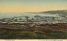
20 වන ශතවර්ෂයේ ආරම්භයේ දී, බ්රිතාන්යයන් නව මුදල් බෝගයක් හඳුන්වා දුන් අතර, කෙසෙල් අපනයනය පාලනය කරන ලද්දේ ෆයිෆෙස් වැනි සමාගම් විසිනි.
1833 නොවැම්බර් 30 කැනරි දූපත් පළාත නිර්මාණය කර තිබුණේ අගනුවර සැන්ටා කෲස් ඩි ටෙනරීෆ් ලෙස ප්රකාශයට පත් කරමිනි.[96] දූපත් වල අගනුවර සඳහා ලාස් පල්මාස් ඩි ග්රාන් කැනරියා සහ සැන්ටා කෲස් ඩි ටෙනරීෆ් යන නගර අතර ඇති වූ එදිරිවාදිකම් හේතුවෙන් 1927 සැප්තැම්බර් 23 දින මෙම දූපත් සමූහය පළාත් දෙකකට බෙදීමට හේතු විය.[97]
දෙවන ස්පාඤ්ඤ ජනරජයේ කාලය තුළ, ජෝස් මිගෙල් පෙරෙස් සහ ගිලර්මෝ අස්කානියෝ වැනි පුද්ගලයින් විසින් නායකත්වය දුන් මාක්ස්වාදී සහ අරාජිකවාදී කම්කරු ව්යාපාර වර්ධනය වීමට පටන් ගත්තේය. කෙසේ වෙතත්, නගර සභා කිහිපයකින් පිටත, මෙම සංවිධාන සුළුතරයක් වූ අතර ස්පාඤ්ඤ සිවිල් යුද්ධයේදී ජාතිකවාදී බලවේගවලට පහසුවෙන් වැටුණි.
ෆ්රැන්කෝ පාලන තන්ත්රය
[සංස්කරණය]1936 දී ෆ්රැන්සිස්කෝ ෆ්රැන්කෝ කැනරිවරුන්ගේ සාමාන්ය අණදෙන නිලධාරියා ලෙස පත් කරන ලදී. ඔහු ස්පාඤ්ඤ සිවිල් යුද්ධය ආරම්භ කළ ජූලි 17 හමුදා කැරැල්ලට සම්බන්ධ විය. ලා පල්මා සහ ලා ගෝමෙරා හි වැලෙහර්මෝසෝ නගරයේ ප්රතිරෝධයේ ස්ථාන කිහිපයක් හැර, ෆ්රැන්කෝ ඉක්මනින් දූපත් සමූහය පාලනය කළේය. දූපත් වල කිසිදා යුද්ධයක් නොතිබුණද, පශ්චාත් යුධ සමයේ කැනරි වල දේශපාලන විසම්මුතිය මර්දනය කිරීම ඉතාමත් දරුණු විය.[98]
දෙවන ලෝක සංග්රාමයේදී වින්ස්ටන් චර්චිල්, ස්පාඤ්ඤ ප්රධාන භූමියෙන් ජිබ්රෝල්ටාර් ආක්රමණය කළහොත්, කැනරි දූපත් බ්රිතාන්ය නාවික කඳවුරක් ලෙස අල්ලා ගැනීම සඳහා සැලසුම් සකස් කළේය.[99][Note 1] සැලසුම් කළ මෙහෙයුම හැඳින්වූයේ ඔපරේෂන් පිල්ග්රිම් ලෙසිනි.[100]
ස්පාඤ්ඤයේ කොමියුනිස්ට් පක්ෂය සහ විවිධ ජාතිකවාදී, වාමාංශික පක්ෂ පිහිටුවීම වැනි පක්ෂවල පෙරළියක් අත්විඳින ලද 1950 ගණන්වල අගභාගය වන තෙක් ෆ්රැන්කෝගේ පාලන තන්ත්රයට විරුද්ධත්වය සංවිධානය වීමට පටන් ගත්තේ නැත.
ඉෆ්නි යුද්ධය අතරතුර, ෆ්රැන්කෝ රෙජීමය විසින් ස්පාඤ්ඤයට පක්ෂපාතී යැයි සැක කරන බටහිර සහරාහි සිටි අයව නීති විරෝධී ලෙස සිරගත කිරීම සඳහා දූපත්වල ගාල් කඳවුරු පිහිටුවූ අතර, ඔවුන්ගෙන් බොහෝ දෙනෙක් යටත් විජිත හමුදා එම ස්ථානයේදීම බඳවා ගත් නමුත් පසුව පස්වන තීරු රචකයන් ලෙස සලකනු ලැබූ අතර පසුව පිටුවහල් කරන ලදී. කැනරි දූපත්. මෙම කඳවුරු යටිතල පහසුකම් ව්යාපෘති සඳහා බලහත්කාරයෙන් ශ්රමිකයන් යොදා ගැනීම සහ ක්ෂය රෝගය පුලුල්ව පැතිරයාමට හේතු වූ දැඩි අපිරිසිදු තත්ත්වයන් මගින් සංලක්ෂිත විය.[101]
ස්වයං පාලනය
[සංස්කරණය]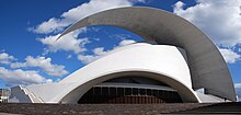
ෆ්රැන්කෝගේ මරණයෙන් පසු, ඇල්ජීරියාව පදනම් කරගත් නිදහසට පක්ෂ සන්නද්ධ ව්යාපාරයක්, කැනරීස් දූපත් සමූහයේ නිදහස සහ ස්වයං නිර්ණය සඳහා වූ ව්යාපාරය (MAIAC) විය. 1968 දී, අප්රිකානු එකමුතුවේ සංවිධානය MAIAC නීත්යානුකූල අප්රිකානු නිදහස් ව්යාපාරයක් ලෙස පිළිගෙන, කැනරි දූපත් තවමත් විදේශ පාලනය යටතේ පවතින අප්රිකානු භූමියක් ලෙස ප්රකාශයට පත් කළේය.[102]
ස්පාඤ්ඤයේ ප්රජාතන්ත්රවාදී ව්යවස්ථාපිත රාජාණ්ඩුවක් පිහිටුවීමෙන් පසු, අලුතින් පිහිටුවන ලද ස්වාධීන බලය බෙදා හරින ලද රජයක් සහ පාර්ලිමේන්තුවක් සමඟ 1982 දී සම්මත කරන ලද නීතියක් හරහා කැනරිවරුන්ට ස්වයං පාලනයක් ලබා දෙන ලදී. 1983 දී පළමු ස්වයං පාලන මැතිවරණය පැවැත්විණි. ස්පාඤ්ඤ සමාජවාදී කම්කරු පක්ෂය (PSOE) ජයග්රහණය කළේය.[103]
අගනුවර
[සංස්කරණය]වර්තමානයේ, කැනරි දූපත් යනු ස්පාඤ්ඤයේ අගනුවර දෙකක් ඇති එකම ස්වාධීන ප්රජාවයි: සැන්ටා කෲස් ඩි ටෙනරීෆ් සහ ලාස් පල්මාස් ඩි ග්රාන් කැනරියා, කැනරි දූපත් වල ස්වයං පාලන ප්රඥප්තිය 1982 දී නිර්මාණය කරන ලද බැවින්.[16][17]
මෙම දූපත් සමූහයේ දේශපාලන අගනුවර දහනව වන ශතවර්ෂය වන තුරුම නොතිබුණි. 15 වන ශතවර්ෂයේ කැනරි දූපත් ආක්රමණය කරන අවස්ථාවේ යුරෝපීයයන් විසින් ආරම්භ කරන ලද පළමු නගර වූයේ: ටෙල්ඩේ (ග්රාන් කැනරියා හි), සැන් මාර්ෂල් ඩෙල් රුබිකන් (ලැන්සරෝට් හි) සහ බෙටන්කුරියා (ෆුර්ටෙවෙන්චුරා හි). මෙම නගර කතෝලික රදගුරු දේවස්ථාන ඇතුළු දූපත් සමූහයේ පළමු යුරෝපීය ආයතන ගැන පුරසාරම් දොඩන ලදී.[104] කෙසේ වෙතත්, මෙම නගරවල තේජස කාලය වර්ධනය වූයේ දූපත් සමූහය මුළුමනින්ම යටත් කර ගැනීමටත්, එය කැස්ටිල් කිරුළට ඇතුළත් කිරීමටත් පෙර කිසි විටෙකත් සමස්ත කැනරි දූපත් සමූහයේ දේශපාලන හා සැබෑ පාලනයක් නොතිබූ බැවිනි.


සමස්ත දූපත් සමූහය සඳහා පූර්ණ අධිකරණ බලය සහිත කැනරියානු නගරයක ක්රියාකාරිත්වය පවතින්නේ කැනරි දූපත් යටත් කර ගැනීමෙන් පසුව පමණි, නමුත් මුලින් තථ්ය, එනම් නෛතික හා සැබෑ අර්ථයක් නොමැතිව සහ කැනරි දූපත් ජෙනරල් කැප්ටන්සි මූලස්ථානයට සම්බන්ධ කර ඇත.
ලාස් පල්මාස් ඩි ග්රාන් කැනරියා මෙම කාර්යය ක්රියාත්මක කළ පළමු නගරයයි. මක්නිසාද යත්, කැනරි දූපත් වල කපිතාන් ජෙනරාල්ගේ වාසස්ථානය දහසයවන සහ දහහත්වන සියවස්වල කොටසක මෙම නගරයේ තිබූ බැවිනි.[105] 1661 මැයි මාසයේදී, කැනරි දූපත් වල කපිතාන් ජෙනරල් ජෙරොනිමෝ ඩි බෙනාවෙන්ටේ වයි ක්විනෝන්ස්, කැප්ටන්සියේ මූලස්ථානය ටෙනරීෆ් දූපතේ සැන් ක්රිස්ටෝබල් ඩි ලා ලගුනා නගරයට ගෙන යන ලදී.[106] මෙයට හේතු වූයේ මෙම දූපත යටත් කර ගැනීමෙන් පසුව වඩාත්ම ජනාකීර්ණ, ඵලදායි හා ඉහළම ආර්ථික අපේක්ෂාවන් සහිත දූපත වීමයි.[107] 19 වන සියවසේදී සැන්ටා කෲස් ඩි ටෙනරීෆ් නගරයේ කැනරි දූපත් අගනුවර නිල තත්ත්වය තහවුරු කරන තුරු,[108] ලා ලගුන දූපත් සමූහයේ තථ්ය අගනුවර ලෙස සලකනු ලැබේ, සැන් ක්රිස්ටෝබල් ඩි ලා ලගුන සහ ලාස් පල්මාස් ඩි ග්රාන් කැනරියා හි ධනේශ්වරය මෙම දූපත් සමූහයේ ආර්ථික, දේශපාලනික සහ ආයතනික ආධිපත්යය සඳහා නිරන්තර මතභේද සහ එදිරිවාදිකම් ඇති විය.[109]
දැනටමත් 1723 දී, කැනරි දූපත් වල කපිතාන් ජෙනරාල් ලොරෙන්සෝ ෆර්නැන්ඩස් ද විලාවිසෙන්සියෝ කැනරි දූපත් වල ජෙනරල් කැප්ටන්සියේ මූලස්ථානය සැන් ක්රිස්ටෝබල් ඩි ලා ලගුන සිට සැන්ටා කෲස් ඩි ටෙනරීෆ් වෙත ගෙන ගොස් ඇත. ග්රාන් කැනරියා දූපතේ සමාජය සතුටු නොකර මෙම තීරණය දිගටම පැවතුනි.[110] එය 1833 නොවැම්බරයේ කැනරි දූපත් පළාත නිර්මාණය කිරීමෙන් පසුව, සැන්ටා කෲස් කැනරි දූපත් වල ප්රථම පූර්ණ නිල අගනුවර බවට පත් වනු ඇත (ඩි ජූර් මිස කලින් සිදු වූවාක් මෙන් නොවේ).[16][19] සැන්ටා කෲස් ඩි ටෙනරීෆ් කැනරි දූපත් සමූහයේ අගනුවර වනු ඇත, 1927 දී ජෙනරල් ප්රීමෝ ඩි රිවේරා රජය සමයේ කැනරි දූපත් පළාත පළාත් දෙකකට බෙදා ඇත: ලාස් පල්මාස් අගනුවර ලාස් පල්මාස් ඩි ග්රාන් කැනරියා සහ සැන්ටා කෲස් ඩි ටෙනරීෆ් සමජාතීය නගරයේ අගනුවර විය.
අවසාන වශයෙන්, 1982 දී කැනරි දූපත් වල ස්වයං පාලන ප්රඥප්තිය සහ කැනරි දූපත් වල ස්වයං පාලන ප්රජාව නිර්මාණය කිරීමත් සමඟ, ලාස් පල්මාස් ඩි ග්රාන් කැනරියා සහ සැන්ටා කෲස් ඩි ටෙනරීෆ් අතර දූපත් සමූහයේ අගනුවර ස්ථාවර වී ඇත, එය අදටත් පවතී. .
ජනවිකාසය
[සංස්කරණය]| ජනගහන ඉතිහාසය[111] | ||
|---|---|---|
| වසර | ජනගහණ. | ±% p.a. |
| 1768 | 155,763 | — |
| 1787 | 168,928 | +0.43% |
| 1797 | 173,865 | +0.29% |
| 1842 | 241,266 | +0.73% |
| 1860 | 237,036 | −0.10% |
| 1887 | 301,983 | +0.90% |
| 1900 | 364,408 | +1.46% |
| 1920 | 488,483 | +1.48% |
| 1940 | 687,937 | +1.73% |
| 1960 | 966,177 | +1.71% |
| 1974 | 1,229,259 | +1.74% |
| 1981 | 1,367,646 | +1.54% |
| 1990 | 1,589,403 | +1.68% |
| 2000 | 1,716,276 | +0.77% |
| 2010 | 2,118,519 | +2.13% |
| 2015[112] | 2,128,647 | +0.10% |
| 2020 | 2,244,369 | +1.06% |
| 2021 | 2,185,693 | −2.61% |
| 2022 | 2,212,018 | +1.20% |
| 2023 | 2,236,013 | +1.08% |
කැනරි දූපත් වල ජනගහනය 2,153,389 (2019) වන අතර, එය ස්පාඤ්ඤයේ ස්වයං පාලන ප්රජාවන්ගෙන් අටවන වැඩිම ජනගහනයක් සහිත වේ.[3] දූපත් සමූහයේ මුළු භූමි ප්රමාණය වර්ග කිලෝමීටර 7,493 (වර්ග සැතපුම් 2,893 ) වේ,[113] එහි ප්රතිඵලයක් ලෙස වර්ග කිලෝමීටරයකට ජනගහන ඝනත්වය 287.4ක් වේ.
2019 දත්ත වලට අනුව දූපත් වල ජනගහනය:[3]
- ටෙනරීෆ් - 917,841
- ග්රාන් කැනරියා - 851,231
- ලැන්සරෝට් – 152,289 (ලා ග්රේසියෝසා හි ජනගහනය ද ඇතුළුව)
- ෆුර්ටෙවෙන්චුරා - 116,886
- ලා පල්මා - 82,671
- ලා ගෝමරා - 21,503
- එල් හියර්රෝ - 10,968
කැනරි දූපත් බොහෝ යුරෝපීය පදිංචිකරුවන්ගේ නිවහන බවට පත්ව ඇත, ප්රධාන වශයෙන් ඉතාලිය, ජර්මනිය සහ එක්සත් රාජධානියෙන් පැමිණේ. 20 වන ශතවර්ෂයේ දෙවන භාගයේදී වෙනිසියුලාව සහ කියුබාව වෙත විශාල සංක්රමණය වීම සහ පසුව ඔවුන්ගේ පවුල් සමඟ කැනරි දූපත් වෙත ආපසු පැමිණීම හේතුවෙන්, වෙනිසියුලාව (66,593) හෝ කියුබාව (41,807) උපන් රට වූ බොහෝ පදිංචිකරුවන් සිටිති. 1990 ගණන්වල සිට බොහෝ නීතිවිරෝධී සංක්රමණිකයන් කැනරි දූපත්, මෙලිලා සහ සීටා වෙත ළඟා වී ඇති අතර, ඒවා යුරෝපා සංගමයට ඇතුල් වීමේ ස්ථාන ලෙස භාවිතා කර ඇත.[114][115][116]
| කැනරි දූපත් වල ජනගහනය 2019 | |||
|---|---|---|---|
| උපන් ස්ථානය | ජනගහනය | ප්රතිශතය | |
| කැනරි දූපත් | 1,553,517 | 72.1 | |
| ස්පාඤ්ඤයේ ඉතිරිය | 176,302 | 8.2 | |
| මුළු, ස්පාඤ්ඤය | 1,735,457 | 80.6 | |
| පිටරට උපන් | 417,932 | 19.4 | |
| ඇමරිකාව | 201,257 | 9.3 | |
| වෙනිසියුලාව | 66,573 | – | |
| කියුබාව | 41,792 | – | |
| කොලොම්බියාව | 31,361 | – | |
| ආර්ජන්ටිනාව | 17,429 | – | |
| උරුගුවේ | 8,687 | – | |
| යුරෝපයේ ඉතිරි | 154,511 | 7.2 | |
| ඉතාලිය | 39,469 | – | |
| ජර්මනිය | 25,921 | – | |
| එක්සත් රාජධානිය | 25,339 | – | |
| අප්රිකාව | 38,768 | 1.8 | |
| මොරොක්කෝව | 24,268 | – | |
| ආසියාව | 23,082 | 1.1 | |
| චීනය | 9,848 | – | |
| ඉන්දියාව | 5,766 | – | |
| ඕෂනියාව | 314 | 0.0 | |
| මුළු | 2,153,389 | 100.0 | |
| Source[115][117] | |||
ආගම
[සංස්කරණය]
කැනරි දූපත් ආක්රමණය කිරීමෙන් පසු සියවස් පහකට වැඩි කාලයක් පුරා කතෝලික පල්ලිය දූපත් සමූහයේ බහුතර ආගම වී ඇත. තවත් ආගමික ප්රජාවන් කිහිපයක් ද ඇත.
රෝමානු කතෝලික පල්ලිය
[සංස්කරණය]ස්වදේශික කැනරියානුවන්ගෙන් අතිමහත් බහුතරය රෝමානු කතෝලික (76.7%)[118] වන අතර ප්රොතෙස්තන්තයන් වැනි අනෙකුත් ක්රිස්තියානි විශ්වාසයන්ගෙන් යුත් විවිධ කුඩා විදේශීය ජනගහණයක් ඇත.
කැන්ඩලේරියා කන්යාව (කැනරි දූපත් වල අනුශාසක) ගේ පෙනුම කැනරි දූපත් ක්රිස්තියානි ධර්මය කරා ගෙන යාමේ ගෞරවය හිමි විය. කතෝලික සාන්තුවරයන් දෙදෙනෙකු කැනරි දූපත් වල උපත ලැබීය: ශාන්ත ජෝසප් ද බෙටන්කුර්ගේ පීටර්[119] සහ ජෝස් ද ඇන්චිටා.[120] ටෙනරීෆ් දූපතේ උපන් දෙදෙනාම පිළිවෙලින් ග්වාටමාලාවේ සහ බ්රසීලයේ මිෂනාරිවරු වූහ.
කැනරි දූපත් කතෝලික රදගුරු පදවි දෙකකට බෙදා ඇති අතර, ඒ සෑම එකක්ම බිෂොප්වරයෙකු විසින් පාලනය කරනු ලැබේ:
- ඩයොසීසිස් කැනරියන්ස්: නැගෙනහිර පළාතේ දූපත් ඇතුළත් වේ: ග්රාන් කැනරියා, ෆුර්ටෙවෙන්චුරා සහ ලැන්සරෝට්. එහි අගනුවර වූයේ සැන් මාර්ෂල් එල් රුබිකන් (1404) සහ ලාස් පල්මාස් ඩි ග්රාන් කැනරියා (1483-වර්තමානය) ය. මීට පෙර ටෙල්ඩේ පදනම් වූ රදගුරු පදවියක් පැවති නමුත් පසුව එය අහෝසි විය.
- ඩයොසීසිස් නිවාරියන්ස්: බස්නාහිර පළාතේ දූපත් ඇතුළත් වේ: ටෙනරීෆ්, ලා පල්මා, ලා ගෝමර සහ එල් හියරෝ. එහි අගනුවර සැන් ක්රිස්ටෝබල් ඩි ලා ලගුනා (1819-වර්තමානය) වේ.
වෙනත් ආගම්
[සංස්කරණය]අති විශාල කතෝලික බහුතරයෙන් වෙන්ව සිටින්නේ මුස්ලිම් ජාතිකයන් සුළුතරයකි.[121] ඉස්ලාමයේ අනුගාමිකයින් අතර, කැනරි දූපත් වල ඉස්ලාමීය ප්රජාව නියෝජනය කිරීමට මෙන්ම ඉස්ලාමීය ප්රජාවේ සාමාජිකයින්ට ප්රායෝගික සහයෝගය ලබා දීමට කැනරි දූපත් වල ඉස්ලාමීය සම්මේලනය පවතී.[122] එහි කොටස සඳහා, දූපත් සමූහයේ කැනරි දූපත් වල එවැන්ජලිකල් කවුන්සිලය ද ඇත.
නියෝජනය කරන අනෙකුත් ආගමික ඇදහිලිවලට යෙහෝවාගේ සාක්ෂිකරුවන්, පසුකාලීන සාන්තුවරයන්ගේ යේසුස් ක්රිස්තුස්ගේ පල්ලිය මෙන්ම හින්දු ආගමද ඇතුළත් වේ.[121] නව මිථ්යාදෘෂ්ටික ස්වදේශික ආගමක් ලෙස වර්ගීකරණය කරන ලද ගුවන්චේ ජනතාව වැනි සුළුතර ආගම් ද පවතී.[121] බුද්ධාගම,[121] යුදෙව් ආගම,[121] බහායි,[121] අප්රිකානු ආගම්,[121] සහ චීන ආගම් ද පවතී.[121]
සංඛ්යාලේඛන
[සංස්කරණය]CIS බැරෝමීටර ස්වයං පාලනයට අනුව 2012 දී විශ්වාස බෙදා හැරීම පහත පරිදි විය:[123]
- කතෝලික 84.9%
- අදේවවාදි/අඥෙයවාදියා/නොඇදහිලිවන්තයා 12.3%
- වෙනත් ආගම් 1.7%
ජනගහන ජාන විද්යාව
[සංස්කරණය]කැනරි දූපත් වල නිතර නිතර (මාතෘ-සම්භව) mtDNA හැප්ලොග් සමූහය H (37.6%), පසුව U6 (14.0%), T (12.7%), U6 U (10.3%) සහ J (7.0%) වේ. හැප්ලොග් කණ්ඩායම් දෙකක්, H සහ U6 පමණක් පුද්ගලයන්ගෙන් 50% කට වඩා වැඩි ප්රමාණයක් නියෝජනය කරයි. උප-සහාරා මාතෘ L haplogroups හි සැලකිය යුතු සංඛ්යාත (6.6%) කැනරි දූපත් වල උප සහරා කාන්තා වහල් ශ්රමය හඳුන්වාදීම පිළිබඳ ඓතිහාසික වාර්තා සමඟ ද අනුකූල වේ. කෙසේ වෙතත්, සමහර උප-සහාරා කාන්තා පරම්පරාවන් උතුරු අප්රිකානු ජනගහණයේ ද දක්නට ලැබෙන අතර, එහි ප්රතිඵලයක් වශයෙන්, මෙම L පරම්පරාවෙන් සමහරක් උතුරු අප්රිකාවෙන් දූපත් වෙත හඳුන්වා දිය හැකිව තිබුණි.[124][125] 2009 දී ආදිවාසී වැසියන්ගේ නටබුන් වලින් ලබාගත් DNA අධ්යයනයකින් හෙළි වූයේ පෙළපත් වලින් 7%ක් Haplogroup L වන අතර, මෙම L පෙළපත් කැනරි දූපත් වල ආරම්භක ජනගහනයේ කොටසක් වීමට ඇති හැකියාව විවෘත කරයි.[126] උප සහරා කාන්තා පරපුර සමහර දූපත් වල 10% හෝ ඊට වැඩි සංඛ්යාතවලින් සොයාගෙන ඇත.
ආර්ථිකය සහ පරිසරය
[සංස්කරණය]| වසර | සංචාරකයින් |
|---|---|
| 2023 | 16,000,000.[11] |
| 2009
(ජන - ජුනි) |
4,002,013 |
| 2008 | 9,210,509 |
| 2007 | 9,326,116 |
| 2006 | 9,530,039 |
| 2005 | 9,276,963 |
| 2004 | 9,427,265 |
| 2003 | 9,836,785 |
| 2002 | 9,778,512 |
| 2001 | 10,137,205 |
| 2000 | 9,975,977 |
| 1993 | 6,545,396 |
| රට අනුව
විශාලතම (2008) |
ජනගහනය |
| ජර්මනිය | 2,498,847 |
| එක්සත් රාජධානිය | 3,355,942 |


ආර්ථිකය මූලික වශයෙන් සංචාරක ව්යාපාරය මත පදනම් වන අතර එය දළ දේශීය නිෂ්පාදිතයෙන් 32% කි. කැනරි වලට වසරකට සංචාරකයින් මිලියන 12ක් පමණ ලැබේ. ඉදිකිරීම් දළ දේශීය නිෂ්පාදිතයෙන් 20% ක් පමණ වන අතර නිවර්තන කෘෂිකර්මාන්තය, මූලික වශයෙන් කෙසෙල් සහ දුම්කොළ යුරෝපයට සහ ඇමරිකාවට අපනයනය කිරීම සඳහා වගා කෙරේ. විශේෂයෙන් ශුෂ්ක දූපත් වල සම්පත් අධික ලෙස සූරාකෑමට ලක්වන නමුත් තක්කාලි, අර්තාපල්, ළූණු, කොහොඹ, උක්, මිදි, වැල්, රටඉඳි, දොඩම්, ලෙමන්, අත්තික්කා, තිරිඟු, බාර්ලි වැනි කෘෂිකාර්මික සම්පත් තවමත් පවතින බව පරිසරවේදීන් කනස්සල්ලට පත්ව සිටිති. , බඩ ඉරිඟු, ඇප්රිකට්, පීච් සහ ආමන්ඩ්.
සංචාරකයින්ගේ අධික ජල පරිභෝජනය හේතුවෙන් ජල සම්පත ද අධික ලෙස සූරා කෑමට ලක් වේ.[128] එසේම, සමහර දූපත් (ග්රාන් කැනරියා සහ ටෙනරීෆ් වැනි) භූගත ජලය අධික ලෙස සූරාකෑම සිදු කරයි. මෙය යුරෝපීය හා ස්පාඤ්ඤ නීති රෙගුලාසිවලට අනුව වත්මන් තත්ත්වය පිළිගත නොහැකි තරම් මට්ටමක සිදු කෙරේ. ගැටලු විසඳීම සඳහා යහපාලනය සහ ජල පරිහරණ ආදර්ශයේ වෙනසක් යෝජනා කර ඇත. මෙම විසඳුම් බොහෝ දුරට රඳා පවතින්නේ ජල භාවිතය පාලනය කිරීම සහ ඉල්ලුම කළමනාකරණය මත ය. මෙය පරිපාලනමය වශයෙන් දුෂ්කර සහ දේශපාලනික වශයෙන් නොගැලපෙන බැවින්, බොහෝ ක්රියාමාර්ග දැනට යොමු වී ඇත්තේ පිටතින් ආනයනය කිරීම හරහා මහජනතාවට ජලය ලබා දීම වැඩි කිරීමට ය. ආර්ථික, දේශපාලනික සහ පාරිසරික වශයෙන් සැක සහිත තීරණයකි.[129]
පාරිසරික ආරක්ෂාව, නවෝත්පාදනය, පුහුණුව සහ ජල සනීපාරක්ෂාව සඳහා ආදායමක් ගෙන ඒම සඳහා සංචාරක බද්දක් 2018 දී සලකා බලන ලදී, ඒ සමඟම පරිසර බදු දෙගුණයක් සහ වැඩිම ඉල්ලුමේ පීඩනයක් ඇති කලාපවල නිවාඩු කුලී සීමා කිරීම් සමඟින්.[130]
ආර්ථිකය යූරෝ බිලියන 25 (2001 GDP සංඛ්යා) වේ. 2001 දක්වා වසර 20ක කාලයක් තුළ වාර්ෂිකව දළ වශයෙන් 5%ක අනුපාතයකින් දූපත් අඛණ්ඩ වර්ධනයක් අත්විඳින ලදී. කැනරි දූපත් කලාපීය අරමුණ ලෙස ලේබල් කර ඇති බැවින්, මෙම වර්ධනයට ප්රධාන වශයෙන් විශාල වශයෙන් විදේශ සෘජු ආයෝජන ප්රමාණයෙන්, බොහෝ දුරට සංචාරක නිශ්චල දේපල (හෝටල් සහ මහල් නිවාස) සහ යුරෝපීය අරමුදල් (2000 සිට 2007 දක්වා කාලය තුළ € බිලියන 11 කට ආසන්න) වර්ධනය විය. 1 (යුරෝ ව්යුහාත්මක අරමුදල් සඳහා සුදුසුකම් ලබයි).[තහවුරු කර නොමැත] මීට අමතරව, Zona Especial Canaria (ZEC) පාලන තන්ත්රය යටතේ සංස්ථාගත වී රැකියා පහකට වඩා වැඩි ප්රමාණයක් නිර්මාණය කරන ආයෝජකයින් සඳහා විශේෂ බදු සහන පිරිනැමීමට යුරෝපා සංගමය කැනරි දූපත් රජයට අවසර දෙයි.[තහවුරු කර නොමැත]
ස්පාඤ්ඤය 2014 අගෝස්තු මාසයේදී Repsol සහ එහි හවුල්කරුවන්ට කැනරි දූපත් වලට ඔබ්බෙන් තෙල් සහ ස්වාභාවික වායු අපේක්ෂාවන් ගවේෂණය කිරීමට අවසර ලබා දී ඇත, වසර හතරක් පුරා යූරෝ බිලියන 7.5 බිලියන ආයෝජනයක් ඇතුළත්, 2016 අවසානයේ ආරම්භ කිරීමට. Repsol එකල ප්රකාශ කළේය අවසානයේ දිනකට තෙල් බැරල් 100,000ක් නිපදවන අතර එමඟින් ස්පාඤ්ඤයේ බලශක්ති අවශ්යතාවයෙන් සියයට 10ක් සපුරාලනු ඇත.[131] කෙසේ වෙතත්, ලබාගත් සාම්පල විශ්ලේෂණය අනාගත නිස්සාරණය සලකා බැලීමට අවශ්ය පරිමාව හෝ ගුණාත්මකභාවය නොපෙන්වූ අතර ව්යාපෘතිය ඉවත් කරන ලදී.[132]
දැනට ෆොසිල ඉන්ධන මත ඉතා ඉහළ යැපීමකින් යුක්ත වුවද, පුනර්ජනනීය බලශක්ති විභවය පිළිබඳ පර්යේෂණයන් නිගමනය කළේ පුනර්ජනනීය බලශක්ති තාක්ෂණයන් සඳහා ඉහළ විභවයක් දූපත් සමූහයේ පවතින බවයි. මෙය, 2050 වන විට 100% පුනර්ජනනීය බලශක්ති සැපයුමක් සඳහා වූ අවස්ථා මාර්ගයක් පවා ඉදිරිපත් කර ඇත.[133]
කැනරි දූපත් වල ස්වභාවික ආකර්ෂණීය ස්ථාන ඇත, දේශගුණය සහ වෙරළ තීරයන් දූපත් ප්රධාන සංචාරක ගමනාන්තයක් බවට පත් කරයි, සෑම වසරකම මිලියන 12 ක ජනතාවක් (2007 දී 11,986,059, බ්රිතාන්යයන්ගෙන් 29% ක්, ස්පාඤ්ඤ ජාතිකයින් 22% ක්) (කැනරිවලින් පිටත) සහ ජර්මානුවන්ගෙන් 21%). දූපත් අතරින්, වාර්ෂිකව වැඩිම සංචාරකයින් සංඛ්යාවක් ලැබෙන්නේ ටෙනරීෆ් නගරයට වන අතර ඉන් පසුව ග්රාන් කැනරියා සහ ලැන්සරෝට් වේ.[12] මෙම දූපත් සමූහයේ ප්රධාන සංචාරක ආකර්ෂණය වන්නේ ස්පාඤ්ඤයේ උසම කන්ද සහ ලොව තුන්වන විශාලතම ගිනි කන්ද (ටෙයිඩ් කන්ද) වන ටෙයිඩ් ජාතික වනෝද්යානය (ටෙනරීෆ් හි) වාර්ෂිකව මිලියන 2.8 කට අධික නරඹන්නන් පැමිණේ.[134]
උස් කඳු, යුරෝපයට සමීප වීම සහ පිරිසිදු වාතය යන දෙකෙහි එකතුව රොක් ඩි ලොස් මුචචෝස් කඳු මුදුන (ලා පැල්මා දූපතේ) ග්රැන්ටේකන් වැනි දුරේක්ෂ සඳහා ප්රමුඛ ස්ථානයක් බවට පත් කර ඇත.
ස්පාඤ්ඤයේ ස්වාධීන කලාපයක් ලෙස දූපත්, යුරෝපීය සංගමයේ සහ ෂෙන්ගන් ප්රදේශයේ ඇත. ඔවුන් සිටින්නේ යුරෝපා සංගමයේ රේගු සංගමයේ නමුත් වැට් බදු ප්රදේශයෙන් පිටතය.[135] වැට් බද්ද වෙනුවට දේශීය විකුණුම් බද්දක් (IGIC) 7% ක සාමාන්ය අනුපාතයක්, 13.5% ක වැඩි කළ බදු අනුපාතයක්, 3% ක අඩු බදු අනුපාතයක් සහ ඇතැම් මූලික අවශ්යතා නිෂ්පාදන සහ සේවා සඳහා ශුන්ය බදු අනුපාතයක් ඇත. එහි ප්රතිඵලයක් වශයෙන්, සමහර නිෂ්පාදන දූපත්වලින් ස්පාඤ්ඤයේ ප්රධාන භූමියට හෝ යුරෝපා සංගමයේ සෙසු ප්රදේශවලට අපනයනය කරන්නේ නම් අමතර වැට් බද්දකට යටත් වේ.
කැනරියානු වේලාව බටහිර යුරෝපීය වේලාව (WET) හෝ GMT වේ. ගිම්හානයේදී, GMT වලට වඩා පැයක් ඉදිරියෙන්. කැනරියානු වේලාව ස්පාඤ්ඤයේ ප්රධාන භූමියට වඩා පැයක් පිටුපසින් ඇති අතර, වසර පුරා එක්සත් රාජධානිය, අයර්ලන්තය සහ පෘතුගාලය ප්රධාන භූමිය මෙන් එකම වේලාවකි.
සංචාරක සංඛ්යාලේඛන
[සංස්කරණය]2018 වසරේ කැනරි දූපත් වෙත පැමිණි සංචාරකයින් සංඛ්යාව 16,150,054 කි. 2019 දී 15,589,290 පැමිණ ඇත.[136]
| ශ්රේණිය | දූපත | නරඹන්නන් සංඛ්යාව |
|---|---|---|
| 1 | ටෙනරීෆ් | 5,889,454 |
| 2 | ග්රාන් කැනරියා | 4,267,385 |
| 3 | ලැන්සරෝට් | 3,065,575 |
| 4 | ෆුර්ටෙවෙන්චුරා | 2,023,196 |
| 5 | ලා පල්මා | 343,680 |
| මාසය | ලැන්සරෝට් | ෆුර්ටෙවෙන්චුරා | ග්රාන් කැනරියා | ටෙනරීෆ් | ලා පල්මා |
|---|---|---|---|---|---|
| 2020 මැයි | 0 | 0 | 0 | 0 | 0 |
| 2020 අප්රේල් | 0 | 0 | 0 | 0 | 0 |
| 2020 මාර්තු | 99,407 | 71,988 | 141,692 | 208,696 | 11,531 |
| 2020 පෙබරවාරි | 215,054 | 175,618 | 387,432 | 528,873 | 31,996 |
| 2020 ජනවාරි | 209,769 | 149,140 | 405,208 | 512,153 | 36,618 |
| 2020 | 524,230 | 396,746 | 934,332 | 1,249,722 | 80,145 |
| 2019 දෙසැම්බර් | 256,733 | 168,717 | 416,723 | 526,258 | 35,515 |
| 2019 නොවැම්බර් | 231,995 | 159,352 | 405,715 | 487,576 | 29,614 |
| 2019 ඔක්තෝබර් | 258,722 | 175,472 | 354,718 | 484,905 | 24,506 |
| 2019 සැප්තැම්බර් | 235,534 | 154,056 | 291,855 | 432,241 | 21,106 |
| 2019 අගෝස්තු | 273,783 | 175,153 | 328,921 | 501,712 | 26,465 |
| 2019 ජූලි | 270,438 | 171,819 | 333,530 | 481,976 | 22,059 |
| 2019 ජූනි | 242,901 | 159,945 | 274,881 | 451,244 | 18,266 |
| 2019 මැයි | 230,821 | 140,370 | 261,250 | 423,740 | 19,447 |
| 2019 අප්රේල් | 256,776 | 179,318 | 324,647 | 484,097 | 32,927 |
| 2019 මාර්තු | 295,614 | 201,556 | 447,905 | 579,224 | 39,570 |
| 2019 පෙබරවාරි | 272,428 | 164,970 | 403,123 | 513,880 | 32,162 |
| 2019 ජනවාරි | 239,830 | 172,468 | 424,117 | 522,601 | 42,043 |
| 2019 | 3,065,575 | 2,023,196 | 4,267,385 | 5,889,454 | 343,680 |
| 2018 දෙසැම්බර් | 258,185 | 171,248 | 420,041 | 519,566 | 34,266 |
| 2018 නොවැම්බර් | 256,755 | 163,189 | 410,456 | 513,953 | 40,401 |
| 2018 ඔක්තෝබර් | 265,950 | 207,176 | 397,411 | 541,492 | 27,865 |
| 2018 සැප්තැම්බර් | 249,877 | 181,272 | 326,673 | 451,957 | 22,094 |
| 2018 අගෝස්තු | 260,216 | 206,718 | 370,232 | 516,048 | 28,054 |
| 2018 ජූලි | 258,746 | 208,723 | 374,844 | 485,961 | 23,453 |
| 2018 ජූනි | 233,824 | 181,406 | 301,068 | 448,667 | 19,384 |
| 2018 මැයි | 245,563 | 159,808 | 285,178 | 421,763 | 22,702 |
| 2018 අප්රේල් | 266,433 | 184,772 | 347,043 | 488,679 | 30,675 |
| 2018 මාර්තු | 299,270 | 223,478 | 441,620 | 572,515 | 35,369 |
| 2018 පෙබරවාරි | 246,215 | 181,218 | 396,707 | 484,485 | 40,282 |
| 2018 ජනවාරි | 222,283 | 184,199 | 438,555 | 503,856 | 50,215 |
| 2018 | 3,063,317 | 2,253,207 | 4,509,828 | 5,948,942 | 374,760 |
| මූලාශ්ර (05/2020):[136] |
GDP සංඛ්යාලේඛන
[සංස්කරණය]2015 දී කැනරි දූපත් වල දළ දේශීය නිෂ්පාදිතය (GDP) දිවයින අනුව සංඛ්යා පහත පරිදි වේ:[137]
| දූපත | GDP |
|---|---|
| ටෙනරීෆ් | 17,615 |
| ග්රාන් කැනරියා | 15,812 |
| ලැන්සරෝට් | 3,203 |
| ෆුර්ටෙවෙන්චුරා | 2,298 |
| ලා පල්මා | 1,423 |
| ලා ගෝමර | 394 |
| එල් හයිරෝ | 178 |
ප්රවාහන
[සංස්කරණය]

කැනරි දූපත් වල සමස්ත ගුවන් තොටුපල අටක්, ස්පාඤ්ඤයේ ප්රධාන වරායන් දෙකක් සහ ඔටෝපිස්ටා (අධිවේගී මාර්ග) සහ අනෙකුත් මාර්ග පුළුල් ජාලයක් ඇත. මාර්ග සිතියමක් සඳහා බහු සිතියම බලන්න.[138] ටෙනරීෆ් සහ ග්රෑන්ඩ් කැනරියා හි රථවාහන තදබදය සමහර විට ගැටලුවකි.[139][140][141]
විශාල පාරු බෝට්ටු සහ වේගවත් පාරු බොහෝ දූපත් සම්බන්ධ කරයි. මෙම වර්ග දෙකටම මගීන්, භාණ්ඩ සහ වාහන විශාල ප්රමාණයක් ප්රවාහනය කළ හැකිය. වේගවත් පාරු ඇලුමිනියම් වලින් සාදා ඇති අතර නවීන හා කාර්යක්ෂම ඩීසල් එන්ජින් වලින් බල ගැන්වෙන අතර සාම්ප්රදායික තොටුපළවල් වානේ බඳක් ඇති අතර බර තෙල් මගින් බල ගැන්වේ. වේගවත් පාරු 30 kn (56 km/h; 35 mph) ඉක්මවා ගමන් කරයි; සාම්ප්රදායික පාරු 20 kn (37 km/h; 23 mph) ඉක්මවා ගමන් කරයි, නමුත් වේගවත් පාරු වලට වඩා මන්දගාමී වේ.[තහවුරු කර නොමැත] ලා පැල්මා සහ ටෙනරීෆ් අතර සාමාන්ය තොටුපල ගමනකට පැය අටක් හෝ ඊට වැඩි කාලයක් ගත විය හැක. තොටුපළ සඳහා පැය දෙකහමාරක් පමණ ගත වන අතර ටෙනරීෆ් සහ ග්රාන් කැනරියා අතර පැයක් පමණ ගත විය හැකිය.[142]
විශාලතම ගුවන් තොටුපළ වන්නේ ග්රාන් කැනරියා ගුවන් තොටුපළයි. ටෙනරීෆ් හි ගුවන් තොටුපළ දෙකක් ඇත, ටෙනරීෆ් උතුරු ගුවන් තොටුපළ සහ ටෙනරීෆ් දකුණු ගුවන් තොටුපළ.[143] ටෙනරීෆ් දූපත එහි ගුවන් තොටුපළ දෙක හරහා සියලුම කැනරි දූපත් අතරින් ඉහළම මගී ප්රවාහනය එක්රැස් කරයි.[144] ප්රධාන දූපත් දෙක (ටෙනරීෆ් සහ ග්රාන් කැනරියා) වැඩිම මගීන් සංඛ්යාවක් ලබා ගනී.[145] ටෙනරීෆ් මගීන් 6,204,499 සහ ග්රාන් කැනරියා මගීන් 5,011,176.[146]
ස්පාඤ්ඤ රජයේ ප්රකාශනය වන Statistical Yearbook of State Ports හි දැක්වෙන පරිදි, ලාස් පල්මාස් වරාය දූපත් වල භාණ්ඩ ප්රවාහනයේ ප්රථම ස්ථානය වන අතර,[147] සැන්ටා කෲස් ඩි ටෙනරීෆ් වරාය දළ වශයෙන් ටොන් 7,500ක් පමණ අල්ලා ගන්නා ලද පළමු ධීවර වරාය වේ. ඒ හා සමානව, එය නැව් ගමනාගමනය සම්බන්ධයෙන් ස්පාඤ්ඤයේ දෙවන වරාය වන අතර එය අල්ජෙසිරාස් බොක්ක වරායෙන් පමණක් අභිබවා යයි.[148] වරායේ පහසුකම්වලට යුරෝපීය සංගමය විසින් අනුමත කරන ලද දේශසීමා පරීක්ෂණ මුරපොලක් (BIP) ඇතුළත් වන අතර, එය තෙවන රටවලින් සියලුම වර්ගවල ආනයනයන් හෝ යුරෝපීය ආර්ථික ප්රදේශයෙන් පිටත රටවලට අපනයනය කිරීම පරීක්ෂා කිරීමේ වගකීම දරයි. කැනරි දූපත් වල වැඩිම මගීන් සංඛ්යාවක් වාර්තා වී ඇත්තේ ලොස් ක්රිස්ටියානොස් (ටෙනරීෆ්) වරාය වන අතර, සැන්ටා කෲස් ඩි ටෙනරීෆ් වරායට පසුවයි.[149] ලාස් පල්මාස් වරාය දිවයිනේ මගීන්ගෙන් තුන්වන වරාය වන අතර ප්රවාහනය කරන ලද වාහන සංඛ්යාවෙන් පළමු වරාය වේ.[149]
එස්එස් ඇමරිකා නෞකාව 1994 ජනවාරි 18 වන දින කැනරි දූපත් වල වෙරළට ගොඩබසින ලදී. කෙසේ වෙතත්, සාගර ලයිනර් වසර කිහිපයකින් කැඩී බිඳී ගොස් අවසානයේ මතුපිටට යටින් ගිලී ගියේය.
දුම්රිය ප්රවාහනය
[සංස්කරණය]ටෙනරීෆ් ට්රෑම් රථය 2007 දී විවෘත කරන ලද අතර එය දැනට කැනරි දූපත් වල ඇති එකම එක වන අතර එය සැන්ටා කෲස් ඩි ටෙනරීෆ් සහ සැන් ක්රිස්ටෝබල් ඩි ලා ලගුනා නගර අතර ගමන් කරයි.
කැනරි දූපත් සඳහා තවත් දුම්රිය මාර්ග තුනක් සැලසුම් කර ඇත:
| මාර්ගය | දිවයින | පර්යන්තය A | පර්යන්තය B |
|---|---|---|---|
| ට්රෙන් ද ග්රාන් කැනරියා[150] | ග්රාන් කැනරියා | ලාස් පල්මාස් ඩි ග්රාන් කැනරියා | මස්පලෝමාස් |
| ට්රෙන් ඩෙල් සූර් | ටෙනරීෆ් | සැන්ටා කෲස් ඩි ටෙනරීෆ් | ලොස් ක්රිස්ටියානොස් |
| ට්රෙන් ඩෙල් නෝර්ටේ[151] | ටෙනරීෆ් | සැන්ටා කෲස් ඩි ටෙනරීෆ් | ලොස් රියලෙජෝස් |
ගුවන් තොටුපලවල්
[සංස්කරණය]- ටෙනරීෆ් දකුණු ගුවන් තොටුපළ - ටෙනරීෆ්
- ටෙනරීෆ් උතුරු ගුවන් තොටුපළ - ටෙනරීෆ්
- සීසර් මැන්රික්-ලැන්සාරෝට් ගුවන් තොටුපළ - ලැන්සාරෝට්
- ෆුර්ටෙවෙන්චුරා ගුවන් තොටුපළ - ෆුර්ටෙවෙන්චුරා
- ග්රාන් කැනරියා ගුවන් තොටුපළ - ග්රාන් කැනරියා
- ලා පල්මා ගුවන් තොටුපළ - ලා පල්මා
- ලා ගොමෙරා ගුවන් තොටුපළ - ලා ගොමෙරා
- එල් හියර්රෝ ගුවන් තොටුපළ - එල් හියරෝ[152]
වරායන්
[සංස්කරණය]
- පෝර්ටෝ ඩෙල් රොසාරියෝ වරාය - ෆුර්ටෙවෙන්චුරා
- අර්රෙසිෆ් වරාය - ලැන්සරෝට්
- ප්ලායා බ්ලැන්කා වරාය - ලැන්සරෝට්
- සැන්ටා කෲස් ඩි ලා පල්මා වරාය - ලා පල්මා
- සැන් සෙබස්තියන් ද ලා ගෝමර වරාය - ලා ගොමෙරා
- ලා එස්ටාකා වරාය - එල් හියර්රෝ
- ලාස් පල්මාස් වරාය - ග්රාන් කැනරියා
- අරිනාගා වරාය - ග්රාන් කැනරියා
- අගේට් වරාය - ග්රාන් කැනරියා
- ලොස් ක්රිස්ටියානොස් වරාය - ටෙනරීෆ්
- සැන්ටා කෲස් ඩි ටෙනරීෆ් වරාය - ටෙනරීෆ්
- ගරාචිකෝ වරාය - ටෙනරීෆ්
- ග්රැනඩිල්ලා වරාය - ටෙනරීෆ්
සෞඛ්ය
[සංස්කරණය]සර්විසියෝ කැනරියෝ ද සලූඩ් යනු කැනරි දූපත් රජයේ සෞඛ්ය සඳහා වගකියන අමාත්යාංශයට අනුයුක්තව පවතින පරිපාලන ස්වභාවයේ ස්වායත්ත ආයතනයකි.[153]
- හොස්පිට්ල් නියුස්ට්රා සෙනෝරා ඩි ලොස් රෙයිස් - එල් හයිරෝ
- හොස්පිට්ල් ජෙනරල් ඩි ලා පල්මා - ලා පල්මා
- හොස්පිට්ල් නියුස්ට්රා සෙනෝරා ඩි ග්වාඩාලුපේ - ලා ගෝමර
- හොස්පිට්ල් යුනිවර්සිටේරියෝ නුවෙස්ට්රා සෙනෝරා ඩි කැන්ඩලරියා - ටෙනරීෆ්
- හොස්පිට්ල් යුනිවර්සිටේරියෝ ඩි කැනරියාස් - ටෙනරීෆ්
- හොස්පිට්ල් ඩෙල් සර් ඩි ටෙනරීෆ් - ටෙනරීෆ්
- හොස්පිට්ල් ඩෙල් නෝර්ටේ ඩි ටෙනරීෆ් - ටෙනරීෆ්
- හොස්පිට්ල් යුනිවර්සිටේරියෝ ඩි ග්රාන් කැනරියා වෛද්ය නෙග්රින් - ග්රාන් කැනරියා
- හොස්පිට්ල් යුනිවර්සිටේරියෝ ඉන්සියුලර් ඩි ග්රාන් කැනරියා - ග්රාන් කැනරියා
- හොස්පිට්ල් ජෙනරල් ඩි ලැන්සාරෝට් ඩොක්ටර් හොසේ මොලිනා ඔරෝසා - ලැන්සාරෝට්
- හොස්පිට්ල් ජෙනරල් ඩි ෆුර්ටෙවෙන්චුරා - ෆුර්ටෙවෙන්ටුරා
වනජීවී
[සංස්කරණය]
සත්ත්ව විශේෂ
[සංස්කරණය]කුරුලු ජීවිතයට යුරෝපීය සහ අප්රිකානු විශේෂ ඇතුළත් වන අතර, කළු-බෙලිඩ් සෑන්ඩ්ග්රූස්, කැනරි, ග්රාජා, ලා පල්මාට ආවේණික රතු-බිල් චොග් උප විශේෂයක්, ග්රාන් කැනරියා බ්ලූ චැෆින්ච්, ටෙනරීෆ් බ්ලූ චැෆින්ච්, කැනරි අයිලන්ඩ්ස් චිෆ්චැෆ්, ෆුර්ටෙවෙන්ටුරා චැට්, ටෙනරීෆ් ගෝල්ඩ්ක්රෙස්ට්, ලා පල්මා චැෆින්ච්, කැනරියන් ඊජිප්තු ගිජුලිහිණියා, බොලේ පරෙවියා, ලෝරල් පරෙවියා, ප්ලේයින් ස්විෆ්ට් සහ හවුබාරා බස්ටාඩ්.
භෞමික සත්ත්ව විශේෂ අතරට එල් හියරෝ යෝධ කටුස්සා, ටචිනා කැනරියෙන්සිස්, ලා ගොමෙරා යෝධ කටුස්සා සහ ලා පල්මා යෝධ කටුස්සා ඇතුළත් වේ. ක්ෂීරපායීන්ට කැනරියන් ෂ්රූ, කැනරි විශාල කන් ඇති වවුලා, ඇල්ජීරියානු හෙජ්ජෝග් සහ මෑතකදී හඳුන්වා දුන් මවුෆ්ලෝන් ඇතුළත් වේ.
වඳ වී ගිය සත්ත්ව විශේෂ
[සංස්කරණය]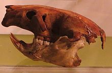
කැනරි දූපත් වල මීට පෙර වඳවී ගිය යෝධ කටුස්සන් (Gallotia goliath), යෝධ කැස්බෑවන් (Centrochelys burchardi සහ C. vulcanica),[154] සහ ටෙනරීෆ් සහ ග්රාන් කැනරියා යෝධ මීයන් (Canariomys. bravoiomys. bravoi) වැනි විවිධ ආවේණික සතුන් වාසය කළහ,[155] වෙනත් අය අතර. ප්ලයිස්ටොසීන් සහ හොලොසීන් යුගයේ අස්ථි වලින් පමණක් දන්නා වඳ වී ගිය පක්ෂීන් අතර කැනරි දූපත් වටුවන් (Coturnix gomerae), ඩන් ෂියර්වෝටර් (Puffinus holeae), ලාවා ෂියර්වෝටර් (P. olsoni), ට්රයස් ග්රීන්ෆින්ච් (Chloris triasi), ස්ලෙන්ඩර්-බිල්ඩ් ග්රීන්ෆින්ච් (C. aurelioi) සහ දිගු කකුල් සහිත බන්ටිං (Emberiza alcoveri) ඇතුළත් වේ.[156]
සාගර ජීවිතය
[සංස්කරණය]
උතුරු අත්ලාන්තික්, මධ්යධරණී සහ ආවේණික විශේෂවල එකතුවක් වන කැනරි දූපත් වල සාගර ජීවීන් ද විවිධ වේ. මෑත වසරවලදී, ස්කූබා කිමිදීම සහ දිය යට ඡායාරූපකරණය යන දෙකෙහිම වැඩිවන ජනප්රියතාවය නිසා ජීව විද්යාඥයින්ට දූපත් වල සාගර ජීවීන් පිළිබඳ බොහෝ නව තොරතුරු ලබා දී ඇත.
දූපත් වල දක්නට ලැබෙන මත්ස්ය විශේෂ අතරට මෝරා, කිරණ, මොරේ ඊල්, බ්රීම්, කොස්, ග්රන්ට්, ගෝනුස්සන්, ට්රිගර්ෆිෂ්, ගෲපර්, ගෝබි සහ බ්ලෙනී විශේෂ ඇතුළත් වේ. මීට අමතරව, ස්පොන්ජ්, ජෙලිෆිෂ්, ඇනිමෝන්, කකුළුවන්, මොලුස්කාවන්, මුහුදු ඉකිරියන්, තරු මාළු, මුහුදු පිපිඤ්ඤා සහ කොරල්පර ඇතුළු අපෘෂ්ඨවංශික විශේෂ රාශියක් ඇත.
දූපත් වල වරින් වර දක්නට ලැබෙන විවිධ සාගර කැස්බෑ විශේෂ පහක් ඇත, ඒවායින් වඩාත් සුලභ වන්නේ වඳවීමේ තර්ජනයට ලක්ව ඇති ලොගර්හෙඩ් මුහුදු කැස්බෑවාය.[157] අනෙක් හතර වන්නේ කොළ කැස්බෑවා, හෝක්ස්බිල් මුහුදු කැස්බෑවා, ලෙදර්බැක් මුහුදු කැස්බෑවා සහ කෙම්ප්ස් රිඩ්ලි මුහුදු කැස්බෑවා ය. දැනට, මෙම විශේෂ කිසිවක් දූපත් වල බෝ වන බවට කිසිදු සලකුනක් නොමැති අතර, එබැවින් ජලයේ දක්නට ලැබෙන ඒවා සාමාන්යයෙන් සංක්රමණය වේ. කෙසේ වෙතත්, මෙම විශේෂයන්ගෙන් සමහරක් අතීතයේ දී දූපත් වල බෝ වන්නට ඇතැයි විශ්වාස කෙරෙන අතර, න්යායට විශ්වසනීයත්වයක් එක් කරමින් ෆුර්ටෙවෙන්ටුරා හි වෙරළ තීරයේ ලෙදර්බැක් මුහුදු කැස්බෑවන් කිහිප දෙනෙකු දැක ඇති බවට වාර්තා තිබේ.
සමුද්ර ක්ෂීරපායීන්ට දුර්ලභ හා ප්රසිද්ධ නොවන විශේෂ ඇතුළුව විශාල කැටේසියන් ප්රභේද ඇතුළත් වේ (කැනරි දූපත් වල සාගර ජීවීන් පිළිබඳ වැඩි විස්තර බලන්න). හුඩ් සීල් මසුන්[158]කැනරි දූපත් වල ඉඳහිට සැරිසරන බව ද දැනගෙන ඇත. කැනරි දූපත් ද මීට පෙර ලොව දුර්ලභ ගණයේ මෙඩිටෙරියන් මොන්ක් සීල් මසුන් වාසය කළේය.
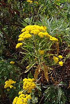
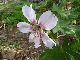
දේශීය ශාක ගැලරිය
[සංස්කරණය]-
Gonospermum elegans
-
Pericallis webbii
නිවාඩු දින
[සංස්කරණය]
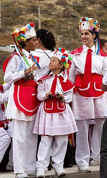

කැනරි දූපත් වල සමරනු ලබන සමහර නිවාඩු දින ජාත්යන්තර සහ ජාතික වන අතර අනෙක් ඒවා කලාපීය නිවාඩු වන අතර අනෙක් ඒවා පරිවාරක ස්වභාවයක් ගනී. ස්වයං පාලන ප්රජාවේ නිල දිනය මැයි 30 වන දින කැනරි දූපත් දිනයයි. 1983 මැයි 30 වන දින සැන්ටා කෲස් ඩි ටෙනරීෆ් නගරය පදනම් කරගත් කැනරි දූපත් පාර්ලිමේන්තුවේ පළමු සැසිවාරයේ සංවත්සරය මෙම දිනය සමඟ සමරනු ලැබේ.
කැනරි දූපත් පුරා පොදු උත්සව දින දර්ශනය පහත පරිදි වේ:[159]
| දිනය | නම | දත්ත |
|---|---|---|
| ජනවාරි 1 | නව වර්ෂය | ජාත්යන්තර උත්සවය. |
| ජනවාරි 6 | එපිෆනි | කතෝලික උත්සවය. |
| මාර්තු හෝ අප්රේල් | ශුද්ධ බ්රහස්පතින්දා සහ ශුද්ධ සිකුරාදා | කිතුනු උත්සවය. |
| මැයි 1 | ජාත්යන්තර කම්කරු දිනය | ජාත්යන්තර උත්සවය. |
| මැයි 30 | කැනරි දූපත් දිනය | ස්වාධීන ප්රජාවගේ දිනය. කැනරි දූපත් පාර්ලිමේන්තුවේ පළමු සැසිවාරයේ සංවත්සරය. |
| අගෝස්තු 15 |
|
කතෝලික උත්සවය. මෙම දිනය සමස්ත ස්පාඤ්ඤයේ මෙන් දූපත් සමූහයේ උත්සවශ්රීයෙන් යුක්ත වේ. ජනප්රියව, කැනරි දූපත් වල එය කැන්ඩලේරියා කන්යාව (කැනරි දූපත්වල ශාන්ත අනුශාසක) සමරන දිනය ලෙස හැඳින්වේ.[160][161] |
| ඔක්තෝබර් 12 | ෆියෙස්ටා නැෂනල් ඩි එස්පානා (ඩියා ඩි ලා හිස්පැනිඩෑඩ්) | ස්පාඤ්ඤයේ ජාතික නිවාඩු දිනය. ඇමරිකාව සොයා ගැනීම සැමරීම. |
| නොවැම්බර් 1 | සියලුම සාන්තුවරයන්ගේ දිනය | කතෝලික උත්සවය. |
| දෙසැම්බර් 6 | ආණ්ඩුක්රම ව්යවස්ථා දිනය | 1978 ස්පාඤ්ඤ ව්යවස්ථා ජනමත විචාරණය සැමරීම. |
| දෙසැම්බර් 8 | නිර්මල පිළිසිඳ ගැනීම | කතෝලික උත්සවය. නිර්මල පිළිසිඳ ගැනීම ස්පාඤ්ඤයේ ශාන්ත අනුශාසක වේ. |
| දෙසැම්බර් 25 | නත්තල | ක්රිස්තියානි උත්සවය. නාසරෙත්හි ජේසුස් වහන්සේගේ උපත සැමරීම. |
ඊට අමතරව, සෑම දූපතකටම දූපත් උත්සවයක් ඇති අතර, එය නිවාඩු දිනයක් වන්නේ එම නිශ්චිත දූපතේ පමණි. මේවා එක් එක් දිවයිනේ දූපත් අනුග්රාහක සාන්තුවරයන්ගේ උත්සව වේ. කාලානුක්රමිකව සංවිධානය කර ඇත:[162]
| දිනය | දිවයින | ශාන්ත/කන්යාව |
|---|---|---|
| පෙබරවාරි 2 | ටෙනරීෆ් | කැන්ඩලේරියා අප ස්වාමිදූ |
| අගෝස්තු 5 | ලා පල්මා | හිම වල අපේ ආර්යාව |
| සැප්තැම්බර් 8 | ග්රාන් කැනරියා | පයින් අපේ ආර්යාව |
| සැප්තැම්බර් 15 | ලැන්සරෝට් | අපේ ඩොලර්ස් ආර්යාව |
| සැප්තැම්බර් මාසයේ තුන්වන සෙනසුරාදා | ෆුර්ටෙවෙන්චුරා | පේනාහි අප ස්වාමිදූ |
| සැප්තැම්බර් 24 | එල් හයිරෝ | රජවරුන්ගේ අප ස්වාමිදූ |
| ඔක්තෝබර් පළමු සෙනසුරාදාට පසු සඳුදා | ලා ගෝමර | ග්වාඩාලුපේ අප ස්වාමිදූ |

කැනරි දූපත් වල වඩාත් ප්රසිද්ධ උත්සව වන්නේ සැණකෙළියයි. එය දූපත් සමූහයේ වඩාත් ප්රසිද්ධ හා ජාත්යන්තර උත්සවය වේ. සැණකෙළිය සියලුම දූපත් සහ එහි සියලුම නගරවල සමරනු ලැබේ, සමහර විට කාර්යබහුලම දෙක කැනරියානු අගනුවර දෙකේ ඒවා විය හැකිය; සැන්ටා කෲස් ඩි ටෙනරීෆ් (ජාත්යන්තර උනන්දුවක් දක්වන සංචාරක උත්සවය) සහ ලාස් පල්මාස් ඩි ග්රාන් කැනරියා සැණකෙළිය. එය පෙබරවාරි සහ මාර්තු මාස අතර වීදිවල සමරනු ලැබේ. නමුත් දූපත් සමූහයේ සෙසු දූපත් වල ඔවුන්ගේම සම්ප්රදායන් සහිත ඔවුන්ගේ සැණකෙළි ඇත: ඒවා අතර කැපී පෙනේ: එල් හියරෝහි කාර්නෙරෝස් උත්සවය, ලැන්සාරෝට්හි ටෙගුයිස් හි දියවැඩියා උත්සවය, ලොස් ඉන්ඩියානොස් ඩි ලා පල්මා, සැන් සැණකෙළිය. සෙබස්තියන් ද ලා ගෝමරා සහ ෆුර්ටෙවෙන්චුරා හි පුවර්ටෝ ඩෙල් රොසාරියෝ හි සැණකෙළිය.
විද්යාව සහ තාක්ෂණය
[සංස්කරණය]
1960 ගණන් වලදී, NASA අභ්යවකාශ වැඩසටහනට සහාය වීම සඳහා මිනිසුන් සහිත අභ්යවකාශ පියාසර ජාලයේ (MSFN) ගොඩබිම් ස්ථාන 14 න් එකක් සඳහා ස්ථානයක් ලෙස ග්රාන් කැනරියා තෝරා ගන්නා ලදී. දිවයිනේ දකුණේ පිහිටා ඇති මස්පලෝමාස් ස්ථානය ඇපලෝ 11 සඳ ගොඩබෑම සහ ස්කයිලැබ් ඇතුළු අභ්යවකාශ මෙහෙයුම් ගණනාවකට සහභාගී විය. අද එය ESA ජාලයේ කොටසක් ලෙස චන්ද්රිකා සන්නිවේදනයට සහය දක්වයි.[163]
දුරස්ථ පිහිටීම නිසා, තාරකා විද්යාත්මක නිරීක්ෂණාගාර ගණනාවක් දූපත් සමූහයේ පිහිටා ඇති අතර, ටෙනරීෆ් හි ටීඩේ නිරීක්ෂණාගාරය, ලා පල්මා හි රොක් ඩි ලොස් මුචචෝස් නිරීක්ෂණාගාරය සහ ග්රාන් කැනරියා හි ටෙමිසාස් තාරකා විද්යා නිරීක්ෂණාගාරය පිහිටයි.
ටෙනරීෆ් යනු ඉන්ස්ටිටියුටෝ ද ඇස්ට්රොෆිසිකා ද කැනරියාස් (කැනරි වල තාරකා භෞතික ආයතනය) හි නිවහනයි. ලා ලගුනා විශ්වවිද්යාලයේ ඉන්ස්ටිටියුටො ඩි බයෝ ඕගනිකා ඇන්ටෝනියෝ ගොන්සාලෙස් (ඇන්ටෝනියෝ ගොන්සාලෙස් ජෛව කාබනික ආයතනය) ද ඇත. එම විශ්ව විද්යාලයේ ඉන්ස්ටිටියුටෝ ඩි ලින්ගුස්ටිකා ඇන්ඩ්රෙස් බෙලෝ (ඇන්ඩ්රෙස් බෙලෝ වාග් විද්යා ආයතනය), සෙන්ට්රෝ ඩි එස්ටුඩියෝස් මෙඩිවේල්ස් වයි රෙනසන්ටිස්ටාස් (මධ්යකාලීන හා පුනරුද අධ්යයන මධ්යස්ථානය), ඉන්ස්ටිටියුටෝ යුනිවර්සිටාරියෝ ඩි ලා එම්ප්රෙසා (ව්යාපාර විශ්වවිද්යාල ආයතනය), ඉන්ස්ටිටියුටෝ ඩි ඩෙරෙචෝ රීජොන් (නීති පිළිබඳ කලාපීය ආයතනය), ඉන්ස්ටිටියුටෝ යුනිවර්සිටාරියෝ ද සියෙන්සියාස් පොලිටිකාස් සහ සෝෂල්ස් (දේශපාලන හා සමාජ විද්යා විශ්වවිද්යාල ආයතනය) සහ ඉන්ස්ටිටියුටෝ ඩි එන්ෆර්මෙඩේස් ට්රොපිකල්ස් (නිවර්තන රෝග පිළිබඳ ආයතනය). ස්පාඤ්ඤයේ විවිධ ප්රදේශවල පිහිටි රෙඩ් ඩි ඉන්වෙස්ටිගේසන් ඩි සෙන්ට්රොස් ඩි එන්ෆර්මෙඩේඩ්ස් ට්රොපිකල් (RICET, "නිවර්තන රෝග පිළිබඳ මධ්යස්ථාන පර්යේෂණ ජාලය" ) ආයතන හතෙන් එකක් මෙහි ඇත.
ඉන්ස්ටිටියුටෝ වොල්කනොලොජිකෝ ඩි කැනරියස් (කැනරි දූපත් වල ගිනිකඳු විද්යා ආයතනය) ටෙනරීෆ් හි පිහිටා ඇත.[තහවුරු කර නොමැත]
ක්රීඩා
[සංස්කරණය]

කැනරියන් මල්ලවපොර (ලුචා කැනේරියා) ලෙස හඳුන්වනු ලබන සුවිශේෂී මල්ලවපොර ක්රමයක් වන්නේ ප්රතිවාදීන් "ටෙරෙරෝ" නම් විශේෂ ප්රදේශයක සිටගෙන ශක්තිය සහ ඉක්මන් චලනයන් භාවිතා කරමින් එකිනෙකා බිම හෙළීමට උත්සාහ කිරීමයි.[167]
තවත් ක්රීඩාවක් වන්නේ "කූරු ක්රීඩාව" (පැලෝ කැනරියෝ) එහිදී විරුද්ධවාදීන් දිගු කූරු වලින් වැට බඳියි. දිගු ඇවිදින සැරයටි භාවිතා කරමින් එකිනෙකාට අභියෝග කරන දූපත් වල එඬේරුන්ගෙන් මෙය සිදුවන්නට ඇත.[167]
තවද, එඬේරාගේ පැනීම (සාල්ටෝ ඩෙල් පාස්ටර්) ඇත. විවෘත ප්රදේශයක් පුරා සුරක්ෂිතාගාරයක් සඳහා දිගු පොල්ලක් භාවිතා කිරීම මෙයට ඇතුළත් වේ. මෙම ක්රීඩාව විකාශනය වූයේ එඬේරුන් තම බැටළුවන් රැකබලා ගන්නා විට කඳුකරයේ විවෘත ප්රදේශයක් හරහා වරින් වර පැමිණීමේ අවශ්යතාවයෙන් විය හැකිය.[167]
දූපත් සමූහයේ ප්රධාන පාපන්දු කණ්ඩායම් දෙක නම්: CD ටෙනරීෆ් (1912 දී ආරම්භ කරන ලදී) සහ UD ලාස් පල්මාස් (1949 දී ආරම්භ කරන ලදී). 2023/2024 වාරය වන විට, UD ලාස් පල්මාස් ස්පාඤ්ඤ පාපන්දු ක්රීඩාවේ ඉහළම ස්ථරය වන ලා ලිගා හි ක්රීඩා කරයි. CD ටෙනරීෆ් කෙසේ වෙතත් සඟුන්ඩා අංශය හි වාදනය වේ. එකම අංශයේ සිටින විට, සමාජ ශාලා කැනරි දූපත් ඩර්බි තරඟ කරයි. ප්රධාන භූමි ස්පාඤ්ඤ පාපන්දු ලීග් ක්රමය තුළ කුඩා ක්රීඩා සමාජ ද ක්රීඩා කරයි, විශේෂයෙන් UD ලැන්සරෝට් සහ CD ලගුනා, නමුත් වෙනත් කිසිදු කැනරියානු සමාජ ශාලා ඉහළ පෙළේ ක්රීඩා කර නැත.
මූලාශ්ර
[සංස්කරණය]සටහන්
[සංස්කරණය]- ^ "So great was the danger that for nearly two years we kept constantly at a few days' notice an expedition of over five thousand men and their ships, ready to seize the Canary Islands, by which we could maintain air and sea control over the U-boats, and contact with Australasia round the Cape, if ever the harbour of Gibraltar were denied to us by the Spaniards."
උපුටා දැක්වීම්
[සංස්කරණය]- ^ "Población por comunidades y ciudades autónomas y sexo". 4 March 2016 දින පැවති මුල් පිටපත වෙතින් සංරක්ෂිත පිටපත. සම්ප්රවේශය 15 November 2022.
- ^ "Contabilidad Regional de España" (PDF). www.ine.es. 18 December 2023 දින පැවති මුල් පිටපත වෙතින් සංරක්ෂිත පිටපත (PDF). සම්ප්රවේශය 7 January 2024.
- ^ a b c "Real Decreto 743/2019, de 20 de diciembre, por el que se declaran oficiales las cifras de población resultantes de la revisión del Padrón municipal referidas al 1 de enero de 2019". BOE (ස්පාඤ්ඤ බසින්). 27 December 2019. pp. 141278–141281. 20 February 2020 දින පැවති මුල් පිටපත වෙතින් සංරක්ෂිත පිටපත. සම්ප්රවේශය 20 February 2020.
- ^ "Sub-national HDI – Area Database – Global Data Lab". hdi.globaldatalab.org (ඉංග්රීසි බසින්). 23 September 2018 දින පැවති මුල් පිටපත වෙතින් සංරක්ෂිත පිටපත. සම්ප්රවේශය 24 June 2023.
- ^ Utreta, Federico (1996). Canarias, secreto de estado: episodios inéditos de la transición política y militar en las islas. Madrid: Mateos López Editores. p. 291.
- ^ Tamaimos. "Canarias está en África". tamaimos.com. 3 October 2018 දින පැවති මුල් පිටපත වෙතින් සංරක්ෂිත පිටපත. සම්ප්රවේශය 3 October 2018.
- ^ Benjamin, Thomas (2009). The Atlantic World: Europeans, Africans, Indians and Their Shared History, 1400–1900. Cambridge University Press. p. 107. ISBN 9780521850995.
- ^ a b "La Macaronesia. Consideraciones geológicas, biogeográficas y paleoecológicas". 17 November 2015 දින මුල් පිටපත වෙතින් සංරක්ෂණය කරන ලදී. සම්ප්රවේශය 10 February 2010.
- ^ "Canarias, un puente entre continentes". La Nación. 19 November 2002. 9 June 2021 දින පැවති මුල් පිටපත වෙතින් සංරක්ෂිත පිටපත. සම්ප්රවේශය 22 January 2018.
- ^ "Canarias - Población 2023 | Datosmacro.com". datosmacro.expansion.com (ස්පාඤ්ඤ බසින්). සම්ප්රවේශය 6 March 2024.
- ^ a b "Mass Protests In Canary Islands Decry Overtourism". Barrons. Agence France Presse. 25 July 2024 දින පැවති මුල් පිටපත වෙතින් සංරක්ෂිත පිටපත. සම්ප්රවේශය 21 April 2024.
- ^ a b Página web සංරක්ෂණය කළ පිටපත 29 අගෝස්තු 2010 at the Wayback Machine del ISTAC sobre entrada de turistas en Canarias.
- ^ "Canary Islands Weather and Climate". Worldtravelguide.net. 31 May 2008 දින මුල් පිටපත වෙතින් සංරක්ෂණය කරන ලදී. සම්ප්රවේශය 21 January 2010.
- ^ "First Light for Laser Guide Star Technology Collaboration". European Southern Observatory. 24 February 2015 දින පැවති මුල් පිටපත වෙතින් සංරක්ෂිත පිටපත. සම්ප්රවේශය 16 February 2015.
- ^ "Ley Orgánica 1/2018, de 5 de noviembre, de reforma del Estatuto de Autonomía de Canarias". BOE (ස්පාඤ්ඤ බසින්). 6 November 2018. pp. 107645–107708. 23 September 2019 දින පැවති මුල් පිටපත වෙතින් සංරක්ෂිත පිටපත. සම්ප්රවේශය 23 September 2019.
- ^ a b c d "Real Decreto de 30 de noviembre de 1833 – Wikisource". es.wikisource.org (ස්පාඤ්ඤ බසින්). 25 July 2024 දින පැවති මුල් පිටපත වෙතින් සංරක්ෂිත පිටපත. සම්ප්රවේශය 13 January 2023.
- ^ a b Real Decreto de 30 de noviembre de 1833 සංරක්ෂණය කළ පිටපත 22 ජූලි 2012 at the Wayback Machine en el sitio web oficial del Gobierno de Canarias
- ^ "La población de Canarias se ha multiplicado por trece en los últimos 250 años". Canarias7.es. 8 December 2015 දින මුල් පිටපත වෙතින් සංරක්ෂණය කරන ලදී. සම්ප්රවේශය 22 February 2011.
- ^ a b Real Decreto de 30 de noviembre de 1833 සංරක්ෂණය කළ පිටපත 22 ජූලි 2012 at the Wayback Machine at the official website of the Canary Islands Government
- ^ "La Laguna. Guía turística de Tenerife. Tenerife, la isla de la eterna primavera". Tenerife2.com. Publiceuta S.L. 5 January 2009. 24 November 2014 දින පැවති මුල් පිටපත වෙතින් සංරක්ෂිත පිටපත. සම්ප්රවේශය 21 January 2010.
- ^ "2.2.6. Diagnóstico" (PDF). Plan Territorial Especial De Ordenación Del Sistema Viario Del Área Metropolitana De Tenerife (ස්පාඤ්ඤ බසින්). 8 August 2019 දින පැවති මුල් පිටපත වෙතින් සංරක්ෂිත පිටපත (PDF). සම්ප්රවේශය 21 January 2010.
- ^ "Presentación general de la isla". Dracma (ස්පාඤ්ඤ බසින්). 3 March 2016 දින පැවති මුල් පිටපත වෙතින් සංරක්ෂිත පිටපත. සම්ප්රවේශය 21 January 2010.
- ^ "1733 Spanish Galleon Trail, Plate Fleets". flheritage.com. Florida Department of State. 28 May 2016 දින පැවති මුල් පිටපත වෙතින් සංරක්ෂිත පිටපත. සම්ප්රවේශය 30 August 2016.
- ^ "Trade Winds and the Hadley Cell". earthguide.ucsd.edu. Calspace, University of California, San Diego. 24 June 2013. 21 May 2008 දින පැවති මුල් පිටපත වෙතින් සංරක්ෂිත පිටපත. සම්ප්රවේශය 30 August 2016.
- ^ Pliny the Elder, The Natural History, Book 6, Chap. 37. (32.) සංරක්ෂණය කළ පිටපත 29 අප්රේල් 2019 at the Wayback Machine —The Fortunate Islands
- ^ Pliny the Elder (1855) [77 CE]. "1 The Two Mauritanias". The Natural History. Vol. 5 An account of countries, nations, seas, towns, havens, mountains, rivers, distances, and peoples who now exist or formerly existed. Translated by John Bostock. London: Taylor and Francis. සම්ප්රවේශය 13 January 2023 – via perseus.tufts.edu.
- ^ "History | portal". www.elhierro.es. 13 November 2023 දින පැවති මුල් පිටපත වෙතින් සංරක්ෂිත පිටපත. සම්ප්රවේශය 13 November 2023.
- ^ "Ferro | Volcanic Island, Atlantic Ocean, Nature Reserve | Britannica". www.britannica.com (ඉංග්රීසි බසින්). 13 November 2023 දින පැවති මුල් පිටපත වෙතින් සංරක්ෂිත පිටපත. සම්ප්රවේශය 13 November 2023.
- ^ Carracedo, Juan C.; Troll, Valentin R.; Day, James M. D.; Geiger, Harri; Aulinas, Meritxell; Soler, Vicente; Deegan, Frances M.; Perez-Torrado, Francisco J.; Gisbert, Guillem; Gazel, Esteban; Rodriguez-Gonzalez, Alejandro (May 2022). "The 2021 eruption of the Cumbre Vieja volcanic ridge on La Palma, Canary Islands". Geology Today (ඉංග්රීසි බසින්). 38 (3): 94–107. Bibcode:2022GeolT..38...94C. doi:10.1111/gto.12388. ISSN 0266-6979. S2CID 246950800. 3 December 2023 දින පැවති මුල් පිටපත වෙතින් සංරක්ෂිත පිටපත. සම්ප්රවේශය 27 July 2022.
- ^ Agustín Monzón (26 June 2018). "La Graciosa se convierte en la octava isla de Canarias". El Independiente (ස්පාඤ්ඤ බසින්). 16 April 2019 දින පැවති මුල් පිටපත වෙතින් සංරක්ෂිත පිටපත. සම්ප්රවේශය 3 December 2019.
- ^ Morris, Hugh (28 June 2018). "Nine fascinating facts about the newest Canary Island". The Telegraph (බ්රිතාන්ය ඉංග්රීසි බසින්). 4 December 2019 දින පැවති මුල් පිටපත වෙතින් සංරක්ෂිත පිටපත. සම්ප්රවේශය 3 December 2019.
- ^ "El Senado reconoce a La Graciosa como la octava isla canaria habitada". La Vanguardia (ස්පාඤ්ඤ බසින්). 26 June 2018. 28 April 2020 දින පැවති මුල් පිටපත වෙතින් සංරක්ෂිත පිටපත. සම්ප්රවේශය 3 December 2019.
- ^ Carracedo, Juan Carlos; Troll, Valentin R. (1 January 2021), Alderton, David; Elias, Scott A., eds. (in en), North-East Atlantic Islands: The Macaronesian Archipelagos, Oxford: Academic Press, pp. 674–699, , https://www.sciencedirect.com/science/article/pii/B9780081029084000278, ප්රතිෂ්ඨාපනය 3 July 2022
- ^ José Mangas Viñuela (2007). "The Canary Islands Hot Spot". www.mantleplumes.org. 19 March 2023 දින පැවති මුල් පිටපත වෙතින් සංරක්ෂිත පිටපත. සම්ප්රවේශය 13 January 2023.
- ^ Webb, Philip Barker; Berthelot, Sabin; Oudart, P. L.; Valenciennes; Goode, G. Brown (1836). Histoire naturelle des Iles Canaries. Paris: Béthune, éditeur. 14 August 2020 දින පැවති මුල් පිටපත වෙතින් සංරක්ෂිත පිටපත. සම්ප්රවේශය 14 May 2020.
- ^ "El clima subtropical canario" (ස්පාඤ්ඤ බසින්). Junta de Andalucía. 22 December 2021 දින මුල් පිටපත වෙතින් සංරක්ෂණය කරන ලදී. සම්ප්රවේශය 22 December 2021.
- ^ "Valores climatológicos normales. Canarias" (ස්පාඤ්ඤ බසින්). AEMET. 26 March 2023 දින පැවති මුල් පිටපත වෙතින් සංරක්ෂිත පිටපත. සම්ප්රවේශය 22 December 2021.
- ^ "Laurisilva. Canarias Wiki" (ස්පාඤ්ඤ බසින්). Gobierno de Canarias (Canary Islands Government). 25 July 2024 දින පැවති මුල් පිටපත වෙතින් සංරක්ෂිත පිටපත. සම්ප්රවේශය 22 December 2021.
- ^ "Valores Climatológicos Normales. Santa Cruz De Tenerife". 18 November 2012 දින මුල් පිටපත වෙතින් සංරක්ෂණය කරන ලදී.
- ^ "Weather Information for Las Palmas". 4 January 2016 දින පැවති මුල් පිටපත වෙතින් සංරක්ෂිත පිටපත. සම්ප්රවේශය 23 August 2010.
- ^ a b "Guía resumida del clima en España (1981–2010)". 18 November 2012 දින මුල් පිටපත වෙතින් සංරක්ෂණය කරන ලදී.
- ^ "Guía resumida del clima en España (1981–2010)". AEMET (ස්පාඤ්ඤ බසින්). 2010. 18 November 2012 දින මුල් පිටපත වෙතින් සංරක්ෂණය කරන ලදී. සම්ප්රවේශය 10 July 2018.
- ^ "Valores climatológicos normales. La Palma Aeropuerto". 30 November 2018 දින පැවති මුල් පිටපත වෙතින් සංරක්ෂිත පිටපත. සම්ප්රවේශය 23 November 2018.
- ^ Carracedo, J. C. (Juan Carlos); Troll, V. R. (26 May 2016). The geology of the Canary Islands. Amsterdam, Netherlands: Elsevier. ISBN 978-0-12-809664-2. OCLC 951031503. 9 June 2021 දින පැවති මුල් පිටපත වෙතින් සංරක්ෂිත පිටපත. සම්ප්රවේශය 1 December 2020.
- ^ "Instituto Geográfico Nacional". Fomento.es. 10 November 1949. 1 April 2010 දින මුල් පිටපත වෙතින් සංරක්ෂණය කරන ලදී. සම්ප්රවේශය 26 April 2010.
- ^ Pararas-Carayannis, G. (2002). "Evaluation of the Threat of Mega Tsunami Generation from Postulated Massive Slope Failure of Island Stratovolcanoes on La Palma, Canary Islands, and on The Island of Hawaii, George". Science of Tsunami Hazards 20 (5): 251–277.
- ^ "Lava shoots up from volcano on La Palma in Spanish Canary Islands". Reuters (ඉංග්රීසි බසින්). 19 September 2021. 19 September 2021 දින පැවති මුල් පිටපත වෙතින් සංරක්ෂිත පිටපත. සම්ප්රවේශය 19 September 2021.
- ^ Carracedo, Juan Carlos; Troll, Valentin R., eds. (2013). Teide Volcano: Geology and Eruptions of a Highly Differentiated Oceanic Stratovolcano. Active Volcanoes of the World (ඉංග්රීසි බසින්). Berlin Heidelberg: Springer-Verlag. ISBN 978-3-642-25892-3. 13 October 2020 දින පැවති මුල් පිටපත වෙතින් සංරක්ෂිත පිටපත. සම්ප්රවේශය 2 September 2021.
- ^ Carracedo, Juan Carlos; Troll, Valentin R. (1 January 2021). "North-East Atlantic Islands: The Macaronesian Archipelagos". Encyclopedia of Geology (ඉංග්රීසි බසින්). pp. 674–699. doi:10.1016/B978-0-08-102908-4.00027-8. ISBN 9780081029091. S2CID 226588940. 21 January 2021 දින පැවති මුල් පිටපත වෙතින් සංරක්ෂිත පිටපත. සම්ප්රවේශය 16 March 2021.
- ^ Carracedo, Juan Carlos; Troll, Valentin R. (1 January 2021), Alderton, David; Elias, Scott A., eds. (in en), North-East Atlantic Islands: The Macaronesian Archipelagos, Oxford: Academic Press, pp. 674–699, , , https://www.sciencedirect.com/science/article/pii/B9780081029084000278, ප්රතිෂ්ඨාපනය 16 March 2021
- ^ Prensa, Nota de. "Finalizada la erupción submarina que se inició en octubre en El Hierro". El Hierro Digital (යුරෝපීය ස්පාඤ්ඤ බසින්). 30 March 2019 දින පැවති මුල් පිටපත වෙතින් සංරක්ෂිත පිටපත. සම්ප්රවේශය 14 May 2020.
- ^ a b "El Teide, el parque más visitado de Europa y el segundo del mundo". Diariodeavisos.com. Canaria de Avisos S.A. 30 July 2010. 26 September 2010 දින මුල් පිටපත වෙතින් සංරක්ෂණය කරන ලදී. සම්ප්රවේශය 20 September 2010.
- ^ a b "El parque nacional del Teide es el primero más visitado de Europa y el segundo del mundo". Sanborondon.info. 24 September 2010 දින මුල් පිටපත වෙතින් සංරක්ෂණය කරන ලදී. සම්ප්රවේශය 20 September 2010.
- ^ "El Teide (Tenerife) es el parque nacional más visitado de Canarias con 2,8 millones de visitantes en 2008". Europapress.es. 31 August 2009. 16 July 2011 දින පැවති මුල් පිටපත වෙතින් සංරක්ෂිත පිටපත. සම්ප්රවේශය 26 April 2010.
- ^ "Official Website of Tenerife Tourism Corporation". Webtenerife.com. 16 January 2010 දින මුල් පිටපත වෙතින් සංරක්ෂණය කරන ලදී. සම්ප්රවේශය 26 April 2010.
- ^ "Ley 7/1991, de 30 de abril, de símbolos de la naturaleza para las Islas Canarias – in Spanish". Gobcan.es. 10 May 1991. 8 August 2011 දින මුල් පිටපත වෙතින් සංරක්ෂණය කරන ලදී. සම්ප්රවේශය 26 April 2010.
- ^ "Parques Nacionales de Canarias". Pueblos10.com. 7 March 2009 දින මුල් පිටපත වෙතින් සංරක්ෂණය කරන ලදී. සම්ප්රවේශය 26 April 2010.
- ^ "Mapa Físico de España (Physical Map of Spain)". Atlas Nacional de España (National Atlas of Spain). Instituto Geográfico Nacional (Spain). 2012. සම්ප්රවේශය 3 October 2018.[permanent dead link]
- ^ "Senators by geographical origin, Comunidad Autónoma de Canarias". Senate of Spain. 4 March 2019 දින මුල් පිටපත වෙතින් සංරක්ෂණය කරන ලදී. සම්ප්රවේශය 29 January 2020.
- ^ Herms, Franziska (2006). Alternative Tourism on Gran Canaria: The diversification of tourism products as an alternative to mass tourism (ඉංග්රීසි බසින්). diplom.de. p. 24. ISBN 9783832492816. 9 June 2021 දින පැවති මුල් පිටපත වෙතින් සංරක්ෂිත පිටපත. සම්ප්රවේශය 18 February 2019.
- ^ González, Sergio Muñoz (18 January 2022). "Naciones Unidas define aguas de Canarias como parte de la costa marroquí ante la pasividad del Gobierno". COPE (ස්පාඤ්ඤ බසින්). 15 August 2023 දින පැවති මුල් පිටපත වෙතින් සංරක්ෂිත පිටපත. සම්ප්රවේශය 30 January 2022.
- ^ "United Nations Convention on the Law of the Sea" (PDF). www.un.org. 27 October 2023 දින පැවති මුල් පිටපත වෙතින් සංරක්ෂිත පිටපත (PDF). සම්ප්රවේශය 13 November 2023.
- ^ "Barómetro Autonómico (III), (Comunidad autónoma de Canarias)" (PDF) (ස්පාඤ්ඤ බසින්). Centro de Investigaciones Sociológicas. 2012. 18 May 2016 දින මුල් පිටපත (PDF) වෙතින් සංරක්ෂණය කරන ලදී. සම්ප්රවේශය 23 September 2019.
- ^ "Según la Página Web del Gobierno de Canarias". 28 December 2009 දින මුල් පිටපත වෙතින් සංරක්ෂණය කරන ලදී. සම්ප්රවේශය 31 January 2020.
- ^ "Old World Contacts/Colonists/Canary Islands". 3 June 2008 දින මුල් පිටපත වෙතින් සංරක්ෂණය කරන ලදී.
- ^ a b Olaya, Vincente (27 November 2021). "Studies shed new light on origins of Canary Islands population". El País. 13 May 2020 දින පැවති මුල් පිටපත වෙතින් සංරක්ෂිත පිටපත.
- ^ Maca-Meyer, Nicole; Arnay, Matilde; Rando, Juan Carlos; Flores, Carlos; González, Ana M.; Cabrera, Vicente M.; Larruga, José M. (February 2004). "Ancient mtDNA analysis and the origin of the Guanches". European Journal of Human Genetics (ඉංග්රීසි බසින්). 12 (2): 155–162. doi:10.1038/sj.ejhg.5201075. ISSN 1476-5438. PMID 14508507. S2CID 10363742.
- ^ Benjamin, Thomas (2009). The Atlantic World: Europeans, Africans, Indians and their shared history, 1400–1900. Cambridge University Press. p. 73.
- ^ Catling, Chris (Oct–Nov 2024). "Colonisation and cohabitation". Current World Archaeology (127): 62–63.
{{cite journal}}: CS1 maint: date format (link) - ^ Santana, Jonathan. "The chronology of the human colonization of the Canary Islands". pnas.org. University of Las Palmas de Gran Canaria. සම්ප්රවේශය 20 October 2024.
- ^ a b Rosa, A. José Farrujia de la (26 November 2013). An Archaeology of the Margins: Colonialism, Amazighity and Heritage Management in the Canary Islands (ඉංග්රීසි බසින්). Springer Science & Business Media. ISBN 978-1-4614-9396-9. 25 July 2024 දින පැවති මුල් පිටපත වෙතින් සංරක්ෂිත පිටපත. සම්ප්රවේශය 4 September 2022.
- ^ Mogán, Turismo. "Lomo de los Gatos Conjunto Arqueológico – Portal de Turismo Iltre Ayuntamiento de Mogán". turismo.mogan.es (ස්පාඤ්ඤ බසින්). 28 February 2019 දින පැවති මුල් පිටපත වෙතින් සංරක්ෂිත පිටපත. සම්ප්රවේශය 27 November 2021.
- ^ Farrujia de la Rosa, José (1 January 2015). "Written in stones: The Amazigh colonization of the Canary Islands". Corpus (ප්රංශ බසින්) (14): 115–138. doi:10.4000/corpus.2641. ISSN 1638-9808. S2CID 135307065.
- ^ Renata Ana Springer Bunk (2014). Die libysch-berberischen Inschriften der Kanarischen Inseln in ihrem Felsbildkontext. Berber Studies Volume 42. Rüdiger Köppe Verlag. ISBN 978-3-89645-942-8.
- ^ Pliny the Elder. "Book 6 Chapter 37". Natural History : 77–79 AD (ඉංග්රීසි බසින්). Translated by Bostock, John. 23 April 2017 දින පැවති මුල් පිටපත වෙතින් සංරක්ෂිත පිටපත. සම්ප්රවේශය 22 April 2017.
- ^ Hogan, C. Michael. Burnham, Andy (ed.). "Chellah". Megalithic.co.uk. The Megalithic Portal. 12 July 2017 දින පැවති මුල් පිටපත වෙතින් සංරක්ෂිත පිටපත. සම්ප්රවේශය 26 April 2010.
- ^ "Natural History of Pliny the Elder". 25 July 2024 දින පැවති මුල් පිටපත වෙතින් සංරක්ෂිත පිටපත. සම්ප්රවේශය 10 April 2022.
- ^ Adhikari, Mohamed (7 September 2017). "Europe's First Settler Colonial Incursion into Africa: The Genocide of Aboriginal Canary Islanders". African Historical Review. 49 (1): 1–26. doi:10.1080/17532523.2017.1336863. S2CID 165086773. 3 May 2022 දින පැවති මුල් පිටපත වෙතින් සංරක්ෂිත පිටපත. සම්ප්රවේශය 6 March 2022.
- ^ Adhikari, Mohamed (25 July 2022). Destroying to Replace: Settler Genocides of Indigenous Peoples. Indianapolis: Hackett Publishing. pp. 1–32. ISBN 978-1647920548. 26 March 2023 දින පැවති මුල් පිටපත වෙතින් සංරක්ෂිත පිටපත. සම්ප්රවේශය 21 March 2023.
- ^ Mercer, John (1980). The Canary Islanders: Their Prehistory, Conquest, and Survival.
- ^ a b Santana, Jonathan; Fregel, Rosa; Lightfoot, Emma; Morales, Jacob; Alamón, Martha; Guillén, José; Moreno, Marco; Rodríguez, Amelia (2016). "The early colonial atlantic world: New insights on the African Diaspora from isotopic and ancient DNA analyses of a multiethnic 15th–17th century burial population from the Canary Islands, Spain". American Journal of Physical Anthropology (ඉංග්රීසි බසින්). 159 (2): 300–312. doi:10.1002/ajpa.22879. ISSN 1096-8644. PMID 26458007. 25 July 2024 දින පැවති මුල් පිටපත වෙතින් සංරක්ෂිත පිටපත. සම්ප්රවේශය 5 December 2021.
- ^ Randi W. (12 December 2006). "Dyeing with Lichens & Mushrooms". blog.mycology.cornell.edu. 22 August 2019 දින පැවති මුල් පිටපත වෙතින් සංරක්ෂිත පිටපත. සම්ප්රවේශය 22 August 2019.
- ^ Brito, Ana del Carmen Viña (2006). "La organización social del trabajo en los ingenios azucareros canarios (siglos XV-XVI)". En la España medieval (29): 359–382. ISSN 0214-3038. 5 December 2021 දින පැවති මුල් පිටපත වෙතින් සංරක්ෂිත පිටපත. සම්ප්රවේශය 5 December 2021.
- ^ Curtin, Philip D.; Curtin, Philip DeArmond (13 February 1998). The Rise and Fall of the Plantation Complex: Essays in Atlantic History (ඉංග්රීසි බසින්). Cambridge University Press. ISBN 978-0-521-62943-0.
- ^ Ronquillo, M (2008). Viña, A (ed.). Ingenios azucareros en la colonización canaria, 1487–1526. Localización espacial y organización del espacio en Gran Canaria. Organismo de Museos y Centros. pp. 133–153.
- ^ Lobo–Cabrera, M (1982). "La Esclavitud en Las Canarias Orientales en El Siglo XVI". The Journal of African History (ඉංග්රීසි බසින්). 28 (2): 332. doi:10.1017/S0021853700030000. ISSN 1469-5138. S2CID 161230066.
- ^ Hoyte, Ralph (2 February 2021). "Close to the Bone: Certain Poetic Considerations & Analyses Pertaining To The Lives Of The Enslaved Based On Archaeological Investigations From A Multiethnic 15th–17th Century Burial Population From The Canary Islands, Spain". 13 December 2021 දින පැවති මුල් පිටපත වෙතින් සංරක්ෂිත පිටපත.
- ^ John Mercer (1980), The Canary Islanders : their prehistory, conquest, and survival, p. 236, Collings.
- ^ "El comercio canario-americano en el siglo XVIII (I parte)". Canariascnnews.com. 7 July 2018 දින මුල් පිටපත වෙතින් සංරක්ෂණය කරන ලදී. සම්ප්රවේශය 8 November 2017.
- ^ "The Spanish of the Canary Islands". Personal.psu.edu. 6 June 2011 දින පැවති මුල් පිටපත වෙතින් සංරක්ෂිත පිටපත. සම්ප්රවේශය 26 April 2010.
- ^ "Handbook of Texas Online – Canary Islanders". Tshaonline.org. 2 December 2010 දින පැවති මුල් පිටපත වෙතින් සංරක්ෂිත පිටපත. සම්ප්රවේශය 26 April 2010.
- ^ "Los Isleños Heritage & Cultural Society website". Losislenos.org. 7 May 2010 දින මුල් පිටපත වෙතින් සංරක්ෂණය කරන ලදී. සම්ප්රවේශය 26 April 2010.
- ^ "Isleños Society of St. Bernard Parish". Americaslibrary.gov. 7 October 2009 දින මුල් පිටපත වෙතින් සංරක්ෂණය කරන ලදී. සම්ප්රවේශය 26 April 2010.
- ^ "The Spanish of the Canary Islands". www.personal.psu.edu. 20 March 2012 දින පැවති මුල් පිටපත වෙතින් සංරක්ෂිත පිටපත. සම්ප්රවේශය 31 January 2020.
- ^ "Montesinos Sirera, Jose Luis and Jurgen Renn (2004) Expeditions to the Canary Islands in the romantic period (1770–1830)". Humboldt.mpiwg-berlin.mpg.de. 31 January 2006 දින මුල් පිටපත වෙතින් සංරක්ෂණය කරන ලදී. සම්ප්රවේශය 26 April 2010.
- ^ Real Decreto de 30 de noviembre de 1833 en wikisource
- ^ "Real Decreto 1586" (PDF) (ස්පාඤ්ඤ බසින්). 9 June 2021 දින පැවති මුල් පිටපත වෙතින් සංරක්ෂිත පිටපත (PDF). සම්ප්රවේශය 16 May 2020.
- ^ León Álvarez, Aarón (19 April 2015). "La represión franquista en Canarias: una guerra de 40 años". canariasahora (ස්පාඤ්ඤ බසින්). 31 January 2017 දින පැවති මුල් පිටපත වෙතින් සංරක්ෂිත පිටපත. සම්ප්රවේශය 18 January 2017 – via eldiario.es.
- ^ Churchill, Winston S. (1949). The Second World War Vol 2: Their Finest Hour. Boston: Houghton Mifflin Co. p. 519.
- ^ Churchill, Winston S. (1950). The Second World War Vol 3: The Grand Alliance. Boston: Houghton Mifflin Co. p. 718.
- ^ Stucki, Andreas (6 February 2018). ""Frequent Deaths": The Colonial Development of Concentration Camps Reconsidered, 1868–1974". Journal of Genocide Research. 20 (3): 305–326. doi:10.1080/14623528.2018.1429808. S2CID 80167476. 25 July 2024 දින පැවති මුල් පිටපත වෙතින් සංරක්ෂිත පිටපත. සම්ප්රවේශය 10 April 2022.
- ^ James B. Minahan (2002), Encyclopedia of the Stateless Nations: Ethnic and National Groups Around the World, p. 377, Greenwood.
- ^ "Parlamento de Canarias – Parlamento de Canarias". www.parcan.es. 18 March 2020 දින මුල් පිටපත වෙතින් සංරක්ෂණය කරන ලදී. සම්ප්රවේශය 31 January 2020.
- ^ Julio Sánchez Rodríguez. "San Marcial de Rubicón y los obispados de Canarias" (PDF) (ස්පාඤ්ඤ බසින්). 3 April 2015 දින මුල් පිටපත (PDF) වෙතින් සංරක්ෂණය කරන ලදී. සම්ප්රවේශය 24 May 2016.
- ^ La Junta Suprema de Canarias. Volumen I. Buenaventura Bonnet y Riveron. Real Sociedad Económica de Amigos del País de Tenerife, Editorial: Editorial Interinsular Canaria SA, publicado en Santa Cruz de Tenerife en 1980 (reedición de 1948) Páginas 104–106
- ^ "Archivo Intermedio Militar de Canarias. Gobierno de España" (ස්පාඤ්ඤ බසින්). 22 February 2017 දින මුල් පිටපත වෙතින් සංරක්ෂණය කරන ලදී. සම්ප්රවේශය 5 April 2017.
- ^ "La Diócesis de San Cristóbal de La Laguna en los inicios del siglo XIX: el Obispo Folgueras Sión, el Cabildo Catedral y la jurisdicción eclesiástica" (ස්පාඤ්ඤ බසින්). 17 June 2018 දින පැවති මුල් පිටපත වෙතින් සංරක්ෂිත පිටපත. සම්ප්රවේශය 7 January 2019.
- ^ "Capital de facto de Canarias" (ස්පාඤ්ඤ බසින්). 5 January 2009 දින මුල් පිටපත වෙතින් සංරක්ෂණය කරන ලදී. සම්ප්රවේශය 5 April 2017.
- ^ "Pleito Insular; Autonomía y Nacionalidad". Gran Enciclopedia Virtual Islas Canarias (ස්පාඤ්ඤ බසින්). 22 April 2020 දින මුල් පිටපත වෙතින් සංරක්ෂණය කරන ලදී. සම්ප්රවේශය 7 January 2019 – via www.gevic.net.
- ^ "Su Origen". Gran Enciclopedia Virtual Islas Canarias (ස්පාඤ්ඤ බසින්). 10 November 2018 දින මුල් පිටපත වෙතින් සංරක්ෂණය කරන ලදී. සම්ප්රවේශය 7 January 2019 – via www.gevic.net.
- ^ "Official census statistics of the Canary Islands population". Gobiernodecanarias.org. 26 March 2010 දින මුල් පිටපත වෙතින් සංරක්ෂණය කරන ලදී. සම්ප්රවේශය 26 April 2010.
- ^ "La población en Canarias" (PDF). Ine.es. 14 July 2015 දින පැවති මුල් පිටපත වෙතින් සංරක්ෂිත පිටපත (PDF). සම්ප්රවේශය 5 August 2015.
- ^ "Estadísticas de la Comunidad Autónoma de Canarias". Gobiernodecanarias.org. 23 March 2010 දින මුල් පිටපත වෙතින් සංරක්ෂණය කරන ලදී. සම්ප්රවේශය 26 April 2010.
- ^ Suárez, Borja (25 June 2018). "El 91% de los nuevos habitantes de Canarias viene del extranjero". www.canarias7.es. 3 October 2018 දින පැවති මුල් පිටපත වෙතින් සංරක්ෂිත පිටපත. සම්ප්රවේශය 3 October 2018.
- ^ a b "Estadística del Padrón Continuo a 1 de enero de 2019. Datos a nivel nacional, comunidad autónoma y provincia". 20 February 2020 දින පැවති මුල් පිටපත වෙතින් සංරක්ෂිත පිටපත. සම්ප්රවේශය 20 February 2020.
- ^ "Morocco People 2020, CIA World Factbook". theodora.com. 7 January 2022 දින පැවති මුල් පිටපත වෙතින් සංරක්ෂිත පිටපත. සම්ප්රවේශය 30 January 2022.
- ^ "Estadística del Padrón Continuo a 1 de enero de 2019. Datos a nivel nacional, comunidad autónoma y provincia (Canarias)". 20 February 2020 දින පැවති මුල් පිටපත වෙතින් සංරක්ෂිත පිටපත. සම්ප්රවේශය 20 February 2020.
- ^ Centro de Investigaciones Sociológicas (Centre for Sociological Research) (October 2019). "Macrobarómetro de octubre 2019, Banco de datos – Document 'Población con derecho a voto en elecciones generales y residente en España, Canarias (aut.)" (PDF) (ස්පාඤ්ඤ බසින්). p. 23. 4 February 2020 දින පැවති මුල් පිටපත වෙතින් සංරක්ෂිත පිටපත (PDF). සම්ප්රවේශය 4 February 2020.
- ^ "Pedro de San José Betancurt, Santo". Es.catholic.net. 23 December 2015 දින පැවති මුල් පිටපත වෙතින් සංරක්ෂිත පිටපත. සම්ප්රවේශය 23 December 2015.
- ^ "José de Anchieta, Santo". Es.catholic.net. 22 December 2015 දින පැවති මුල් පිටපත වෙතින් සංරක්ෂිත පිටපත. සම්ප්රවේශය 23 December 2015.
- ^ a b c d e f g h Tenerife, La Opinión de. "Un 5% de canarios profesa una religión minoritaria". Laopinion.es. 11 September 2017 දින පැවති මුල් පිටපත වෙතින් සංරක්ෂිත පිටපත. සම්ප්රවේශය 3 July 2015.
- ^ Tenerife, La Opinión de. "Los musulmanes de la Isla constituyen la primera Federación Islámica de Canarias". Laopinion.es. 12 September 2017 දින පැවති මුල් පිටපත වෙතින් සංරක්ෂිත පිටපත. සම්ප්රවේශය 2 May 2016.
- ^ "Frecuencias marginales unidimensionales del estudio 2956.5.0". Cis.es. 29 December 2016 දින පැවති මුල් පිටපත වෙතින් සංරක්ෂිත පිටපත. සම්ප්රවේශය 23 December 2015.
- ^ Rando JC, Cabrera VM, Larruga JM, et al. (September 1999). "Phylogeographic patterns of mtDNA reflecting the colonization of the Canary Islands". Annals of Human Genetics. 63 (Pt 5): 413–28. doi:10.1046/j.1469-1809.1999.6350413.x. PMID 10735583. S2CID 25089862.
- ^ Brehm A, Pereira L, Kivisild T, Amorim A (December 2003). "Mitochondrial portraits of the Madeira and Açores archipelagos witness different genetic pools of its settlers". Human Genetics. 114 (1): 77–86. doi:10.1007/s00439-003-1024-3. hdl:10400.13/3046. PMID 14513360. S2CID 8870699.
- ^ Fregel R, Pestano J, Arnay M, Cabrera VM, Larruga JM, González AM (October 2009). "The maternal aborigine colonization of La Palma (Canary Islands)". European Journal of Human Genetics. 17 (10): 1314–24. doi:10.1038/ejhg.2009.46. PMC 2986650. PMID 19337312.
- ^ "Statistics". Gobiernodecanarias.org. 26 March 2010 දින මුල් පිටපත වෙතින් සංරක්ෂණය කරන ලදී. සම්ප්රවේශය 26 April 2010.
- ^ Santamarta, Juan; Rodríguez-Martín, Jesica (1 January 2013). INTRODUCTION TO WATER PROBLEMS IN CANARY ISLANDS. pp. 169–179. 9 June 2021 දින පැවති මුල් පිටපත වෙතින් සංරක්ෂිත පිටපත. සම්ප්රවේශය 31 January 2020 – via ResearchGate.
- ^ Custodio, Emilio; Albiac, José; Cermerón, Manuel; Hernández, Marta; Llamas, M. Ramón; Sahuquillo, Andrés (1 September 2017). "Groundwater mining: benefits, problems and consequences in Spain". Sustainable Water Resources Management. 3 (3): 213–226. Bibcode:2017SWRM....3..213C. doi:10.1007/s40899-017-0099-2. S2CID 132272387.
- ^ Kim, Soo (25 January 2018). "The Canary Islands could become the next holiday hotspot to introduce a tourist tax". The Telegraph. 31 January 2020 දින පැවති මුල් පිටපත වෙතින් සංරක්ෂිත පිටපත. සම්ප්රවේශය 31 January 2020.
- ^ "Spain's Repsol gets long awaited green signal to explore off Canary Islands". Spain News.Net. 13 August 2014. 14 August 2014 දින මුල් පිටපත වෙතින් සංරක්ෂණය කරන ලදී. සම්ප්රවේශය 13 August 2014.
- ^ "Repsol completes its exploration well in the Canary Islands - repsol.com". Repsol.com. 20 December 2016 දින මුල් පිටපත වෙතින් සංරක්ෂණය කරන ලදී. සම්ප්රවේශය 8 December 2016.
- ^ Gils, Hans Christian; Simon, Sonja (2017). "Carbon neutral archipelago – 100% renewable energy supply for the Canary Islands". Applied Energy. 188: 342–355. Bibcode:2017ApEn..188..342G. doi:10.1016/j.apenergy.2016.12.023. 30 June 2020 දින පැවති මුල් පිටපත වෙතින් සංරක්ෂිත පිටපත. සම්ප්රවේශය 23 January 2021.
- ^ "Página Web Oficial de Turismo de Tenerife; El Teide". Webtenerife.com. 16 January 2010 දින මුල් පිටපත වෙතින් සංරක්ෂණය කරන ලදී. සම්ප්රවේශය 26 April 2010.
- ^ "Territorial status of EU countries and certain territories". taxation-customs.ec.europa.eu (ඉංග්රීසි බසින්). 20 June 2023 දින පැවති මුල් පිටපත වෙතින් සංරක්ෂිත පිටපත. සම්ප්රවේශය 13 January 2023.
- ^ a b "ISTAC: Estadísticas de la Comunidad Autónoma de Canarias". www.gobiernodecanarias.org. 26 October 2020 දින පැවති මුල් පිටපත වෙතින් සංරක්ෂිත පිටපත. සම්ප්රවේශය 14 May 2020.
- ^ "Macromagnitudes de Canarias por Islas (2015)". www.datosdelanzarote.com. 26 January 2021 දින පැවති මුල් පිටපත වෙතින් සංරක්ෂිත පිටපත. සම්ප්රවේශය 25 March 2021.
- ^ "Canary Islands road map: Spain – Multimap". Multimap.de. 18 August 2013 දින මුල් පිටපත වෙතින් සංරක්ෂණය කරන ලදී. සම්ප්රවේශය 21 January 2010.
- ^ "Cabildo announce changes to reduce massive traffic jams caused by GC1 daytime resurfacing work | The Canary – News, Views & Sunshine". 31 January 2020 දින මුල් පිටපත වෙතින් සංරක්ෂණය කරන ලදී. සම්ප්රවේශය 31 January 2020.
- ^ "Arona leads fight against south's "unbearable" traffic jams". Tenerife News – Official Website. 2 July 2017. 31 January 2020 දින මුල් පිටපත වෙතින් සංරක්ෂණය කරන ලදී. සම්ප්රවේශය 31 January 2020.
- ^ "Traffic – Information about the trafic on Canaria". www.canariainfo.com. 7 September 2017 දින මුල් පිටපත වෙතින් සංරක්ෂණය කරන ලදී. සම්ප්රවේශය 31 January 2020.
- ^ "Las Palmas de Gran Canaria to Santa Cruz de Tenerife Ferry from $31 | Tickets & Timetables". Rome2rio (ඉංග්රීසි බසින්). සම්ප්රවේශය 12 July 2022.
- ^ "Airport traffic". 30 August 2010 දින මුල් පිටපත වෙතින් සංරක්ෂණය කරන ලදී. සම්ප්රවේශය 31 January 2020.
- ^ "AENA statistics for 2012" (PDF). Estadisticas.aena.es. 8 August 2019 දින මුල් පිටපත (PDF) වෙතින් සංරක්ෂණය කරන ලදී. සම්ප්රවේශය 10 March 2017.
- ^ "Passengers in airports". 13 November 2010 දින මුල් පිටපත වෙතින් සංරක්ෂණය කරන ලදී. සම්ප්රවේශය 31 January 2020.
- ^ "TURISTAS EXTRANJEROS ENTRADOS SEGÚN PAIS DE ORIGEN, POR ISLAS. 1997–2001". Gobiernodecanarias.org. 22 January 2003. 22 January 2003 දින මුල් පිටපත වෙතින් සංරක්ෂණය කරන ලදී.
- ^ "Freight traffic". 30 August 2010 දින මුල් පිටපත වෙතින් සංරක්ෂණය කරන ලදී. සම්ප්රවේශය 31 January 2020.
- ^ "04-CAPITULO 4-2006" (PDF). 31 March 2010 දින මුල් පිටපත (PDF) වෙතින් සංරක්ෂණය කරන ලදී. සම්ප්රවේශය 20 September 2010.
- ^ a b "TRÁFICO DE PASAJE REGISTRADO EN LOS PUERTOS. 1996–2007". gobiernodecanarias.org. සම්ප්රවේශය 20 September 2010.[permanent dead link]
- ^ "Gran Canaria Train". Playa-del-ingles.biz. 18 May 2010 දින මුල් පිටපත වෙතින් සංරක්ෂණය කරන ලදී. සම්ප්රවේශය 26 April 2010.
- ^ "Aprobado el avance del proyecto del tren del norte de Tenerife con 7 paradas entre Los Realejos y S/C". Canarias7. 18 January 2017 දින මුල් පිටපත වෙතින් සංරක්ෂණය කරන ලදී.
- ^ "Airports by passenger traffic, 2010, July". 30 August 2010 දින මුල් පිටපත වෙතින් සංරක්ෂණය කරන ලදී. සම්ප්රවේශය 31 January 2020.
- ^ "Hospitales pertenecientes al Servicio Canario de la Salud". gobiernodecanarias.org. 16 March 2018 දින පැවති මුල් පිටපත වෙතින් සංරක්ෂිත පිටපත. සම්ප්රවේශය 15 March 2018.
- ^ "La Paleontología de vertebrados en Canarias." සංරක්ෂණය කළ පිටපත 1 ඔක්තෝබර් 2018 at the Wayback Machine Spanish Journal of Palaeontology (antes Revista Española de Paleontología). Consultado el 17 de junio de 2016.
- ^ Algunas extinciones en Canarias සංරක්ෂණය කළ පිටපත 28 දෙසැම්බර් 2009 at the Wayback Machine Consejería de Medio Ambiente y Ordenación Territorial del Gobierno de Canarias
- ^ Illera, Juan Carlos; Spurgin, Lewis G.; Rodriguez-Exposito, E.; Nogales, Manuel; Rando, Juan Carlos (2016). "What are we learning about Speciation and Extinction from the Canary Islands?". Ardeola. 63 (1): 15–33. doi:10.13157/arla.63.1.2016.rp1. S2CID 55386208.
- ^ Lissie Wright; Brian Groombridge (1982). The IUCN Amphibia-reptilia Red Data Book. IUCN. p. 140. ISBN 978-2-88032-601-2.
- ^ Kovacs, K.M. (2016). "Cystophora cristata". IUCN Red List of Threatened Species. 2016: e.T6204A45225150. doi:10.2305/IUCN.UK.2016-1.RLTS.T6204A45225150.en. සම්ප්රවේශය 29 October 2018.
- ^ "Calendario oficial en Canarias". Sede.gobcan.es. 9 October 2020 දින පැවති මුල් පිටපත වෙතින් සංරක්ෂිත පිටපත. සම්ප්රවේශය 26 June 2018.
- ^ "Programa de las Fiestas de la Virgen de Candelaria. Agosto de 2017" (PDF). Webtenerfife.ru. 4 October 2020 දින පැවති මුල් පිටපත වෙතින් සංරක්ෂිත පිටපත (PDF). සම්ප්රවේශය 26 June 2018.
- ^ "Candelaria se prepara para recibir en agosto a 150.000 devotos de la Virgen". Diariodeavisos.elespanol.com. 20 July 2017. 4 October 2020 දින පැවති මුල් පිටපත වෙතින් සංරක්ෂිත පිටපත. සම්ප්රවේශය 26 June 2018.
- ^ "Fiestas insulares de Canarias" (PDF). Ccooendesa.com. 4 February 2018 දින මුල් පිටපත (PDF) වෙතින් සංරක්ෂණය කරන ලදී. සම්ප්රවේශය 26 June 2018.
- ^ "Maspalomas station". European Space Agency. 8 February 2019 දින පැවති මුල් පිටපත වෙතින් සංරක්ෂිත පිටපත. සම්ප්රවේශය 8 February 2019.
- ^ Alonso, Javier (25 July 2015). "El Heliodoro Rodríguez López cumple 90 años". Vavel.com. 29 June 2016 දින පැවති මුල් පිටපත වෙතින් සංරක්ෂිත පිටපත. සම්ප්රවේශය 22 February 2017.
- ^ "Estadio Heliodoro Rodríguez López". Lovecanarias.com. 29 June 2016 දින මුල් පිටපත වෙතින් සංරක්ෂණය කරන ලදී. සම්ප්රවේශය 22 February 2017.
- ^ "Canary Islands Stadiums". WorldStadiums.com. 27 March 2010 දින මුල් පිටපත වෙතින් සංරක්ෂණය කරන ලදී. සම්ප්රවේශය 1 April 2010.
- ^ a b c "The Canary Islands". Ctspanish.com. 21 October 1971. 11 November 2020 දින පැවති මුල් පිටපත වෙතින් සංරක්ෂිත පිටපත. සම්ප්රවේශය 21 January 2010.


