අප්රිකාවේ ස්වෛරී රාජ්යයන් සහ පරායත්ත භූමි ප්රදේශ ලැයිස්තුව
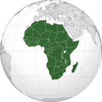
මෙය අප්රිකාවේ ස්වෛරී රාජ්යයන් සහ යැපෙන භූමි ප්රදේශ ලැයිස්තුවකි . එයට සම්පුර්ණයෙන්ම පිළිගත් රාජ්යයන්, සීමිත හෝ ශුන්ය පිළිගැනීමක් සහිත රාජ්යයන් සහ අප්රිකානු සහ අප්රිකානු නොවන රාජ්යයන් දෙකෙහිම යැපෙන ප්රදේශ ඇතුළත් වේ. එය ස්වෛරී රාජ්යයන් 56ක් (එයින් 54ක් එක්සත් ජාතීන්ගේ සාමාජික රටවල් වේ), අප්රිකානු නොවන ස්වෛරී රාජ්යවල (යැපෙන) ප්රදේශ දෙකක් සහ අප්රිකානු ස්වෛරී රාජ්යවල උප-ජාතික කලාප නවයක් ලැයිස්තුගත කරයි. මෝල්ටාව සහ ප්රංශය, ඉතාලිය, පෘතුගාලය සහ ස්පාඤ්ඤයේ කොටස් අප්රිකානු මහාද්වීපික තලයේ පිහිටා ඇත, සමහර ඒවා යුරෝපීය ප්රධාන භූමියට වඩා අප්රිකානු ප්රධාන භූමියට සැලකිය යුතු තරම් සමීප නමුත් දේශපාලනික වශයෙන් සාමාන්යයෙන් සම්මුතියෙන් යුරෝපීය ලෙස සැලකේ. ඊජිප්තුව, සීනායි අර්ධද්වීපය හරහා ආසියාව දක්වා විහිදුණත්, අප්රිකානු රාජ්යයක් ලෙස සැලකේ.
ස්වෛරී රාජ්යයන්
[සංස්කරණය]පිළිගත් රාජ්යයන්
[සංස්කරණය]පහත දැක්වෙන සම්පුර්ණයෙන්ම පිළිගත් රාජ්ය 54, එක්සත් ජාතීන්ගේ [1] සහ අප්රිකානු සංගමයේ සාමාජිකයන් වේ.[2][3][4][5]
| ධජය | සිතියම | කෙටි නම, නිළ විධිමත් නාමය සහ ISO කේතය [6][7][8][9] |
අගනුවර [8][10][11] |
ජනගහණය (2021) | භූමි ප්රමාණය[a][b] [12] |
මුදල් වර්ගය [8] |
|---|---|---|---|---|---|---|
 |
|
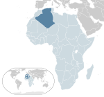
ඇල්ජීරියාව ඇල්ජීරියා මහජන ප්රජාතන්ත්රවාදී ජනරජය DZA |
ඇල්ජියර්ස් | 44,177,969 | වර්ග කිලෝමීටර 2381740 (වර්ග සැතපුම් 919595) | ඇල්ජීරියානු ඩිනාර් |
 |

|
ඇන්ගෝලාව ඇන්ගෝලා ජනරජය AGO |
ලොන්ඩා | 34,503,774 | වර්ග කිලෝමීටර 1246700 (වර්ග සැතපුම් 481353) | ක්වන්සා |
 |

|
බෙනින් බෙනින් ජනරජය BEN |
පෝර්ටෝ-නොවෝ | 13,754,688 | වර්ග කිලෝමීටර 112622 (වර්ග සැතපුම් 43484) | CFA ෆ්රෑන්ක් |
 |

|
බොට්ස්වානා බොට්ස්වානා ජනරජය BWA |
ගැබොරෝන් | 2,346,179 | වර්ග කිලෝමීටර 581726 (වර්ග සැතපුම් 224606) | පුලා |
 |

|
බුර්කිනා ෆාසෝ BFA |
ඔවාගඩෝගු | 21,935,389 | වර්ග කිලෝමීටර 274000 (වර්ග සැතපුම් 105792) | CFA ෆ්රෑන්ක් |
 |
|
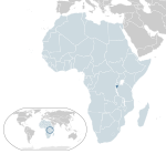
බුරුන්ඩි බුරුන්ඩි ජනරජය BDI |
ගීතේගා | 11,865,821
(2020 ඇස්.) |
වර්ග කිලෝමීටර 27830 (වර්ග සැතපුම් 10745) | බුරුන්ඩි ෆ්රෑන්ක් |
 |

|
කැමරූන් කැමරූන් ජනරජය CMR |
යවුන්ඩේ | 29,321,637
(2022 ඇස්.) |
වර්ග කිලෝමීටර 475442 (වර්ග සැතපුම් 183569)
අම්බසෝනියා ජනරජය ලෙස දකුණු කැමරූන් මහජන සංවිධානය විසින් හිමිකම් කියන දකුණු කැමරූන් හි කැමරූනියානු-පරිපාලන කොටස් ඇතුළත් වේ. |
CFA ෆ්රෑන්ක් |
 |

|
කේප් වර්ඩ් කබෝ වර්ඩ් ජනරජය CPV |
ප්රියා | 587,925 | වර්ග කිලෝමීටර 4033 (වර්ග සැතපුම් 1557) | කේප් වර්ඩින් එස්කුඩෝ |
 |

|
මධ්යම අප්රිකානු ජනරජය CAF |
බැංගුයි | 5,457,154 | වර්ග කිලෝමීටර 622984 (වර්ග සැතපුම් 240535) | CFA ෆ්රෑන්ක් |
 |

|
චෑඩ් චෑඩ් ජනරජය TCD |
එන්'ජමේනා | 17,179,740 | වර්ග කිලෝමීටර 1284000 (වර්ග සැතපුම් 495755) | CFA ෆ්රෑන්ක් |
 |

|
කොමරොස් කොමරොස් සංගමය COM |
මොරෝනි | 821,625 | වර්ග කිලෝමීටර 2235 (වර්ග සැතපුම් 863) | කොමෝරියන් ෆ්රෑන්ක් |
 |

|
කොන්ගෝ ප්රජාතන්ත්රවාදී ජනරජය COD |
කිංෂාසා | 95,894,118 | වර්ග කිලෝමීටර 2344858 (වර්ග සැතපුම් 905354) | කොංගෝ ෆ්රෑන්ක් |
 |

|
කොංගෝ ජනරජය COG |
බ්රසාවිල් | 5,835,806 | වර්ග කිලෝමීටර 342000 (වර්ග සැතපුම් 132047) | CFA ෆ්රෑන්ක් |
 |

|
ජිබුටි ජිබුටි ජනරජය DJI |
ජිබුටි | 1,105,557 | වර්ග කිලෝමීටර 23200 (වර්ග සැතපුම් 8958) | ජිබුටි ෆ්රෑන්ක් |
 |

|
ඊජිප්තුව ඊජිප්තු අරාබි ජනරජය EGY |
කයිරෝ | 109,262,178 | වර්ග කිලෝමීටර 1001449 (වර්ග සැතපුම් 386661) | ඊජිප්තු පවුම |
 |

|
සමක ගිනියාව සමක ගිනියා ජනරජය GNQ |
මලබෝ | 1,634,466 | වර්ග කිලෝමීටර 28051 (වර්ග සැතපුම් 10831) | CFA ෆ්රෑන්ක් |
 |

|
එරිත්රියාව එරිත්රියා ජනපදය ERI |
අස්මරා | 3,620,312 | වර්ග කිලෝමීටර 117600 (වර්ග සැතපුම් 45406) | නැක්ෆා |
 |

|
එස්වාටිනි එස්වාටිනි රාජධානිය SWZ |
ලොබම්බා (රාජකීය සහ ව්යවස්ථාදායක)
ම්බාබේන් (පරිපාලන) |
1,192,271 | වර්ග කිලෝමීටර 17364 (වර්ග සැතපුම් 6704) | ලිලංගේනි |
 |

|
ඉතියෝපියාව ඉතියෝපියාවේ ෆෙඩරල් ප්රජාතන්ත්රවාදී ජනරජය ETH |
අඩිස් අබාබා | 120,283,026 | වර්ග කිලෝමීටර 1104300 (වර්ග සැතපුම් 426372) | ඉතියෝපියානු බර් |
 |

|
ගැබෝන් ගැබෝන් ජනරජය GAB |
ලිබ්රවිල් | 2,341,179 | වර්ග කිලෝමීටර 267668 (වර්ග සැතපුම් 103347) | CFA ෆ්රෑන්ක් |
 |

|
ගැම්බියාව ගැම්බියා ජනරජය GMB |
බන්ජුල් | 2,639,916 | වර්ග කිලෝමීටර 10380 (වර්ග සැතපුම් 4008) | දලසි |
 |

|
ඝානාව ඝානා ජනරජය GHA |
ඇක්රා | 32,833,031 | වර්ග කිලෝමීටර 238534 (වර්ග සැතපුම් 92098) | ඝානා සීඩි |
 |

|
ගිනියාව ගිනියා ජනරජය GIN |
කොන්ක්රි | 13,531,906 | වර්ග කිලෝමීටර 245857 (වර්ග සැතපුම් 94926) | ගිනියානු ෆ්රෑන්ක් |
 |

|
ගිනි බිසවු ගිනි බිසවු ජනරජය GNB |
බිසවු | 2,060,721 | වර්ග කිලෝමීටර 36125 (වර්ග සැතපුම් 13948) | CFA ෆ්රෑන්ක් |
 |

|
අයිවරි කෝස්ට් | යමුසූක්රෝ | 27,478,249 | වර්ග කිලෝමීටර 322460 (වර්ග සැතපුම් 124502) | CFA ෆ්රෑන්ක් |
 |

|
කෙන්යාව කෙන්යා ජනරජය KEN |
නයිරෝබි | 53,005,614 | වර්ග කිලෝමීටර 580367 (වර්ග සැතපුම් 224081) | කෙන්යානු සිලිං |
 |

|
ලෙසොතෝ ලෙසොතෝ රාජධානිය LSO |
මසරු | 2,281,454 | වර්ග කිලෝමීටර 30355 (වර්ග සැතපුම් 11720) | ලෝටි |
 |

|
ලයිබීරියාව ලයිබීරියා ජනරජය LBR |
මොන්රෝවියා | 5,193,416 | වර්ග කිලෝමීටර 111369 (වර්ග සැතපුම් 43000) | ලයිබීරියානු ඩොලරය |
 |

|
ලිබියාව
|
ට්රිපොලි | 6,735,277 | වර්ග කිලෝමීටර 1759540 (වර්ග සැතපුම් 679362) | ලිබියානු ඩිනාර් |
 |

|
මැඩගස්කරය මැඩගස්කර ජනරජය MDG |
ඇන්ටනානාරිවෝ | 28,915,653 | වර්ග කිලෝමීටර 587041 (වර්ග සැතපුම් 226658) | ඇරියරි |
 |

|
මලාවි
මලාවි ජනරජය |
ලිලොන්ග්වේ | 19,889,742 | වර්ග කිලෝමීටර 118484 (වර්ග සැතපුම් 45747) | මලාවියානු ක්වාචා |
 |

|
මාලි මාලි ජනරජය MLI |
බමකෝ | 21,904,983 | වර්ග කිලෝමීටර 1240192 (වර්ග සැතපුම් 478841) | CFA ෆ්රෑන්ක් |
 |

|
මොරිටේනියාව | නූවාක්චොට් | 4,614,974 | වර්ග කිලෝමීටර 1030700 (වර්ග සැතපුම් 397955) | ඔගියා |
 |

|
මුරුසිය
|
පෝට් ලුවී | 1,298,915 | වර්ග කිලෝමීටර 2040 (වර්ග සැතපුම් 788) | මුරුසි රුපියල් |
 |
|
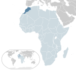
මොරොක්කෝව | රබාත් | 37,076,584 | වර්ග කිලෝමීටර 446550 (වර්ග සැතපුම් 172414)
මතභේදයට තුඩු දී ඇති සියලුම භූමි ප්රදේශ බැහැර කර සහරාවි අරාබි ප්රජාතන්ත්රවාදී ජනරජය ලෙස පොලිසාරියෝ පෙරමුණ විසින් හිමිකම් කියන බටහිර සහරාවේ මොරොක්කෝ-පරිපාලන කොටස් ඇතුළත් වේ |
මොරොක්කෝ ඩිරාම් |
 |

|
මොසැම්බික්
MOZ |
මාපුටෝ | 32,077,072 | වර්ග කිලෝමීටර 801590 (වර්ග සැතපුම් 309496) | මෙටිකල් |
 |

|
නැමීබියාව | වින්ඩ්හෝක් | 2,530,151 | වර්ග කිලෝමීටර 825418 (වර්ග සැතපුම් 318696) | නැමීබියානු ඩොලරය |
 |

|
නයිජර්
|
නියාමි | 25,252,722 | වර්ග කිලෝමීටර 1267000 (වර්ග සැතපුම් 489191) | CFA ෆ්රෑන්ක් |
 |

|
නයිජීරියාව නයිජීරියා ෆෙඩරල් ජනරජය NGA |
අබුජා | 213,401,323 | වර්ග කිලෝමීටර 923768 (වර්ග සැතපුම් 356669) | නයිරා |
 |

|
රුවන්ඩාව | කිගාලි | 13,461,888 | වර්ග කිලෝමීටර 26798 (වර්ග සැතපුම් 10347) | රුවන්ඩේස් ෆ්රෑන්ක් |
 |

|
සාඕ ටෝමේ සහ ප්රින්සිපේ සාඕ ටෝමේ සහ ප්රින්සිපේ ප්රජාත්රන්තවාදී ජනරජය STP |
සාඕ ටෝමේ | 178,739
(2012 ඇස්.) |
වර්ග කිලෝමීටර 964 (වර්ග සැතපුම් 372) | ඩොබ්රා |
 |

|
සෙනගාලය
|
ඩකාර් | 16,876,720 | වර්ග කිලෝමීටර 196723 (වර්ග සැතපුම් 75955) | CFA ෆ්රෑන්ක් |
 |

|
සීෂෙල්ස්
|
වික්ටෝරියා | 106,471 | වර්ග කිලෝමීටර 451 (වර්ග සැතපුම් 174) | සීෂෙල්ස් රුපියල |
 |

|
සියෙරා ලියෝන්
|
ෆ්රීටවුන් | 8,420,641 | වර්ග කිලෝමීටර 71740 (වර්ග සැතපුම් 27699) | ලියොන් |
 |

|
සෝමාලියාව
|
මොගඩිෂු | 17,065,581 | වර්ග කිලෝමීටර 637657 (වර්ග සැතපුම් 246201) | සෝමාලියානු සිලිං |
 |

|
දකුණු අප්රිකාව | බ්ලූම්ෆොන්ටයින් (අධිකරණ)
කේප් ටවුන් (ව්යවස්ථාදායක) ප්රිටෝරියා (විධායක) |
59,392,255 | වර්ග කිලෝමීටර 1221037 (වර්ග සැතපුම් 471445) | රැන්ඩ් |
 |

|
දකුණු සුඩානය | ජුබා | 10,748,272 | වර්ග කිලෝමීටර 644329 (වර්ග සැතපුම් 248777) | දකුණු සුඩාන පවුම
|
 |

|
සුඩානය
|
කාර්ටූම් | 45,657,202 | වර්ග කිලෝමීටර 1861484 (වර්ග සැතපුම් 718723) | සුඩාන පවුම |
 |

|
ටැන්සානියාව | ඩොඩෝමා (නිල)
|
63,588,334 | වර්ග කිලෝමීටර 945203 (වර්ග සැතපුම් 364945) | ටැන්සානියානු සිලිං |
 |

|
ටෝගෝ
|
ලෝමේ | 8,644,829 | වර්ග කිලෝමීටර 56785 (වර්ග සැතපුම් 21925) | CFA ෆ්රෑන්ක් |
 |

|
ටියුනීසියාව
|
ටියුනිස් | 12,262,946 | වර්ග කිලෝමීටර 163610 (වර්ග සැතපුම් 63170) | ටියුනීසියානු ඩිනාර් |
 |

|
උගන්ඩාව
|
කම්පාලා | 45,853,778 | වර්ග කිලෝමීටර 236040 (වර්ග සැතපුම් 91136) | උගන්ඩා සිලිං |
 |

|
සැම්බියාව | ලුසාකා | 19,473,125 | වර්ග කිලෝමීටර 752614 (වර්ග සැතපුම් 290586) | සැම්බියානු ක්වාචා |
 |

|
සිම්බාබ්වේ | හරාරේ | 15,993,524 | වර්ග කිලෝමීටර 390757 (වර්ග සැතපුම් 150872) | සිම්බාබ්වේ ඩොලරය |
සීමිත හෝ ජාත්යන්තර පිළිගැනීමක් නොමැති රාජ්යයන්
[සංස්කරණය]පහත සඳහන් ආයතන දෙක තමන් ස්වෛරී රාජ්යයන් ලෙස ප්රකාශ කර ඇති අතර යම් භූමි ප්රදේශයක පාලනයේ පවතින නමුත් අනෙකුත් රාජ්ය වලින් සීමිත හෝ පිළිගැනීමක් නොමැත. සහරාවි අරාබි ප්රජාතන්ත්රවාදී ජනරජය අප්රිකානු සංගමයේ සාමාජිකයෙකු වුවද, කිසිදු එක්සත් ජාතීන්ගේ ආයතනයක සාමාජික රාජ්යයක් නොවේ.
| ධජය | සිතියම | කෙටි නම, නිළ විධිමත් නාමය සහ ISO කේතය | තත්ත්වය | අගනුවර [8][10][11] |
ජනගහන | භූමි ප්රමාණය | මුදල් |
|---|---|---|---|---|---|---|---|
 |

|
සහරාවි අරාබි ප්රජාතන්ත්රවාදී ජනරජය [n 1] |
|
එල් අයියන් (ප්රකාශිත) [n 2] | 582,478 | වර්ග කිලෝමීටර 267405 (වර්ග සැතපුම් 103246) | සහරාවි පෙසෙටා |
 |

|
සෝමාලිලන්තය සෝමාලිලන්ත ජනරජය[13][14] |
හර්ගීසා | 4,000,000 | වර්ග කිලෝමීටර 176120 (වර්ග සැතපුම් 68000) | සෝමාලිලන්ත සිලිං |
ස්වෛරී නොවන ප්රදේශ
[සංස්කරණය]දැනට අප්රිකාවේ ස්වෛරී නොවන ප්රදේශ 12ක් ඇත. ස්පාඤ්ඤයේ ස්වයං පාලන නගර දෙකක් සහ පීනෝන් ඩි වේලෙස් ඩි ලා ගෝමරා හැර, ඉතිරි සියලුම භූමි ප්රදේශ මහාද්වීපයේ වෙරළට ඔබ්බෙන් වූ දූපත් වේ.
යැපෙන ප්රදේශ
[සංස්කරණය]| ධජ | සිතියම | ඉංග්රීසි කෙටි, විධිමත් නම් සහ ISO | පාලන බලය | තත්ත්වය [18] | අගනුවර | ජනගහන | ප්රදේශය [12] | මුදල් |
|---|---|---|---|---|---|---|---|---|
 |
|
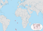
ශාන්ත හෙලේනා, ඇසෙන්ෂන් සහ ට්රිස්ටන් ඩා කුන්හා SH |
බ්රිතාන්ය විදේශ ප්රදේශය | ජේම්ස්ටවුන් | 5,633 | වර්ග කිලෝමීටර 420 (වර්ග සැතපුම් 162) | ශාන්ත හෙලේනා පවුම (ශාන්ත හෙලේනා සහ ඇසෙන්ෂන්) පවුම් ස්ටර්ලින් (ට්රිස්ටන් ඩා කුන්හා) | |
 |

|
දකුණු සහ ඇන්ටාක්ටික් ප්රංශ භූමිය[n 3] FR-TF |
ප්රංශයේ විදේශ ප්රදේශය | ශාන්ත පියරේ[n 4] | ස්ථිර ජනගහනයක් නැත[19] | වර්ග කිලෝමීටර 38.6 (වර්ග සැතපුම් 15) | යූරෝ |
වෙනත් ප්රදේශ
[සංස්කරණය]මෙම ලැයිස්තුවේ මූලික වශයෙන් අප්රිකානු නොවන රටක සංස්ථාපිත ප්රදේශ ලෙස පරිපාලනය කෙරෙන ප්රදේශ 9ක් අඩංගු වේ.
| ධජ | සිතියම | ඉංග්රීසි කෙටි, විධිමත් නම් සහ ISO | පාලන බලය | තත්ත්වය [18] | අගනුවර | ජනගහන | ප්රදේශය [12] | මුදල් |
|---|---|---|---|---|---|---|---|---|
 |

|
කැනරි දූපත් | ස්පාඤ්ඤයේ ස්වයං පාලන ප්රජාව | සැන්ටා කෲස් සහ ලාස් පල්මාස්[20] | 2,207,225 | වර්ග කිලෝමීටර 7447 (වර්ග සැතපුම් 2875) | යූරෝ | |
 |

|
සියුටා | ස්පාඤ්ඤයේ ස්වයං පාලන නගරය | සියුටා | 84,843 | වර්ග කිලෝමීටර 28 (වර්ග සැතපුම් 11) | යූරෝ | |
 |

|
මැඩෙයිරා
PT-30 |
පෘතුගාලයේ ස්වයං පාලන කලාපය | ෆන්චල් | 267,785 | වර්ග කිලෝමීටර 828 (වර්ග සැතපුම් 320) | යූරෝ | |
 |

|
මයෝට්
YT |
එතෙර කලාපය සහ ප්රංශ ජනරජයේ කොටසකි | ඩ්සාවුඩ්සි (නිල)
මාමූඩ්සූ (ප්රිෆෙක්ට් සහ දෙපාර්තමේන්තු සභා ආසනය) |
266,380 | වර්ග කිලෝමීටර 374 (වර්ග සැතපුම් 144) | යූරෝ | |
 |

|
මෙලිලා | ස්පාඤ්ඤයේ ස්වයං පාලන නගරය | මෙලිලා | 84,714 | වර්ග කිලෝමීටර 20 (වර්ග සැතපුම් 8) | යූරෝ | |
 |

|
පෙලගී දූපත් | ඉතාලියේ දූපත් සමූහය | ලැම්පෙඩුසා ඊ ලිනෝසා[n 5] | 6,304 | වර්ග කිලෝමීටර 21.4 (වර්ග සැතපුම් 8) | යූරෝ | |
 |

|
ප්ලාසාස් ඩි සොබෙරානියා | ස්පාඤ්ඤයේ විදේශීය භූමිය | නැත | 74 | වර්ග කිලෝමීටර 0.59 (වර්ග සැතපුම් 0.23) | යූරෝ | |

|

|
රීයුනියන් රීයුනියන් කලාපය RE |
එතෙර කලාපය සහ ප්රංශ ජනරජයේ කොටසකි | ශාන්ත-ඩෙනිස් | 889,918 | වර්ග කිලෝමීටර 2512 (වර්ග සැතපුම් 970) | යූරෝ | |
 |
|
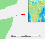
සොකොත්රා දූපත් සමූහය | යේමනයේ ආණ්ඩුකාර ප්රදේශයකි | හදිබු | 60,550 | වර්ග කිලෝමීටර 3974.64 (වර්ග සැතපුම් 1535) | යේමන රියාල් |
මේවාද බලන්න
[සංස්කරණය]- ආසියාවේ ස්වෛරී රාජ්යයන් සහ පරායත්ත භූමි ප්රදේශ ලැයිස්තුව
- යුරෝපයේ ස්වෛරී රාජ්යයන් සහ පරායත්ත භූමි ප්රදේශ ලැයිස්තුව
- උතුරු ඇමරිකාවේ ස්වෛරී රාජ්යයන් සහ පරායත්ත භූමි ප්රදේශ ලැයිස්තුව
- දකුණු ඇමරිකාවේ රාජ්යයන් සහ පරායත්ත භූමි ප්රදේශ ලැයිස්තුව
- ඕෂනියාවේ ස්වෛරී රාජ්යයන් සහ පරායත්ත භූමි ප්රදේශ ලැයිස්තුව
- ඇන්ටාක්ටිකාවේ භෞමික හිමිකම්
සටහන්
[සංස්කරණය]- ^ Occupies part of the territory of Western Sahara, disputed with Morocco.
- ^ Currently under Moroccan administration. Tifariti is the factual temporary capital, but Tindouf located in Algeria is the place of some government and military facilities.
- ^ Only the Îles Éparses are considered part of the African continent. The remaining four districts lie outside the continental shelf in the Indian Ocean or Antarctica.
- ^ The main station on the Îles Éparses is on Tromelin. The headquarters of the district chief, however, is Saint Pierre, in Réunion.
- ^ Geographically part of the archipelago (Lampedusa and Lampione) belongs to the African continent; politically and administratively, the islands fall within the Province of Agrigento in Sicily
යොමු කිරීම්
[සංස්කරණය]- ^ "Member States". United Nations. 2011-02-07 දින පැවති මුල් පිටපත වෙතින් සංරක්ෂිත පිටපත. සම්ප්රවේශය 28 July 2011.
- ^ "Member States". African Union. 9 January 2015 දින මුල් පිටපත වෙතින් සංරක්ෂණය කරන ලදී. සම්ප්රවේශය 15 July 2013.
- ^ "African Union Welcomes South Sudan as the 54th Member State of the Union". StarAfrica.com. 27 July 2011. 23 December 2011 දින මුල් පිටපත වෙතින් සංරක්ෂණය කරන ලදී. සම්ප්රවේශය 28 July 2011.
- ^ "African Union suspends Central African Republic after coup". Los Angeles Times. 25 March 2013. 2014-12-31 දින පැවති මුල් පිටපත වෙතින් සංරක්ෂිත පිටපත. සම්ප්රවේශය 14 March 2015.
- ^ "Africa Population (LIVE)". www.worldometers.info. සම්ප්රවේශය 31 July 2019.
- ^ "Field Listing :: Names". CIA. 2017-07-01 දින මුල් පිටපත වෙතින් සංරක්ෂණය කරන ලදී. සම්ප්රවේශය 28 July 2017.
- ^ "UNGEGN List of Country Names" (PDF). United Nations Group of Experts on Geographical Names. 2007. 2011-07-28 දින පැවති මුල් පිටපත වෙතින් සංරක්ෂිත පිටපත (PDF). සම්ප්රවේශය 28 July 2011.
- ^ a b c d "List of countries, territories and currencies". Europa. 9 August 2011. 2013-08-05 දින පැවති මුල් පිටපත වෙතින් සංරක්ෂිත පිටපත. සම්ප්රවේශය 10 August 2011.
- ^ "ISO 3166". International Organization for Standardization. 1974. සම්ප්රවේශය 2022-07-24.
{{cite web}}: CS1 maint: url-status (link) - ^ a b "Field Listing :: Capital". CIA. 2011-06-29 දින මුල් පිටපත වෙතින් සංරක්ෂණය කරන ලදී. සම්ප්රවේශය 3 August 2011.
- ^ a b "UNGEGN World Geographical Names". United Nations Group of Experts on Geographical Names. 29 July 2011. 2011-08-01 දින පැවති මුල් පිටපත වෙතින් සංරක්ෂිත පිටපත. සම්ප්රවේශය 3 August 2011.
- ^ a b c "Field Listing :: Area". CIA. 2012-09-16 දින මුල් පිටපත වෙතින් සංරක්ෂණය කරන ලදී. සම්ප්රවේශය 7 August 2011.
- ^ Name used in The Constitution of the Republic of Somaliland සංරක්ෂණය කළ පිටපත 2015-09-24 at the Wayback Machine
- ^ Susan M. Hassig, Zawiah Abdul Latif, Somalia, (Marshall Cavendish: 2007), p.10.
- ^ "The Transitional Federal Charter of the Somali Republic" (PDF). University of Pretoria. 1 February 2004. Archived from the original on December 18, 2008. සම්ප්රවේශය 2 February 2010.
{{cite web}}: CS1 maint: unfit URL (link) "The Somali Republic shall have the following boundaries. (a) North; Gulf of Aden. (b) North West; Djibouti. (c) West; Ethiopia. (d) South south-west; Kenya. (e) East; Indian Ocean." - ^ Lacey, Marc (5 June 2006). The Signs Say Somaliland, but the World Says Somalia සංරක්ෂණය කළ පිටපත 2011-06-27 at the Wayback Machine. The New York Times. Retrieved 2010-05-25.
- ^ "UN in Action: Reforming Somaliland's Judiciary" (PDF). 2012-01-21 දින පැවති මුල් පිටපත වෙතින් සංරක්ෂිත පිටපත (PDF). සම්ප්රවේශය 2012-05-29.
- ^ a b "Field Listing :: Dependency Status". CIA. 2011-06-29 දින මුල් පිටපත වෙතින් සංරක්ෂණය කරන ලදී. සම්ප්රවේශය 8 August 2011.
- ^ "French Southern and Antarctic Lands". සම්ප්රවේශය 5 October 2014.
- ^ "Estatuto de Autonomía de Canarias en la Página Web Oficial del Gobierno de Canarias". .gobiernodecanarias.org. 2011-01-20 දින මුල් පිටපත වෙතින් සංරක්ෂණය කරන ලදී. සම්ප්රවේශය 2010-09-20.
