ශ්රී ලංකාවේ පරිපාලන දිස්ත්රික්ක
Appearance
| ශ්රී ලංකාවේ පරිපාලන ඒකක |
|---|
| පළමු ඒකකය |
| පළාත් |
| දෙවන ඒකකය |
| දිස්ත්රික්ක |
| තෙවන ඒකකය |
| ප්රාදේශීය ලේකම් කොට්ඨාස |
| සිව්වන ඒකකය |
| පළාත් පාලන ඡන්ද කොට්ඨාශය |
| පස්වන ඒකකය |
ශ්රී ලංකාවේ පරිපාලන දිස්ත්රික්ක 25 ක් ඇත. දිස්ත්රික්කයේ පරිපාලන ප්රධානියා දිස්ත්රික් ලේකම් වන අතර , දිස්ත්රික් ලේකම් කාර්යාලය ප්රධාන කාර්යාලය වේ.
නෛතික භාවය
[සංස්කරණය]ශ්රී ලංකාව ජනරජයට අයත් දේශය පරිපාලන දිස්ත්රික්ක විසි පහෙන්ද ශ්රී ලංකාව ජනරජයේ දේශීය ජලතීරයෙන්ද සමන්විත වන්නේය. පරිපාලන දිස්ත්රික්ක විසිපහෙහි නම් පළමුවන උපලේඛනයෙහි දැක්වෙන්නේය; එසේ වුවද පාර්ලිමේන්තුව විසින් යෝජනා සම්මතයක් මගින් තීරණය කරනුලබන පරිදි, ඒ පරිපාලන දිස්ත්රික්ක ඒවාට වෙනස්වූ පරිපාලන දිස්ත්රික්ක සංයුක්ත වන පරිදි නැවත බෙදීම හෝ ඒකාබද්ධකිරීම හෝ කරනු ලැබිය හැක්කේය.
— ශ්රී ලංකා ප්රජාතාන්ත්රික සමාජවාදී ජනරජයේ ආණ්ඩුක්රම ව්යවස්ථාව හත්වන ආණ්ඩුක්රම ව්යවස්ථා සංශෝධනය 1983 ඹක් 4 [1]
දිස්ත්රික්කයන්
[සංස්කරණය]මෙහි සම්පූර්ණ ජනගහණයන් පිළිබද දත්තයන් වර්ෂ 2012 දි පැවති ජනසංගණනය දක්වා ඇත.
| අංකය (ආණ්ඩුක්රම ව්යවස්ථාව පරිදි) |
නම | සිතියම | පළාත | දිස්ත්රික් අග නගරය හෙවත් පරිපාලන නගරය | විශාලතම වෙළඳ නගරය | භූමි ප්රමාණය | ජල වපසරිය | මුළු භූමි ප්රමාණය | ජනගහනය[2] | ජන ඝනත්වය↓[N 1] |
|---|---|---|---|---|---|---|---|---|---|---|
| 16 | අම්පාර | 
|
නැගෙනහිර පළාත | අම්පාර | අම්පාර | 4,222 km² (1,630 sq mi) | 193 km² (75 sq mi) | 4,415 km² (1,705 sq mi) | 648,057 | 140/km² (363/sq mi) |
| 20 | අනුරාධපුර | 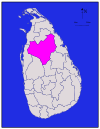
|
උතුරු මැද පළාත | අනුරාධපුර නව නගරය | අනුරාධපුර නව නගරය | 6,664 km² (2,573 sq mi) | 515 km² (199 sq mi) | 7,179 km² (2,772 sq mi) | 856,232 | 112/km² (290/sq mi) |
| 22 | බදුල්ල | 
|
ඌව පළාත | බදුල්ල | බදුල්ල | 2,827 km² (1,092 sq mi) | 34 km² (13 sq mi) | 2,861 km² (1,105 sq mi) | 811,758 | 276/km² (715/sq mi) |
| 15 | මඩකලපුව | 
|
නැගෙනහිර පළාත | මඩකලපුව | මඩකලපුව | 2,610 km² (1,008 sq mi) | 244 km² (94 sq mi) | 2,854 km² (1,102 sq mi) | 525,142 | 186/km² (482/sq mi) |
| 1 | කොළඹ | 
|
බස්නාහිර පළාත | කොළඹ | කොළඹ | 676 km² (261 sq mi) | 23 km² (9 sq mi) | 699 km² (270 sq mi) | 2,309,809 | 3,330/km² (8,625/sq mi) |
| 7 | ගාල්ල | 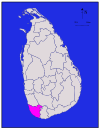
|
දකුණු පළාත | ගාල්ල | ගාල්ල | 1,617 km² (624 sq mi) | 35 km² (14 sq mi) | 1,652 km² (638 sq mi) | 1,058,771 | 613/km² (1,588/sq mi) |
| 2 | ගම්පහ | 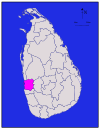
|
බස්නාහිර පළාත | ගම්පහ | මීගමුව | 1,341 km² (518 sq mi) | 46 km² (18 sq mi) | 1,387 km² (536 sq mi) | 2,294,641 | 1,539/km² (3,986/sq mi) |
| 9 | හම්බන්තොට | 
|
දකුණු පළාත | හම්බන්තොට | හම්බන්තොට | 2,496 km² (964 sq mi) | 113 km² (44 sq mi) | 2,609 km² (1,007 sq mi) | 596,617 | 211/km² (546/sq mi) |
| 10 | යාපනය | 
|
උතුරු පළාත | යාපනය | යාපනය | 929 km² (359 sq mi) | 96 km² (37 sq mi) | 1,025 km² (396 sq mi) | 583,378 | 528/km² (1,368/sq mi) |
| 3 | කළුතර | 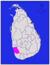
|
බස්නාහිර පළාත | කළුතර | පානදුර | 1,576 km² (608 sq mi) | 22 km² (8 sq mi) | 1,598 km² (617 sq mi) | 1,217,260 | 677/km² (1,753/sq mi) |
| 4 | මහනුවර | 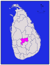
|
මධ්යම පළාත | මහනුවර | මහනුවර | 1,917 km² (740 sq mi) | 23 km² (9 sq mi) | 1,940 km² (749 sq mi) | 1,369,899 | 667/km² (1,728/sq mi) |
| 25 | කෑගල්ල | 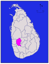
|
සබරගමුව පළාත | කෑගල්ල | කෑගල්ල | 1,685 km² (651 sq mi) | 8 km² (3 sq mi) | 1,693 km² (654 sq mi) | 836,603 | 466/km² (1,207/sq mi) |
| 11 | කිලිනොච්චි | 
|
උතුරු පළාත | කිලිනොච්චිය | කිලිනොච්චිය | 1,205 km² (465 sq mi) | 74 km² (29 sq mi) | 1,279 km² (494 sq mi) | 112,875 | 106/km² (275/sq mi) |
| 18 | කුරුණෑගල | 
|
වයඹ පළාත | කුරුණෑගල | කුරුණෑගල | 4,624 km² (1,785 sq mi) | 192 km² (74 sq mi) | 4,816 km² (1,859 sq mi) | 1,610,299 | 316/km² (818/sq mi) |
| 12 | මන්නාරම | 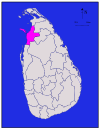
|
උතුරු පළාත | මන්නාරම | මන්නාරම | 1,880 km² (726 sq mi) | 116 km² (45 sq mi) | 1,996 km² (771 sq mi) | 99,051 | 81/km² (210/sq mi) |
| 5 | මාතලේ | 
|
මධ්යම පළාත | මාතලේ | දඹුල්ල | 1,952 km² (754 sq mi) | 41 km² (16 sq mi) | 1,993 km² (770 sq mi) | 482,229 | 226/km² (585/sq mi) |
| 8 | මාතර | 
|
දකුණු පළාත | මාතර | මාතර | 1,270 km² (490 sq mi) | 13 km² (5 sq mi) | 1,283 km² (495 sq mi) | 809,344 | 600/km² (1,554/sq mi) |
| 23 | මොණරාගල | 
|
ඌව පළාත | මොණරාගල | මොණරාගල | 5,508 km² (2,127 sq mi) | 131 km² (51 sq mi) | 5,639 km² (2,177 sq mi) | 448,142 | 72/km² (186/sq mi) |
| 14 | මුලතිව් | 
|
උතුරු පළාත | මුලතිව් | මුලතිව් | 2,415 km² (932 sq mi) | 202 km² (78 sq mi) | 2,617 km² (1,010 sq mi) | 91,947 | 50/km² (129/sq mi) |
| 6 | නුවරඑළිය | 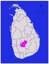
|
මධ්යම පළාත | නුවරඑළිය | නුවරඑළිය | 1,706 km² (659 sq mi) | 35 km² (14 sq mi) | 1,741 km² (672 sq mi) | 706,588 | 412/km² (1,067/sq mi) |
| 21 | පොළොන්නරුව | 
|
උතුරු මැද පළාත | පොළොන්නරුව | කදුරුවෙල | 3,077 km² (1,188 sq mi) | 216 km² (83 sq mi) | 3,293 km² (1,271 sq mi) | 403,335 | 117/km² (303/sq mi) |
| 19 | පුත්තලම | 
|
වයඹ පළාත | පුත්තලම | හලාවත | 2,882 km² (1,113 sq mi) | 190 km² (73 sq mi) | 3,072 km² (1,186 sq mi) | 759,776 | 246/km² (637/sq mi) |
| 24 | රත්නපුර | 
|
සබරගමුව පළාත | රත්නපුර | රත්නපුර | 3,236 km² (1,249 sq mi) | 39 km² (15 sq mi) | 3,275 km² (1,264 sq mi) | 1,082,277 | 314/km² (813/sq mi) |
| 17 | ත්රිකුණාමලය | 
|
නැගෙනහිර පළාත | ත්රිකුණාමලය | ත්රිකුණාමලය | 2,529 km² (976 sq mi) | 198 km² (76 sq mi) | 2,727 km² (1,053 sq mi) | 378,182 | 135/km² (350/sq mi) |
| 13 | වවුනියාව | 
|
උතුරු පළාත | වවුනියාව | වවුනියාව | 1,861 km² (719 sq mi) | 106 km² (41 sq mi) | 1,967 km² (759 sq mi) | 171,511 | 81/km² (210/sq mi) |
උප බෙදීම්
[සංස්කරණය]සෑම පරිපාලන දිස්ත්රක්කයක්ම ප්රාදේශීය ලේකම් කොට්ටාස වලටත් ඒවා නැවත ග්රාම නිලධාරී වසම් (තුලාන) වලටත් බෙදා පරිපාලන කටයුතු විමද්යගතකොට ඇත.
ආශ්රිත ලිපි
[සංස්කරණය]- ශ්රී ලංකාවේ උප බෙදීම්
- ශ්රී ලංකාවේ පළාත්
- ශ්රී ලංකාවේ ප්රාදේශීය ලේකම් කොට්ඨාස
- ශ්රී ලංකාවේ නගර ලැයිස්තුව
- ශ්රී ලංකාවේ ප්රාදේශීය සභා
මූලාශ්ර
[සංස්කරණය]- ^ Population density has been calculated using the land area rather than the total area.
- ^ ශ්රී ලංකා ප්රජාතාන්ත්රික සමාජවාදී ජනරජයේ ආණ්ඩුක්රම ව්යවස්ථාව සහ හත්වන ආණ්ඩුක්රම ව්යවස්ථා සංශෝධනය.
- ^ ශ්රී ලංකා ජනලේඛන හා සංඛ්යාලේඛන දෙපාර්තමේන්තුවේ නිල වෙබ් අඩවිය[1]
