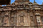
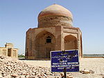
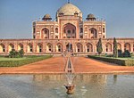
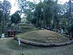
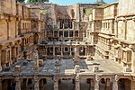
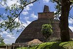
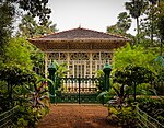
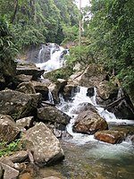
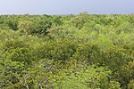
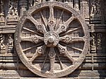
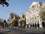
"දකුණු ආසියාවේ ලෝක උරුම අඩවි ලැයිස්තුව" හි සංශෝධන අතර වෙනස්කම්
Appearance
Content deleted Content added
සුළු Lee (සාකච්ඡාව) ගේ සංස්කරණයන් VihirLak007 ගේ අවසන් අනුවාදය වෙත ප්රතිවර්තනය කෙරිණි ටැගය: Rollback |
|||
| 27 පේළිය: | 27 පේළිය: | ||
{|class="wikitable sortable plainrowheaders" |
{|class="wikitable sortable plainrowheaders" |
||
! style="width:15%;" scope="col"| |
! style="width:15%;" scope="col"| අඩවිය |
||
! class="unsortable" scope="col" | |
! class="unsortable" scope="col" | පිංතූරය |
||
! scope="col" | |
! scope="col" | ස්ථානය |
||
! scope="col" | [[World Heritage Site#Selection criteria| |
! scope="col" | [[World Heritage Site#Selection criteria|නිර්ණායක]] |
||
! scope="col"| |
! scope="col"| ප්රදේශය<br />හෙ. (අක්කර) |
||
! scope="col"| |
! scope="col"| වර්ශය |
||
! scope="col" class="unsortable" | |
! scope="col" class="unsortable" | විස්තරය |
||
! scope="col" class="unsortable" | |
! scope="col" class="unsortable" | යොමු. |
||
|- |
|- |
||
! scope="row" | [[ |
! scope="row" | [[අග්රා බලකොටුව]] |
||
| {{center|[[File:AgraFort.jpg|150x150px|alt=Decorated gate to a fortress of red stone.]]}} |
| {{center|[[File:AgraFort.jpg|150x150px|alt=Decorated gate to a fortress of red stone.]]}} |
||
| {{sort| |
| {{sort|ඉන්දියාව|[[අග්රා]], [[උත්තර් ප්රදේශ්]], {{flag|ඉන්දියාව}}<br/><small>{{coord|27|11|0|N|78|2|0|E|region:IN_type:landmark|name=Agra Fort}}</small>}} |
||
| Cultural:<br />(iii) |
| Cultural:<br />(iii) |
||
| {{center|—}} |
| {{center|—}} |
||
| 47 පේළිය: | 47 පේළිය: | ||
! scope="row" | [[අජන්තා ලෙන්]] |
! scope="row" | [[අජන්තා ලෙන්]] |
||
| [[File:Ajanta (63).jpg|150x150px|alt=A line of caves, some with columns on the outside, along a rock face.]] |
| [[File:Ajanta (63).jpg|150x150px|alt=A line of caves, some with columns on the outside, along a rock face.]] |
||
| {{sort| |
| {{sort|ඉන්දියාව|[[ඕරංගබාද් දිස්ත්රික්කය, මහාරාෂ්ට්ර|ඕරංගබාද් දිස්ත්රික්කය]], [[මහාරාෂ්ට්ර]], {{flag|ඉන්දියාව}}<br/><small>{{coord|20|33|12|N|75|42|0|E|region:IN_type:landmark|name=Ajanta Caves}}</small>}} |
||
| Cultural:<br />(i), (ii), (iii), (vi) |
| Cultural:<br />(i), (ii), (iii), (vi) |
||
| {{center|—}} |
| {{center|—}} |
||
| 56 පේළිය: | 56 පේළිය: | ||
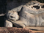
! scope="row" | [[පොළොන්නරුව පෞරාණික නගරය]] |
! scope="row" | [[පොළොන්නරුව පෞරාණික නගරය]] |
||
| [[File:Galvihara-sunny2.jpg|150x150px|alt=Upper part of a reclining Buddha.]] |
| [[File:Galvihara-sunny2.jpg|150x150px|alt=Upper part of a reclining Buddha.]] |
||
| {{sort|Sri Lanka|[[ |
| {{sort|Sri Lanka|[[පොළොන්නරුව දිස්ත්රික්කය]], [[උතුරු මැද පළාත, ශ්රී ලංකාව|උතුරු මැද පළාත]], {{flag|ශ්රී ලංකාව}}<br/><small>{{coord|7|54|57|N|81|0|2|E|region:LK_type:landmark|name=Ancient City of Polonnaruwa}}</small>}} |
||
| Cultural:<br />(ii), (iii), (vi) |
| Cultural:<br />(ii), (iii), (vi) |
||
| {{center|—}} |
| {{center|—}} |
||
| 72 පේළිය: | 72 පේළිය: | ||
|<ref>{{cite web |url=https://whc.unesco.org/en/list/202|title=Ancient City of Sigiriya|publisher=[[UNESCO]] |access-date=28 May 2010}}</ref> |
|<ref>{{cite web |url=https://whc.unesco.org/en/list/202|title=Ancient City of Sigiriya|publisher=[[UNESCO]] |access-date=28 May 2010}}</ref> |
||
|- |
|- |
||
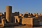
! scope="row" | [[මොහෙන්ජදාරෝහි පුරාවිද්යා නටඹුන්]] |
|||
! scope="row" | [[Archaeological Ruins at Moenjodaro]] |
|||
| [[File:Other side of Moenjodaro by Usman Ghani.jpg|150x150px]] |
| [[File:Other side of Moenjodaro by Usman Ghani.jpg|150x150px]] |
||
| {{sort|Pakistan|[[Sindh]], {{flag|Pakistan}}<br/><small>{{coord|27|19|45|N|68|8|20|E|region:PK_type:landmark|name=Archaeological Ruins at Moenjodaro}}</small>}} |
| {{sort|Pakistan|[[Sindh]], {{flag|Pakistan}}<br/><small>{{coord|27|19|45|N|68|8|20|E|region:PK_type:landmark|name=Archaeological Ruins at Moenjodaro}}</small>}} |
||
| 81 පේළිය: | 81 පේළිය: | ||
|<ref>{{cite web |url=https://whc.unesco.org/en/list/138 |title=Archaeological Ruins at Moenjodaro|publisher=[[UNESCO]] |access-date=28 May 2010}}</ref> |
|<ref>{{cite web |url=https://whc.unesco.org/en/list/138 |title=Archaeological Ruins at Moenjodaro|publisher=[[UNESCO]] |access-date=28 May 2010}}</ref> |
||
|- |
|- |
||
! scope="row" | [[නාලන්දා|බිහාර්, නාලන්දාවේ පිහිටි නාලන්දා ''මහාවිහාර'' (නාලන්දා විශ්ව විද්යාලය) පුරාවිද්යා භූමිය ]] |
|||
! scope="row" | [[Nalanda|Archaeological Site of Nalanda ''Mahavihara'' (Nalanda University) at Nalanda, Bihar]] |
|||
|[[File:Nalanda-1017 (4396710763).jpg|150x150px]] |
|[[File:Nalanda-1017 (4396710763).jpg|150x150px]] |
||
| {{sort|India|[[Nalanda District]], [[Bihar]], {{flag|India}}<br/><small>{{coord|25|8|12|N|85|26|38|E|region:IN_type:landmark|name=Archaeological Site of Nalanda Mahavihara (Nalanda University) at Nalanda, Bihar}}</small>}} |
| {{sort|India|[[Nalanda District]], [[Bihar]], {{flag|India}}<br/><small>{{coord|25|8|12|N|85|26|38|E|region:IN_type:landmark|name=Archaeological Site of Nalanda Mahavihara (Nalanda University) at Nalanda, Bihar}}</small>}} |
||
| 90 පේළිය: | 90 පේළිය: | ||
|<ref>{{cite web |url=https://whc.unesco.org/en/list/1502|title=Archaeological Site of Nalanda Mahavihara at Nalanda, Bihar|publisher=[[UNESCO]] |access-date=15 July 2016}}</ref> |
|<ref>{{cite web |url=https://whc.unesco.org/en/list/1502|title=Archaeological Site of Nalanda Mahavihara at Nalanda, Bihar|publisher=[[UNESCO]] |access-date=15 July 2016}}</ref> |
||
|- |
|- |
||
! scope="row" | [[ |
! scope="row" | [[සාංචි හි බෞද්ධ ස්මාරක]] |
||
| [[File:Sanchi Great Stupa Torana.jpg|150x150px]] |
| [[File:Sanchi Great Stupa Torana.jpg|150x150px]] |
||
| {{sort|India|[[Raisen District]], [[Madhya Pradesh]], {{flag|India}}<br/><small>{{coord|23|28|46|N|77|44|23|E|region:IN_type:landmark|name=Buddhist Monuments at Sanchi}}</small>}} |
| {{sort|India|[[Raisen District]], [[Madhya Pradesh]], {{flag|India}}<br/><small>{{coord|23|28|46|N|77|44|23|E|region:IN_type:landmark|name=Buddhist Monuments at Sanchi}}</small>}} |
||
| 99 පේළිය: | 99 පේළිය: | ||
|<ref>{{cite web |url=https://whc.unesco.org/en/list/524|title=Buddhist Monuments at Sanchi|publisher=[[UNESCO]] |access-date=28 May 2011}}</ref> |
|<ref>{{cite web |url=https://whc.unesco.org/en/list/524|title=Buddhist Monuments at Sanchi|publisher=[[UNESCO]] |access-date=28 May 2011}}</ref> |
||
|- |
|- |
||
! scope="row" | |
! scope="row" | [[Takt-i-Bahi]] සහ අසල්වැසි [[Seri Bahlol|Sahr-i-Bahlol]] නගරයේ බෞද්ධ නටබුන්. |
||
| [[File:Takht-e-bahi.jpg|150x150px]] |
| [[File:Takht-e-bahi.jpg|150x150px]] |
||
| {{sort|Pakistan|[[Khyber Pakhtunkhwa]], {{flag|Pakistan}}<br/><small>{{coord|34|19|15|N|71|56|45|E|region:PK_type:landmark|name=Buddhist Ruins of Takht-i-Bahi and Neighbouring City Remains at Sahr-i-Bahlol}}</small>}} |
| {{sort|Pakistan|[[Khyber Pakhtunkhwa]], {{flag|Pakistan}}<br/><small>{{coord|34|19|15|N|71|56|45|E|region:PK_type:landmark|name=Buddhist Ruins of Takht-i-Bahi and Neighbouring City Remains at Sahr-i-Bahlol}}</small>}} |
||
| 108 පේළිය: | 108 පේළිය: | ||
|<ref>{{cite web |url=https://whc.unesco.org/en/list/140 |title=Buddhist Ruins of Takht-i-Bahi and Neighbouring City Remains at Sahr-i-Bahlol |publisher=[[UNESCO]] |access-date=28 May 2010}}</ref> |
|<ref>{{cite web |url=https://whc.unesco.org/en/list/140 |title=Buddhist Ruins of Takht-i-Bahi and Neighbouring City Remains at Sahr-i-Bahlol |publisher=[[UNESCO]] |access-date=28 May 2010}}</ref> |
||
|- |
|- |
||
! scope="row" | [[ |
! scope="row" | [[ශ්රී ලංකාවේ මධ්යම කඳුකරය]] |
||
| [[File:Adam's Peak 3.jpg|150x150px]] |
| [[File:Adam's Peak 3.jpg|150x150px]] |
||
| {{sort|Sri Lanka|{{flag|Sri Lanka}}<br/><small>{{coord|7|27|9|N|80|48|8|E|region:LK_type:landmark|name=Central Highlands of Sri Lanka}}</small>}} |
| {{sort|Sri Lanka|{{flag|Sri Lanka}}<br/><small>{{coord|7|27|9|N|80|48|8|E|region:LK_type:landmark|name=Central Highlands of Sri Lanka}}</small>}} |
||
| 114 පේළිය: | 114 පේළිය: | ||
| {{convert|56844|ha|abbr=values|sortable=on}}; buffer zone {{convert|72645|ha|abbr=values}} |
| {{convert|56844|ha|abbr=values|sortable=on}}; buffer zone {{convert|72645|ha|abbr=values}} |
||
| align="center" |2010 |
| align="center" |2010 |
||
| අඩවි තුනකින් සෑදී ඇත; |
|||
| Composed by three sites; |
|||
* [[හෝර්ටන් තැන්න ජාතික උද්යානය]] |
|||
* [[Horton Plains National Park]] |
|||
* [[දුම්බර කඳුවැටිය|නකල්ස් සංරක්ෂණ වනාන්තරය]] |
|||
* [[Knuckles Mountain Range|Knuckles Conservation Forest]] |
|||
* [[උච්ච වනෝද්යාන අභයභූමිය|උච්ච වනගත ආරක්ෂිත ප්රදේශය]] |
|||
* [[Peak Wilderness Sanctuary|Peak Wilderness Protected Area]] |
|||
|<ref>{{cite web |url=https://whc.unesco.org/en/list/1203|title=Central Highlands of Sri Lanka|publisher=[[UNESCO]] |access-date=28 May 2010}}</ref> |
|<ref>{{cite web |url=https://whc.unesco.org/en/list/1203|title=Central Highlands of Sri Lanka|publisher=[[UNESCO]] |access-date=28 May 2010}}</ref> |
||
|- |
|- |
||
! scope="row" | [[චම්පනර්-පවාගාද් පුරාවිද්යා උද්යානය]] |
|||
! scope="row" | [[Champaner-Pavagadh Archaeological Park]] |
|||
| [[File:Jama Mosque,PMS.jpg|150x150px]] |
| [[File:Jama Mosque,PMS.jpg|150x150px]] |
||
| {{sort|India|[[Panchmahal district]], [[Gujarat]], {{flag|India}}<br/><small>{{coord|22|29|0|N|73|32|0|E|region:IN_type:landmark|name=Champaner-Pavagadh Archaeological Park}}</small>}} |
| {{sort|India|[[Panchmahal district]], [[Gujarat]], {{flag|India}}<br/><small>{{coord|22|29|0|N|73|32|0|E|region:IN_type:landmark|name=Champaner-Pavagadh Archaeological Park}}</small>}} |
||
| 129 පේළිය: | 129 පේළිය: | ||
|<ref>{{cite web |url=https://whc.unesco.org/en/list/1101|title=Champaner-Pavagadh Archaeological Park|publisher=[[UNESCO]] |access-date=28 May 2010}}</ref> |
|<ref>{{cite web |url=https://whc.unesco.org/en/list/1101|title=Champaner-Pavagadh Archaeological Park|publisher=[[UNESCO]] |access-date=28 May 2010}}</ref> |
||
|- |
|- |
||
! scope="row" | [[චත්රපති ශිවාජි පර්යන්තය]] (කලින් වික්ටෝරියා පර්යන්තය) |
|||
! scope="row" | [[Chhatrapati Shivaji Terminus]] (formerly Victoria Terminus) |
|||
| [[File:Chhatrapati Shivaji Terminus (Victoria Terminus).jpg|150x150px|alt=Large building of reddish stone with columns, cupolas and turrets. The main cupola is topped by a human sculpture.]] |
| [[File:Chhatrapati Shivaji Terminus (Victoria Terminus).jpg|150x150px|alt=Large building of reddish stone with columns, cupolas and turrets. The main cupola is topped by a human sculpture.]] |
||
| {{sort|India|[[Mumbai]], [[Maharashtra]], {{flag|India}}<br/><small>{{coord|18|56|24|N|72|50|10|E|region:IN_type:landmark|name=Chhatrapati Shivaji Terminus (formerly Victoria Terminus)}}</small>}} |
| {{sort|India|[[Mumbai]], [[Maharashtra]], {{flag|India}}<br/><small>{{coord|18|56|24|N|72|50|10|E|region:IN_type:landmark|name=Chhatrapati Shivaji Terminus (formerly Victoria Terminus)}}</small>}} |
||
| 138 පේළිය: | 138 පේළිය: | ||
|<ref>{{cite web |url=https://whc.unesco.org/en/list/945|title=Chhatrapati Shivaji Terminus (formerly Victoria Terminus)|publisher=[[UNESCO]] |access-date=28 May 2010}}</ref> |
|<ref>{{cite web |url=https://whc.unesco.org/en/list/945|title=Chhatrapati Shivaji Terminus (formerly Victoria Terminus)|publisher=[[UNESCO]] |access-date=28 May 2010}}</ref> |
||
|- |
|- |
||
! scope="row"| [[ |
! scope="row"| [[චිත්වාන් ජාතික උද්යානය]] |
||
| [[File:Chitwan 2.jpg|150x150px|alt=A lake with tree trunks in the water.]] |
| [[File:Chitwan 2.jpg|150x150px|alt=A lake with tree trunks in the water.]] |
||
| {{sort|Nepal|[[Chitwan District]], [[Narayani Zone]], {{flag|Nepal}}<br/><small>{{coord|27|30|0|N|84|20|0|E|region:NP_type:landmark|name=Chitwan National Park}}</small>}} |
| {{sort|Nepal|[[Chitwan District]], [[Narayani Zone]], {{flag|Nepal}}<br/><small>{{coord|27|30|0|N|84|20|0|E|region:NP_type:landmark|name=Chitwan National Park}}</small>}} |
||
| 147 පේළිය: | 147 පේළිය: | ||
|<ref>{{cite web |url=https://whc.unesco.org/en/list/284|title=Chitwan National Park|publisher=[[UNESCO]] |access-date=28 May 2010}}</ref> |
|<ref>{{cite web |url=https://whc.unesco.org/en/list/284|title=Chitwan National Park|publisher=[[UNESCO]] |access-date=28 May 2010}}</ref> |
||
|- |
|- |
||
! scope="row" | [[ |
! scope="row" | [[ගෝවාහි පල්ලි සහ කන්යාරාම]] |
||
| {{center|[[File:Old Goa - panoramio (1).jpg|150x150px|alt=A stone church.]]}} |
| {{center|[[File:Old Goa - panoramio (1).jpg|150x150px|alt=A stone church.]]}} |
||
| {{sort|India|[[Goa]], {{flag|India}}<br/><small>{{coord|15|30|8|N|73|54|42|E|region:IN_type:landmark|name=Churches and Convents of Goa}}</small>}} |
| {{sort|India|[[Goa]], {{flag|India}}<br/><small>{{coord|15|30|8|N|73|54|42|E|region:IN_type:landmark|name=Churches and Convents of Goa}}</small>}} |
||
| 157 පේළිය: | 157 පේළිය: | ||
|-style="background-color: #FFE6BD" |
|-style="background-color: #FFE6BD" |
||
! scope="row" style="background-color: #FFE6BD"| [[ |
! scope="row" style="background-color: #FFE6BD"| [[බාමියන් නිම්නයේ සංස්කෘතික භූ දර්ශනය සහ පුරාවිද්යාත්මක නටබුන්]]<sup>†</sup> |
||
| {{center|[[File:BigBuddha.jpg|150x150px|alt=A large niche in a rock with the outline of a human figure.]]}} |
| {{center|[[File:BigBuddha.jpg|150x150px|alt=A large niche in a rock with the outline of a human figure.]]}} |
||
| {{sort|Afghanistan|[[Bamyan Province|Bamyan]], {{flag|Afghanistan}}<br/><small>{{coord|34|49|55|N|67|49|36|E|region:AF_type:landmark|name=Cultural Landscape and Archaeological Remains of the Bamiyan Valley}}</small>}} |
| {{sort|Afghanistan|[[Bamyan Province|Bamyan]], {{flag|Afghanistan}}<br/><small>{{coord|34|49|55|N|67|49|36|E|region:AF_type:landmark|name=Cultural Landscape and Archaeological Remains of the Bamiyan Valley}}</small>}} |
||
| 166 පේළිය: | 166 පේළිය: | ||
|<ref>{{cite web |url=https://whc.unesco.org/en/list/208 |title=Cultural Landscape and Archaeological Remains of the Bamiyan Valley |publisher=[[UNESCO]] |access-date=28 May 2010}}</ref><br><ref name="27-sess-p122-123">{{harvnb|27th session|2003|pp=122–123}}</ref> |
|<ref>{{cite web |url=https://whc.unesco.org/en/list/208 |title=Cultural Landscape and Archaeological Remains of the Bamiyan Valley |publisher=[[UNESCO]] |access-date=28 May 2010}}</ref><br><ref name="27-sess-p122-123">{{harvnb|27th session|2003|pp=122–123}}</ref> |
||
|- |
|- |
||
! scope="row" | [[ |
! scope="row" | [[දොලවිර|දොලවිර: හරප්පා නගරයක්]] |
||
|[[File:Dholavira archaeological site.jpg|150x150px]] |
|[[File:Dholavira archaeological site.jpg|150x150px]] |
||
|{{sort|India|[[Kutch district]], [[Gujarat]], {{flag|India}}<br/><small>{{coord|23|53|18.27|N|70|12|47.89|E|region:IN_type:landmark|name=Dholavira: a Harappan City}}</small>}} |
|{{sort|India|[[Kutch district]], [[Gujarat]], {{flag|India}}<br/><small>{{coord|23|53|18.27|N|70|12|47.89|E|region:IN_type:landmark|name=Dholavira: a Harappan City}}</small>}} |
||
| 175 පේළිය: | 175 පේළිය: | ||
|<ref>{{Cite web |last= |first= |title=Dholavira: a Harappan City |url=https://whc.unesco.org/en/list/1645/ |access-date=2023-09-20 |website= |publisher=[[UNESCO]] |language=en}}</ref> |
|<ref>{{Cite web |last= |first= |title=Dholavira: a Harappan City |url=https://whc.unesco.org/en/list/1645/ |access-date=2023-09-20 |website= |publisher=[[UNESCO]] |language=en}}</ref> |
||
|- |
|- |
||
! scope="row" | [[ |
! scope="row" | [[එලිෆන්ටා ගුහා]] |
||
| {{center|[[File:Elephanta Caves Trimurti.jpg|150x150px|alt=Sculpture of a three-headed figure.]]}} |
| {{center|[[File:Elephanta Caves Trimurti.jpg|150x150px|alt=Sculpture of a three-headed figure.]]}} |
||
| {{sort|India|[[Elephanta Island]], [[Raigad district]], [[Maharashtra]], {{flag|India}}<br/><small>{{coord|18|58|0|N|72|56|9|E|region:IN_type:landmark|name=Elephanta Caves}}</small>}} |
| {{sort|India|[[Elephanta Island]], [[Raigad district]], [[Maharashtra]], {{flag|India}}<br/><small>{{coord|18|58|0|N|72|56|9|E|region:IN_type:landmark|name=Elephanta Caves}}</small>}} |
||
| 184 පේළිය: | 184 පේළිය: | ||
|<ref>{{cite web |url=https://whc.unesco.org/en/list/244|title=Elephanta Caves|publisher=[[UNESCO]] |access-date=28 May 2010}}</ref> |
|<ref>{{cite web |url=https://whc.unesco.org/en/list/244|title=Elephanta Caves|publisher=[[UNESCO]] |access-date=28 May 2010}}</ref> |
||
|- |
|- |
||
! scope="row" | [[ |
! scope="row" | [[එල්ලෝරා ගුහා]] |
||
| [[File:Kailasha temple at ellora.JPG|150x150px|alt=Heavily decorated religious structure cut from dark rock.]] |
| [[File:Kailasha temple at ellora.JPG|150x150px|alt=Heavily decorated religious structure cut from dark rock.]] |
||
| {{sort|India|[[Verul]], [[Aurangabad district, Maharashtra|Aurangabad District]], [[Maharashtra]], {{flag|India}}<br/><small>{{coord|20|1|35|N|75|10|45|E|region:IN_type:landmark|name=Ellora Caves}}</small>}} |
| {{sort|India|[[Verul]], [[Aurangabad district, Maharashtra|Aurangabad District]], [[Maharashtra]], {{flag|India}}<br/><small>{{coord|20|1|35|N|75|10|45|E|region:IN_type:landmark|name=Ellora Caves}}</small>}} |
||
| 193 පේළිය: | 193 පේළිය: | ||
|<ref>{{cite web |url=https://whc.unesco.org/en/list/243|title=Ellora Caves|publisher=[[UNESCO]] |access-date=28 May 2010}}</ref> |
|<ref>{{cite web |url=https://whc.unesco.org/en/list/243|title=Ellora Caves|publisher=[[UNESCO]] |access-date=28 May 2010}}</ref> |
||
|- |
|- |
||
! scope="row" | [[ |
! scope="row" | [[ෆතේපූර් සික්රි]] |
||
| [[File:Fatehpur Sikri 175.JPG|150x150px]] |
| [[File:Fatehpur Sikri 175.JPG|150x150px]] |
||
| {{sort|India|[[Agra district]], [[Uttar Pradesh]], {{flag|India}}<br/><small>{{coord|27|5|40|N|77|39|51|E|region:IN_type:landmark|name=Fatehpur Sikri}}</small>}} |
| {{sort|India|[[Agra district]], [[Uttar Pradesh]], {{flag|India}}<br/><small>{{coord|27|5|40|N|77|39|51|E|region:IN_type:landmark|name=Fatehpur Sikri}}</small>}} |
||
| 202 පේළිය: | 202 පේළිය: | ||
|<ref>{{cite web |url=https://whc.unesco.org/en/list/255|title=Fatehpur Sikri|publisher=[[UNESCO]] |access-date=28 May 2010}}</ref> |
|<ref>{{cite web |url=https://whc.unesco.org/en/list/255|title=Fatehpur Sikri|publisher=[[UNESCO]] |access-date=28 May 2010}}</ref> |
||
|- |
|- |
||
! scope="row" | [[ලාහෝර් කොටුව]] සහ [[ශාලිමර් උද්යානය (ලාහෝර්)|ශාලිමාර් උද්යානය]] |
|||
! scope="row" | [[Lahore Fort|Fort]] and [[Shalimar Gardens (Lahore)|Shalimar Gardens]] in [[Lahore]] |
|||
| [[File:Alamgiri Gate at Lahore Fort.jpeg|150x150px|alt=Entrance gate to a fort flanked by two large towers.]] |
| [[File:Alamgiri Gate at Lahore Fort.jpeg|150x150px|alt=Entrance gate to a fort flanked by two large towers.]] |
||
| {{sort|Pakistan|[[Punjab, Pakistan|Punjab]], {{flag|Pakistan}}<br/><small>{{coord|31|35|25|N|74|18|35|E|region:PK_type:landmark|name=Fort and Shalimar Gardens in Lahore}}</small>}} |
| {{sort|Pakistan|[[Punjab, Pakistan|Punjab]], {{flag|Pakistan}}<br/><small>{{coord|31|35|25|N|74|18|35|E|region:PK_type:landmark|name=Fort and Shalimar Gardens in Lahore}}</small>}} |
||
| 208 පේළිය: | 208 පේළිය: | ||
| {{center|—}} |
| {{center|—}} |
||
| align="center" |1981 |
| align="center" |1981 |
||
| 1999 දී මාර්ගයක් පුළුල් කිරීම සඳහා ඓතිහාසික ජල ටැංකි විනාශ කිරීම සහ පකිස්ථාන රජයේ ඉල්ලීම මත ලැයිස්තුගත කර ඇති උද්යානයේ පරිමිති බැමි පිරිහීම හේතුවෙන් මෙම ස්ථානය 2000 වසරේ සිට තර්ජනයට ලක්ව ඇති ස්ථානයක් ලෙස ලැයිස්තුගත කර ඇත. |
|||
| The site has been listed as [[World Heritage in Danger|endangered]] since 2000 because of the destruction of historic water tanks in 1999 to widen a road and deteriorating perimeter walls of the Garden, listed on request of the Pakistan government |
|||
|<ref>{{cite web |title=Fort and Shalimar Gardens in Lahore |publisher=[[UNESCO]] }}</ref><br><ref name="24-sess-p26">{{harvnb|24th session|2000|p=26}}</ref> |
|<ref>{{cite web |title=Fort and Shalimar Gardens in Lahore |publisher=[[UNESCO]] }}</ref><br><ref name="24-sess-p26">{{harvnb|24th session|2000|p=26}}</ref> |
||
|- |
|- |
||
| 220 පේළිය: | 220 පේළිය: | ||
|<ref>{{cite web |url=https://whc.unesco.org/en/list/561|title=Golden Temple of Dambulla|publisher=[[UNESCO]] |access-date=28 May 2010}}</ref> |
|<ref>{{cite web |url=https://whc.unesco.org/en/list/561|title=Golden Temple of Dambulla|publisher=[[UNESCO]] |access-date=28 May 2010}}</ref> |
||
|- |
|- |
||
! scope="row"| [[ |
! scope="row"| [[මහා හිමාලය ජාතික උද්යානය]] |
||
|[[File:Rakhundi Top.jpg|150x150px]] |
|[[File:Rakhundi Top.jpg|150x150px]] |
||
| {{sort|India|[[Kullu]] region, [[Himachal Pradesh]],{{flag|India}}<br/><small>{{coord|31|44|N|77|33|E|region:IN_type:landmark|name=Great Himalayan National Park}}</small>}} |
| {{sort|India|[[Kullu]] region, [[Himachal Pradesh]],{{flag|India}}<br/><small>{{coord|31|44|N|77|33|E|region:IN_type:landmark|name=Great Himalayan National Park}}</small>}} |
||
| 229 පේළිය: | 229 පේළිය: | ||
|<ref>{{cite web|url=https://whc.unesco.org/en/news/1160|title=Six new sites inscribed on World Heritage List|publisher=UNESCO|access-date=23 June 2014}}</ref> |
|<ref>{{cite web|url=https://whc.unesco.org/en/news/1160|title=Six new sites inscribed on World Heritage List|publisher=UNESCO|access-date=23 June 2014}}</ref> |
||
|- |
|- |
||
! scope="row" | [[ |
! scope="row" | [[මහා ජීවමාන චෝල විහාර]] |
||
|[[File:"A beauty of World Heritage Monument Airavatesvara Temple".JPG|225x225px]] |
|[[File:"A beauty of World Heritage Monument Airavatesvara Temple".JPG|225x225px]] |
||
| [[Tamil Nadu]], {{sort|India|{{flag|India}}<br/><small>{{coord|10|46|59|N|79|7|57|E|region:IN_type:landmark|name=Great Living Chola Temples}}</small>}} |
| [[Tamil Nadu]], {{sort|India|{{flag|India}}<br/><small>{{coord|10|46|59|N|79|7|57|E|region:IN_type:landmark|name=Great Living Chola Temples}}</small>}} |
||
| 235 පේළිය: | 235 පේළිය: | ||
| {{convert|22|ha|abbr=values|sortable=on}}; buffer zone {{convert|17|ha|abbr=values}} |
| {{convert|22|ha|abbr=values|sortable=on}}; buffer zone {{convert|17|ha|abbr=values}} |
||
| align="center" |1987<ref group="nb">Extended in 2004 to include the Brihadisvara Temple Complex in Gangaikondacholapuram and the Airavatesvara Temple Complex in Darasuram and name change from ''Brihadisvara Temple, Thanjavur'' to the present name.</ref> |
| align="center" |1987<ref group="nb">Extended in 2004 to include the Brihadisvara Temple Complex in Gangaikondacholapuram and the Airavatesvara Temple Complex in Darasuram and name change from ''Brihadisvara Temple, Thanjavur'' to the present name.</ref> |
||
|අඩවි තුනකින් සමන්විත වේ: |
|||
|Composed by three sites: |
|||
* බ්රහදීස්වර විහාරය |
|||
* [[Brihadeeswarar Temple|Brihadisvara Temple]], [[Thanjavur]] |
|||
* අයිරාවතේශ්වර විහාරය |
|||
* [[Airavatesvara Temple]], [[Darasuram]] |
|||
* බ්රහදිවර විහාරය, ගංගයිකොණ්ඩ |
|||
* [[Brihadeeswarar Temple, Gangaikonda Cholapuram|Brihadivara Temple]], [[Gangaikonda Cholapuram|Gangaikonda]] |
|||
|<ref>{{cite web |url=https://whc.unesco.org/en/list/250|title=Great Living Chola Temples|publisher=[[UNESCO]] |access-date=28 May 2010}}</ref> |
|<ref>{{cite web |url=https://whc.unesco.org/en/list/250|title=Great Living Chola Temples|publisher=[[UNESCO]] |access-date=28 May 2010}}</ref> |
||
|- |
|- |
||
! scope="row" | [[ |
! scope="row" | [[හම්පි හි ස්මාරක සමූහය]] |
||
| {{center|[[File:Hampi 107.JPG|150x150px|alt=Ruins of a large decorated building.]]}} |
| {{center|[[File:Hampi 107.JPG|150x150px|alt=Ruins of a large decorated building.]]}} |
||
| {{sort|India|[[Bellary district]], [[Karnataka]], {{flag|India}}<br/><small>{{coord|15|18|52|N|76|28|18|E|region:IN_type:landmark|name=Group of Monuments at Hampi}}</small>}} |
| {{sort|India|[[Bellary district]], [[Karnataka]], {{flag|India}}<br/><small>{{coord|15|18|52|N|76|28|18|E|region:IN_type:landmark|name=Group of Monuments at Hampi}}</small>}} |
||
| 250 පේළිය: | 250 පේළිය: | ||
|<ref>{{cite web |url=https://whc.unesco.org/en/list/241|title=Group of Monuments at Hampi|publisher=[[UNESCO]] |access-date=28 May 2010}}</ref> |
|<ref>{{cite web |url=https://whc.unesco.org/en/list/241|title=Group of Monuments at Hampi|publisher=[[UNESCO]] |access-date=28 May 2010}}</ref> |
||
|- |
|- |
||
! scope="row" | [[ |
! scope="row" | [[මහාබලිපුරම්හි ස්මාරක සමූහය]] |
||
| {{center|[[File:Bhima and Dharmaraja temples.jpg|150x150px|alt=Ruins of a sandstone building with columns.]]}} |
| {{center|[[File:Bhima and Dharmaraja temples.jpg|150x150px|alt=Ruins of a sandstone building with columns.]]}} |
||
| {{sort|India|[[Chingleput district]], [[Tamil Nadu]], {{flag|India}}<br/><small>{{coord|12|37|0|N|80|11|30|E|region:IN_type:landmark|name=Group of Monuments at Mahabalipuram}}</small>}} |
| {{sort|India|[[Chingleput district]], [[Tamil Nadu]], {{flag|India}}<br/><small>{{coord|12|37|0|N|80|11|30|E|region:IN_type:landmark|name=Group of Monuments at Mahabalipuram}}</small>}} |
||
| 259 පේළිය: | 259 පේළිය: | ||
|<ref>{{cite web |url=https://whc.unesco.org/en/list/249|title=Group of Monuments at Mahabalipuram|publisher=[[UNESCO]] |access-date=28 May 2010}}</ref> |
|<ref>{{cite web |url=https://whc.unesco.org/en/list/249|title=Group of Monuments at Mahabalipuram|publisher=[[UNESCO]] |access-date=28 May 2010}}</ref> |
||
|- |
|- |
||
! scope="row" | [[ |
! scope="row" | [[පට්ටඩකල්හි ස්මාරක සමූහය]] |
||
| [[File:Godly Elegance.jpg|150x150px]] |
| [[File:Godly Elegance.jpg|150x150px]] |
||
| {{sort|India|[[Badami]], [[Bijapur district, Karnataka|Bijapur district]], [[Karnataka]], {{flag|India}}<br/><small>{{coord|15|56|54|N|75|49|0|E|region:IN_type:landmark|name=Group of Monuments at Pattadakal}}</small>}} |
| {{sort|India|[[Badami]], [[Bijapur district, Karnataka|Bijapur district]], [[Karnataka]], {{flag|India}}<br/><small>{{coord|15|56|54|N|75|49|0|E|region:IN_type:landmark|name=Group of Monuments at Pattadakal}}</small>}} |
||
| 268 පේළිය: | 268 පේළිය: | ||
|<ref>{{cite web |url=https://whc.unesco.org/en/list/239|title=Group of Monuments at Pattadakal|publisher=[[UNESCO]] |access-date=28 May 2011}}</ref> |
|<ref>{{cite web |url=https://whc.unesco.org/en/list/239|title=Group of Monuments at Pattadakal|publisher=[[UNESCO]] |access-date=28 May 2011}}</ref> |
||
|- |
|- |
||
! scope="row" | [[ |
! scope="row" | [[රාජස්ථානයේ කඳුකර බලකොටු]] |
||
|[[File:Fort Jaisalmer at sunset.jpg|150x150px]][[File:Amber Palace 014.jpg|150x150px]][[File:Hill Forts of Rajasthan.jpg|150x150px]] |
|[[File:Fort Jaisalmer at sunset.jpg|150x150px]][[File:Amber Palace 014.jpg|150x150px]][[File:Hill Forts of Rajasthan.jpg|150x150px]] |
||
| {{sort|India|[[Rajasthan]], {{flag|India}}<br/><small>{{coord|24.883333|74.646111|format=dms|region:IN_type:landmark|name=Hill Forts of Rajasthan}}<!-- Coordinates indicate Chittorgarh --></small>}} |
| {{sort|India|[[Rajasthan]], {{flag|India}}<br/><small>{{coord|24.883333|74.646111|format=dms|region:IN_type:landmark|name=Hill Forts of Rajasthan}}<!-- Coordinates indicate Chittorgarh --></small>}} |
||
| 274 පේළිය: | 274 පේළිය: | ||
| {{center|—}} |
| {{center|—}} |
||
| align="center" |2013 |
| align="center" |2013 |
||
|අඩවි හයක් ඇතුළත් වේ: |
|||
|Composed by six sites: |
|||
* [[ඇම්බර් කොටුව]], ජායිපූර් දිස්ත්රික්කය |
|||
* [[Amber Fort]], [[Jaipur district]] |
|||
* [[රන්තම්බෝර් කොටුව]], සවායි මධෝපූර් දිස්ත්රික්කය |
|||
* [[Ranthambore Fort]], [[Sawai Madhopur district]] |
|||
* [[ගග්රොන් කොටුව]], ජලවාර් දිස්ත්රික්කය |
|||
* [[Gagron Fort]], [[Jhalawar district]] |
|||
* [[චිත්තෝර් කොටුව]], චිත්තෝර්ගාර් දිස්ත්රික්කය |
|||
* [[Chittor Fort]], [[Chittorgarh district]] |
|||
* [[කුම්බල්ගාර්]], රාජ්සමන්ඩ් දිස්ත්රික්කය |
|||
* [[Kumbhalgarh]], [[Rajsamand district]] |
|||
* [[ජයිසල්මර් කොටුව]], ජයිසල්මර් දිස්ත්රික්කය |
|||
* [[Jaisalmer Fort]], [[Jaisalmer district]] |
|||
|<ref>{{cite web |url=https://whc.unesco.org/en/list/247|title=Hill Forts of Rajasthan|publisher=[[UNESCO]] |access-date=25 June 2013}}</ref> |
|<ref>{{cite web |url=https://whc.unesco.org/en/list/247|title=Hill Forts of Rajasthan|publisher=[[UNESCO]] |access-date=25 June 2013}}</ref> |
||
|- |
|- |
||
! scope="row" | [[ |
! scope="row" | [[අහමදාබාද් ඓතිහාසික නගරය]] |
||
| [[File:Ahmedabad2007-055.JPG|150x150px]] |
| [[File:Ahmedabad2007-055.JPG|150x150px]] |
||
| {{Sort|India|[[Ahmedabad]], [[Ahmedabad District]], [[Gujarat]], {{flag|India}}<br/><small>{{coord|23.135|72.3517|format=dms|region:IN_type:landmark|name=Historic City of Ahmadabad}}</small>}} |
| {{Sort|India|[[Ahmedabad]], [[Ahmedabad District]], [[Gujarat]], {{flag|India}}<br/><small>{{coord|23.135|72.3517|format=dms|region:IN_type:landmark|name=Historic City of Ahmadabad}}</small>}} |
||
| 293 පේළිය: | 293 පේළිය: | ||
|<ref>{{Cite web|url=https://whc.unesco.org/en/list/1551/|title=Historic City of Ahmadabad|last=Centre|first=UNESCO World Heritage|website=whc.unesco.org|language=en|access-date=23 August 2017}}</ref> |
|<ref>{{Cite web|url=https://whc.unesco.org/en/list/1551/|title=Historic City of Ahmadabad|last=Centre|first=UNESCO World Heritage|website=whc.unesco.org|language=en|access-date=23 August 2017}}</ref> |
||
|- |
|- |
||
! scope="row" | [[ |
! scope="row" | [[මක්ලි, තට්ටා හි ඓතිහාසික ස්මාරක]] |
||
| [[File:Tomb 1 Thatta.jpg|150x150px|alt=Ruins of an octagonal building crowned by a cupola.]] |
| [[File:Tomb 1 Thatta.jpg|150x150px|alt=Ruins of an octagonal building crowned by a cupola.]] |
||
| {{sort|Pakistan|[[Sindh]], {{flag|Pakistan}}<br/><small>{{coord|24|46|0|N|67|54|0|E|region:PK_type:landmark|name=Historical Monuments at Makli, Thatta}}</small>}} |
| {{sort|Pakistan|[[Sindh]], {{flag|Pakistan}}<br/><small>{{coord|24|46|0|N|67|54|0|E|region:PK_type:landmark|name=Historical Monuments at Makli, Thatta}}</small>}} |
||
| 302 පේළිය: | 302 පේළිය: | ||
|<ref>{{cite web |url=https://whc.unesco.org/en/list/143 |title=Historical Monuments at Makli, Thatta |publisher=[[UNESCO]] |access-date=28 May 2010}}</ref> |
|<ref>{{cite web |url=https://whc.unesco.org/en/list/143 |title=Historical Monuments at Makli, Thatta |publisher=[[UNESCO]] |access-date=28 May 2010}}</ref> |
||
|- |
|- |
||
! scope="row"| [[ |
! scope="row"| [[බගරත් ඓතිහාසික මුස්ලිම් නගරය]] |
||
| {{center|[[File:Shat Gombuj Mosque (ষাট গম্বুজ মসজিদ) 002.jpg|150x150px|alt=Building of red bricks with a roof consisting of many white domes. There are small round towers on the corners of the building each crowned by a white cupola.]]}} |
| {{center|[[File:Shat Gombuj Mosque (ষাট গম্বুজ মসজিদ) 002.jpg|150x150px|alt=Building of red bricks with a roof consisting of many white domes. There are small round towers on the corners of the building each crowned by a white cupola.]]}} |
||
| {{sort|Bangladesh|[[Bagerhat District]], [[Khulna Division]], {{flag|Bangladesh}}<br/><small>{{coord|22|40|0|N|89|48|0|E|region:BD_type:landmark|name=Historic Mosque City of Bagerhat}}</small>}} |
| {{sort|Bangladesh|[[Bagerhat District]], [[Khulna Division]], {{flag|Bangladesh}}<br/><small>{{coord|22|40|0|N|89|48|0|E|region:BD_type:landmark|name=Historic Mosque City of Bagerhat}}</small>}} |
||
| 311 පේළිය: | 311 පේළිය: | ||
|<ref>{{cite web |url=https://whc.unesco.org/en/list/321|title=Historic Mosque City of Bagerhat|publisher=[[UNESCO]] |access-date=28 May 2010}}</ref> |
|<ref>{{cite web |url=https://whc.unesco.org/en/list/321|title=Historic Mosque City of Bagerhat|publisher=[[UNESCO]] |access-date=28 May 2010}}</ref> |
||
|- |
|- |
||
! scope="row" | [[ |
! scope="row" | [[හුමායුන්ගේ සොහොන, දිල්ලිය]] |
||
| [[File:Fountain at the centre of the Charbagh, surrounding Humayun's Tomb.jpg|150x150px]] |
| [[File:Fountain at the centre of the Charbagh, surrounding Humayun's Tomb.jpg|150x150px]] |
||
| {{sort|India|[[Delhi]], {{flag|India}}<br/><small>{{coord|28|35|36|N|77|15|2|E|region:IN_type:landmark|name=Humayun's Tomb, Delhi}}</small>}} |
| {{sort|India|[[Delhi]], {{flag|India}}<br/><small>{{coord|28|35|36|N|77|15|2|E|region:IN_type:landmark|name=Humayun's Tomb, Delhi}}</small>}} |
||
| 320 පේළිය: | 320 පේළිය: | ||
|<ref>{{cite web |url=https://whc.unesco.org/en/list/232|title=Humayun's Tomb, Delhi|publisher=[[UNESCO]] |access-date=28 May 2010}}</ref> |
|<ref>{{cite web |url=https://whc.unesco.org/en/list/232|title=Humayun's Tomb, Delhi|publisher=[[UNESCO]] |access-date=28 May 2010}}</ref> |
||
|- |
|- |
||
! scope="row" | [[ |
! scope="row" | [[ජායිපූර්|ජයිපූර් නගරය]] |
||
| [[File:Hawa_Mahal_2011.jpg|150x150px|Hawa Mahal]] |
| [[File:Hawa_Mahal_2011.jpg|150x150px|Hawa Mahal]] |
||
| {{sort|India|[[Jaipur]], {{flag|India}}<br/><small>{{coord|26|55|27.4|N|75|49|18.7|E|region:IN_type:landmark|name=The Jantar Mantar, Jaipur}}</small>}} |
| {{sort|India|[[Jaipur]], {{flag|India}}<br/><small>{{coord|26|55|27.4|N|75|49|18.7|E|region:IN_type:landmark|name=The Jantar Mantar, Jaipur}}</small>}} |
||
| 329 පේළිය: | 329 පේළිය: | ||
|<ref>{{cite web|url=http://whc.unesco.org/document/168584|title=Jaipur City|access-date=21 June 2020|publisher=UNESCO|archive-url=https://web.archive.org/web/20200526043126/http://whc.unesco.org/en/list/1605/documents/|archive-date=26 May 2020|url-status=live}}</ref> |
|<ref>{{cite web|url=http://whc.unesco.org/document/168584|title=Jaipur City|access-date=21 June 2020|publisher=UNESCO|archive-url=https://web.archive.org/web/20200526043126/http://whc.unesco.org/en/list/1605/documents/|archive-date=26 May 2020|url-status=live}}</ref> |
||
|- |
|- |
||
! scope="row"| [[ |
! scope="row"| [[කත්මණ්ඩු නිම්නය]] |
||
| [[File:Kathmandu Durbar Market 2007.jpg|150x150px|alt=Streetscene with various characteristically shaped temple buildings.]][[File:Bhaktapur (Nepal)1.jpg|150x150px]] |
| [[File:Kathmandu Durbar Market 2007.jpg|150x150px|alt=Streetscene with various characteristically shaped temple buildings.]][[File:Bhaktapur (Nepal)1.jpg|150x150px]] |
||
| {{sort|Nepal|Kathmandu Valley, {{flag|Nepal}}<br/><small>{{coord|27|42|14|N|85|18|31|E|region:NP_type:landmark|name=Kathmandu Valley }}</small>}} |
| {{sort|Nepal|Kathmandu Valley, {{flag|Nepal}}<br/><small>{{coord|27|42|14|N|85|18|31|E|region:NP_type:landmark|name=Kathmandu Valley }}</small>}} |
||
| 338 පේළිය: | 338 පේළිය: | ||
|<ref>{{cite web |url=https://whc.unesco.org/en/list/121|title=Kathmandu Valley |publisher=[[UNESCO]] |access-date=28 May 2010}}</ref> |
|<ref>{{cite web |url=https://whc.unesco.org/en/list/121|title=Kathmandu Valley |publisher=[[UNESCO]] |access-date=28 May 2010}}</ref> |
||
|- |
|- |
||
! scope="row" | [[රාමප්පා කෝවිළ|කකටිය රුද්රේශ්වර (රාමප්පා) කෝවිළ]], තෙලන්ගානා |
|||
! scope="row" | [[Ramappa Temple|Kakatiya Rudreshwara (Ramappa) Temple]], Telangana |
|||
|[[File:13th century Ramappa temple, Rudresvara, Palampet Telangana India - 05.jpg|150x150px]] |
|[[File:13th century Ramappa temple, Rudresvara, Palampet Telangana India - 05.jpg|150x150px]] |
||
|{{sort|India|[[Mulugu district]], [[Telangana]], {{flag|India}}<br/><small>{{coord|18|15|32.88|N|79|56|35.54|E|region:IN_type:landmark|name=Kakatiya Rudreshwara (Ramappa) Temple, Telangana}}</small>}} |
|{{sort|India|[[Mulugu district]], [[Telangana]], {{flag|India}}<br/><small>{{coord|18|15|32.88|N|79|56|35.54|E|region:IN_type:landmark|name=Kakatiya Rudreshwara (Ramappa) Temple, Telangana}}</small>}} |
||
| 347 පේළිය: | 347 පේළිය: | ||
|<ref>{{Cite web |last= |first= |title=Kakatiya Rudreshwara (Ramappa) Temple, Telangana |url=https://whc.unesco.org/en/list/1570/ |access-date=2023-09-20 |website= |publisher=[[UNESCO]] |language=en}}</ref> |
|<ref>{{Cite web |last= |first= |title=Kakatiya Rudreshwara (Ramappa) Temple, Telangana |url=https://whc.unesco.org/en/list/1570/ |access-date=2023-09-20 |website= |publisher=[[UNESCO]] |language=en}}</ref> |
||
|- |
|- |
||
! scope="row" | [[ |
! scope="row" | [[කසිරංග ජාතික උද්යානය]] |
||
| [[File:Asiatic buffalo.jpg|150x150px]] |
| [[File:Asiatic buffalo.jpg|150x150px]] |
||
| {{sort|India|[[Assam]], {{flag|India}}<br/><small>{{coord|26|40|N|93|25|E|region:IN_type:landmark|name=Kaziranga National Park}}</small>}} |
| {{sort|India|[[Assam]], {{flag|India}}<br/><small>{{coord|26|40|N|93|25|E|region:IN_type:landmark|name=Kaziranga National Park}}</small>}} |
||
| 356 පේළිය: | 356 පේළිය: | ||
|<ref>{{cite web |url=https://whc.unesco.org/en/list/337|title=Kaziranga National Park|publisher=[[UNESCO]] |access-date=28 May 2010}}</ref> |
|<ref>{{cite web |url=https://whc.unesco.org/en/list/337|title=Kaziranga National Park|publisher=[[UNESCO]] |access-date=28 May 2010}}</ref> |
||
|- |
|- |
||
! scope="row" | [[ |
! scope="row" | [[කියෝල්ඩියෝ ජාතික උද්යානය]] |
||
| [[File:Siberian Cranes (Grus leucogeranus) (19810170143).jpg|150x150px]] |
| [[File:Siberian Cranes (Grus leucogeranus) (19810170143).jpg|150x150px]] |
||
| {{sort|India|[[Rajasthan]], {{flag|India}}<br/><small>{{coord|27|9|32|N|77|30|31|E|region:IN_type:landmark|name=Keoladeo National Park}}</small>}} |
| {{sort|India|[[Rajasthan]], {{flag|India}}<br/><small>{{coord|27|9|32|N|77|30|31|E|region:IN_type:landmark|name=Keoladeo National Park}}</small>}} |
||
| 365 පේළිය: | 365 පේළිය: | ||
|<ref>{{cite web |url=https://whc.unesco.org/en/list/340|title=Keoladeo National Park|publisher=[[UNESCO]] |access-date=28 May 2010}}</ref> |
|<ref>{{cite web |url=https://whc.unesco.org/en/list/340|title=Keoladeo National Park|publisher=[[UNESCO]] |access-date=28 May 2010}}</ref> |
||
|- |
|- |
||
! scope="row" | [[ |
! scope="row" | [[ඛජුරාහෝ ස්මාරක සමූහය]] |
||
|[[File:Khajuraho, Lakshmana-Tempel, Skulpturen1 (1999).jpg|150x150px]] |
|[[File:Khajuraho, Lakshmana-Tempel, Skulpturen1 (1999).jpg|150x150px]] |
||
| {{sort|India|[[Madhya Pradesh]], {{flag|India}}<br/><small>{{coord|24|51|8|N|79|55|20|E|region:IN_type:landmark|name=Khajuraho Group of Monuments}}</small>}} |
| {{sort|India|[[Madhya Pradesh]], {{flag|India}}<br/><small>{{coord|24|51|8|N|79|55|20|E|region:IN_type:landmark|name=Khajuraho Group of Monuments}}</small>}} |
||
| 374 පේළිය: | 374 පේළිය: | ||
|<ref>{{cite web |url=https://whc.unesco.org/en/list/240|title=Khajuraho Group of Monuments|publisher=[[UNESCO]] |access-date=28 May 2010}}</ref> |
|<ref>{{cite web |url=https://whc.unesco.org/en/list/240|title=Khajuraho Group of Monuments|publisher=[[UNESCO]] |access-date=28 May 2010}}</ref> |
||
|- |
|- |
||
! scope="row" | [[ |
! scope="row" | [[Khanchchendzong ජාතික වනෝද්යානය]] |
||
| [[File:A scene from Kanchendzonga National Park, Sikkim (3).jpg|150x150px]] |
| [[File:A scene from Kanchendzonga National Park, Sikkim (3).jpg|150x150px]] |
||
| {{Sort|India|[[Sikkim]], {{flag|India}}<br/><small>{{coord|27|45|53|N|88|22|38|E|region:IN_type:landmark|name=Khangchendzonga National Park}}</small>}} |
| {{Sort|India|[[Sikkim]], {{flag|India}}<br/><small>{{coord|27|45|53|N|88|22|38|E|region:IN_type:landmark|name=Khangchendzonga National Park}}</small>}} |
||
| 383 පේළිය: | 383 පේළිය: | ||
|<ref>{{Cite web|url=https://whc.unesco.org/en/list/1513|title=Khangchendzonga National Park|last=Centre|first=UNESCO World Heritage|website=whc.unesco.org|language=en|access-date=23 August 2017}}</ref> |
|<ref>{{Cite web|url=https://whc.unesco.org/en/list/1513|title=Khangchendzonga National Park|last=Centre|first=UNESCO World Heritage|website=whc.unesco.org|language=en|access-date=23 August 2017}}</ref> |
||
|- |
|- |
||
! scope="row"| [[ලුම්බිණිය|ලුම්බිණිය, බුදුරජාණන් වහන්සේ උපන් ස්ථානය]] |
|||
! scope="row"| [[Lumbini, the Birthplace of the Lord Buddha]] |
|||
| [[File:Lumbinibodhi.jpg|150x150px|alt=A large tree next to a water filled pool.]] |
| [[File:Lumbinibodhi.jpg|150x150px|alt=A large tree next to a water filled pool.]] |
||
| {{sort|Nepal|[[Rupandehi District]], [[Lumbini Zone]], {{flag|Nepal}}<br/><small>{{coord|27|28|8|N|83|16|34|E|region:NP_type:landmark|name=Lumbini, the Birthplace of the Lord Buddha}}</small>}} |
| {{sort|Nepal|[[Rupandehi District]], [[Lumbini Zone]], {{flag|Nepal}}<br/><small>{{coord|27|28|8|N|83|16|34|E|region:NP_type:landmark|name=Lumbini, the Birthplace of the Lord Buddha}}</small>}} |
||
| 392 පේළිය: | 392 පේළිය: | ||
|<ref>{{cite web |url=https://whc.unesco.org/en/list/666|title=Lumbini, the Birthplace of the Lord Buddha|publisher=[[UNESCO]] |access-date=28 May 2010}}</ref> |
|<ref>{{cite web |url=https://whc.unesco.org/en/list/666|title=Lumbini, the Birthplace of the Lord Buddha|publisher=[[UNESCO]] |access-date=28 May 2010}}</ref> |
||
|- |
|- |
||
! scope="row" | [[මහාබෝධි විහාරය, බුද්ධගයා|බුද්ධගයාවේ මහාබෝධි විහාර සංකීර්ණය]] |
|||
! scope="row" | [[Mahabodhi Temple Complex at Bodh Gaya]] |
|||
|[[File:Mahabodhi in Bodhgaya.jpg|244x244px]] |
|[[File:Mahabodhi in Bodhgaya.jpg|244x244px]] |
||
| {{sort|India|[[Bihar]], {{flag|India}}<br/><small>{{coord|24|41|43|N|84|59|38|E|region:IN_type:landmark|name=Mahabodhi Temple Complex at Bodh Gaya}}</small>}} |
| {{sort|India|[[Bihar]], {{flag|India}}<br/><small>{{coord|24|41|43|N|84|59|38|E|region:IN_type:landmark|name=Mahabodhi Temple Complex at Bodh Gaya}}</small>}} |
||
| 401 පේළිය: | 401 පේළිය: | ||
|<ref>{{cite web |url=https://whc.unesco.org/en/list/1056|title=Mahabodhi Temple Complex at Bodh Gaya|publisher=[[UNESCO]] |access-date=28 May 2010}}</ref> |
|<ref>{{cite web |url=https://whc.unesco.org/en/list/1056|title=Mahabodhi Temple Complex at Bodh Gaya|publisher=[[UNESCO]] |access-date=28 May 2010}}</ref> |
||
|- |
|- |
||
! scope="row" | [[ |
! scope="row" | [[මනස් වනජීවී අභයභූමිය]] |
||
|[[File:Spectacular view of the mountains from Manas National Park.jpg|150x150px]] |
|[[File:Spectacular view of the mountains from Manas National Park.jpg|150x150px]] |
||
| {{sort|India|[[Assam]], {{flag|India}}<br/><small>{{coord|26|43|30|N|91|1|50|E|region:IN_type:landmark|name=Manas Wildlife Sanctuary}}</small>}} |
| {{sort|India|[[Assam]], {{flag|India}}<br/><small>{{coord|26|43|30|N|91|1|50|E|region:IN_type:landmark|name=Manas Wildlife Sanctuary}}</small>}} |
||
| 410 පේළිය: | 410 පේළිය: | ||
|<ref>{{cite web |url=https://whc.unesco.org/en/list/338|title=Manas Wildlife Sanctuary|publisher=[[UNESCO]] |access-date=12 November 2017}}</ref> |
|<ref>{{cite web |url=https://whc.unesco.org/en/list/338|title=Manas Wildlife Sanctuary|publisher=[[UNESCO]] |access-date=12 November 2017}}</ref> |
||
|-style="background-color: #FFE6BD" |
|-style="background-color: #FFE6BD" |
||
! scope="row" style="background-color: #FFE6BD"| [[ |
! scope="row" style="background-color: #FFE6BD"| [[මිනාරට් සහ ජාම් පුරාවිද්යාත්මක අවශේෂ]]<sup>†</sup> |
||
| [[File:Jam Qasr Zarafshan.jpg|150x150px|alt=A tall minaret in a river valley. At the top of the nearby mountains there are other, smaller structures.]] |
| [[File:Jam Qasr Zarafshan.jpg|150x150px|alt=A tall minaret in a river valley. At the top of the nearby mountains there are other, smaller structures.]] |
||
| {{sort|Afghanistan|[[Ghōr Province|Ghōr]], {{flag|Afghanistan}}<br/><small>{{coord|34|23|48|N|64|30|58|E|region:AF_type:landmark|name=Minaret and Archaeological Remains of Jam}}</small>}} |
| {{sort|Afghanistan|[[Ghōr Province|Ghōr]], {{flag|Afghanistan}}<br/><small>{{coord|34|23|48|N|64|30|58|E|region:AF_type:landmark|name=Minaret and Archaeological Remains of Jam}}</small>}} |
||
| 416 පේළිය: | 416 පේළිය: | ||
| {{convert|70|ha|abbr=values|sortable=on}} |
| {{convert|70|ha|abbr=values|sortable=on}} |
||
| align="center" | 2002 |
| align="center" | 2002 |
||
| නෛතික ආරක්ෂාවක් නොමැතිකම, ආරක්ෂණ පියවරක් හෝ කළමනාකරණ සැලැස්මක් නොමැතිකම සහ අඩවියේ සාමාන්යයෙන් දුර්වල තත්ත්වය හේතුවෙන් මෙම අඩවිය තර්ජනයට ලක්ව ඇති ලෙස ලැයිස්තුගත කර ඇත. |
|||
| The site has been listed as [[World Heritage in Danger|endangered]] since its inscription due to lack of legal protection, lack of protection measure or management plan and the generally poor condition of the site. |
|||
|<ref>{{cite web |url=https://whc.unesco.org/en/list/211 |title=Minaret and Archaeological Remains of Jam |publisher=[[UNESCO]] |access-date=28 May 2010}}</ref><br><ref name="26-sess-p55">{{cite web |url=https://whc.unesco.org/archive/2002/whc-02-conf202-25e.pdf|title=World Heritage Committee: Twenty-sixth session |publisher=[[UNESCO]] |access-date=26 June 2011|page=55}}</ref> |
|<ref>{{cite web |url=https://whc.unesco.org/en/list/211 |title=Minaret and Archaeological Remains of Jam |publisher=[[UNESCO]] |access-date=28 May 2010}}</ref><br><ref name="26-sess-p55">{{cite web |url=https://whc.unesco.org/archive/2002/whc-02-conf202-25e.pdf|title=World Heritage Committee: Twenty-sixth session |publisher=[[UNESCO]] |access-date=26 June 2011|page=55}}</ref> |
||
|- |
|- |
||
! scope="row" | [[මයිඩම්|මොයිඩම්ස්]] – අහෝම් රාජවංශයේ ගොඩැල්ල-සුසාන පද්ධතිය |
|||
! scope="row" | [[Maidam|Moidams]] – the Mound-Burial system of the [[Ahom Dynasty]] |
|||
| [[File:Maidams (N-AS-24).jpg|150px|alt=Several tumuli in a forest, tourists walking around]] |
| [[File:Maidams (N-AS-24).jpg|150px|alt=Several tumuli in a forest, tourists walking around]] |
||
| {{sort|India|{{flag|India}}<br/><small>{{coord|26|58|01|N|94|52|01|E|region:IN_type:landmark|name=Moidams}}</small>}} |
| {{sort|India|{{flag|India}}<br/><small>{{coord|26|58|01|N|94|52|01|E|region:IN_type:landmark|name=Moidams}}</small>}} |
||
| 428 පේළිය: | 428 පේළිය: | ||
|<ref>{{cite web|url=https://whc.unesco.org/en/tentativelists/5915/|title=Moidams – the Mound-Burial system of the Ahom Dynasty|publisher=UNESCO World Heritage Centre|access-date=3 May 2022|archive-date=May 16, 2022|archive-url=https://web.archive.org/web/20220516235030/http://whc.unesco.org/en/tentativelists/5915/|url-status=live}}</ref><ref>{{cite web|url=https://whc.unesco.org/en/list/1711|title=Moidams – the Mound-Burial System of the Ahom Dynasty|publisher=UNESCO World Heritage Centre|access-date=23 July 2024|archive-date=July 27, 2024|archive-url=https://web.archive.org/web/20240727121513/https://whc.unesco.org/en/list/1711|url-status=live}}</ref> |
|<ref>{{cite web|url=https://whc.unesco.org/en/tentativelists/5915/|title=Moidams – the Mound-Burial system of the Ahom Dynasty|publisher=UNESCO World Heritage Centre|access-date=3 May 2022|archive-date=May 16, 2022|archive-url=https://web.archive.org/web/20220516235030/http://whc.unesco.org/en/tentativelists/5915/|url-status=live}}</ref><ref>{{cite web|url=https://whc.unesco.org/en/list/1711|title=Moidams – the Mound-Burial System of the Ahom Dynasty|publisher=UNESCO World Heritage Centre|access-date=23 July 2024|archive-date=July 27, 2024|archive-url=https://web.archive.org/web/20240727121513/https://whc.unesco.org/en/list/1711|url-status=live}}</ref> |
||
|- |
|- |
||
! scope="row" | [[ |
! scope="row" | [[ඉන්දියාවේ කඳුකර දුම්රිය]] |
||
| {{center|[[File:Darjeelinghimalayanrailway.jpg|150x150px|alt=A small steam locomotive with three blue carriages.]]}} |
| {{center|[[File:Darjeelinghimalayanrailway.jpg|150x150px|alt=A small steam locomotive with three blue carriages.]]}} |
||
| {{sort|India|{{flag|India}}<br/><small>{{coord|11|30|37|N|76|56|9|E|region:IN_type:landmark|name=Mountain Railways of India}}</small>}} |
| {{sort|India|{{flag|India}}<br/><small>{{coord|11|30|37|N|76|56|9|E|region:IN_type:landmark|name=Mountain Railways of India}}</small>}} |
||
| 440 පේළිය: | 440 පේළිය: | ||
|<ref>{{cite web |url=https://whc.unesco.org/en/list/944|title=Mountain Railways of India|publisher=[[UNESCO]] |access-date=28 May 2010}}</ref><br><ref>{{cite web |url=https://whc.unesco.org/en/decisions/494/|title=Decision - 29COM 8B.31 - Extension of Properties Inscribed on World Heritage List (Mountain Railways of India) |publisher=[[UNESCO]] |access-date=28 May 2010}}</ref><br><ref>{{cite web |url=https://whc.unesco.org/en/decisions/1489|title=Decision - 32COM 8B.28 - Examination of nomination of natural, mixed and cultural proprerties to the World Heritage List - Kalka Shimla Railway, Extension of Mountain Railways of India (INDIA) |publisher=[[UNESCO]] |access-date=28 May 2010}}</ref> |
|<ref>{{cite web |url=https://whc.unesco.org/en/list/944|title=Mountain Railways of India|publisher=[[UNESCO]] |access-date=28 May 2010}}</ref><br><ref>{{cite web |url=https://whc.unesco.org/en/decisions/494/|title=Decision - 29COM 8B.31 - Extension of Properties Inscribed on World Heritage List (Mountain Railways of India) |publisher=[[UNESCO]] |access-date=28 May 2010}}</ref><br><ref>{{cite web |url=https://whc.unesco.org/en/decisions/1489|title=Decision - 32COM 8B.28 - Examination of nomination of natural, mixed and cultural proprerties to the World Heritage List - Kalka Shimla Railway, Extension of Mountain Railways of India (INDIA) |publisher=[[UNESCO]] |access-date=28 May 2010}}</ref> |
||
|- |
|- |
||
! scope="row" | [[නන්දා දේවි ජාතික වනෝද්යානය|නන්දා දේවි]] සහ [[මල් නිම්නය ජාතික වනෝද්යානය]] |
|||
! scope="row" | [[Nanda Devi National Park|Nanda Devi]] and [[Valley of Flowers National Park]]s |
|||
|[[File:Valley of flowers uttaranchal full view.JPG|150x150px]] |
|[[File:Valley of flowers uttaranchal full view.JPG|150x150px]] |
||
| {{sort|India|[[Uttarakhand]], {{flag|India}}<br/><small>{{coord|30|43|N|79|40|E|region:IN_type:landmark|name=Nanda Devi and Valley of Flowers National Parks}}</small>}} |
| {{sort|India|[[Uttarakhand]], {{flag|India}}<br/><small>{{coord|30|43|N|79|40|E|region:IN_type:landmark|name=Nanda Devi and Valley of Flowers National Parks}}</small>}} |
||
| 476 පේළිය: | 476 පේළිය: | ||
|<ref>{{cite web|url=https://whc.unesco.org/en/list/922|title=Rani-ki-Vav (the Queen's Stepwell) at Patan, Gujarat|author=UNESCO World Heritage Centre|work=unesco.org}}</ref> |
|<ref>{{cite web|url=https://whc.unesco.org/en/list/922|title=Rani-ki-Vav (the Queen's Stepwell) at Patan, Gujarat|author=UNESCO World Heritage Centre|work=unesco.org}}</ref> |
||
|- |
|- |
||
! scope="row" | [[ |
! scope="row" | [[රතු බලකොටුව සංකීර්ණය]] |
||
| [[File:Red Fort, Delhi by alexfurr (2).jpg|150x150px]] |
| [[File:Red Fort, Delhi by alexfurr (2).jpg|150x150px]] |
||
| {{sort|India|[[Delhi]], {{flag|India}}<br/><small>{{coord|28|39|20|N|77|14|27|E|region:IN_type:landmark|name=Red Fort Complex}}</small>}} |
| {{sort|India|[[Delhi]], {{flag|India}}<br/><small>{{coord|28|39|20|N|77|14|27|E|region:IN_type:landmark|name=Red Fort Complex}}</small>}} |
||
| 485 පේළිය: | 485 පේළිය: | ||
|<ref>{{cite web |url=https://whc.unesco.org/en/list/231|title=Red Fort Complex|publisher=[[UNESCO]] |access-date=28 May 2010}}</ref> |
|<ref>{{cite web |url=https://whc.unesco.org/en/list/231|title=Red Fort Complex|publisher=[[UNESCO]] |access-date=28 May 2010}}</ref> |
||
|- |
|- |
||
! scope="row" | [[ |
! scope="row" | [[බිම්බෙට්කා හි පාෂාණ වාසස්ථාන]] |
||
| [[File:Cave Paintings Bhembetika (22)e.jpg|150x150px]] |
| [[File:Cave Paintings Bhembetika (22)e.jpg|150x150px]] |
||
| {{sort|India|[[Madhya Pradesh]], {{flag|India}}<br/><small>{{coord|22|55|40|N|77|35|0|E|region:IN_type:landmark|name=Rock Shelters of Bhimbetka}}</small>}} |
| {{sort|India|[[Madhya Pradesh]], {{flag|India}}<br/><small>{{coord|22|55|40|N|77|35|0|E|region:IN_type:landmark|name=Rock Shelters of Bhimbetka}}</small>}} |
||
| 494 පේළිය: | 494 පේළිය: | ||
|<ref>{{cite web |url=https://whc.unesco.org/en/list/925|title=Rock Shelters of Bhimbetka|publisher=[[UNESCO]] |access-date=28 May 2010}}</ref> |
|<ref>{{cite web |url=https://whc.unesco.org/en/list/925|title=Rock Shelters of Bhimbetka|publisher=[[UNESCO]] |access-date=28 May 2010}}</ref> |
||
|- |
|- |
||
! scope="row" | [[ |
! scope="row" | [[රොහ්ටාස් බලකොටුව]] |
||
| [[File:Rohtas Fort Magnificent Kabuli Gate.jpg|150x150px|alt=Ruins of the gate to a fortress.]] |
| [[File:Rohtas Fort Magnificent Kabuli Gate.jpg|150x150px|alt=Ruins of the gate to a fortress.]] |
||
| {{sort|Pakistan|[[Jhelum]], [[Punjab, Pakistan|Punjab]], {{flag|Pakistan}}<br/><small>{{coord|32|57|45|N|73|35|20|E|region:PK_type:landmark|name=Rohtas Fort}}</small>}} |
| {{sort|Pakistan|[[Jhelum]], [[Punjab, Pakistan|Punjab]], {{flag|Pakistan}}<br/><small>{{coord|32|57|45|N|73|35|20|E|region:PK_type:landmark|name=Rohtas Fort}}</small>}} |
||
| 503 පේළිය: | 503 පේළිය: | ||
|<ref>{{cite web |url=https://whc.unesco.org/en/list/586|title=Rohtas Fort|publisher=[[UNESCO]] |access-date=28 May 2010}}</ref> |
|<ref>{{cite web |url=https://whc.unesco.org/en/list/586|title=Rohtas Fort|publisher=[[UNESCO]] |access-date=28 May 2010}}</ref> |
||
|- |
|- |
||
! scope="row"| [[පහාර්පූර්හි බෞද්ධ විහාරයේ නටබුන්]] |
|||
! scope="row"| [[Ruins of the Buddhist Vihara at Paharpur]] |
|||
| {{center|[[File:Naogaon Paharpur 11Oct12 IMG 3695.jpg|150x150px|alt=Ruins of a structure of red stone now resembling a small hill or mound.]]}} |
| {{center|[[File:Naogaon Paharpur 11Oct12 IMG 3695.jpg|150x150px|alt=Ruins of a structure of red stone now resembling a small hill or mound.]]}} |
||
| {{sort|Bangladesh|[[Naogaon District]], [[Rajshahi Division]], {{flag|Bangladesh}}<br/><small>{{coord|25|2|0|N|88|59|0|E|region:BD_type:landmark|name=Ruins of the Buddhist Vihara at Paharpur}}</small>}} |
| {{sort|Bangladesh|[[Naogaon District]], [[Rajshahi Division]], {{flag|Bangladesh}}<br/><small>{{coord|25|2|0|N|88|59|0|E|region:BD_type:landmark|name=Ruins of the Buddhist Vihara at Paharpur}}</small>}} |
||
| 530 පේළිය: | 530 පේළිය: | ||
|<ref>{{cite web |url=https://whc.unesco.org/en/list/450|title=Sacred City of Kandy|publisher=[[UNESCO]] |access-date=28 May 2010}}</ref> |
|<ref>{{cite web |url=https://whc.unesco.org/en/list/450|title=Sacred City of Kandy|publisher=[[UNESCO]] |access-date=28 May 2010}}</ref> |
||
|- |
|- |
||
! scope="row" | [[ |
! scope="row" | [[හොයිසාලයන්ගේ පූජනීය කණ්ඩායම්]] |
||
|[[File:Hoysala emblem.JPG|226x226px]] |
|[[File:Hoysala emblem.JPG|226x226px]] |
||
|{{sort|India|[[Karnataka]], {{flag|India}}<br/><small>{{coord|13|12|44.83|N|75|59|38.66|E|region:IN_type:landmark|name=Sacred Ensembles of the Hoysalas}}</small>}} |
|{{sort|India|[[Karnataka]], {{flag|India}}<br/><small>{{coord|13|12|44.83|N|75|59|38.66|E|region:IN_type:landmark|name=Sacred Ensembles of the Hoysalas}}</small>}} |
||
| 543 පේළිය: | 543 පේළිය: | ||
|<ref>{{Cite web |last= |first= |title=Sacred Ensembles of the Hoysalas |url=https://whc.unesco.org/en/list/1670/ |access-date=2023-09-20 |website= |publisher=[[UNESCO]] |language=en}}</ref> |
|<ref>{{Cite web |last= |first= |title=Sacred Ensembles of the Hoysalas |url=https://whc.unesco.org/en/list/1670/ |access-date=2023-09-20 |website= |publisher=[[UNESCO]] |language=en}}</ref> |
||
|- |
|- |
||
! scope="row"| [[ |
! scope="row"| [[සාගර්මාතා ජාතික උද්යානය]] |
||
| [[File:Sagarmatha National Park-Gorak Shep to Pheriche 2013-05-06 11-46-32.jpg|150x150px]] |
| [[File:Sagarmatha National Park-Gorak Shep to Pheriche 2013-05-06 11-46-32.jpg|150x150px]] |
||
| {{sort|Nepal|[[Solukhumbu District]], [[Sagarmatha Zone]], {{flag|Nepal}}<br/><small>{{coord|27|57|55|N|86|54|47|E|region:NP_type:landmark|name=Sagarmatha National Park}}</small>}} |
| {{sort|Nepal|[[Solukhumbu District]], [[Sagarmatha Zone]], {{flag|Nepal}}<br/><small>{{coord|27|57|55|N|86|54|47|E|region:NP_type:landmark|name=Sagarmatha National Park}}</small>}} |
||
| 570 පේළිය: | 570 පේළිය: | ||
|<ref>{{cite web |url=https://whc.unesco.org/en/list/405|title=Sinharaja Forest Reserve|publisher=[[UNESCO]] |access-date=28 May 2010}}</ref> |
|<ref>{{cite web |url=https://whc.unesco.org/en/list/405|title=Sinharaja Forest Reserve|publisher=[[UNESCO]] |access-date=28 May 2010}}</ref> |
||
|- |
|- |
||
! scope="row" | [[ |
! scope="row" | [[සුන්දරබන්ස් ජාතික වනෝද්යානය]] |
||
| [[File:Forest near Sudhanyakhali Camp Sundarbans National Park in India.jpg|150x150px]] |
| [[File:Forest near Sudhanyakhali Camp Sundarbans National Park in India.jpg|150x150px]] |
||
| {{sort|India|[[West Bengal]], {{flag|India}}<br/><small>{{coord|21|56|42|N|88|53|45|E|region:IN_type:landmark|name=Sundarbans National Park}}</small>}} |
| {{sort|India|[[West Bengal]], {{flag|India}}<br/><small>{{coord|21|56|42|N|88|53|45|E|region:IN_type:landmark|name=Sundarbans National Park}}</small>}} |
||
| 579 පේළිය: | 579 පේළිය: | ||
|<ref>{{cite web |url=https://whc.unesco.org/en/list/452|title=Sundarbans National Park|publisher=[[UNESCO]] |access-date=28 May 2010}}</ref> |
|<ref>{{cite web |url=https://whc.unesco.org/en/list/452|title=Sundarbans National Park|publisher=[[UNESCO]] |access-date=28 May 2010}}</ref> |
||
|- |
|- |
||
! scope="row" | [[ |
! scope="row" | [[සූර්ය කෝවිල, කොනාරක්]] |
||
| [[File:Konark Sun Temple Wheel.jpg|150x150px|alt=Decorated wheel in stone relief.]] |
| [[File:Konark Sun Temple Wheel.jpg|150x150px|alt=Decorated wheel in stone relief.]] |
||
| {{sort|India|[[Puri district]], [[Odisha]], {{flag|India}}<br/><small>{{coord|19|53|15|N|86|5|41|E|region:IN_type:landmark|name=Sun Temple, Konârak}}</small>}} |
| {{sort|India|[[Puri district]], [[Odisha]], {{flag|India}}<br/><small>{{coord|19|53|15|N|86|5|41|E|region:IN_type:landmark|name=Sun Temple, Konârak}}</small>}} |
||
| 588 පේළිය: | 588 පේළිය: | ||
|<ref>{{cite web |url=https://whc.unesco.org/en/list/246|title=Sun Temple, Konârak|publisher=[[UNESCO]] |access-date=28 May 2010}}</ref> |
|<ref>{{cite web |url=https://whc.unesco.org/en/list/246|title=Sun Temple, Konârak|publisher=[[UNESCO]] |access-date=28 May 2010}}</ref> |
||
|- |
|- |
||
! scope="row" | [[ |
! scope="row" | [[ටජ් මහල්]] |
||
| [[File:Taj Mahal, Agra, India edit3.jpg|150x150px|alt=A white building with a big and several smaller cupolas framed by four white minarets at each corner.]] |
| [[File:Taj Mahal, Agra, India edit3.jpg|150x150px|alt=A white building with a big and several smaller cupolas framed by four white minarets at each corner.]] |
||
| {{sort|India|[[Agra]], [[Uttar Pradesh]], {{flag|India}}<br/><small>{{coord|27|10|27|N|78|2|32|E|region:IN_type:landmark|name=Taj Mahal}}</small>}} |
| {{sort|India|[[Agra]], [[Uttar Pradesh]], {{flag|India}}<br/><small>{{coord|27|10|27|N|78|2|32|E|region:IN_type:landmark|name=Taj Mahal}}</small>}} |
||
| 615 පේළිය: | 615 පේළිය: | ||
|<ref>{{Cite web|url=https://whc.unesco.org/en/list/1321/|title=The Architectural Work of Le Corbusier, an Outstanding Contribution to the Modern Movement|last=Centre|first=UNESCO World Heritage|website=whc.unesco.org|language=en|access-date=23 August 2017}}</ref> |
|<ref>{{Cite web|url=https://whc.unesco.org/en/list/1321/|title=The Architectural Work of Le Corbusier, an Outstanding Contribution to the Modern Movement|last=Centre|first=UNESCO World Heritage|website=whc.unesco.org|language=en|access-date=23 August 2017}}</ref> |
||
|- |
|- |
||
! scope="row" | [[ |
! scope="row" | [[ජන්තර් මන්තර්, ජයිපූර්]] |
||
| [[File:Jantar Mantar, Jaipur - panoramio.jpg|150x150px]] |
| [[File:Jantar Mantar, Jaipur - panoramio.jpg|150x150px]] |
||
| {{sort|India|[[Jaipur]], [[Rajasthan]], {{flag|India}}<br/><small>{{coord|26|55|29|N|75|49|30|E|region:IN_type:landmark|name=The Jantar Mantar, Jaipur}}</small>}} |
| {{sort|India|[[Jaipur]], [[Rajasthan]], {{flag|India}}<br/><small>{{coord|26|55|29|N|75|49|30|E|region:IN_type:landmark|name=The Jantar Mantar, Jaipur}}</small>}} |
||
| 624 පේළිය: | 624 පේළිය: | ||
|<ref>{{cite web |url=https://whc.unesco.org/en/list/1338|title=The Jantar Mantar, Jaipur|publisher=[[UNESCO]] |access-date=28 May 2011}}</ref> |
|<ref>{{cite web |url=https://whc.unesco.org/en/list/1338|title=The Jantar Mantar, Jaipur|publisher=[[UNESCO]] |access-date=28 May 2011}}</ref> |
||
|- |
|- |
||
! scope="row"| [[ |
! scope="row"| [[සුන්දරබාන්ස්]] |
||
| {{center|[[File:Sundarban Tiger.jpg|150x150px|alt=Boat on a river in a densely forested plain.]]}} |
| {{center|[[File:Sundarban Tiger.jpg|150x150px|alt=Boat on a river in a densely forested plain.]]}} |
||
| {{sort|Bangladesh|[[Khulna Division]], {{flag|Bangladesh}}<br/><small>{{coord|21|57|0|N|89|11|0|E|region:BD_type:landmark|name=The Sundarbans}}</small>}} |
| {{sort|Bangladesh|[[Khulna Division]], {{flag|Bangladesh}}<br/><small>{{coord|21|57|0|N|89|11|0|E|region:BD_type:landmark|name=The Sundarbans}}</small>}} |
||
| 633 පේළිය: | 633 පේළිය: | ||
|<ref>{{cite web |url=https://whc.unesco.org/en/list/798|title=The Sundarbans|publisher=[[UNESCO]] |access-date=28 May 2010}}</ref> |
|<ref>{{cite web |url=https://whc.unesco.org/en/list/798|title=The Sundarbans|publisher=[[UNESCO]] |access-date=28 May 2010}}</ref> |
||
|- |
|- |
||
! scope="row"| [[මුම්බායි හි වික්ටෝරියානු සහ ආර්ට් ඩෙකෝ සමූහය|වික්ටෝරියානු ගොතික් සහ මුම්බායිහි ආර්ට් ඩෙකෝ සමූහය]] |
|||
! scope="row"| [[The Victorian and Art Deco Ensemble of Mumbai|Victorian Gothic and Art Deco Ensembles of Mumbai]] |
|||
| [[File:Lascar An example of the Victorian architecture found in Mumbai (4558366397).jpg|center|150x150px]] |
| [[File:Lascar An example of the Victorian architecture found in Mumbai (4558366397).jpg|center|150x150px]] |
||
| {{Sort|India|[[Mumbai]], [[Maharashtra]], {{flag|India}}<br/><small>{{coord|18|55|47.3|N|72|49|48.3|E|region:BD_type:landmark|name=Victorian Gothic and Art Deco Ensembles of Mumbai}}</small>}} |
| {{Sort|India|[[Mumbai]], [[Maharashtra]], {{flag|India}}<br/><small>{{coord|18|55|47.3|N|72|49|48.3|E|region:BD_type:landmark|name=Victorian Gothic and Art Deco Ensembles of Mumbai}}</small>}} |
||
| 642 පේළිය: | 642 පේළිය: | ||
|<ref>{{Cite web|url=https://whc.unesco.org/en/list/1480|title=Victorian Gothic and Art Deco Ensembles of Mumbai|last=Centre|first=UNESCO World Heritage|website=whc.unesco.org|language=en|access-date=30 July 2018}}</ref> |
|<ref>{{Cite web|url=https://whc.unesco.org/en/list/1480|title=Victorian Gothic and Art Deco Ensembles of Mumbai|last=Centre|first=UNESCO World Heritage|website=whc.unesco.org|language=en|access-date=30 July 2018}}</ref> |
||
|- |
|- |
||
! scope="row"| [[ |
! scope="row"| [[බටහිර ඝාට්ස්]] |
||
| {{center|[[File:KDHK5.jpg|150x150px|alt=Western Ghats at Kudremukh National Park, Karnataka.]]}} |
| {{center|[[File:KDHK5.jpg|150x150px|alt=Western Ghats at Kudremukh National Park, Karnataka.]]}} |
||
| {{sort|India|{{flag|India}}<br/><small>{{coord|8.529722|77.249722|format=dms|region:IN_type:landmark|name=Western Ghats}}</small>}} |
| {{sort|India|{{flag|India}}<br/><small>{{coord|8.529722|77.249722|format=dms|region:IN_type:landmark|name=Western Ghats}}</small>}} |
||
| 652 පේළිය: | 652 පේළිය: | ||
|} |
|} |
||
===අනෙකුත් ආසියානු කලාපවලට සාපේක්ෂව දකුණු ආසියාව සඳහා යුනෙස්කෝ අඩවි=== |
|||
===UNESCO sites for South Asia compared to other Asian regions=== |
|||
දකුණු ආසියාවේ යුනෙස්කෝ අඩවි සංඛ්යාව අග්නිදිග සහ නැගෙනහිර ආසියාවේ ස්ථාන සංඛ්යාවෙන් වෙනස් වේ. දකුණු ආසියාතික රටවල් 'SA' සහ දුඹුරු පැහැයෙන් සටහන් වේ. |
|||
The number of UNESCO sites of South Asia is contrasted by the number of sites Southeast and East Asia. South Asian countries are noted with 'SA' and in brown colour. |
|||
<div> |
<div> |
||
<timeline> |
<timeline> |
||
13:38, 5 නොවැම්බර් 2024 වන විට නවතම සංශෝධනය
මෙම ලිපිය පරිවර්තනය කළ යුතුය කරුණාකර මෙම ලිපිය සිංහල භාෂාවට පරිවර්තනය කිරීමෙන් දායකවන්න. |
යුනෙස්කෝ සංවිධානය දකුණු ආසියාවේ රටවල් හයක ලෝක උරුම හැටපහක් (65) නම් කර ඇත. ඒ ඇෆ්ගනිස්ථානය, ඉන්දියාව, නේපාලය, පකිස්ථානය, ශ්රී ලංකාව සහ බංග්ලාදේශය තුළ ය. කලාපය තුළ පිහිටා ඇති භූතානය සහ මාලදිවයිනට ලෝක උරුම අඩවි කිසිවක් නොමැත.[1][2]
වගුව පැහැදිලි කිරීම
[සංස්කරණය]- අඩවිය; නිල නාමය[3]
- පිහිටි ස්ථානය; නගරය සහ භූගෝලීය ඛණ්ඩාංක
- උපමාන; ලෝක උරුම කමිටුවේ[4] අර්ථ දැක්වීම
- වපසරිය; හෙක්ටයාර සහ අක්කර වලින්.
- වසර; ලෝක උරුම ලැයිස්තුවට එක් කළ වසර
- විස්තරය; අඩවිය පිළිබඳ කෙටි විස්තරයක්
ලෝක උරුම අඩවි
[සංස්කරණය] † අනතුරට ලක් ව ඇත
* දේශ සීමා හරහා යන අඩවි
අනෙකුත් ආසියානු කලාපවලට සාපේක්ෂව දකුණු ආසියාව සඳහා යුනෙස්කෝ අඩවි
[සංස්කරණය]දකුණු ආසියාවේ යුනෙස්කෝ අඩවි සංඛ්යාව අග්නිදිග සහ නැගෙනහිර ආසියාවේ ස්ථාන සංඛ්යාවෙන් වෙනස් වේ. දකුණු ආසියාතික රටවල් 'SA' සහ දුඹුරු පැහැයෙන් සටහන් වේ.

අමතර අවධානයට
[සංස්කරණය]- List of World Heritage Sites in Afghanistan
- List of World Heritage Sites in Bangladesh
- List of World Heritage Sites in India
- List of World Heritage Sites in Nepal
- List of World Heritage Sites in Pakistan
- List of World Heritage Sites in Sri Lanka
සටහන්
[සංස්කරණය]- ^ Extended in 2004 to include the Brihadisvara Temple Complex in Gangaikondacholapuram and the Airavatesvara Temple Complex in Darasuram and name change from Brihadisvara Temple, Thanjavur to the present name.
- ^ Minor modification of boundaries in 2006.
- ^ Extended in 2005 to include the Nilgiri Mountain Railway and in 2008 to include the Kalka–Shimla Railway. Name change in 2005 from Darjeeling Himalayan Railway to the present name.
- ^ Extended in 2005???
මූලාශ්ර
[සංස්කරණය]- ^ "Number of World Heritage Properties by region". UNESCO. සම්ප්රවේශය 10 September 2011.
- ^ "Composition of macro geographical (continental) regions, geographical sub-regions, and selected economic and other groupings". Geographical region and composition of each region. United Nations Statistics Division. 2010. සම්ප්රවේශය 20 October 2011.
- ^ "World Heritage List". UNESCO. සම්ප්රවේශය 28 May 2010.
- ^ "The Criteria for Selection". UNESCO. සම්ප්රවේශය 10 September 2011.
- ^ "Agra Fort". UNESCO. සම්ප්රවේශය 28 May 2010.
- ^ "Ajanta Caves". UNESCO. සම්ප්රවේශය 28 May 2010.
- ^ "Ancient City of Polonnaruwa". UNESCO. සම්ප්රවේශය 28 May 2010.
- ^ "Ancient City of Sigiriya". UNESCO. සම්ප්රවේශය 28 May 2010.
- ^ "Archaeological Ruins at Moenjodaro". UNESCO. සම්ප්රවේශය 28 May 2010.
- ^ "Archaeological Site of Nalanda Mahavihara at Nalanda, Bihar". UNESCO. සම්ප්රවේශය 15 July 2016.
- ^ "Buddhist Monuments at Sanchi". UNESCO. සම්ප්රවේශය 28 May 2011.
- ^ "Buddhist Ruins of Takht-i-Bahi and Neighbouring City Remains at Sahr-i-Bahlol". UNESCO. සම්ප්රවේශය 28 May 2010.
- ^ "Central Highlands of Sri Lanka". UNESCO. සම්ප්රවේශය 28 May 2010.
- ^ "Champaner-Pavagadh Archaeological Park". UNESCO. සම්ප්රවේශය 28 May 2010.
- ^ "Chhatrapati Shivaji Terminus (formerly Victoria Terminus)". UNESCO. සම්ප්රවේශය 28 May 2010.
- ^ "Chitwan National Park". UNESCO. සම්ප්රවේශය 28 May 2010.
- ^ "Churches and Convents of Goa". UNESCO. සම්ප්රවේශය 28 May 2010.
- ^ "Cultural Landscape and Archaeological Remains of the Bamiyan Valley". UNESCO. සම්ප්රවේශය 28 May 2010.
- ^ 27th session 2003, pp. 122–123
- ^ "Dholavira: a Harappan City" (ඉංග්රීසි බසින්). UNESCO. සම්ප්රවේශය 2023-09-20.
- ^ "Elephanta Caves". UNESCO. සම්ප්රවේශය 28 May 2010.
- ^ "Ellora Caves". UNESCO. සම්ප්රවේශය 28 May 2010.
- ^ "Fatehpur Sikri". UNESCO. සම්ප්රවේශය 28 May 2010.
- ^ "Fort and Shalimar Gardens in Lahore". UNESCO.
{{cite web}}: Missing or empty|url=(help) - ^ 24th session 2000, p. 26
- ^ "Golden Temple of Dambulla". UNESCO. සම්ප්රවේශය 28 May 2010.
- ^ "Six new sites inscribed on World Heritage List". UNESCO. සම්ප්රවේශය 23 June 2014.
- ^ "Great Living Chola Temples". UNESCO. සම්ප්රවේශය 28 May 2010.
- ^ "Group of Monuments at Hampi". UNESCO. සම්ප්රවේශය 28 May 2010.
- ^ "Group of Monuments at Mahabalipuram". UNESCO. සම්ප්රවේශය 28 May 2010.
- ^ "Group of Monuments at Pattadakal". UNESCO. සම්ප්රවේශය 28 May 2011.
- ^ "Hill Forts of Rajasthan". UNESCO. සම්ප්රවේශය 25 June 2013.
- ^ Centre, UNESCO World Heritage. "Historic City of Ahmadabad". whc.unesco.org (ඉංග්රීසි බසින්). සම්ප්රවේශය 23 August 2017.
- ^ "Historical Monuments at Makli, Thatta". UNESCO. සම්ප්රවේශය 28 May 2010.
- ^ "Historic Mosque City of Bagerhat". UNESCO. සම්ප්රවේශය 28 May 2010.
- ^ "Humayun's Tomb, Delhi". UNESCO. සම්ප්රවේශය 28 May 2010.
- ^ "Jaipur City". UNESCO. 26 May 2020 දින පැවති මුල් පිටපත වෙතින් සංරක්ෂිත පිටපත. සම්ප්රවේශය 21 June 2020.
- ^ "Kathmandu Valley". UNESCO. සම්ප්රවේශය 28 May 2010.
- ^ "Kakatiya Rudreshwara (Ramappa) Temple, Telangana" (ඉංග්රීසි බසින්). UNESCO. සම්ප්රවේශය 2023-09-20.
- ^ "Kaziranga National Park". UNESCO. සම්ප්රවේශය 28 May 2010.
- ^ "Keoladeo National Park". UNESCO. සම්ප්රවේශය 28 May 2010.
- ^ "Khajuraho Group of Monuments". UNESCO. සම්ප්රවේශය 28 May 2010.
- ^ Centre, UNESCO World Heritage. "Khangchendzonga National Park". whc.unesco.org (ඉංග්රීසි බසින්). සම්ප්රවේශය 23 August 2017.
- ^ "Lumbini, the Birthplace of the Lord Buddha". UNESCO. සම්ප්රවේශය 28 May 2010.
- ^ "Mahabodhi Temple Complex at Bodh Gaya". UNESCO. සම්ප්රවේශය 28 May 2010.
- ^ "Manas Wildlife Sanctuary". UNESCO. සම්ප්රවේශය 12 November 2017.
- ^ "Minaret and Archaeological Remains of Jam". UNESCO. සම්ප්රවේශය 28 May 2010.
- ^ "World Heritage Committee: Twenty-sixth session" (PDF). UNESCO. p. 55. සම්ප්රවේශය 26 June 2011.
- ^ "Moidams – the Mound-Burial system of the Ahom Dynasty". UNESCO World Heritage Centre. May 16, 2022 දින පැවති මුල් පිටපත වෙතින් සංරක්ෂිත පිටපත. සම්ප්රවේශය 3 May 2022.
- ^ "Moidams – the Mound-Burial System of the Ahom Dynasty". UNESCO World Heritage Centre. July 27, 2024 දින පැවති මුල් පිටපත වෙතින් සංරක්ෂිත පිටපත. සම්ප්රවේශය 23 July 2024.
- ^ "Mountain Railways of India". UNESCO. සම්ප්රවේශය 28 May 2010.
- ^ "Decision - 29COM 8B.31 - Extension of Properties Inscribed on World Heritage List (Mountain Railways of India)". UNESCO. සම්ප්රවේශය 28 May 2010.
- ^ "Decision - 32COM 8B.28 - Examination of nomination of natural, mixed and cultural proprerties to the World Heritage List - Kalka Shimla Railway, Extension of Mountain Railways of India (INDIA)". UNESCO. සම්ප්රවේශය 28 May 2010.
- ^ "Nanda Devi and Valley of Flowers National Parks". UNESCO. සම්ප්රවේශය 28 May 2010.
- ^ "Old Town of Galle and its Fortifications". UNESCO. සම්ප්රවේශය 28 May 2010.
- ^ "Qutb Minar and its Monuments, Delhi". UNESCO. සම්ප්රවේශය 28 May 2010.
- ^ UNESCO World Heritage Centre. "Rani-ki-Vav (the Queen's Stepwell) at Patan, Gujarat". unesco.org.
- ^ "Red Fort Complex". UNESCO. සම්ප්රවේශය 28 May 2010.
- ^ "Rock Shelters of Bhimbetka". UNESCO. සම්ප්රවේශය 28 May 2010.
- ^ "Rohtas Fort". UNESCO. සම්ප්රවේශය 28 May 2010.
- ^ "Ruins of the Buddhist Vihara at Paharpur". UNESCO. සම්ප්රවේශය 28 May 2010.
- ^ "Sacred City of Anuradhapura". UNESCO. සම්ප්රවේශය 28 May 2010.
- ^ "Sacred City of Kandy". UNESCO. සම්ප්රවේශය 28 May 2010.
- ^ "Sacred Ensembles of the Hoysalas" (ඉංග්රීසි බසින්). UNESCO. සම්ප්රවේශය 2023-09-20.
- ^ "Sagarmatha National Park". UNESCO. සම්ප්රවේශය 28 May 2010.
- ^ "Santiniketan" (ඉංග්රීසි බසින්). UNESCO. සම්ප්රවේශය 2023-09-20.
- ^ "Sinharaja Forest Reserve". UNESCO. සම්ප්රවේශය 28 May 2010.
- ^ "Sundarbans National Park". UNESCO. සම්ප්රවේශය 28 May 2010.
- ^ "Sun Temple, Konârak". UNESCO. සම්ප්රවේශය 28 May 2010.
- ^ "Taj Mahal". UNESCO. සම්ප්රවේශය 28 May 2010.
- ^ "Taxila". UNESCO. සම්ප්රවේශය 28 May 2010.
- ^ Centre, UNESCO World Heritage. "The Architectural Work of Le Corbusier, an Outstanding Contribution to the Modern Movement". whc.unesco.org (ඉංග්රීසි බසින්). සම්ප්රවේශය 23 August 2017.
- ^ "The Jantar Mantar, Jaipur". UNESCO. සම්ප්රවේශය 28 May 2011.
- ^ "The Sundarbans". UNESCO. සම්ප්රවේශය 28 May 2010.
- ^ Centre, UNESCO World Heritage. "Victorian Gothic and Art Deco Ensembles of Mumbai". whc.unesco.org (ඉංග්රීසි බසින්). සම්ප්රවේශය 30 July 2018.
- ^ "Western Ghats". සම්ප්රවේශය 3 July 2012.


