ටයිග්රීස්
Appearance
| Tigris | |
|---|---|
 About 100 km from its source, the Tigris enables rich agriculture in Diyarbakır Province. | |
 | |
| පිහිටීම | |
| Country | Turkey, Syria, Iraq |
| Cities | Diyarbakır, Mosul, Baghdad |
| භෞතික ලක්ෂණ | |
| ජල මූලාශ්රය | Lake Hazar[තහවුරු කර නොමැත] |
| - coordinates | 38°29′0″N 39°25′0″E / 38.48333°N 39.41667°E |
| - elevation | 1,150 m (3,770 ft) |
| ගං මෝය | Shatt al-Arab |
- ස්ථානය | Al-Qurnah, Basra Governorate, Iraq |
| දිග | 1,850 km (1,150 mi) |
| Basin size | 375,000 km2 (145,000 sq mi) |
| Discharge | |
| - location | Baghdad |
| - average | 1,014 m3/s (35,800 cu ft/s) |
| - minimum | 337 m3/s (11,900 cu ft/s) |
| - maximum | 2,779 m3/s (98,100 cu ft/s) |
| ද්රෝණියේ ලක්ෂණ | |
| River system | Tigris–Euphrates river system |
| අතු ගංගා | |
| - වම | Garzan, Botan, Khabur, Greater Zab, Lesser Zab, 'Adhaim, Cizre, Diyala |
| - දකුණ | Wadi Tharthar |
| [1] [2] | |

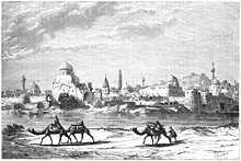
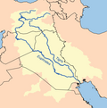
ටයිග්රීස් (ඉංග්රීසි: Tigris, /ˈtaɪɡrɪs/) යනු මෙසපොතේමියාවේ මහා ගංගා දෙකෙන් එකකි. අනෙක යුප්රටීස් වේ.
මූලාශ්ර
[සංස්කරණය]- Assyria
- Cradle of civilization
- Ilisu Dam Campaign campaign against a dam on Tigris in Turkey
- List of places in Iraq
- Wildlife of Iraq
සටහන්
[සංස්කරණය]- ^ Isaev, V.A.; Mikhailova, M.V. (2009). "The hydrology, evolution, and hydrological regime of the mouth area of the Shatt al-Arab River". Water Resources. 36 (4): 380–395. doi:10.1134/S0097807809040022.
- ^ Kolars, J.F.; Mitchell, W.A. (1991). The Euphrates River and the Southeast Anatolia Development Project. Carbondale: Southern Illinois University Press. pp. 6–8. ISBN 0-8093-1572-6.
භාහිර සබැඳි
[සංස්කරණය]ටයිග්රීස් හා සබැඳි මාධ්ය විකිමාධ්ය කොමන්ස් හි ඇත.
ප්රවර්ග:
- Tigris River
- International rivers of Asia
- Rivers of Iraq
- Rivers of Kurdistan
- Rivers of Syria
- Rivers of Turkey
- මෙසොපොටේමියාව
- Upper Mesopotamia
- Tur Abdin
- Levant
- Geography of Iraqi Kurdistan
- Landforms of Elazığ Province
- Landforms of Diyarbakır Province
- Landforms of Batman Province
- Landforms of Siirt Province
- Landforms of Şırnak Province
- Border rivers
- Water and religion


