ජර්විස් බේ බලප්රදේශය
Appearance
| Jervis Bay Territory Australia | |||||||||
|---|---|---|---|---|---|---|---|---|---|
 | |||||||||
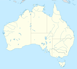
 Location of the Australian Capital Territory and the Jervis Bay Territory | |||||||||
| ඛණ්ඩාංක | 35°8′55″S 150°42′49″E / 35.14861°S 150.71361°Eඛණ්ඩාංක: 35°8′55″S 150°42′49″E / 35.14861°S 150.71361°E | ||||||||
| ජනගහණය | 391 (සැකිල්ල:CensusAU)[1] | ||||||||
| • ඝනත්වය | 5.6/km2 (15/sq mi) | ||||||||
| සංස්ථාපනය | 1915 | ||||||||
| තැපැල් කේතය(න්) | 2540 | ||||||||
| භූමි ප්රමාණය | 67.8 km2 (26.2 sq mi)[2] | ||||||||
| වේලා කලාපය | AEST (UTC+10) | ||||||||
| • ගිම්හාන (DST) | AEDT (UTC+11) | ||||||||
| පිහිටුම | |||||||||
| Federal Division(s) | Fenner[3] | ||||||||
| |||||||||
ජර්විස් බේ බලප්රදේශය (ඉංග්රීසි: Jervis Bay Territory), ඕස්ට්රේලියාවේ පිහිටි ප්රාන්තයකි.
මූලාශ්ර
[සංස්කරණය]- ^ Australian Bureau of Statistics (27 June 2017). "Jervis Bay Territory (OT)". 2016 Census QuickStats. සම්ප්රවේශය 28 February 2018.
- ^ Australian Bureau of Statistics (31 October 2012). "2011 Community Profiles: Jervis Bay (OT)". 2011 Census of Population and Housing. සම්ප්රවේශය 8 May 2013.
- ^ "Profile of the electoral division of Fenner". Australian Electoral Commission. 8 February 2016. සම්ප්රවේශය 25 June 2016.
- ^ a b c "Jervis Bay (Point Perpendicular AWS)". Climate statistics for Australian locations. Bureau of Meteorology. සම්ප්රවේශය 8 May 2013.

