ගොනුව:NCC-highres.png

Page contents not supported in other languages.
විකිපීඩියා වෙතින්

මුල් ගොනුව(1,854 × 1,974 පික්සල, ගොනු විශාලත්වය: 5.51 මෙ.බ., MIME ශෛලිය: image/png)

මෙම ගොනුව Wikimedia Commons වෙතින් වන අතර අනෙකුත් ව්‍යාපෘතීන් විසින්ද භාවිතා කල හැක. එහි ගොනු විස්තර පිටුව තුල අඩංගු විස්තර මෙහි පහත දැක්වෙයි.

සාරාංශය

VI seal

This image has been assessed under the valued image criteria and is considered the most valued image on Commons within the scope: The National Conference Center. You can see its nomination here.

විස්තරය
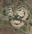
English: Aerial image of The National Conference Center, a corporate training facility in Leesburg, Virginia, United States.
Français : Vue aérienne du National Conference Center, un centre de conférences construit par Xerox en 1974 à Leesburg, en Virginie (États-Unis d'Amérique).
දිනය
මූලාශ්‍රය USGS The National Map, via MSR Maps (formerly TerraServer-USA)
කර්තෘ United States Geological Survey (USGS)
අවසරය
(මෙම ගොනුව නැවත භාවිතා කරමින්)
Public domain
This image is in the public domain in the United States because it only contains materials that originally came from the United States Geological Survey, an agency of the United States Department of the Interior. For more information, see the official USGS copyright policy.

Bahasa Indonesia  català  čeština  Deutsch  eesti  English  español  français  galego  italiano  Nederlands  português  polski  sicilianu  suomi  Tiếng Việt  Türkçe  български  македонски  русский  മലയാളം  한국어  日本語  中文  中文(简体)  中文(繁體)  العربية  فارسی  +/−

අනෙකුත් අනුවාදයන්
Low resolution jpeg
Camera location39° 05′ 36.85″ N, 77° 29′ 03.41″ W Kartographer map based on OpenStreetMap.View this and other nearby images on: OpenStreetMapinfo

Captions

මෙම ගොනුව නිරූපණය කරන්නෙඑ කුමක්දැයි තනි පේළියේ පැහැදිළි කිරීමක් එක් කරන්න.

Items portrayed in this file

depicts ඉංග්‍රීසි

inception ඉංග්‍රීසි

7 අප්‍රේල් 2002

Commons quality assessment ඉංග්‍රීසි

Wikimedia Commons valued image ඉංග්‍රීසි

ආරම්භ වූ දිනය: 12 ඔක්තෝබර් 2008

coordinates of the point of view ඉංග්‍රීසි

39°5'36.848"N, 77°29'3.412"W

ගොනු ඉතිහාසය

එම අවස්ථාවෙහිදී ගොනුව පැවැති ආකාරය නැරඹීමට දිනය/වේලාව මත ක්ලික් කරන්න.

දිනය/වේලාවකුඩා-රූපයමානපරිශීලකපරිකථනය
වත්මන්17:01, 8 ඔක්තෝබර් 2008 17:01, 8 ඔක්තෝබර් 2008වන විට අනුවාදය සඳහා කුඩා-රූපය1,854 × 1,974 (5.51 මෙ.බ.)MBisanz{{Information |Description={{en|1=== Summary == {{Information |Description={{en|1=Aerial map of the National Conference Center}} |Source=http://terraserver-usa.com/usgsentry.aspx?T=4&S=9&Z=18&X=2851&Y=43300&W=3 |Author=USGS |Date=4/7/2002 |Permission= |ot

පහත දැක්වෙන පිටුව විසින් මෙම ගොනුව භාවිතා කෙරෙයි:

ගෝලීය ගොනු භාවිතය

පහත දැක්වෙන අනෙකුත් විකියන් මගින් මෙම ගොනුව භාවිතා කරයි:

පාරදත්ත

"https://si.wikipedia.org/wiki/ගොනුව:NCC-highres.png" වෙතින් සම්ප්‍රවේශනය කෙරිණි