
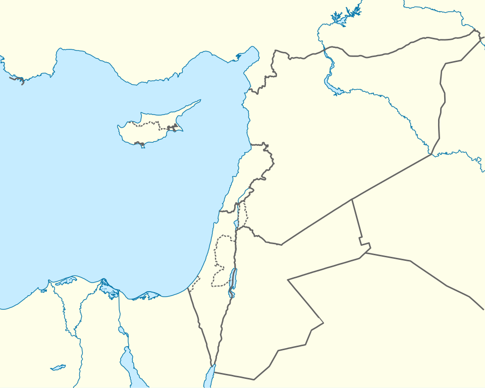
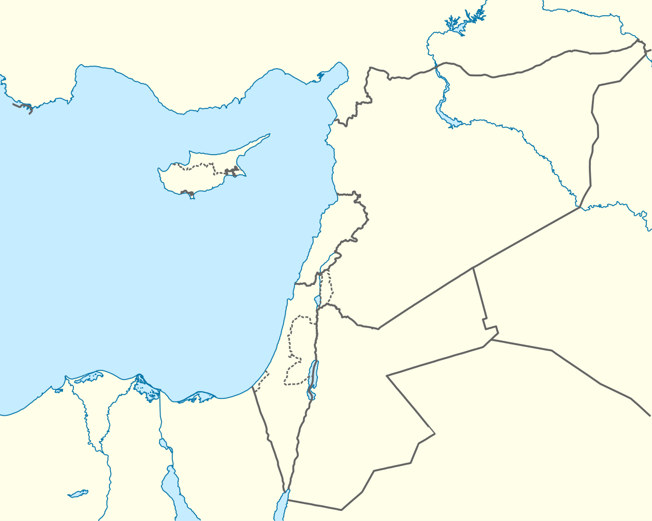
ගොනුව:Mediterranean Sea East location map.svg

මුල් ගොනුව (SVG ගොනුව, නාමමාත්රිකව 957 × 765 පික්සල්, ගොනු විශාලත්වය: 186 කි.බ.)
සාරාංශය
| විස්තරය |
Deutsch: Positionskarte des östlichen Mittelmeers
Quadratische Plattkarte, N-S-Streckung 120 %. Geographische Begrenzung der Karte:
English: Location map of the Eastern Mediterranean Sea
Equirectangular projection, N/S stretching 120 %. Geographic limits of the map:
|
|
| දිනය | ||
| මූලාශ්රය | Own work using: World Data Base II data | |
| කර්තෘ | NordNordWest | |
| අවසරය (මෙම ගොනුව නැවත භාවිතා කරමින්) |
මෙම ගොනුව උත්පාදක සාර්වයන් Attribution-Share Alike 3.0 Germany වරපත යටතේ අවසර ලබා ඇත.
 |


|
This map has been made or improved in the German Kartenwerkstatt (Map Lab). You can propose maps to improve as well.
|
බලපත්රීකරණය
- ඔබ නිදහස්:
- බෙදාහදා ගැනීමට – කාර්යය පිටපත් කිරීමට,බෙදා හැරීමට සහ සම්ප්රේෂණය කිරීමට
- නැවත සංකලනය කිරීමට – කාර්යයට අනුවර්තනය වීමට
- පහත කොන්දේසිවලට යටත්ව:
- attribution – වරපත වෙත බැඳියක්ද සපයමින් ඔබ විසින් සුදුසු කර්තෘභාරය ප්රදානය කල යුතු අතර, කිසියම් වෙනස්වීම් සිදුකලේ නම් එයද සඳහන් කල යුතු වෙයි. ඕනෑම සුදුසු ආකාරයට මෙය ඔබ විසින් සිදුකල හැකි මුත්, වරපත්දායකයා විසින් ඔබ හෝ ඔබගේ භාවිතය හෝ පිටසන් කරන බවට ඇඟවෙන ලෙසින් එය සිදු නොකල යුතු වෙයි.
- share alike – මෙම විෂය කාරණා භාවිතා කොට නැවත සංකලනය, ප්රතියෝජනය හෝ වැඩිදියුණුව කලේ නම්, ඉන්පසු ඔබගේ දායකත්වය ඔබ විසින් බෙදාහැරිය යුත්තේ මුල් වරපත හා සමාන හෝ සංගතික හෝ වරපතක් භාවිතා කරමිනි.
ගොනු ඉතිහාසය
එම අවස්ථාවෙහිදී ගොනුව පැවැති ආකාරය නැරඹීමට දිනය/වේලාව මත ක්ලික් කරන්න.
| දිනය/වේලාව | කුඩා-රූපය | මාන | පරිශීලක | පරිකථනය | |
|---|---|---|---|---|---|
| වත්මන් | 17:28, 3 අප්රේල් 2013 | | 957 × 765 (186 කි.බ.) | NordNordWest | =={{int:filedesc}}== {{Information |Description= {{de|Positionskarte des östlichen Mittelmeers}} Quadratische Plattkarte, N-S-Streckung 120 %. Geographische Begrenzung der Karte: * N: 38.0° N * S: 29.0° N * W: 29.0° O * O: 42.5°... |
ගොනු භාවිතය
පහත දැක්වෙන පිටු 3 ක් විසින් මෙම ගොනුව භාවිතා කෙරෙයි:
ගෝලීය ගොනු භාවිතය
පහත දැක්වෙන අනෙකුත් විකියන් මගින් මෙම ගොනුව භාවිතා කරයි:
- ast.wikipedia.org හි භාවිතය
- Episkopí
- Acrotiri (pueblu)
- Nicosia
- Limasol
- Famagusta
- Módulu:Mapa de llocalización/datos/Xipre
- Módulu:Mapa de llocalización/datos/Xipre/usu
- Aeropuertu Internacional de Lárnaca
- Aeropuertu Internacional de Pafos
- Aeropuertu d'Ercan
- Aeropuertu de Nicosia
- Base Aérea de Geçitkale
- Puertu de Limasol
- Pelendri
- Kantou
- Mouttagiaka
- Paramali
- Platres
- Pano Polemidia
- Kato Kivides
- Pissouri
- Omodos
- Platanisteia
- Kolossi
- Kyperounta
- Foini
- Pachna
- Palodia
- Palaiomylos
- Pera Pedi
- Monagroulli
- Paramytha
- Pentakomo
- Parekklisia
- Moniatis
- Prastio (Avdimou)
- Potamitissa
- Potamiou
- Asgata
- Prodromos
- Trachoni
- Vouni
- Armenokhori
- Vikla
- Vasa Koilaniou
- Vasa Kellakiou
- Tserkezoi
- Trimiklini
- Treis Elies
- Sykopetra
මෙම ගොනුවේ තවත් ගෝලීය භාවිත බලන්න.