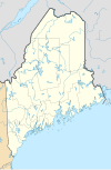
ගොනුව:USA Maine relief location map.svg
Appearance

Size of this PNG preview of this SVG file: 393 × 599 පික්සල. අනෙකුත් විභේදනයන්: 157 × 240 පික්සල | 315 × 480 පික්සල | 504 × 768 පික්සල | 672 × 1,024 පික්සල | 1,343 × 2,048 පික්සල | 820 × 1,250 පික්සල.
මුල් ගොනුව (SVG ගොනුව, නාමමාත්රිකව 820 × 1,250 පික්සල්, ගොනු විශාලත්වය: 2.84 මෙ.බ.)
ගොනු ඉතිහාසය
එම අවස්ථාවෙහිදී ගොනුව පැවැති ආකාරය නැරඹීමට දිනය/වේලාව මත ක්ලික් කරන්න.
| දිනය/වේලාව | කුඩා-රූපය | මාන | පරිශීලක | පරිකථනය | |
|---|---|---|---|---|---|
| වත්මන් | 17:30, 31 ජනවාරි 2021 |  | 820 × 1,250 (2.84 මෙ.බ.) | SANtosito | Uploaded own work with UploadWizard |
ගොනු භාවිතය
පහත දැක්වෙන පිටු 3 ක් විසින් මෙම ගොනුව භාවිතා කෙරෙයි:
ගෝලීය ගොනු භාවිතය
පහත දැක්වෙන අනෙකුත් විකියන් මගින් මෙම ගොනුව භාවිතා කරයි:
- ban.wikipedia.org හි භාවිතය
- bg.wikipedia.org හි භාවිතය
- ca.wikipedia.org හි භාවිතය
- de.wikipedia.org හි භාවිතය
- WMTW-Sendemast
- Machias Seal Island
- Mount Katahdin
- Long Lake (Chute River)
- Sebago Lake
- Vorlage:Positionskarte USA Maine
- WGME-Sendemast
- Marinefunkstelle Cutler
- Spencer Lake (Stausee, Maine)
- Flagstaff Lake (Maine)
- Two Bush Island
- Baker Island (Maine)
- Mount Desert Island
- Cadillac Mountain
- Bear Island (Maine)
- Cranberry Islands
- Avery Rock
- Pond Island (Sagadahoc County, Maine)
- Benutzer:DiethartK/Nordic Heritage Center
- Amazon Lake (Maine)
- WWLN
- Moosehead Lake
- Sugar Island (Piscataquis County, Maine)
- Deer Island (Piscataquis County, Maine)
මෙම ගොනුවේ තවත් ගෝලීය භාවිත බලන්න.

