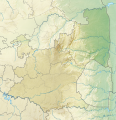
ගොනුව:South Africa Mpumalanga relief location map.svg
Appearance

Size of this PNG preview of this SVG file: 579 × 599 පික්සල. අනෙකුත් විභේදනයන්: 232 × 240 පික්සල | 464 × 480 පික්සල | 742 × 768 පික්සල | 989 × 1,024 පික්සල | 1,979 × 2,048 පික්සල | 1,031 × 1,067 පික්සල.
මුල් ගොනුව (SVG ගොනුව, නාමමාත්රිකව 1,031 × 1,067 පික්සල්, ගොනු විශාලත්වය: 2.26 මෙ.බ.)
ගොනු ඉතිහාසය
එම අවස්ථාවෙහිදී ගොනුව පැවැති ආකාරය නැරඹීමට දිනය/වේලාව මත ක්ලික් කරන්න.
| දිනය/වේලාව | කුඩා-රූපය | මාන | පරිශීලක | පරිකථනය | |
|---|---|---|---|---|---|
| වත්මන් | 20:23, 6 ජනවාරි 2013 |  | 1,031 × 1,067 (2.26 මෙ.බ.) | Htonl | == {{int:filedesc}} == {{Information |Description ={{en|Relief location map of en:Mpumalanga Equirectangular projection, N/S stretching 110%. Geographic limits of the map: * N: 23.75° S * S: 27.75° S * W: 28° E * E: 32.25° E}} |Source ... |
ගොනු භාවිතය
පහත දැක්වෙන පිටු 2 ක් විසින් මෙම ගොනුව භාවිතා කෙරෙයි:
ගෝලීය ගොනු භාවිතය
පහත දැක්වෙන අනෙකුත් විකියන් මගින් මෙම ගොනුව භාවිතා කරයි:
- af.wikipedia.org හි භාවිතය
- ar.wikipedia.org හි භාවිතය
- bg.wikipedia.org හි භාවිතය
- ceb.wikipedia.org හි භාවිතය
- de.wikipedia.org හි භාවිතය
- en.wikipedia.org හි භාවිතය
- Alfred Dunhill Championship
- Timbavati Private Nature Reserve
- Goedehoop natural rock bridge
- Highveld Classic
- Blyde River Canyon Nature Reserve
- Loskop Dam Nature Reserve
- Songimvelo Game Reserve
- Kowyn Pass
- Lion Sands Reserve
- Module:Location map/data/South Africa Mpumalanga/doc
- Lisbon Falls (waterfall)
- Skukuza Airport
- Sabi Sand Game Reserve
- Module:Location map/data/South Africa Mpumalanga
- Pam Golding Ladies International
- eo.wikipedia.org හි භාවිතය
- es.wikipedia.org හි භාවිතය
- frr.wikipedia.org හි භාවිතය
- fr.wikipedia.org හි භාවිතය
- he.wikipedia.org හි භාවිතය
- id.wikipedia.org හි භාවිතය
- ja.wikipedia.org හි භාවිතය
මෙම ගොනුවේ තවත් ගෝලීය භාවිත බලන්න.
