
ගොනුව:London Postal District.png
මෙයට ඉහල විසර්ජනයක් ලබාගත නොහැක.
London_Postal_District.png (561 × 439 පික්සල, ගොනු විශාලත්වය: 467 කි.බ., MIME ශෛලිය: image/png)
සාරාංශය
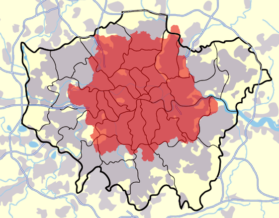
A modified map of Greater London, highlighting the London postal district in red, created by en:User:Jhamez84

|
This image could be re-created using vector graphics as an SVG file. This has several advantages; see Commons:Media for cleanup for more information. If an SVG form of this image is available, please upload it and afterwards replace this template with
{{vector version available|new image name}}.
It is recommended to name the SVG file “London Postal District.svg”—then the template Vector version available (or Vva) does not need the new image name parameter. |
බලපත්රීකරණය
| මම, මෙම කාර්යයේ ප්රතිරූපණ අයිති හිමිකරු, මෙම කාර්යය public domain වෙත නිදහස් කරමි. මෙය ලෝක ව්යාප්තව අදාළ වේ. සමහර රටවල මෙය අනීතික විය හැකිය. එසේ වුවහොත්; මම කිසිදු කොන්දේසියකින් තොරව,ඕනෑම අයෙකුට ඕනෑම කාර්යයක් සඳහා මෙය, නීතිමය බාධාවක් නොමැති වනතුරු, භාවිතා කිරීමේ අයිතිය ලබාදෙමි. |
ගොනු ඉතිහාසය
එම අවස්ථාවෙහිදී ගොනුව පැවැති ආකාරය නැරඹීමට දිනය/වේලාව මත ක්ලික් කරන්න.
| දිනය/වේලාව | කුඩා-රූපය | මාන | පරිශීලක | පරිකථනය | |
|---|---|---|---|---|---|
| වත්මන් | 09:18, 30 මාර්තු 2007 | | 561 × 439 (467 කි.බ.) | Steff | == Summary == A modified map of Greater London, highlighting the London postal district in red, created by en:User:Jhamez84 == Licensing == {{PD-self}} |
ගොනු භාවිතය
පහත දැක්වෙන පිටු 2 ක් විසින් මෙම ගොනුව භාවිතා කෙරෙයි:
ගෝලීය ගොනු භාවිතය
පහත දැක්වෙන අනෙකුත් විකියන් මගින් මෙම ගොනුව භාවිතා කරයි:
- ar.wikipedia.org හි භාවිතය
- ceb.wikipedia.org හි භාවිතය
- en.wikipedia.org හි භාවිතය
- London postal district
- Inner London
- Postal counties of the United Kingdom
- Module:Location map/data/UK Greater London postal/doc
- User:Richardguk/Postcode areas transcluded
- User:Richardguk/N postcode area
- User:Richardguk/NW postcode area
- User:Richardguk/W postcode area
- Greater London
- Module:Location map/data/UK Greater London postal
- eu.wikipedia.org හි භාවිතය
- fa.wikipedia.org හි භාවිතය
- fr.wikipedia.org හි භාවිතය
- he.wikipedia.org හි භාවිතය
- hr.wikipedia.org හි භාවිතය
- it.wikipedia.org හි භාවිතය
- ja.wikipedia.org හි භාවිතය
- kn.wikipedia.org හි භාවිතය
- mk.wikipedia.org හි භාවිතය
- ml.wikipedia.org හි භාවිතය
- qu.wikipedia.org හි භාවිතය
- ro.wikipedia.org හි භාවිතය
- sco.wikipedia.org හි භාවිතය
- sl.wikipedia.org හි භාවිතය
- war.wikipedia.org හි භාවිතය