
ගොනුව:West Malaysia location map with districts.svg

Size of this PNG preview of this SVG file: 400 × 457 පික්සල. අනෙකුත් විභේදනයන්: 210 × 240 පික්සල | 420 × 480 පික්සල | 672 × 768 පික්සල | 896 × 1,024 පික්සල | 1,792 × 2,048 පික්සල.
මුල් ගොනුව (SVG ගොනුව, නාමමාත්රිකව 400 × 457 පික්සල්, ගොනු විශාලත්වය: 998 කි.බ.)
සාරාංශය
| විස්තරය |
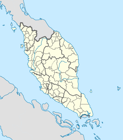
English: Location map of West Malaysia (with districts). |
| දිනය | |
| මූලාශ්රය | ස්වයං නිර්මාණයකි |
| කර්තෘ | Hellerick |
| අනෙකුත් අනුවාදයන් | |
| SVG genesis |

බලපත්රීකරණය
මෙම කෘතියෙහි හිමිකම් අයිතීන් දරන්නා වන මම,පහත වරපත යටතේ එය ප්රකාශයට පත් කරමි:
This file is licensed under the Creative Commons Attribution-Share Alike 4.0 International license.
- ඔබ නිදහස්:
- බෙදාහදා ගැනීමට – කාර්යය පිටපත් කිරීමට,බෙදා හැරීමට සහ සම්ප්රේෂණය කිරීමට
- නැවත සංකලනය කිරීමට – කාර්යයට අනුවර්තනය වීමට
- පහත කොන්දේසිවලට යටත්ව:
- attribution – වරපත වෙත බැඳියක්ද සපයමින් ඔබ විසින් සුදුසු කර්තෘභාරය ප්රදානය කල යුතු අතර, කිසියම් වෙනස්වීම් සිදුකලේ නම් එයද සඳහන් කල යුතු වෙයි. ඕනෑම සුදුසු ආකාරයට මෙය ඔබ විසින් සිදුකල හැකි මුත්, වරපත්දායකයා විසින් ඔබ හෝ ඔබගේ භාවිතය හෝ පිටසන් කරන බවට ඇඟවෙන ලෙසින් එය සිදු නොකල යුතු වෙයි.
- share alike – මෙම විෂය කාරණා භාවිතා කොට නැවත සංකලනය, ප්රතියෝජනය හෝ වැඩිදියුණුව කලේ නම්, ඉන්පසු ඔබගේ දායකත්වය ඔබ විසින් බෙදාහැරිය යුත්තේ මුල් වරපත හා සමාන හෝ සංගතික හෝ වරපතක් භාවිතා කරමිනි.
ගොනු ඉතිහාසය
එම අවස්ථාවෙහිදී ගොනුව පැවැති ආකාරය නැරඹීමට දිනය/වේලාව මත ක්ලික් කරන්න.
| දිනය/වේලාව | කුඩා-රූපය | මාන | පරිශීලක | පරිකථනය | |
|---|---|---|---|---|---|
| වත්මන් | 10:01, 18 ඔක්තෝබර් 2023 | | 400 × 457 (998 කි.බ.) | Zh9567 | add Genting sub-district, Gebeng sub-district, Jelai sub-district: https://mygos.mygeoportal.gov.my/upi/ |
| 15:19, 29 අගෝස්තු 2021 |  | 400 × 457 (996 කි.බ.) | Zh9567 | adjusted Kuala Terengganu / Kuala Nerus border | |
| 09:42, 10 අප්රේල් 2020 |  | 400 × 457 (1,000 කි.බ.) | *angys* | UPDATE | |
| 12:41, 17 අප්රේල් 2019 |  | 400 × 457 (2.32 මෙ.බ.) | *angys* | correcting borders | |
| 15:33, 27 දෙසැම්බර් 2017 |  | 400 × 457 (1.76 මෙ.බ.) | Hellerick | Kuala Terengganu borders corrected | |
| 16:19, 25 දෙසැම්බර් 2017 |  | 400 × 457 (1.76 මෙ.බ.) | Hellerick | correcting district borders | |
| 17:31, 22 දෙසැම්බර් 2017 |  | 400 × 457 (1.75 මෙ.බ.) | Hellerick | User created page with UploadWizard |
ගොනු භාවිතය
පහත දැක්වෙන පිටු 2 ක් විසින් මෙම ගොනුව භාවිතා කෙරෙයි:
ගෝලීය ගොනු භාවිතය
පහත දැක්වෙන අනෙකුත් විකියන් මගින් මෙම ගොනුව භාවිතා කරයි:
- bn.wikipedia.org හි භාවිතය
- en.wikipedia.org හි භාවිතය
- List of districts in Malaysia
- RMAF Butterworth Air Base
- Memali Incident
- Pergau Dam
- User talk:Hellerick
- Tuanku Mizan Zainal Abidin Mosque
- Siege of Malacca (1641)
- Aur Island
- Linggi River
- Module:Location map/data/Malaysia West/doc
- Module:Location map/data/Malaysia West
- 2002 Eisenhower Trophy
- User:Zh9567/Schools/Tamil primary schools
- 2002 Espirito Santo Trophy
- hi.wikipedia.org හි භාවිතය
- ko.wikipedia.org හි භාවිතය
- min.wikipedia.org හි භාවිතය
- ms.wikipedia.org හි භාවිතය
- simple.wikipedia.org හි භාවිතය
- th.wikipedia.org හි භාවිතය
- zh-yue.wikipedia.org හි භාවිතය
- zh.wikipedia.org හි භාවිතය