
ගොනුව:Warwickshire UK location map.svg

Size of this PNG preview of this SVG file: 493 × 599 පික්සල. අනෙකුත් විභේදනයන්: 197 × 240 පික්සල | 395 × 480 පික්සල | 632 × 768 පික්සල | 843 × 1,024 පික්සල | 1,686 × 2,048 පික්සල | 1,042 × 1,266 පික්සල.
මුල් ගොනුව (SVG ගොනුව, නාමමාත්රිකව 1,042 × 1,266 පික්සල්, ගොනු විශාලත්වය: 2.18 මෙ.බ.)
| විස්තරය |
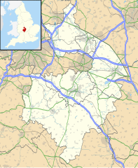
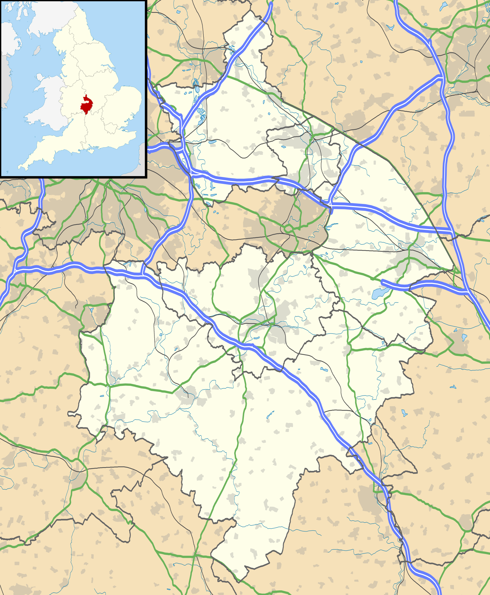
Map of Warwickshire, UK with the following information shown:
Equirectangular map projection on WGS 84 datum, with N/S stretched 160% Geographic limits:
|
| දිනය | |
| මූලාශ්රය |
|
| කර්තෘ | Nilfanion, created using Ordnance Survey data |
| අවසරය (මෙම ගොනුව නැවත භාවිතා කරමින්) |
මෙම ගොනුව ක්රියේටිව් කොමන්ස් Attribution-Share Alike 3.0 Unported වරපත යටතේ අවසර ලබා ඇත. Attribution: Contains Ordnance Survey data © Crown copyright and database right
|
| අනෙකුත් අනුවාදයන් | File:Warwickshire UK district map (blank).svg - Blank map |
.svg)
ගොනු ඉතිහාසය
එම අවස්ථාවෙහිදී ගොනුව පැවැති ආකාරය නැරඹීමට දිනය/වේලාව මත ක්ලික් කරන්න.
| දිනය/වේලාව | කුඩා-රූපය | මාන | පරිශීලක | පරිකථනය | |
|---|---|---|---|---|---|
| වත්මන් | 19:17, 26 සැප්තැම්බර් 2010 | | 1,042 × 1,266 (2.18 මෙ.බ.) | Nilfanion | {{Information |Description=Map of Warwickshire, UK with the following information shown: *Administrative borders *Coastline, lakes and rivers *Roads and railways *Urban areas Equirectangular map projection on WGS 84 datum, with N/S str |
ගොනු භාවිතය
පහත දැක්වෙන පිටු 3 ක් විසින් මෙම ගොනුව භාවිතා කෙරෙයි:
ගෝලීය ගොනු භාවිතය
පහත දැක්වෙන අනෙකුත් විකියන් මගින් මෙම ගොනුව භාවිතා කරයි:
- ar.wikipedia.org හි භාවිතය
- bg.wikipedia.org හි භාවිතය
- ceb.wikipedia.org හි භාවිතය
- en.wikipedia.org හි භාවිතය
- Kenilworth Castle
- Stratford-upon-Avon
- Kenilworth
- Rugby, Warwickshire
- Battle of Edgehill
- Napton on the Hill
- Warwick Castle
- Leamington Spa
- Nuneaton
- Southam
- Warwick
- Bedworth
- Atherstone
- Mancetter
- Ryton-on-Dunsmore
- Alcester
- Shipston-on-Stour
- Dunchurch
- Warwickshire
- Wellesbourne Watermill
- Whitnash
- Bulkington
- Kineton
- Studley, Warwickshire
- Brinklow
- Monks Kirby
- Gaydon
- Leek Wootton
- Bodymoor Heath
- Compton Wynyates
- Long Compton
- Ansty, Warwickshire
- Coleshill, Warwickshire
- Broadwell, Warwickshire
- Bidford-on-Avon
- Rugby Radio Station
- Newbold-on-Avon
- Kingsbury, Warwickshire
- Binley Woods
- Long Lawford
- Willoughby, Warwickshire
- Wibtoft
- Wolston
- Newton, Warwickshire
- Burton Green
මෙම ගොනුවේ තවත් ගෝලීය භාවිත බලන්න.