
ගොනුව:Usa edcp (+HI +AK) location map.svg

Size of this PNG preview of this SVG file: 800 × 495 පික්සල. අනෙකුත් විභේදනයන්: 320 × 198 පික්සල | 640 × 396 පික්සල | 1,024 × 634 පික්සල | 1,280 × 792 පික්සල | 2,560 × 1,585 පික්සල | 1,181 × 731 පික්සල.
මුල් ගොනුව (SVG ගොනුව, නාමමාත්රිකව 1,181 × 731 පික්සල්, ගොනු විශාලත්වය: 3.68 මෙ.බ.)
සාරාංශය
| විස්තරය |
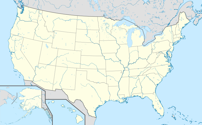
English: Location map of the USA (Hawaii and Alaska shown in sidemaps).
Main map: EquiDistantConicProjection : Central parallel : * N: 37.0° N Central meridian : * E: 96.0° W Standard parallels: * 1: 32.0° N * 2: 42.0° N Made with Natural Earth. Free vector and raster map data @ naturalearthdata.com. Formulas for x and y: x = 50.0 + 124.03149777329222 * ((1.9694462586094064-({{{2}}}* pi / 180))
* sin(0.6010514667026994 * ({{{3}}} + 96) * pi / 180))
y = 50.0 + 1.6155950752393982 * 124.03149777329222 * 0.02613325650382181
- 1.6155950752393982 * 124.03149777329222 *
(1.3236744353715044 - (1.9694462586094064-({{{2}}}* pi / 180))
* cos(0.6010514667026994 * ({{{3}}} + 96) * pi / 180))
Hawaii side map: Equirectangular projection, N/S stretching 107 %. Geographic limits of the map:
Alaska side map: Equirectangular projection, N/S stretching 210.0 %. Geographic limits of the map:
|
| දිනය | |
| මූලාශ්රය |
ස්වයං නිර්මාණයකි This vector image includes elements that have been taken or adapted from this file: This vector image includes elements that have been taken or adapted from this file: This vector image includes elements that have been taken or adapted from this file: This vector image includes elements that have been taken or adapted from this file: This vector image includes elements that have been taken or adapted from this file: This vector image includes elements that have been taken or adapted from this file: |
| කර්තෘ |
TUBS |
| අනෙකුත් අනුවාදයන් |
|
| SVG genesis |
_location_map.svg)
_relief_location_map.png)
_relief_location_map.svg)
_location_map.svg)
බලපත්රීකරණය
මෙම කෘතියෙහි හිමිකම් අයිතීන් දරන්නා වන මම,පහත වරපත යටතේ එය ප්රකාශයට පත් කරමි:
මෙම ගොනුව ක්රියේටිව් කොමන්ස් Attribution-Share Alike 3.0 Unported වරපත යටතේ අවසර ලබා ඇත.
- ඔබ නිදහස්:
- බෙදාහදා ගැනීමට – කාර්යය පිටපත් කිරීමට,බෙදා හැරීමට සහ සම්ප්රේෂණය කිරීමට
- නැවත සංකලනය කිරීමට – කාර්යයට අනුවර්තනය වීමට
- පහත කොන්දේසිවලට යටත්ව:
- attribution – වරපත වෙත බැඳියක්ද සපයමින් ඔබ විසින් සුදුසු කර්තෘභාරය ප්රදානය කල යුතු අතර, කිසියම් වෙනස්වීම් සිදුකලේ නම් එයද සඳහන් කල යුතු වෙයි. ඕනෑම සුදුසු ආකාරයට මෙය ඔබ විසින් සිදුකල හැකි මුත්, වරපත්දායකයා විසින් ඔබ හෝ ඔබගේ භාවිතය හෝ පිටසන් කරන බවට ඇඟවෙන ලෙසින් එය සිදු නොකල යුතු වෙයි.
- share alike – මෙම විෂය කාරණා භාවිතා කොට නැවත සංකලනය, ප්රතියෝජනය හෝ වැඩිදියුණුව කලේ නම්, ඉන්පසු ඔබගේ දායකත්වය ඔබ විසින් බෙදාහැරිය යුත්තේ මුල් වරපත හා සමාන හෝ සංගතික හෝ වරපතක් භාවිතා කරමිනි.
ගොනු ඉතිහාසය
එම අවස්ථාවෙහිදී ගොනුව පැවැති ආකාරය නැරඹීමට දිනය/වේලාව මත ක්ලික් කරන්න.
| දිනය/වේලාව | කුඩා-රූපය | මාන | පරිශීලක | පරිකථනය | |
|---|---|---|---|---|---|
| වත්මන් | 10:32, 15 මාර්තු 2019 | | 1,181 × 731 (3.68 මෙ.බ.) | Lasunncty | remove unused elements and fix SVG errors |
| 17:03, 24 ඔක්තෝබර් 2013 |  | 1,181 × 731 (6.93 මෙ.බ.) | TUBS | ||
| 16:27, 24 ඔක්තෝබර් 2013 |  | 1,181 × 731 (6.94 මෙ.බ.) | TUBS | ||
| 15:52, 24 ඔක්තෝබර් 2013 |  | 1,181 × 731 (3.73 මෙ.බ.) | TUBS | ||
| 15:38, 24 ඔක්තෝබර් 2013 |  | 1,181 × 731 (3.73 මෙ.බ.) | TUBS | ||
| 15:25, 24 ඔක්තෝබර් 2013 |  | 1,181 × 731 (3.73 මෙ.බ.) | TUBS | == Summary == {{Information |Description={{en|1=Location map of the USA (Hawaii and Alaska shown in sidemaps). ===Main Map Projection=== EquiDistantConicProjection : Central parallel : * N: 37.0° N Central meridian : * E: 96.0° W Standard parallel... |
ගොනු භාවිතය
පහත දැක්වෙන පිටු 2 ක් විසින් මෙම ගොනුව භාවිතා කෙරෙයි:
ගෝලීය ගොනු භාවිතය
පහත දැක්වෙන අනෙකුත් විකියන් මගින් මෙම ගොනුව භාවිතා කරයි:
- als.wikipedia.org හි භාවිතය
- San Marino (Kalifornien)
- Modesto
- Karlsruhe (Nord Dakota)
- Fargo
- Vorlage:Positionskarte USA
- St. Louis
- Philadelphia
- Norwood (Missouri)
- Wind Gap (Pennsylvania)
- Park City (Kentucky)
- Berne (Indiana)
- Vorlage:Infobox NRHP
- Vorlage:Positionskarte USA Texas
- Vorlage:Positionskarte USA Wisconsin
- Vorlage:Positionskarte USA Maryland
- Vorlage:Positionskarte USA New York
- Vorlage:Positionskarte USA New York City
- Vorlage:Positionskarte USA New York City Manhattan
- de.wikipedia.org හි භාවිතය
- Hollywood
- Los Angeles
- San Francisco
- Wyoming
- Houston
- Boston
- Cape Canaveral (Küstenabschnitt)
- Seattle
- Grand Canyon
- Philadelphia
- Crazy Horse Memorial
- Phoenix (Arizona)
- Yellowstone-Nationalpark
- Arches-Nationalpark
- Badlands-Nationalpark
- Big-Bend-Nationalpark
- Biscayne-Nationalpark
- Bryce-Canyon-Nationalpark
- Canyonlands-Nationalpark
- Acadia-Nationalpark
- Black-Canyon-of-the-Gunnison-Nationalpark
- Carlsbad-Caverns-Nationalpark
- Channel-Islands-Nationalpark
- Miami
- Everglades-Nationalpark
- Glacier-Nationalpark (Vereinigte Staaten)
- Grand-Teton-Nationalpark
- Great-Basin-Nationalpark
- Isle-Royale-Nationalpark
- Joshua-Tree-Nationalpark
- Mount St. Helens
- Lassen-Volcanic-Nationalpark
මෙම ගොනුවේ තවත් ගෝලීය භාවිත බලන්න.
_location_map.svg)
_location_map.svg)