
ගොනුව:USA Region West relief location map.jpg

මෙම පෙරදසුනෙහි විශාලත්වය: 535 × 599 පික්සල. අනෙකුත් විභේදනයන්: 214 × 240 පික්සල | 429 × 480 පික්සල | 686 × 768 පික්සල | 914 × 1,024 පික්සල | 1,867 × 2,091 පික්සල.
මුල් ගොනුව (1,867 × 2,091 පික්සල, ගොනු විශාලත්වය: 1.4 මෙ.බ., MIME ශෛලිය: image/jpeg)
සාරාංශය
| විස්තරය |
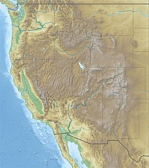
Deutsch: Physische Positionskarte der westlichen Staaten der USA
Quadratische Plattkarte, N-S-Streckung 130.0 %. Geographische Begrenzung der Karte: Equirectangular projection, N/S stretching 130.0 %. Geographic limits of the map:
|
| දිනය | |
| මූලාශ්රය |
ස්වයං නිර්මාණයකි
|
| කර්තෘ | Alexrk2 |
| අනෙකුත් අනුවාදයන් |
|


|
This map has been made or improved in the German Kartenwerkstatt (Map Lab). You can propose maps to improve as well.
|
බලපත්රීකරණය
මෙම කෘතියෙහි හිමිකම් අයිතීන් දරන්නා වන මම,පහත වරපත යටතේ එය ප්රකාශයට පත් කරමි:
මෙම ගොනුව නිර්මාණශීලී පොදුවූවන් Attribution 3.0 Unported බලපත්රය යටතේ අවසර ලබා ඇත.
- ඔබ නිදහස්:
- බෙදාහදා ගැනීමට – කාර්යය පිටපත් කිරීමට,බෙදා හැරීමට සහ සම්ප්රේෂණය කිරීමට
- නැවත සංකලනය කිරීමට – කාර්යයට අනුවර්තනය වීමට
- පහත කොන්දේසිවලට යටත්ව:
- attribution – වරපත වෙත බැඳියක්ද සපයමින් ඔබ විසින් සුදුසු කර්තෘභාරය ප්රදානය කල යුතු අතර, කිසියම් වෙනස්වීම් සිදුකලේ නම් එයද සඳහන් කල යුතු වෙයි. ඕනෑම සුදුසු ආකාරයට මෙය ඔබ විසින් සිදුකල හැකි මුත්, වරපත්දායකයා විසින් ඔබ හෝ ඔබගේ භාවිතය හෝ පිටසන් කරන බවට ඇඟවෙන ලෙසින් එය සිදු නොකල යුතු වෙයි.
ගොනු ඉතිහාසය
එම අවස්ථාවෙහිදී ගොනුව පැවැති ආකාරය නැරඹීමට දිනය/වේලාව මත ක්ලික් කරන්න.
| දිනය/වේලාව | කුඩා-රූපය | මාන | පරිශීලක | පරිකථනය | |
|---|---|---|---|---|---|
| වත්මන් | 11:59, 25 අප්රේල් 2010 | | 1,867 × 2,091 (1.4 මෙ.බ.) | Alexrk2 | == {{int:filedesc}} == {{Information |Description= {{de|Physische Positionskarte der westlichen Staaten der USA}} Quadratische Plattkarte, N-S-Streckung 130.0 %. Geographische Begrenzung der Karte: {{en|Physical location map of [[:en:Western U |
ගොනු භාවිතය
පහත දැක්වෙන පිටු 2 ක් විසින් මෙම ගොනුව භාවිතා කෙරෙයි:
ගෝලීය ගොනු භාවිතය
පහත දැක්වෙන අනෙකුත් විකියන් මගින් මෙම ගොනුව භාවිතා කරයි:
- ar.wikipedia.org හි භාවිතය
- az.wikipedia.org හි භාවිතය
- ba.wikipedia.org හි භාවිතය
- bn.wikipedia.org හි භාවිතය
- ceb.wikipedia.org හි භාවිතය
- de.wikipedia.org හි භාවිතය
- Lolo Pass
- Loveland Pass
- South Pass
- McClure-Pass
- Independence Pass
- Vail Pass
- Tennessee Pass (Colorado)
- Fremont Pass
- Wilkerson Pass
- Ute Pass
- Red Mountain Pass
- Molas Pass
- Coal Bank Pass
- Wikipedia:Kartenwerkstatt/Positionskarten/Nordamerika
- Berthoud Pass
- Bald Mountain Pass
- Vorlage:Positionskarte USA West
- Wikipedia:Kartenwerkstatt/Archiv/2010-04
- Togwotee Pass
- Two Ocean Pass
- Kingman Pass
- Dunraven Pass
- en.wikipedia.org හි භාවිතය
- Alpine skiing at the 2002 Winter Olympics
- Cattle mutilation
- Jackson Hole
- Casper Mountain
- Battle of San Pasqual
- Alpine skiing at the 1960 Winter Olympics
- Women's Challenge
- Treasure Valley Community College
- Camas Prairie Railroad
- Intermountain West
- National Interagency Fire Center
- Vince Genna Stadium
- Lost Trail Pass
- Hungry Horse Dam
- Wichita State University football team plane crash
මෙම ගොනුවේ තවත් ගෝලීය භාවිත බලන්න.