
ගොනුව:Trenčín Region - physical map.png

මෙම පෙරදසුනෙහි විශාලත්වය: 700 × 600 පික්සල. අනෙකුත් විභේදනයන්: 280 × 240 පික්සල | 560 × 480 පික්සල | 896 × 768 පික්සල | 1,120 × 960 පික්සල.
මුල් ගොනුව (1,120 × 960 පික්සල, ගොනු විශාලත්වය: 3.08 මෙ.බ., MIME ශෛලිය: image/png)
| විස්තරය |
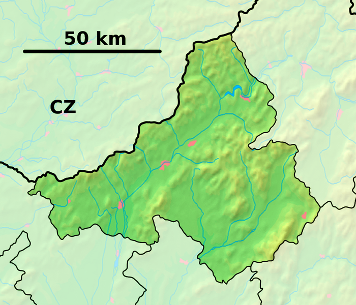
Background map of the Trenčín Region, Slovakia, ready for the Geobox template, calibrated at en:Template:Geobox locator Trenčín Region Outline map of the Trenčín Region, Slovakia, ready for the Geobox template, calibrated at en:Template:Geobox locator Trenčín Region |
| දිනය | (UTC) |
| මූලාශ්රය | |
| කර්තෘ |
| This is a retouched picture, which means that it has been digitally altered from its original version. Modifications: fusion. The original can be viewed here: Trenčín Region - outline map.svg:
|
මෙම ගොනුව ක්රියේටිව් කොමන්ස් Attribution-Share Alike 3.0 Unported වරපත යටතේ අවසර ලබා ඇත.
- ඔබ නිදහස්:
- බෙදාහදා ගැනීමට – කාර්යය පිටපත් කිරීමට,බෙදා හැරීමට සහ සම්ප්රේෂණය කිරීමට
- නැවත සංකලනය කිරීමට – කාර්යයට අනුවර්තනය වීමට
- පහත කොන්දේසිවලට යටත්ව:
- attribution – වරපත වෙත බැඳියක්ද සපයමින් ඔබ විසින් සුදුසු කර්තෘභාරය ප්රදානය කල යුතු අතර, කිසියම් වෙනස්වීම් සිදුකලේ නම් එයද සඳහන් කල යුතු වෙයි. ඕනෑම සුදුසු ආකාරයට මෙය ඔබ විසින් සිදුකල හැකි මුත්, වරපත්දායකයා විසින් ඔබ හෝ ඔබගේ භාවිතය හෝ පිටසන් කරන බවට ඇඟවෙන ලෙසින් එය සිදු නොකල යුතු වෙයි.
- share alike – මෙම විෂය කාරණා භාවිතා කොට නැවත සංකලනය, ප්රතියෝජනය හෝ වැඩිදියුණුව කලේ නම්, ඉන්පසු ඔබගේ දායකත්වය ඔබ විසින් බෙදාහැරිය යුත්තේ මුල් වරපත හා සමාන හෝ සංගතික හෝ වරපතක් භාවිතා කරමිනි.
ප්රකෘති පැටවුම් ලොගය
This image is a derivative work of the following images:
- File:Trenčín_Region_-_background_map.png licensed with PD-Demis
- 2007-10-27T11:23:15Z Caroig 1120x960 (1213296 Bytes) == Summary == {{Information |Description=Background map of the Trenčín Region, Slovakia, ready for the [[:en:Template:Geobox|Geobox]] template, calibrated at [[:en:Template:Geobox locator Trenčín Region]] |Source=Made my
- File:Trenčín_Region_-_outline_map.svg licensed with Cc-by-sa-3.0,2.5,2.0,1.0, GFDL
- 2007-10-27T11:45:36Z Caroig 1400x1200 (127004 Bytes) == Summary == {{Information |Description=Outline map of the Trenčín Region, Slovakia, ready for the [[:en:Template:Geobox|Geobox]] template, calibrated at [[:en:Template:Geobox locator Trenčín Region]] |Source=self-made |
Uploaded with derivativeFX
ගොනු ඉතිහාසය
එම අවස්ථාවෙහිදී ගොනුව පැවැති ආකාරය නැරඹීමට දිනය/වේලාව මත ක්ලික් කරන්න.
| දිනය/වේලාව | කුඩා-රූපය | මාන | පරිශීලක | පරිකථනය | |
|---|---|---|---|---|---|
| වත්මන් | 19:05, 28 සැප්තැම්බර් 2010 | | 1,120 × 960 (3.08 මෙ.බ.) | Adehertogh | {{Information |Description=Background map of the Trenčín Region, Slovakia, ready for the Geobox template, calibrated at en:Template:Geobox locator Trenčín Region Outline map of the Trenčín Region, Slovakia, ready for the |
ගොනු භාවිතය
පහත දැක්වෙන පිටු 2 ක් විසින් මෙම ගොනුව භාවිතා කෙරෙයි:
ගෝලීය ගොනු භාවිතය
පහත දැක්වෙන අනෙකුත් විකියන් මගින් මෙම ගොනුව භාවිතා කරයි:
- bg.wikipedia.org හි භාවිතය
- Тренчин
- Приевидза
- Шаблон:ПК Словакия Тренчински край
- Партизанске
- Долни Лесков
- Долне Вестенице
- Буковец (окръг Миява)
- Върбовце
- Крайне
- Яблонка
- Костолне
- Брезова под Брадлом
- Кошариска
- Порядие
- Брестовец (окръг Миява)
- Подкилава
- Полянка
- Приепасне
- Рудник (окръг Миява)
- Стара Миява
- Хвойница (окръг Миява)
- Грашне
- en.wikipedia.org හි භාවිතය
- Trenčín
- Bojnice
- Horná Streda
- Ilava
- Malinová, Slovakia
- Nitrianske Pravno
- Trenčianske Teplice
- Prievidza
- Beluša
- Púchov
- Čachtice
- Dubnica nad Váhom
- Nové Mesto nad Váhom
- Bánovce nad Bebravou
- Partizánske
- Krásna Ves
- Podskalie
- Nová Dubnica
- Myjava
- Nimnica
- Dvorec
- Bohunice, Ilava District
- Dulov
- Jablonka, Myjava District
- Borčany
- Brezolupy
- Cimenná
- Čierna Lehota, Bánovce nad Bebravou District
මෙම ගොනුවේ තවත් ගෝලීය භාවිත බලන්න.