
ගොනුව:South Yorkshire UK relief location map.jpg

මෙම පෙරදසුනෙහි විශාලත්වය: 800 × 547 පික්සල. අනෙකුත් විභේදනයන්: 320 × 219 පික්සල | 640 × 437 පික්සල | 1,024 × 700 පික්සල | 1,280 × 875 පික්සල | 1,999 × 1,366 පික්සල.
මුල් ගොනුව (1,999 × 1,366 පික්සල, ගොනු විශාලත්වය: 310 කි.බ., MIME ශෛලිය: image/jpeg)
| විස්තරය |
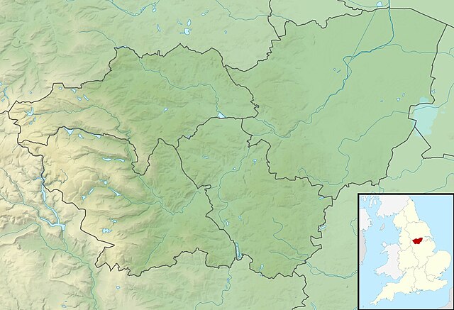
Relief map of South Yorkshire, UK. Equirectangular map projection on WGS 84 datum, with N/S stretched 165% Geographic limits:
|
| දිනය | |
| මූලාශ්රය |
|
| කර්තෘ | Nilfanion, created using Ordnance Survey data |
| අවසරය (මෙම ගොනුව නැවත භාවිතා කරමින්) |
මෙම ගොනුව ක්රියේටිව් කොමන්ස් Attribution-Share Alike 3.0 Unported වරපත යටතේ අවසර ලබා ඇත. Attribution: Contains Ordnance Survey data © Crown copyright and database right
|
| අනෙකුත් අනුවාදයන් | File:South Yorkshire UK district map (blank).svg - Blank map |
.svg)
ගොනු ඉතිහාසය
එම අවස්ථාවෙහිදී ගොනුව පැවැති ආකාරය නැරඹීමට දිනය/වේලාව මත ක්ලික් කරන්න.
| දිනය/වේලාව | කුඩා-රූපය | මාන | පරිශීලක | පරිකථනය | |
|---|---|---|---|---|---|
| වත්මන් | 01:54, 29 නොවැම්බර් 2011 | | 1,999 × 1,366 (310 කි.බ.) | Nilfanion | {{Information |Description=Relief map of South Yorkshire, UK. Equirectangular map projection on WGS 84 datum, with N/S stretched 165% Geographic limits: *West: 1.84W *East: 0.85W *North: 53.67N *South: 53.26N |Source=[[w:Ordnance S |
ගොනු භාවිතය
පහත දැක්වෙන පිටු 3 ක් විසින් මෙම ගොනුව භාවිතා කෙරෙයි:
ගෝලීය ගොනු භාවිතය
පහත දැක්වෙන අනෙකුත් විකියන් මගින් මෙම ගොනුව භාවිතා කරයි:
- ar.wikipedia.org හි භාවිතය
- bg.wikipedia.org හි භාවිතය
- ceb.wikipedia.org හි භාවිතය
- en.wikipedia.org හි භාවිතය
- Highfields Lake
- RSPB Dearne Valley Old Moor
- Damflask Reservoir
- Agden Reservoir
- Derwent Edge
- Car Care Plan International
- Langsett Reservoir
- Margery Hill
- Module:Location map/data/United Kingdom South Yorkshire/doc
- Higger Tor
- Ulley Reservoir
- High Stones
- Strines Reservoir
- Module:Location map/data/United Kingdom South Yorkshire
- Module:Location map/data/South Yorkshire
- Winscar Reservoir
- More Hall Reservoir
- River Cheswold
- Ea Beck
- Rockingham Kiln
- eo.wikipedia.org හි භාවිතය
- es.wikipedia.org හි භාවිතය
- fr.wikipedia.org හි භාවිතය
- ja.wikipedia.org හි භාවිතය
- kn.wikipedia.org හි භාවිතය
- mk.wikipedia.org හි භාවිතය
- mni.wikipedia.org හි භාවිතය
- nl.wikipedia.org හි භාවිතය
- os.wikipedia.org හි භාවිතය
- pl.wikipedia.org හි භාවිතය
- pl.wikibooks.org හි භාවිතය
- sco.wikipedia.org හි භාවිතය
- simple.wikipedia.org හි භාවිතය
- sv.wikipedia.org හි භාවිතය
මෙම ගොනුවේ තවත් ගෝලීය භාවිත බලන්න.