
ගොනුව:South Yorkshire UK location map.svg

Size of this PNG preview of this SVG file: 800 × 547 පික්සල. අනෙකුත් විභේදනයන්: 320 × 219 පික්සල | 640 × 437 පික්සල | 1,024 × 700 පික්සල | 1,280 × 875 පික්සල | 2,560 × 1,750 පික්සල | 1,425 × 974 පික්සල.
මුල් ගොනුව (SVG ගොනුව, නාමමාත්රිකව 1,425 × 974 පික්සල්, ගොනු විශාලත්වය: 1.47 මෙ.බ.)
| විස්තරය |
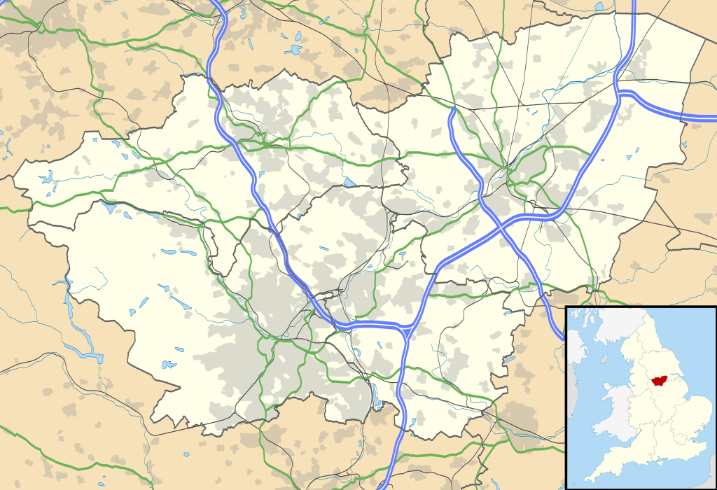
Map of South Yorkshire, UK with the following information shown:
Equirectangular map projection on WGS 84 datum, with N/S stretched 165% Geographic limits:
|
| දිනය | |
| මූලාශ්රය |
|
| කර්තෘ | Nilfanion, created using Ordnance Survey data |
| අවසරය (මෙම ගොනුව නැවත භාවිතා කරමින්) |
මෙම ගොනුව ක්රියේටිව් කොමන්ස් Attribution-Share Alike 3.0 Unported වරපත යටතේ අවසර ලබා ඇත. Attribution: Contains Ordnance Survey data © Crown copyright and database right
|
| අනෙකුත් අනුවාදයන් | File:South Yorkshire UK district map (blank).svg - Blank map |
| SVG genesis |
.svg)
ගොනු ඉතිහාසය
එම අවස්ථාවෙහිදී ගොනුව පැවැති ආකාරය නැරඹීමට දිනය/වේලාව මත ක්ලික් කරන්න.
| දිනය/වේලාව | කුඩා-රූපය | මාන | පරිශීලක | පරිකථනය | |
|---|---|---|---|---|---|
| වත්මන් | 19:12, 26 සැප්තැම්බර් 2010 | | 1,425 × 974 (1.47 මෙ.බ.) | Nilfanion | {{Information |Description=Map of South Yorkshire, UK with the following information shown: *Administrative borders *Coastline, lakes and rivers *Roads and railways *Urban areas Equirectangular map projection on WGS 84 datum, with N |
ගොනු භාවිතය
පහත දැක්වෙන පිටු 3 ක් විසින් මෙම ගොනුව භාවිතා කෙරෙයි:
ගෝලීය ගොනු භාවිතය
පහත දැක්වෙන අනෙකුත් විකියන් මගින් මෙම ගොනුව භාවිතා කරයි:
- ar.wikipedia.org හි භාවිතය
- bg.wikipedia.org හි භාවිතය
- ceb.wikipedia.org හි භාවිතය
- en.wikipedia.org හි භාවිතය
- Sheffield
- Roche Abbey
- Wentworth Woodhouse
- Conisbrough Castle
- Conisbrough
- Doncaster
- Anston
- Battle of Orgreave
- Barnsley
- Dore, South Yorkshire
- Ecclesall
- Stocksbridge
- Bradfield, South Yorkshire
- Dinnington, South Yorkshire
- Great Sheffield Flood
- Dunford Bridge
- Sheffield Botanical Gardens
- Woodlands, South Yorkshire
- Sheffield City Hall
- Askern
- Penistone
- Weston Park Museum
- Bawtry
- Handsworth, South Yorkshire
- Grimethorpe
- Darton
- Thorne, South Yorkshire
- Tickhill
- Beauchief Abbey
- Green Moor
- Oxspring
- Darfield, South Yorkshire
- Woodsetts
- Firbeck
- Austerfield
- Finningley
- Blaxton
- Hatfield, South Yorkshire
- Dunsville
- Moorends
- Sykehouse
- Pincheon Green
- Norton, Doncaster
- Campsall
- Hampole
- Skelbrooke
- Hooton Pagnell
මෙම ගොනුවේ තවත් ගෝලීය භාවිත බලන්න.