
ගොනුව:South Lanarkshire UK location map.svg

Size of this PNG preview of this SVG file: 588 × 600 පික්සල. අනෙකුත් විභේදනයන්: 235 × 240 පික්සල | 471 × 480 පික්සල | 753 × 768 පික්සල | 1,004 × 1,024 පික්සල | 2,008 × 2,048 පික්සල | 1,319 × 1,345 පික්සල.
මුල් ගොනුව (SVG ගොනුව, නාමමාත්රිකව 1,319 × 1,345 පික්සල්, ගොනු විශාලත්වය: 1.3 මෙ.බ.)
| විස්තරය |
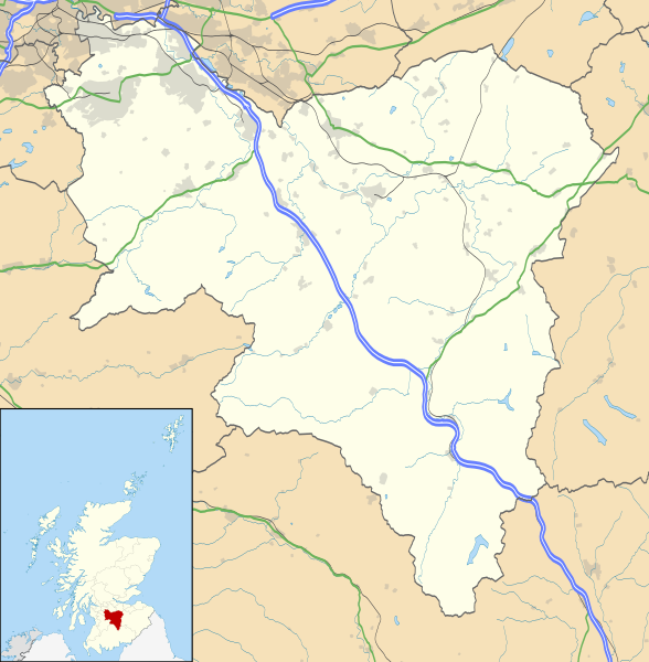
Blank map of South Lanarkshire, UK with the following information shown:
Equirectangular map projection on WGS 84 datum, with N/S stretched 170% Geographic limits:
|
| දිනය | |
| මූලාශ්රය |
|
| කර්තෘ | Nilfanion, created using Ordnance Survey data |
| අවසරය (මෙම ගොනුව නැවත භාවිතා කරමින්) |
මෙම ගොනුව ක්රියේටිව් කොමන්ස් Attribution-Share Alike 3.0 Unported වරපත යටතේ අවසර ලබා ඇත. Attribution: Contains Ordnance Survey data © Crown copyright and database right
|
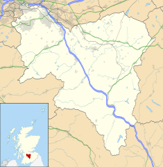
| අනෙකුත් අනුවාදයන් | File:South Lanarkshire UK blank map.svg - Blank map |
ගොනු ඉතිහාසය
එම අවස්ථාවෙහිදී ගොනුව පැවැති ආකාරය නැරඹීමට දිනය/වේලාව මත ක්ලික් කරන්න.
| දිනය/වේලාව | කුඩා-රූපය | මාන | පරිශීලක | පරිකථනය | |
|---|---|---|---|---|---|
| වත්මන් | 20:25, 26 සැප්තැම්බර් 2010 | | 1,319 × 1,345 (1.3 මෙ.බ.) | Nilfanion | {{Information |Description=Blank map of South Lanarkshire, UK with the following information shown: *Administrative borders *Coastline, lakes and rivers *Roads and railways *Urban areas Equirectangular map projection on WGS 84 dat |
ගොනු භාවිතය
පහත දැක්වෙන පිටු 2 ක් විසින් මෙම ගොනුව භාවිතා කෙරෙයි:
ගෝලීය ගොනු භාවිතය
පහත දැක්වෙන අනෙකුත් විකියන් මගින් මෙම ගොනුව භාවිතා කරයි:
- ar.wikipedia.org හි භාවිතය
- bg.wikipedia.org හි භාවිතය
- ceb.wikipedia.org හි භාවිතය
- cs.wikipedia.org හි භාවිතය
- de.wikipedia.org හි භාවිතය
- en.wikipedia.org හි භාවිතය
- Hamilton, South Lanarkshire
- List of monastic houses in Scotland
- South Lanarkshire
- Rutherglen
- Lanark
- East Kilbride
- Cambuslang
- Biggar, South Lanarkshire
- New Lanark
- Blantyre, South Lanarkshire
- Lesmahagow
- Kirkmuirhill
- Blackwood, South Lanarkshire
- Larkhall
- Bothwell
- Falls of Clyde (waterfalls)
- Bothwell Castle
- Strathaven
- Carluke
- Leadhills
- Uddingston
- Walston, South Lanarkshire
- Abington, South Lanarkshire
- Eastfield, South Lanarkshire
- Fernhill, South Lanarkshire
- Carnwath
- Coulter, South Lanarkshire
- Forth, South Lanarkshire
- Law, South Lanarkshire
- Braidwood, South Lanarkshire
- Craignethan Castle
- Ferniegair
මෙම ගොනුවේ තවත් ගෝලීය භාවිත බලන්න.