
ගොනුව:South Ayrshire UK location map.svg

Size of this PNG preview of this SVG file: 463 × 599 පික්සල. අනෙකුත් විභේදනයන්: 185 × 240 පික්සල | 371 × 480 පික්සල | 594 × 768 පික්සල | 792 × 1,024 පික්සල | 1,583 × 2,048 පික්සල | 1,040 × 1,345 පික්සල.
මුල් ගොනුව (SVG ගොනුව, නාමමාත්රිකව 1,040 × 1,345 පික්සල්, ගොනු විශාලත්වය: 1.24 මෙ.බ.)
| විස්තරය |
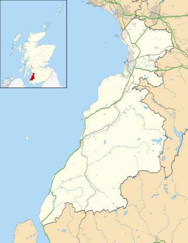
Blank map of South Ayrshire, UK with the following information shown:
Equirectangular map projection on WGS 84 datum, with N/S stretched 170% Geographic limits:
|
| දිනය | |
| මූලාශ්රය |
|
| කර්තෘ | Nilfanion, created using Ordnance Survey data |
| අවසරය (මෙම ගොනුව නැවත භාවිතා කරමින්) |
මෙම ගොනුව ක්රියේටිව් කොමන්ස් Attribution-Share Alike 3.0 Unported වරපත යටතේ අවසර ලබා ඇත. Attribution: Contains Ordnance Survey data © Crown copyright and database right
|
| අනෙකුත් අනුවාදයන් | File:South Ayrshire UK blank map.svg - Blank map |
ගොනු ඉතිහාසය
එම අවස්ථාවෙහිදී ගොනුව පැවැති ආකාරය නැරඹීමට දිනය/වේලාව මත ක්ලික් කරන්න.
| දිනය/වේලාව | කුඩා-රූපය | මාන | පරිශීලක | පරිකථනය | |
|---|---|---|---|---|---|
| වත්මන් | 20:24, 26 සැප්තැම්බර් 2010 | | 1,040 × 1,345 (1.24 මෙ.බ.) | Nilfanion | {{Information |Description=Blank map of South Ayrshire, UK with the following information shown: *Administrative borders *Coastline, lakes and rivers *Roads and railways *Urban areas Equirectangular map projection on WGS 84 datum, wi |
ගොනු භාවිතය
පහත දැක්වෙන පිටු 2 ක් විසින් මෙම ගොනුව භාවිතා කෙරෙයි:
ගෝලීය ගොනු භාවිතය
පහත දැක්වෙන අනෙකුත් විකියන් මගින් මෙම ගොනුව භාවිතා කරයි:
- ar.wikipedia.org හි භාවිතය
- bg.wikipedia.org හි භාවිතය
- ceb.wikipedia.org හි භාවිතය
- cy.wikipedia.org හි භාවිතය
- de.wikipedia.org හි භාවිතය
- en.wikipedia.org හි භාවිතය
- List of monastic houses in Scotland
- South Ayrshire
- Ayr
- Glasgow Prestwick Airport
- Girvan
- Troon
- Alloway
- Prestwick
- Royal Troon Golf Club
- Maybole
- Alloway Auld Kirk
- RAF Prestwick
- Kirkmichael, South Ayrshire
- Straiton
- Barr, Ayrshire
- Annbank
- Blairquhan Castle
- Ballantrae
- Somerset Park
- RAF Heathfield
- Dundonald, South Ayrshire
- Seafield, Ayr
- Kincaidston
- Doonfoot
- Tarbolton
- Belmont, Ayr
- Dunure
- Colmonell
- Mossblown
- Girvan Steeple
- University Hospital Ayr
- Old Dailly
- 2004 Open Championship
- Kirkoswald, South Ayrshire
- Barrhill, South Ayrshire
- Barassie
- RAF Dundonald
- Dailly
- 1997 Open Championship
- 1994 Open Championship
- 1989 Open Championship
- 1986 Open Championship
- 1982 Open Championship
මෙම ගොනුවේ තවත් ගෝලීය භාවිත බලන්න.