
ගොනුව:Somaliland Physical map with National and Administrative boundaries.svg

Size of this PNG preview of this SVG file: 651 × 407 පික්සල. අනෙකුත් විභේදනයන්: 320 × 200 පික්සල | 640 × 400 පික්සල | 1,024 × 640 පික්සල | 1,280 × 800 පික්සල | 2,560 × 1,600 පික්සල.
මුල් ගොනුව (SVG ගොනුව, නාමමාත්රිකව 651 × 407 පික්සල්, ගොනු විශාලත්වය: 2.49 මෙ.බ.)
සාරාංශය
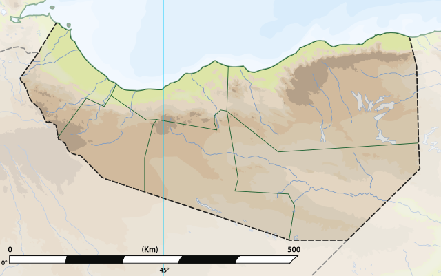
| විස්තරය | Somaliland: Physical map with National and Administrative boundaries.svg |
| දිනය | |
| මූලාශ්රය | File:Somaliland relief location map.jpg |
| කර්තෘ | MacMoreno |
බලපත්රීකරණය
This file is licensed under the Creative Commons Attribution-Share Alike 4.0 International license.
- ඔබ නිදහස්:
- බෙදාහදා ගැනීමට – කාර්යය පිටපත් කිරීමට,බෙදා හැරීමට සහ සම්ප්රේෂණය කිරීමට
- නැවත සංකලනය කිරීමට – කාර්යයට අනුවර්තනය වීමට
- පහත කොන්දේසිවලට යටත්ව:
- attribution – වරපත වෙත බැඳියක්ද සපයමින් ඔබ විසින් සුදුසු කර්තෘභාරය ප්රදානය කල යුතු අතර, කිසියම් වෙනස්වීම් සිදුකලේ නම් එයද සඳහන් කල යුතු වෙයි. ඕනෑම සුදුසු ආකාරයට මෙය ඔබ විසින් සිදුකල හැකි මුත්, වරපත්දායකයා විසින් ඔබ හෝ ඔබගේ භාවිතය හෝ පිටසන් කරන බවට ඇඟවෙන ලෙසින් එය සිදු නොකල යුතු වෙයි.
- share alike – මෙම විෂය කාරණා භාවිතා කොට නැවත සංකලනය, ප්රතියෝජනය හෝ වැඩිදියුණුව කලේ නම්, ඉන්පසු ඔබගේ දායකත්වය ඔබ විසින් බෙදාහැරිය යුත්තේ මුල් වරපත හා සමාන හෝ සංගතික හෝ වරපතක් භාවිතා කරමිනි.
ගොනු ඉතිහාසය
එම අවස්ථාවෙහිදී ගොනුව පැවැති ආකාරය නැරඹීමට දිනය/වේලාව මත ක්ලික් කරන්න.
| දිනය/වේලාව | කුඩා-රූපය | මාන | පරිශීලක | පරිකථනය | |
|---|---|---|---|---|---|
| වත්මන් | 09:18, 27 ජූනි 2021 | | 651 × 407 (2.49 මෙ.බ.) | MacMoreno | Updade image size |
| 23:14, 26 ජූනි 2021 |  | 866 × 538 (2.78 මෙ.බ.) | Siirski | Update file size | |
| 22:30, 26 ජූනි 2021 |  | 510 × 283 (3.25 මෙ.බ.) | Siirski | Reverted to version as of 20:45, 26 June 2021 (UTC) | |
| 22:29, 26 ජූනි 2021 |  | 866 × 538 (2.82 මෙ.බ.) | Siirski | Update file size | |
| 20:45, 26 ජූනි 2021 |  | 510 × 283 (3.25 මෙ.බ.) | MacMoreno | Update with distance measurements in kilometers | |
| 16:25, 26 ජූනි 2021 |  | 510 × 283 (3.24 මෙ.බ.) | MacMoreno | == {{int:filedesc}} == {{Information |Description= Somaliland: Physical map with National and Administrative boundaries.svg |Source= https://commons.wikimedia.org/wiki/File:Somaliland.png |Date= 26-06-2021 |Author= MacMoreno |Permission= |other_versions= }} |
ගොනු භාවිතය
පහත දැක්වෙන පිටු 2 ක් විසින් මෙම ගොනුව භාවිතා කෙරෙයි:
ගෝලීය ගොනු භාවිතය
පහත දැක්වෙන අනෙකුත් විකියන් මගින් මෙම ගොනුව භාවිතා කරයි:
- de.wikipedia.org හි භාවිතය
- el.wikipedia.org හි භාවිතය
- en.wikipedia.org හි භාවිතය
- fa.wikipedia.org හි භාවිතය
- id.wikipedia.org හි භාවිතය
- it.wikipedia.org හි භාවිතය
- no.wikipedia.org හි භාවිතය
- os.wikipedia.org හි භාවිතය
- pl.wikipedia.org හි භාවිතය
- uz.wikipedia.org හි භාවිතය