
ගොනුව:Rutland UK location map.svg

Size of this PNG preview of this SVG file: 750 × 600 පික්සල. අනෙකුත් විභේදනයන්: 300 × 240 පික්සල | 600 × 480 පික්සල | 960 × 768 පික්සල | 1,280 × 1,024 පික්සල | 2,560 × 2,048 පික්සල | 1,425 × 1,140 පික්සල.
මුල් ගොනුව (SVG ගොනුව, නාමමාත්රිකව 1,425 × 1,140 පික්සල්, ගොනු විශාලත්වය: 856 කි.බ.)
| විස්තරය |
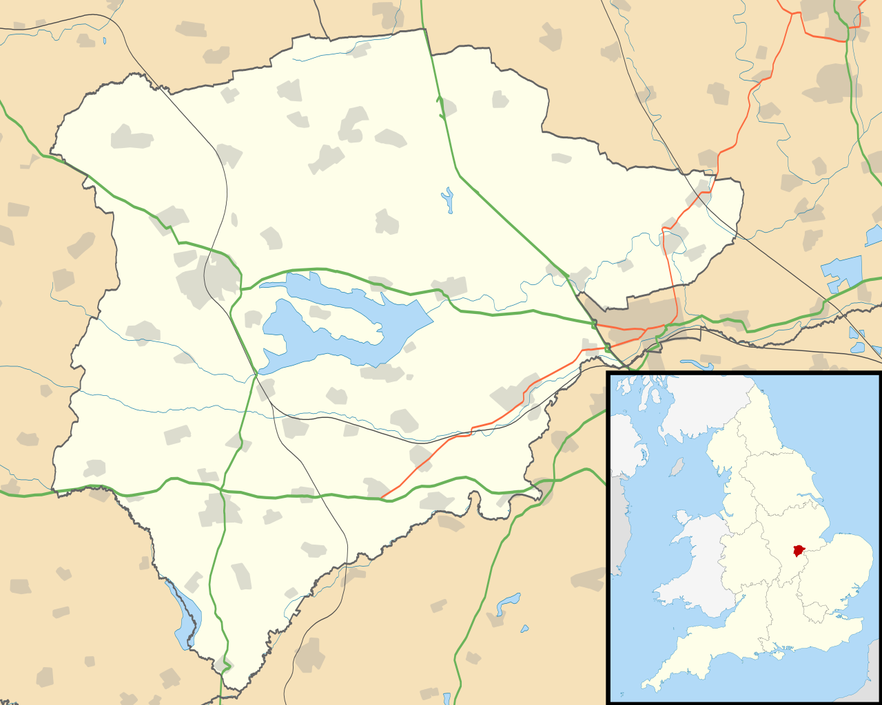
Map of Rutland, UK with the following information shown:
Equirectangular map projection on WGS 84 datum, with N/S stretched 160% Geographic limits:
|
| දිනය | |
| මූලාශ්රය |
|
| කර්තෘ | Nilfanion, created using Ordnance Survey data |
| අවසරය (මෙම ගොනුව නැවත භාවිතා කරමින්) |
මෙම ගොනුව ක්රියේටිව් කොමන්ස් Attribution-Share Alike 3.0 Unported වරපත යටතේ අවසර ලබා ඇත. Attribution: Contains Ordnance Survey data © Crown copyright and database right
|
| අනෙකුත් අනුවාදයන් | File:Rutland UK district map (blank).svg - Blank map |
.svg)
ගොනු ඉතිහාසය
එම අවස්ථාවෙහිදී ගොනුව පැවැති ආකාරය නැරඹීමට දිනය/වේලාව මත ක්ලික් කරන්න.
| දිනය/වේලාව | කුඩා-රූපය | මාන | පරිශීලක | පරිකථනය | |
|---|---|---|---|---|---|
| වත්මන් | 19:10, 26 සැප්තැම්බර් 2010 | | 1,425 × 1,140 (856 කි.බ.) | Nilfanion | {{Information |Description=Map of Rutland, UK with the following information shown: *Administrative borders *Coastline, lakes and rivers *Roads and railways *Urban areas Equirectangular map projection on WGS 84 datum, with N/S stretched 160 |
ගොනු භාවිතය
පහත දැක්වෙන පිටු 3 ක් විසින් මෙම ගොනුව භාවිතා කෙරෙයි:
ගෝලීය ගොනු භාවිතය
පහත දැක්වෙන අනෙකුත් විකියන් මගින් මෙම ගොනුව භාවිතා කරයි:
- af.wikipedia.org හි භාවිතය
- ar.wikipedia.org හි භාවිතය
- bg.wikipedia.org හි භාවිතය
- ceb.wikipedia.org හි භාවිතය
- en.wikipedia.org හි භාවිතය
- Oakham
- Uppingham
- RAF Cottesmore
- Wing, Rutland
- Stretton, Rutland
- Langham, Rutland
- Pickworth, Rutland
- Great Casterton
- Ryhall
- Little Casterton
- Tixover
- North Luffenham
- RAF North Luffenham
- Whitwell, Rutland
- Braunston-in-Rutland
- Whissendine
- Ashwell, Rutland
- Ayston
- Barleythorpe
- Barrow, Rutland
- Barrowden
- Belton-in-Rutland
- Bisbrooke
- Brooke, Rutland
- Burley, Rutland
- Caldecott, Rutland
- Clipsham
- Cottesmore, Rutland
- Edith Weston
- Egleton
- Empingham
- Essendine
- Exton, Rutland
- Glaston
- Greetham, Rutland
- Gunthorpe, Rutland
- Hambleton, Rutland
- Ketton
- Lyddington
- Lyndon, Rutland
- Manton, Rutland
- Market Overton
- Morcott
- Normanton, Rutland
- Pilton, Rutland
මෙම ගොනුවේ තවත් ගෝලීය භාවිත බලන්න.