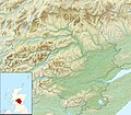
ගොනුව:Perth and Kinross UK relief location map.jpg
Appearance

මෙම පෙරදසුනෙහි විශාලත්වය: 685 × 600 පික්සල. අනෙකුත් විභේදනයන්: 274 × 240 පික්සල | 548 × 480 පික්සල | 877 × 768 පික්සල | 1,170 × 1,024 පික්සල | 2,002 × 1,753 පික්සල.
මුල් ගොනුව (2,002 × 1,753 පික්සල, ගොනු විශාලත්වය: 671 කි.බ., MIME ශෛලිය: image/jpeg)
ගොනු ඉතිහාසය
එම අවස්ථාවෙහිදී ගොනුව පැවැති ආකාරය නැරඹීමට දිනය/වේලාව මත ක්ලික් කරන්න.
| දිනය/වේලාව | කුඩා-රූපය | මාන | පරිශීලක | පරිකථනය | |
|---|---|---|---|---|---|
| වත්මන් | 12:27, 30 නොවැම්බර් 2011 |  | 2,002 × 1,753 (671 කි.බ.) | Nilfanion | {{Information |Description=Relief map of Perth and Kinross, UK. Equirectangular map projection on WGS 84 datum, with N/S stretched 180% Geographic limits: *West: 4.80W *East: 2.95W *North: 57.00N *South: 56.10N |Source=[[w:Ordnan |
ගොනු භාවිතය
පහත දැක්වෙන පිටු 2 ක් විසින් මෙම ගොනුව භාවිතා කෙරෙයි:
ගෝලීය ගොනු භාවිතය
පහත දැක්වෙන අනෙකුත් විකියන් මගින් මෙම ගොනුව භාවිතා කරයි:
- ar.wikipedia.org හි භාවිතය
- ba.wikipedia.org හි භාවිතය
- bg.wikipedia.org හි භාවිතය
- ceb.wikipedia.org හි භාවිතය
- de.wikipedia.org හි භාවිතය
- Blair Castle
- Loch Tay
- Schiehallion
- Dunalastair Water
- Loch Earn
- Loch Rannoch
- Loch Tummel
- Loch of the Lowes (Perth and Kinross)
- Loch Eigheach
- Loch Faskally
- Vorlage:Positionskarte Schottland Perth and Kinross
- Loch Garry (Perth and Kinross)
- Loch Leven (Perth and Kinross)
- Ben Lawers
- Glen Lyon
- Loch Leven Castle
- Ben Chonzie
- Beinn a’ Chreachain
- Càrn Mairg
- Càrn Gorm
- Meall nan Aighean
- Meall Garbh (Càrn Mairg)
- Stuchd an Lochain
- Beinn Mhanach
- Meall Buidhe (Glen Lyon)
- An Stùc
- Meall Garbh (Ben Lawers)
- Beinn Ghlas
- Meall Greigh
- Beinn Heasgarnich
- Meall Corranaich
- Meall a’ Choire Lèith
- Creag Mhòr
- Meall nan Tarmachan
- Meall Ghaordaidh
- Elcho Castle
- Huntingtower Castle
- Kinnaird Castle (Perth and Kinross)
- Meggernie Castle
මෙම ගොනුවේ තවත් ගෝලීය භාවිත බලන්න.
