
ගොනුව:NZ-West Coast plain map.png
මෙයට ඉහල විසර්ජනයක් ලබාගත නොහැක.
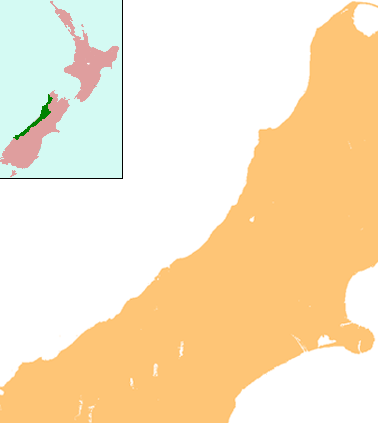
NZ-West_Coast_plain_map.png (378 × 423 පික්සල, ගොනු විශාලත්වය: 21 කි.බ., MIME ශෛලිය: image/png)
සාරාංශය
| විස්තරය | Locator map for West Coast Region, New Zealand |
| දිනය | |
| මූලාශ්රය | combination of Image:NZ-SI plain map.png and Image:Position of West Coast.png |
| කර්තෘ | Grutness |
| අවසරය (මෙම ගොනුව නැවත භාවිතා කරමින්) |
public domain |
බලපත්රීකරණය
| මම, මෙම කාර්යයේ ප්රතිරූපණ අයිති හිමිකරු, මෙම කාර්යය public domain වෙත නිදහස් කරමි. මෙය ලෝක ව්යාප්තව අදාළ වේ. සමහර රටවල මෙය අනීතික විය හැකිය. එසේ වුවහොත්; මම කිසිදු කොන්දේසියකින් තොරව,ඕනෑම අයෙකුට ඕනෑම කාර්යයක් සඳහා මෙය, නීතිමය බාධාවක් නොමැති වනතුරු, භාවිතා කිරීමේ අයිතිය ලබාදෙමි. |
ගොනු ඉතිහාසය
එම අවස්ථාවෙහිදී ගොනුව පැවැති ආකාරය නැරඹීමට දිනය/වේලාව මත ක්ලික් කරන්න.
| දිනය/වේලාව | කුඩා-රූපය | මාන | පරිශීලක | පරිකථනය | |
|---|---|---|---|---|---|
| වත්මන් | 13:25, 17 ජූලි 2008 | | 378 × 423 (21 කි.බ.) | Grutness | {{Information |Description=== Summary == {{Information |Description=Locator map for West Coast Region, New Zealand |Source=combination of Image:NZ-SI plain map.png and Image:Position of West Coast.png |Date=17 July 2008 |Author=Grutness |Permiss |
ගොනු භාවිතය
පහත දැක්වෙන පිටු 2 ක් විසින් මෙම ගොනුව භාවිතා කෙරෙයි:
ගෝලීය ගොනු භාවිතය
පහත දැක්වෙන අනෙකුත් විකියන් මගින් මෙම ගොනුව භාවිතා කරයි:
- ar.wikipedia.org හි භාවිතය
- ceb.wikipedia.org හි භාවිතය
- en.wikipedia.org හි භාවිතය
- Kokiri
- Punakaiki
- Franz Josef Glacier
- Crushington, New Zealand
- Lake Christabel
- Brunner, New Zealand
- Hokitika Airport
- Lendenfeld Peak
- Ngahere
- Cronadun
- Te Kuha
- Lake Ianthe
- Pukekura
- Lake Poerua
- Inchbonnie
- Ruatapu, New Zealand
- Lake Mahinapua
- Whataroa River
- Whataroa
- Stillwater, West Coast
- Westport Airport (New Zealand)
- Millerton, New Zealand
- Stockton, New Zealand
- Seddonville
- Summerlea, New Zealand
- Sergeants Hill
- List of schools in the West Coast, New Zealand
- Lake Daniell
- Module:Location map/data/New Zealand West Coast/doc
- Maruia
- Haupiri
- Kokatahi
- Lyell, New Zealand
- Waiuta
- Mount Rolleston
- User:Sladew/Charles Edward Douglas
- Charlie Douglas
- Mount Cook Aerodrome
- Mokihinui
- Module:Location map/data/New Zealand West Coast
- Agassiz Glacier (New Zealand)
- Wallsend, New Zealand
- Dunollie, New Zealand
- Ballroom Overhang
- Pancake Rocks and Blowholes
- Ōtūmahana Estuary
- Gates of Haast
- fa.wikipedia.org හි භාවිතය
මෙම ගොනුවේ තවත් ගෝලීය භාවිත බලන්න.