
ගොනුව:Middle East location map.svg

Size of this PNG preview of this SVG file: 250 × 160 පික්සල. අනෙකුත් විභේදනයන්: 320 × 205 පික්සල | 640 × 410 පික්සල | 1,024 × 655 පික්සල | 1,280 × 819 පික්සල | 2,560 × 1,638 පික්සල.
මුල් ගොනුව (SVG ගොනුව, නාමමාත්රිකව 250 × 160 පික්සල්, ගොනු විශාලත්වය: 258 කි.බ.)
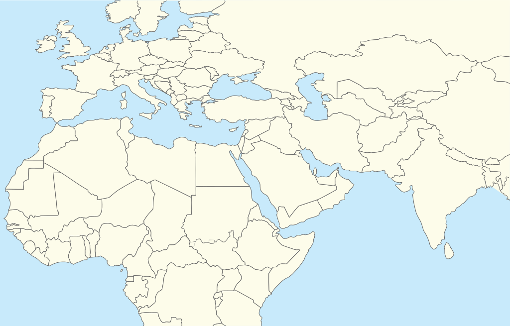
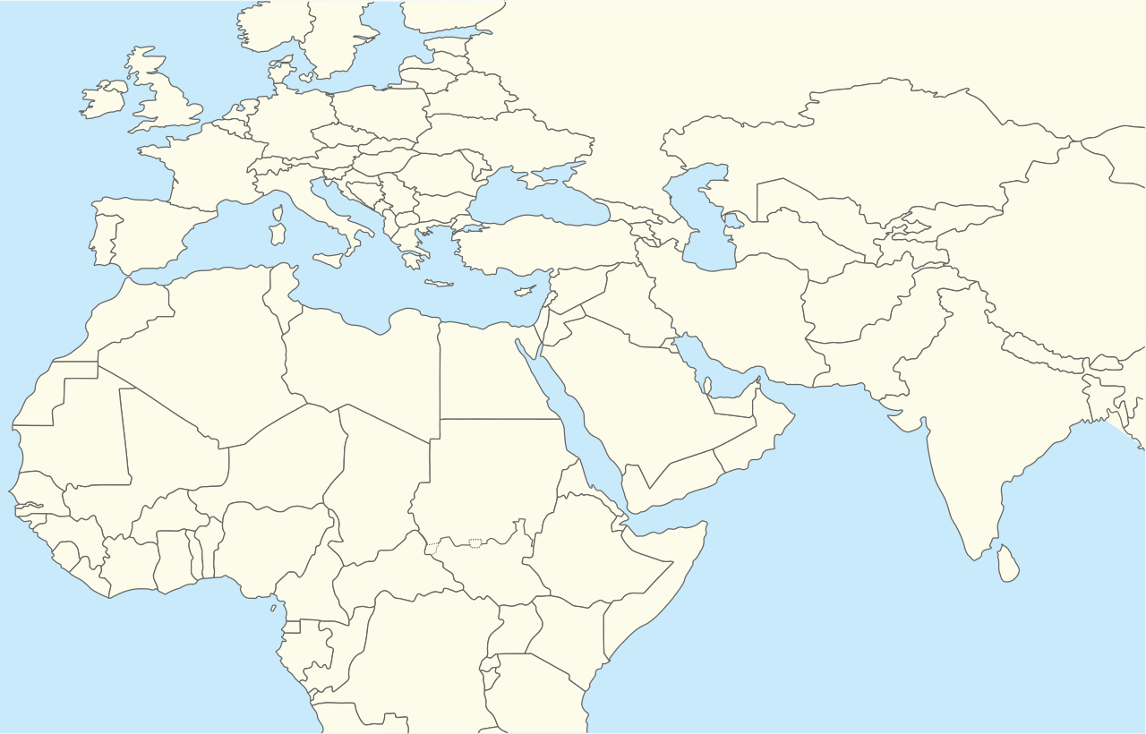
| විස්තරය | Location map for Middle East (Greater Middle East) |
| දිනය | (UTC) |
| මූලාශ්රය | |
| කර්තෘ |
|
| This is a retouched picture, which means that it has been digitally altered from its original version. The original can be viewed here: World location map.svg:
|
මෙම කෘතියෙහි හිමිකම් අයිතීන් දරන්නා වන මම,පහත වරපත යටතේ එය ප්රකාශයට පත් කරමි:
| මම, මෙම කාර්යයේ ප්රතිරූපණ අයිති හිමිකරු, මෙම කාර්යය public domain වෙත නිදහස් කරමි. මෙය ලෝක ව්යාප්තව අදාළ වේ. සමහර රටවල මෙය අනීතික විය හැකිය. එසේ වුවහොත්; මම කිසිදු කොන්දේසියකින් තොරව,ඕනෑම අයෙකුට ඕනෑම කාර්යයක් සඳහා මෙය, නීතිමය බාධාවක් නොමැති වනතුරු, භාවිතා කිරීමේ අයිතිය ලබාදෙමි. |
ප්රකෘති පැටවුම් ලොගය
This image is a derivative work of the following images:
- File:World_location_map.svg licensed with PD-self
- 2010-04-18T18:53:02Z STyx 800x400 (599024 Bytes) {{Information |Description={{en|1=?}} |Source=? |Author=? |Date= |Permission= |other_versions= }} == {{int:filedesc}} == {{Information |Description={{en}}Blank world map for location map templates ([[:en:Equirectangular proje
Uploaded with derivativeFX
ගොනු ඉතිහාසය
එම අවස්ථාවෙහිදී ගොනුව පැවැති ආකාරය නැරඹීමට දිනය/වේලාව මත ක්ලික් කරන්න.
| දිනය/වේලාව | කුඩා-රූපය | මාන | පරිශීලක | පරිකථනය | |
|---|---|---|---|---|---|
| වත්මන් | 16:52, 11 අප්රේල් 2024 | | 250 × 160 (258 කි.බ.) | Iktsokh | Clearing the map |
| 20:12, 5 අප්රේල් 2014 |  | 250 × 160 (258 කි.බ.) | RicHard-59 | Sudan divided, Cyprus has been missing | |
| 13:06, 28 ඔක්තෝබර් 2010 |  | 250 × 160 (250 කි.බ.) | 배우는사람 | {{Information |Description=Location map for Middle East (Greater Middle East) |Source=*File:World_location_map.svg |Date=2010-10-28 13:06 (UTC) |Author=*File:World_location_map.svg *derivative work: ~~~ |Permission= |other_versions= }} {{Reto |
ගොනු භාවිතය
පහත දැක්වෙන පිටු 2 ක් විසින් මෙම ගොනුව භාවිතා කෙරෙයි:
ගෝලීය ගොනු භාවිතය
පහත දැක්වෙන අනෙකුත් විකියන් මගින් මෙම ගොනුව භාවිතා කරයි:
- ar.wikipedia.org හි භාවිතය
- azb.wikipedia.org හි භාවිතය
- bn.wikipedia.org හි භාවිතය
- ceb.wikipedia.org හි භාවිතය
- ckb.wikipedia.org හි භාවිතය
- da.wikipedia.org හි භාවිතය
- en.wikipedia.org හි භාවිතය
- Shiraz
- Abarim
- Sea of Galilee
- Dubai International Airport
- Taba, Egypt
- Taif
- Dubai
- Al Ain
- Midian
- Prophet's Mosque
- Kuwait International Airport
- Sharjah International Airport
- King Khalid International Airport
- Zayed International Airport
- Fujairah International Airport
- Jebel Akhdar (Oman)
- Salman Pak
- Doha International Airport
- Mount Arafat
- 1973 Rome airport attacks and hijacking
- Safa and Marwa
- Dhaid
- King Abdulaziz International Airport
- Nizwa
- Shibam
- Sohar
- Seeb
- Abha
- Shah Amanat International Airport
- Prince Mohammad bin Abdulaziz International Airport
මෙම ගොනුවේ තවත් ගෝලීය භාවිත බලන්න.