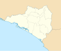
ගොනුව:Mexico Colima location map.svg

Size of this PNG preview of this SVG file: 512 × 389 පික්සල. අනෙකුත් විභේදනයන්: 316 × 240 පික්සල | 632 × 480 පික්සල | 1,011 × 768 පික්සල | 1,280 × 973 පික්සල | 2,560 × 1,945 පික්සල.
මුල් ගොනුව (SVG ගොනුව, නාමමාත්රිකව 512 × 389 පික්සල්, ගොනු විශාලත්වය: 755 කි.බ.)
ගොනු ඉතිහාසය
එම අවස්ථාවෙහිදී ගොනුව පැවැති ආකාරය නැරඹීමට දිනය/වේලාව මත ක්ලික් කරන්න.
| දිනය/වේලාව | කුඩා-රූපය | මාන | පරිශීලක | පරිකථනය | |
|---|---|---|---|---|---|
| වත්මන් | 14:46, 5 ජූනි 2016 |  | 512 × 389 (755 කි.බ.) | Addicted04 | Borders |
| 13:43, 5 ජූනි 2016 |  | 512 × 389 (756 කි.බ.) | Addicted04 | New map. N:19.6, S:18.6, E:-103.4, W:-104.8 | |
| 19:25, 7 අගෝස්තු 2011 |  | 799 × 664 (212 කි.බ.) | Battroid | {{Information |Description={{es|1=Trabajo propio a partir del mapa de municipios del INEGI y costas tomadas de OpenStreetMap.org (bajo licencia Creative Commons Attribution-Share Alike 2.0 Generic). Límites del mapa: * Oeste : 104º 7' O * Este : 103� | |
| 22:15, 4 ජනවාරි 2011 |  | 799 × 664 (212 කි.බ.) | Addicted04 | Costa oeste | |
| 21:15, 27 ඔක්තෝබර් 2009 |  | 799 × 664 (222 කි.බ.) | Spischot | {{Information |Description={{es|1=Trabajo propio a partir del mapa de municipios del INEGI y costas tomadas de OpenStreetMap.org (bajo licencia Creative Commons Attribution-Share Alike 2.0 Generic). Límites del mapa: * Oeste : 104º 7' O * Este : 103� |
ගොනු භාවිතය
පහත දැක්වෙන පිටු 2 ක් විසින් මෙම ගොනුව භාවිතා කෙරෙයි:
ගෝලීය ගොනු භාවිතය
පහත දැක්වෙන අනෙකුත් විකියන් මගින් මෙම ගොනුව භාවිතා කරයි:
- ar.wikipedia.org හි භාවිතය
- ba.wikipedia.org හි භාවිතය
- bg.wikipedia.org හි භාවිතය
- ceb.wikipedia.org හි භාවිතය
- ce.wikipedia.org හි භාවිතය
- cs.wikipedia.org හි භාවිතය
- de.wikipedia.org හි භාවිතය
- en.wikipedia.org හි භාවිතය
- Colima (city)
- Manzanillo, Colima
- Tecomán
- Comala
- Playa de Oro International Airport
- Colima Airport
- Villa de Álvarez
- Ixtlahuacán
- Minatitlán, Colima
- Coquimatlán
- Module:Location map/data/Mexico Colima/doc
- User:Ty654/List of earthquakes exceeding magnitude 8+
- User:Ty654/List of earthquakes from 1900-1949 exceeding magnitude 7+
- Module:Location map/data/Mexico Colima
- User:Ty654/List of earthquakes from 2000-present exceeding magnitude 7+
- User:Ty654/List of earthquakes from 1930-1939 exceeding magnitude 6+
- User:Ty654/List of earthquakes from 1995-1999 exceeding magnitude 6+
- User:Ty654/List of earthquakes from 2000-2004 exceeding magnitude 6+
- eo.wikipedia.org හි භාවිතය
- es.wikipedia.org හි භාවිතය
- fa.wikipedia.org හි භාවිතය
- fr.wikipedia.org හි භාවිතය
- he.wikipedia.org හි භාවිතය
මෙම ගොනුවේ තවත් ගෝලීය භාවිත බලන්න.

