
ගොනුව:Mexico Aguascalientes location map.svg

Size of this PNG preview of this SVG file: 741 × 599 පික්සල. අනෙකුත් විභේදනයන්: 297 × 240 පික්සල | 594 × 480 පික්සල | 950 × 768 පික්සල | 1,266 × 1,024 පික්සල | 2,532 × 2,048 පික්සල | 1,988 × 1,608 පික්සල.
මුල් ගොනුව (SVG ගොනුව, නාමමාත්රිකව 1,988 × 1,608 පික්සල්, ගොනු විශාලත්වය: 82 කි.බ.)
W3C-validity not checked.
සාරාංශය
| විස්තරය |
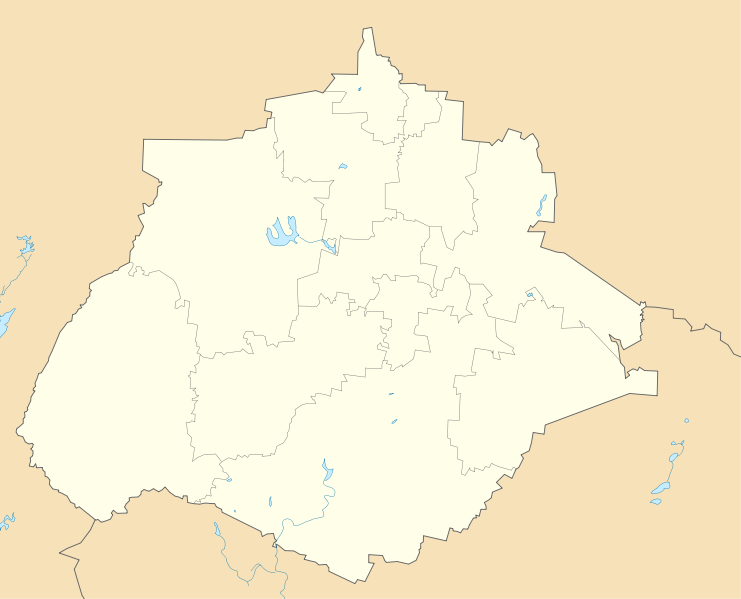
English: Location Map of Aguascalientes
Equirectangular projection, Geographic limits of the map:
|
| දිනය | |
| මූලාශ්රය | ස්වයං නිර්මාණයකි |
| කර්තෘ | Addicted04 |
බලපත්රීකරණය
| මම, මෙම කාර්යයේ ප්රතිරූපණ අයිති හිමිකරු, මෙම කාර්යය public domain වෙත නිදහස් කරමි. මෙය ලෝක ව්යාප්තව අදාළ වේ. සමහර රටවල මෙය අනීතික විය හැකිය. එසේ වුවහොත්; මම කිසිදු කොන්දේසියකින් තොරව,ඕනෑම අයෙකුට ඕනෑම කාර්යයක් සඳහා මෙය, නීතිමය බාධාවක් නොමැති වනතුරු, භාවිතා කිරීමේ අයිතිය ලබාදෙමි. |
ගොනු ඉතිහාසය
එම අවස්ථාවෙහිදී ගොනුව පැවැති ආකාරය නැරඹීමට දිනය/වේලාව මත ක්ලික් කරන්න.
| දිනය/වේලාව | කුඩා-රූපය | මාන | පරිශීලක | පරිකථනය | |
|---|---|---|---|---|---|
| වත්මන් | 09:01, 16 ජූලි 2011 | | 1,988 × 1,608 (82 කි.බ.) | Battroid | {{ValidSVG}} == Summary == {{Information |Description={{en|1=Location Map of Aguascalientes Equirectangular projection, Geographic limits of the map: * N: 22.50° N * S: 21.60° N * W: 102.90° W * E: 101.70° W}} |Source={{own}} | |
| 19:30, 4 ජනවාරි 2011 |  | 1,988 × 1,608 (82 කි.බ.) | Addicted04 | recursos hidrológicos | |
| 01:28, 4 ජනවාරි 2011 |  | 1,988 × 1,608 (67 කි.බ.) | Addicted04 | {{Information |Description={{en|1=Location Map of Aguascalientes Equirectangular projection, Geographic limits of the map: * N: 22.50° N * S: 21.60° N * W: 102.90° W * E: 101.70° W}} |Source={{own}} |Author=[[User:Addicted04|Add |
ගොනු භාවිතය
පහත දැක්වෙන පිටු 2 ක් විසින් මෙම ගොනුව භාවිතා කෙරෙයි:
ගෝලීය ගොනු භාවිතය
පහත දැක්වෙන අනෙකුත් විකියන් මගින් මෙම ගොනුව භාවිතා කරයි:
- ar.wikipedia.org හි භාවිතය
- ba.wikipedia.org හි භාවිතය
- bg.wikipedia.org හි භාවිතය
- ceb.wikipedia.org හි භාවිතය
- ce.wikipedia.org හි භාවිතය
- de.wikipedia.org හි භාවිතය
- en.wikipedia.org හි භාවිතය
- Calvillo
- Jesús María, Aguascalientes
- Pabellón de Arteaga
- San Francisco de los Romo
- Aguascalientes International Airport
- Palo Alto, Aguascalientes
- Module:Location map/data/Mexico Aguascalientes/doc
- Pabellón de Hidalgo
- Cosío
- Module:Location map/data/Mexico Aguascalientes
- Emiliano Zapata, Aguascalientes
- eo.wikipedia.org හි භාවිතය
- es.wikipedia.org හි භාවිතය
- fa.wikipedia.org හි භාවිතය
- fr.wikipedia.org හි භාවිතය
මෙම ගොනුවේ තවත් ගෝලීය භාවිත බලන්න.