
ගොනුව:Map of Chaco Province.svg

Size of this PNG preview of this SVG file: 776 × 600 පික්සල. අනෙකුත් විභේදනයන්: 311 × 240 පික්සල | 621 × 480 පික්සල | 994 × 768 පික්සල | 1,280 × 989 පික්සල | 2,560 × 1,978 පික්සල | 906 × 700 පික්සල.
මුල් ගොනුව (SVG ගොනුව, නාමමාත්රිකව 906 × 700 පික්සල්, ගොනු විශාලත්වය: 699 කි.බ.)
සාරාංශය
| විස්තරය |
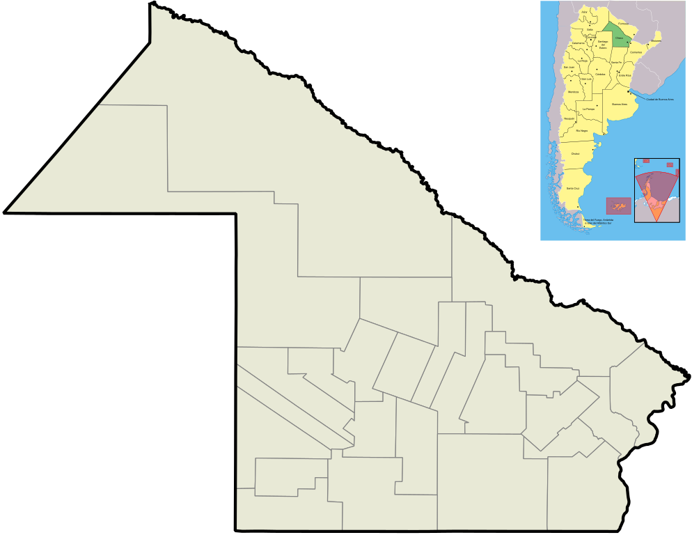
English: Map of Chaco Province, and its departaments.
Español: Mapa de la Provincia del Chaco y sus departamentos. |
| දිනය | |
| මූලාශ්රය | ස්වයං නිර්මාණයකි |
| කර්තෘ | Pertile |
| අනෙකුත් අනුවාදයන් |
Derivative works of this file: |
බලපත්රීකරණය
I, මෙම කාර්යයේ ප්රකාශන අයිතිය දරන්නා,පහත බලපත්රය යටතේ එය ප්රකාශයට පත් කරනු ලබයි:

|
Free Software Foundation විසින් ප්රකාශිත GNU Free Documentation License බලපත්රයෙහි 1.2 හෝ ඊට අලුත් පිටපත්වල කොන්දේසිවලට යටත්ව මෙම ගොනුව පිටපත් කෙරුමට, නැවත බෙදාහාරුමට සහ/හෝ වෙනස් කෙරුමට අවසර දී ඇත; ඒ වෙනස් අංශ නොමැතිව, මුල් පිටු පෙළ නොමැතිව, පසු පිටු පෙළ නොමැතිවය. බලපත්රයේ පිටපතක් GNU Free Documentation License නම් අංශයේ දැක්වේ. |
This file is licensed under the Creative Commons Attribution-Share Alike Attribution-Share Alike 4.0 International, 3.0 Unported, 2.5 Generic, 2.0 Generic and 1.0 Generic license.
- ඔබ නිදහස්:
- බෙදාහදා ගැනීමට – කාර්යය පිටපත් කිරීමට,බෙදා හැරීමට සහ සම්ප්රේෂණය කිරීමට
- නැවත සංකලනය කිරීමට – කාර්යයට අනුවර්තනය වීමට
- පහත කොන්දේසිවලට යටත්ව:
- attribution – වරපත වෙත බැඳියක්ද සපයමින් ඔබ විසින් සුදුසු කර්තෘභාරය ප්රදානය කල යුතු අතර, කිසියම් වෙනස්වීම් සිදුකලේ නම් එයද සඳහන් කල යුතු වෙයි. ඕනෑම සුදුසු ආකාරයට මෙය ඔබ විසින් සිදුකල හැකි මුත්, වරපත්දායකයා විසින් ඔබ හෝ ඔබගේ භාවිතය හෝ පිටසන් කරන බවට ඇඟවෙන ලෙසින් එය සිදු නොකල යුතු වෙයි.
- share alike – මෙම විෂය කාරණා භාවිතා කොට නැවත සංකලනය, ප්රතියෝජනය හෝ වැඩිදියුණුව කලේ නම්, ඉන්පසු ඔබගේ දායකත්වය ඔබ විසින් බෙදාහැරිය යුත්තේ මුල් වරපත හා සමාන හෝ සංගතික හෝ වරපතක් භාවිතා කරමිනි.
ඔබට අභිමත වරපත තෝරාගත හැක.
ගොනු ඉතිහාසය
එම අවස්ථාවෙහිදී ගොනුව පැවැති ආකාරය නැරඹීමට දිනය/වේලාව මත ක්ලික් කරන්න.
| දිනය/වේලාව | කුඩා-රූපය | මාන | පරිශීලක | පරිකථනය | |
|---|---|---|---|---|---|
| වත්මන් | 12:49, 21 සැප්තැම්බර් 2012 | | 906 × 700 (699 කි.බ.) | Sergio Andres Segovia | Tamaño |
| 02:53, 29 ජූලි 2010 |  | 906 × 700 (839 කි.බ.) | Pertile | Added a map of Argentina where Chaco Province is highlighted. | |
| 21:12, 31 මැයි 2010 |  | 901 × 696 (126 කි.බ.) | Pertile | Better colors and no more limits of provinces others than Chaco. | |
| 18:49, 12 නොවැම්බර් 2009 |  | 1,069 × 756 (869 කි.බ.) | Pertile | Grosor de provincia | |
| 23:26, 28 සැප්තැම්බර් 2009 |  | 297 × 209 (358 කි.බ.) | Pertile | {{Information |Description={{en|1=Map of Chaco Province, and its departaments.}} {{es|1=Mapa de la Provincia del Chaco y sus departamentos.}} |Source={{own}} |Author=Pertile |Date=2009-09-28 |Permission= |other_versions= }} [[Category:Ma |
ගොනු භාවිතය
පහත දැක්වෙන පිටු 2 ක් විසින් මෙම ගොනුව භාවිතා කෙරෙයි:
ගෝලීය ගොනු භාවිතය
පහත දැක්වෙන අනෙකුත් විකියන් මගින් මෙම ගොනුව භාවිතා කරයි:
- ar.wikipedia.org හි භාවිතය
- ceb.wikipedia.org හි භාවිතය
- en.wikipedia.org හි භාවිතය
- es.wikipedia.org හි භාවිතය
- fa.wikipedia.org හි භාවිතය
- kn.wikipedia.org හි භාවිතය
- ko.wikipedia.org හි භාවිතය
- pt.wikipedia.org හි භාවිතය
- sd.wikipedia.org හි භාවිතය
- simple.wikipedia.org හි භාවිතය
- sv.wikipedia.org හි භාවිතය
- tr.wikipedia.org හි භාවිතය
- uz.wikipedia.org හි භාවිතය
- war.wikipedia.org හි භාවිතය