
ගොනුව:Map Gaels Brythons Picts GB.png
මෙයට ඉහල විසර්ජනයක් ලබාගත නොහැක.
Map_Gaels_Brythons_Picts_GB.png (220 × 284 පික්සල, ගොනු විශාලත්වය: 26 කි.බ., MIME ශෛලිය: image/png)
සාරාංශය
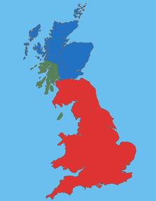
| විස්තරය |
English: Map Gaels Brythons Picts GB |
| මූලාශ්රය | ස්වයං නිර්මාණයකි |
| කර්තෘ | malus36 |
බලපත්රීකරණය
| This work is ineligible for copyright and therefore in the public domain because it consists entirely of information that is common property and contains no original authorship. |
ගොනු ඉතිහාසය
එම අවස්ථාවෙහිදී ගොනුව පැවැති ආකාරය නැරඹීමට දිනය/වේලාව මත ක්ලික් කරන්න.
| දිනය/වේලාව | කුඩා-රූපය | මාන | පරිශීලක | පරිකථනය | |
|---|---|---|---|---|---|
| වත්මන් | 14:17, 16 ජනවාරි 2010 | | 220 × 284 (26 කි.බ.) | Malus36 | {{Information |Description={{en|1=Map Gaels Brythons Picts GB}} |Source=own work |Author=malus36 |Date= |Permission= |other_versions= }} |
ගොනු භාවිතය
පහත දැක්වෙන පිටුව විසින් මෙම ගොනුව භාවිතා කෙරෙයි:
ගෝලීය ගොනු භාවිතය
පහත දැක්වෙන අනෙකුත් විකියන් මගින් මෙම ගොනුව භාවිතා කරයි:
- ca.wikipedia.org හි භාවිතය
- de.wikipedia.org හි භාවිතය
- el.wikipedia.org හි භාවිතය
- en.wikipedia.org හි භාවිතය
- es.wikipedia.org හි භාවිතය
- fa.wikipedia.org හි භාවිතය
- fi.wikipedia.org හි භාවිතය
- fr.wikipedia.org හි භාවිතය
- fy.wikipedia.org හි භාවිතය
- hr.wikipedia.org හි භාවිතය
- id.wikipedia.org හි භාවිතය
- is.wikipedia.org හි භාවිතය
- ka.wikipedia.org හි භාවිතය
- ko.wikipedia.org හි භාවිතය
- nl.wikipedia.org හි භාවිතය
- pt.wikipedia.org හි භාවිතය
- ro.wikipedia.org හි භාවිතය
- sh.wikipedia.org හි භාවිතය
- sl.wikipedia.org හි භාවිතය
- ta.wikipedia.org හි භාවිතය
- tr.wikipedia.org හි භාවිතය
- uk.wikipedia.org හි භාවිතය
- vi.wikipedia.org හි භාවිතය
- www.wikidata.org හි භාවිතය
- zh.wikipedia.org හි භාවිතය