
ගොනුව:Location map of Ogle County, Illinois.svg

Size of this PNG preview of this SVG file: 600 × 600 පික්සල. අනෙකුත් විභේදනයන්: 240 × 240 පික්සල | 480 × 480 පික්සල | 768 × 768 පික්සල | 1,024 × 1,024 පික්සල | 2,048 × 2,048 පික්සල.
මුල් ගොනුව (SVG ගොනුව, නාමමාත්රිකව 768 × 768 පික්සල්, ගොනු විශාලත්වය: 236 කි.බ.)
සාරාංශය
| විස්තරය |
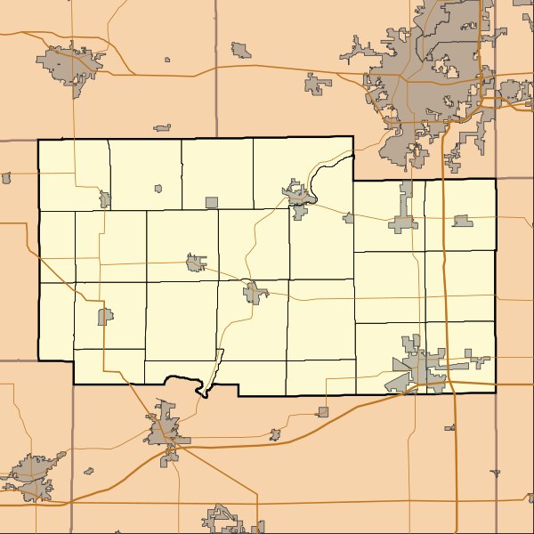
English: This is a map of Ogle County, Illinois, USA which includes township borders. |
| දිනය | |
| මූලාශ්රය | My own work, using custom-written MapScript applications with National Atlas and United States Census Bureau data |
| කර්තෘ | Omnedon |
බලපත්රීකරණය
| මම, මෙම කාර්යයේ ප්රතිරූපණ අයිති හිමිකරු, මෙම කාර්යය public domain වෙත නිදහස් කරමි. මෙය ලෝක ව්යාප්තව අදාළ වේ. සමහර රටවල මෙය අනීතික විය හැකිය. එසේ වුවහොත්; මම කිසිදු කොන්දේසියකින් තොරව,ඕනෑම අයෙකුට ඕනෑම කාර්යයක් සඳහා මෙය, නීතිමය බාධාවක් නොමැති වනතුරු, භාවිතා කිරීමේ අයිතිය ලබාදෙමි. |
ගොනු ඉතිහාසය
එම අවස්ථාවෙහිදී ගොනුව පැවැති ආකාරය නැරඹීමට දිනය/වේලාව මත ක්ලික් කරන්න.
| දිනය/වේලාව | කුඩා-රූපය | මාන | පරිශීලක | පරිකථනය | |
|---|---|---|---|---|---|
| වත්මන් | 14:34, 23 නොවැම්බර් 2010 | | 768 × 768 (236 කි.බ.) | Omnedon | == {{int:filedesc}} == {{Information |Description={{en|This is a map of Ogle County, Illinois, USA which includes township borders.}} |Source=My own work, using custom-written MapScript applications with [http://www.nationalat |
ගොනු භාවිතය
පහත දැක්වෙන පිටු 2 ක් විසින් මෙම ගොනුව භාවිතා කෙරෙයි:
ගෝලීය ගොනු භාවිතය
පහත දැක්වෙන අනෙකුත් විකියන් මගින් මෙම ගොනුව භාවිතා කරයි:
- ar.wikipedia.org හි භාවිතය
- azb.wikipedia.org හි භාවිතය
- ceb.wikipedia.org හි භාවිතය
- de.wikipedia.org හි භාවිතය
- en.wikipedia.org හි භාවිතය
- Adeline, Illinois
- Byron, Illinois
- Creston, Illinois
- Davis Junction, Illinois
- Forreston, Illinois
- Hillcrest, Illinois
- Leaf River, Illinois
- Mount Morris, Illinois
- Oregon, Illinois
- Polo, Illinois
- Rochelle, Illinois
- Stillman Valley, Illinois
- Grand Detour, Illinois
- Monroe Center, Illinois
- Baileyville, Illinois
- Chana, Illinois
- Kings, Ogle County, Illinois
- Lindenwood, Illinois
- Woosung, Illinois
- Daysville, Illinois
- Egan, Illinois
- Paynes Point, Illinois
- Buffalo Grove, Ogle County, Illinois
- Flagg, Illinois
- Brookville, Illinois
- Module:Location map/data/USA Illinois Ogle County/doc
- Ogle County Airport
- Rochelle Municipal Airport
- Module:Location map/data/USA Illinois Ogle County
- User:CMadeo (WMF)/sandbox
- User:CMadeo (WMF)/grand detour
- fa.wikipedia.org හි භාවිතය
මෙම ගොනුවේ තවත් ගෝලීය භාවිත බලන්න.