
ගොනුව:Location map of Montgomery County, Indiana.svg

Size of this PNG preview of this SVG file: 600 × 600 පික්සල. අනෙකුත් විභේදනයන්: 240 × 240 පික්සල | 480 × 480 පික්සල | 768 × 768 පික්සල | 1,024 × 1,024 පික්සල | 2,048 × 2,048 පික්සල | 960 × 960 පික්සල.
මුල් ගොනුව (SVG ගොනුව, නාමමාත්රිකව 960 × 960 පික්සල්, ගොනු විශාලත්වය: 1.32 මෙ.බ.)
සාරාංශය
| විස්තරය |
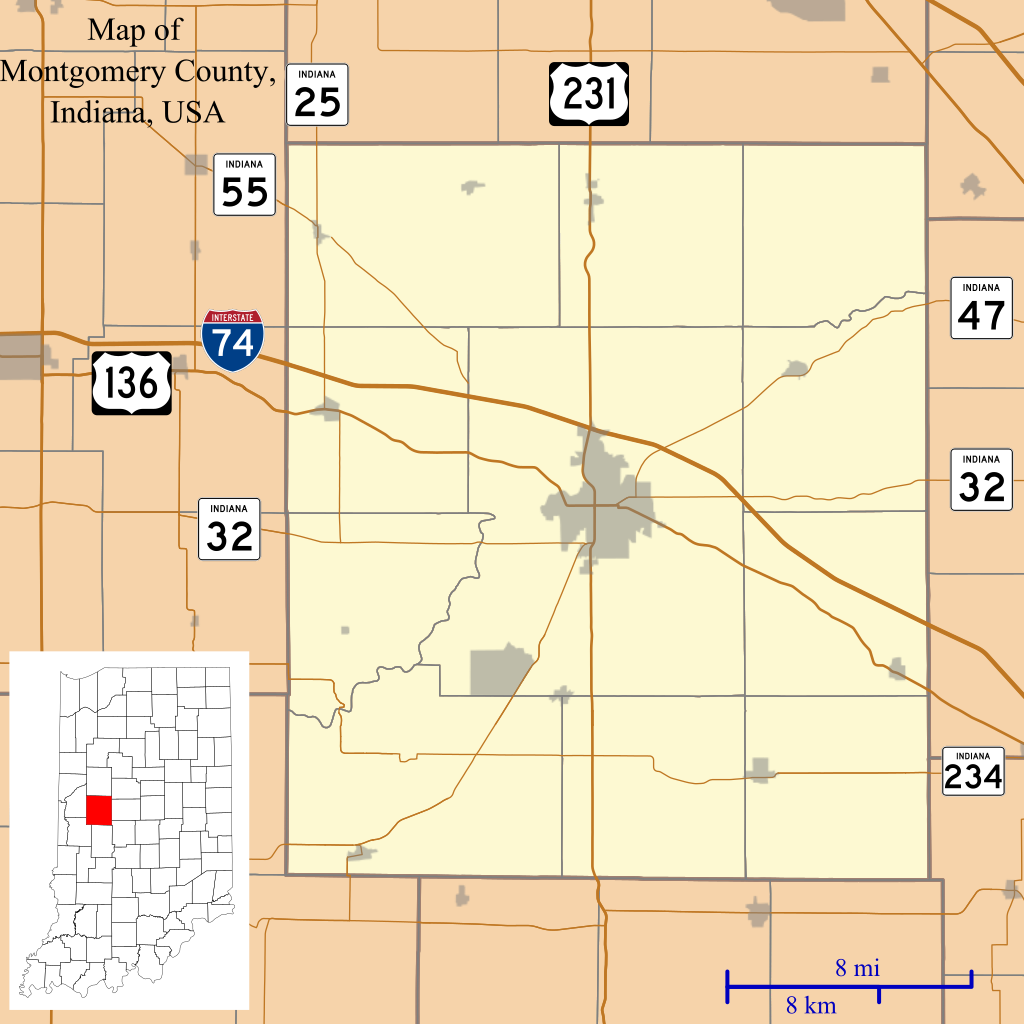
English: This is a map of Montgomery County, Indiana, USA which includes incorporated settlements, township borders, and major highways. |
| දිනය | |
| මූලාශ්රය | Source=My own work, using custom-written MapScript applications with United States Census Bureau TIGER 2013 data |
| කර්තෘ | Omnedon |
බලපත්රීකරණය
| මම, මෙම කාර්යයේ ප්රතිරූපණ අයිති හිමිකරු, මෙම කාර්යය public domain වෙත නිදහස් කරමි. මෙය ලෝක ව්යාප්තව අදාළ වේ. සමහර රටවල මෙය අනීතික විය හැකිය. එසේ වුවහොත්; මම කිසිදු කොන්දේසියකින් තොරව,ඕනෑම අයෙකුට ඕනෑම කාර්යයක් සඳහා මෙය, නීතිමය බාධාවක් නොමැති වනතුරු, භාවිතා කිරීමේ අයිතිය ලබාදෙමි. |
ගොනු ඉතිහාසය
එම අවස්ථාවෙහිදී ගොනුව පැවැති ආකාරය නැරඹීමට දිනය/වේලාව මත ක්ලික් කරන්න.
| දිනය/වේලාව | කුඩා-රූපය | මාන | පරිශීලක | පරිකථනය | |
|---|---|---|---|---|---|
| වත්මන් | 03:47, 27 දෙසැම්බර් 2013 | | 960 × 960 (1.32 මෙ.බ.) | Omnedon | == {{int:filedesc}} == {{Information |Description={{en|This is a map of Montgomery County, Indiana, USA which includes incorporated settlements, township borders, and major highways.}} |Source=Source=My own work, using... |
ගොනු භාවිතය
පහත දැක්වෙන පිටු 2 ක් විසින් මෙම ගොනුව භාවිතා කෙරෙයි:
ගෝලීය ගොනු භාවිතය
පහත දැක්වෙන අනෙකුත් විකියන් මගින් මෙම ගොනුව භාවිතා කරයි:
- ar.wikipedia.org හි භාවිතය
- azb.wikipedia.org හි භාවිතය
- ceb.wikipedia.org හි භාවිතය
- en.wikipedia.org හි භාවිතය
- Alamo, Indiana
- Crawfordsville, Indiana
- Darlington, Indiana
- Ladoga, Indiana
- Linden, Indiana
- New Market, Indiana
- New Richmond, Indiana
- New Ross, Indiana
- Waveland, Indiana
- Waynetown, Indiana
- Browns Valley, Indiana
- Bowers, Indiana
- Deer's Mill, Indiana
- Elmdale, Indiana
- Garfield, Indiana
- Hibernia, Montgomery County, Indiana
- Kirkpatrick, Indiana
- Lapland, Indiana
- Mace, Indiana
- Parkersburg, Indiana
- Shannondale, Indiana
- Smartsburg, Indiana
- Wesley, Indiana
- Whitesville, Indiana
- Yountsville, Indiana
- Cherry Grove, Indiana
- Balhinch, Indiana
- Linnsburg, Indiana
- Lake Holiday, Indiana
- Darlington Woods, Indiana
- Module:Location map/data/USA Indiana Montgomery County/doc
- Beckville, Indiana
- North Union, Indiana
- Fiskville, Indiana
- Manchester, Montgomery County, Indiana
මෙම ගොනුවේ තවත් ගෝලීය භාවිත බලන්න.