
ගොනුව:Location map United Kingdom Preston 2012.svg

Size of this PNG preview of this SVG file: 733 × 449 පික්සල. අනෙකුත් විභේදනයන්: 320 × 196 පික්සල | 640 × 392 පික්සල | 1,024 × 627 පික්සල | 1,280 × 784 පික්සල | 2,560 × 1,568 පික්සල.
මුල් ගොනුව (SVG ගොනුව, නාමමාත්රිකව 733 × 449 පික්සල්, ගොනු විශාලත්වය: 5.86 මෙ.බ.)
සාරාංශය
| විස්තරය |
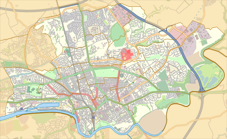
English: Map of the unparished area of en:Preston, Lancashire, England, from April 2012.
Equirectangular map projection on WGS 84 datum, with N/S stretched 165% Geographic limits:
|
| දිනය | |
| මූලාශ්රය |
This file was derived from : Preston UK ward map 2010 (blank).svg:
|
| කර්තෘ |
|
.svg)
බලපත්රීකරණය
| This work contains information from OpenStreetMap, which is made available under the Open Database License (ODbL).
The ODbL does not require any particular license for maps produced from ODbL data. Prior to 1 August 2020, map tiles produced by the OpenStreetMap Foundation were licensed under the CC-BY-SA-2.0 license. Maps produced by other people may be subject to other licences. |
This file is licensed under the Creative Commons Attribution-Share Alike 4.0 International license.
Attribution: Nilfanion and Dr Greg. © OpenStreetMap contributors. Contains Ordnance Survey data © Crown copyright and database right 2012.
- ඔබ නිදහස්:
- බෙදාහදා ගැනීමට – කාර්යය පිටපත් කිරීමට,බෙදා හැරීමට සහ සම්ප්රේෂණය කිරීමට
- නැවත සංකලනය කිරීමට – කාර්යයට අනුවර්තනය වීමට
- පහත කොන්දේසිවලට යටත්ව:
- attribution – වරපත වෙත බැඳියක්ද සපයමින් ඔබ විසින් සුදුසු කර්තෘභාරය ප්රදානය කල යුතු අතර, කිසියම් වෙනස්වීම් සිදුකලේ නම් එයද සඳහන් කල යුතු වෙයි. ඕනෑම සුදුසු ආකාරයට මෙය ඔබ විසින් සිදුකල හැකි මුත්, වරපත්දායකයා විසින් ඔබ හෝ ඔබගේ භාවිතය හෝ පිටසන් කරන බවට ඇඟවෙන ලෙසින් එය සිදු නොකල යුතු වෙයි.
- share alike – මෙම විෂය කාරණා භාවිතා කොට නැවත සංකලනය, ප්රතියෝජනය හෝ වැඩිදියුණුව කලේ නම්, ඉන්පසු ඔබගේ දායකත්වය ඔබ විසින් බෙදාහැරිය යුත්තේ මුල් වරපත හා සමාන හෝ සංගතික හෝ වරපතක් භාවිතා කරමිනි.
ගොනු ඉතිහාසය
එම අවස්ථාවෙහිදී ගොනුව පැවැති ආකාරය නැරඹීමට දිනය/වේලාව මත ක්ලික් කරන්න.
| දිනය/වේලාව | කුඩා-රූපය | මාන | පරිශීලක | පරිකථනය | |
|---|---|---|---|---|---|
| වත්මන් | 22:53, 26 නොවැම්බර් 2015 | | 733 × 449 (5.86 මෙ.බ.) | Dr Greg | User created page with UploadWizard |
ගොනු භාවිතය
පහත දැක්වෙන පිටු 2 ක් විසින් මෙම ගොනුව භාවිතා කෙරෙයි:
ගෝලීය ගොනු භාවිතය
පහත දැක්වෙන අනෙකුත් විකියන් මගින් මෙම ගොනුව භාවිතා කරයි:
- ar.wikipedia.org හි භාවිතය
- en.wikipedia.org හි භාවිතය
- Preston, Lancashire
- Deepdale
- Moor Park, Preston
- Royal Preston Hospital
- Deepdale railway station
- Cadley, Lancashire
- Preston College
- Ribbleton railway station
- Ashton-on-Ribble
- Deepdale Street railway station
- Ashton Park
- Avenham
- Ribbleton
- Brookfield, Preston
- Tulketh
- Riversway
- Deepdale, Preston
- Greyfriars, Preston
- Sharoe Green
- St George's, Preston
- Larches, Preston
- College (Preston ward)
- St Matthew's, Preston
- Transport in Preston
- Tulketh Hall
- St Andrew's Church, Ashton-on-Ribble
- St Michael and All Angels Church, Ashton-on-Ribble
- St Mary Magdalene's Church, Ribbleton
- Fernyhalgh Wood
- Christ Church, Fulwood
- Church of St Thomas of Canterbury and the English Martyrs, Preston
- Fulwood Barracks
- St Mary's Church, Preston
- St Joseph's Church, Preston
- St Thomas' Church, Preston
- Module:Location map/data/United Kingdom Preston
- Module:Location map/data/United Kingdom Preston/doc
- Emmanuel Church, Preston
- Moor Park Methodist Church
- St Luke's Church, Preston
- Preston Royal Infirmary
- Kimberley Barracks