
ගොනුව:La Guajira Topographic 2.png

මෙම පෙරදසුනෙහි විශාලත්වය: 733 × 600 පික්සල. අනෙකුත් විභේදනයන්: 293 × 240 පික්සල | 587 × 480 පික්සල | 939 × 768 පික්සල | 1,252 × 1,024 පික්සල | 1,925 × 1,575 පික්සල.
මුල් ගොනුව (1,925 × 1,575 පික්සල, ගොනු විශාලත්වය: 3.35 මෙ.බ., MIME ශෛලිය: image/png)
සාරාංශය
| විස්තරය |
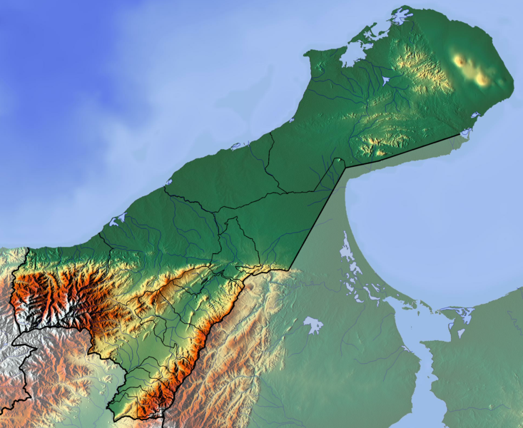
Français : La Guajira dept |
| දිනය | |
| මූලාශ්රය | ස්වයං නිර්මාණයකි (backgroung : http://www.maps-for-free.com) |
| කර්තෘ | Dr Brains |
බලපත්රීකරණය
I, මෙම කාර්යයේ ප්රකාශන අයිතිය දරන්නා,පහත බලපත්රය යටතේ එය ප්රකාශයට පත් කරනු ලබයි:

|
Free Software Foundation විසින් ප්රකාශිත GNU Free Documentation License බලපත්රයෙහි 1.2 පිටපතේ කොන්දේසිවලට පමණක් යටත්ව මෙම ගොනුව පිටපත් කෙරුමට, නැවත බෙදාහාරුමට සහ/හෝ වෙනස් කෙරුමට අවසර දී ඇත; ඒ වෙනස් අංශ නොමැතිව, මුල් පිටු පෙළ නොමැතිව, පසු පිටු පෙළ නොමැතිවය. බලපත්රයේ පිටපතක් GNU Free Documentation License නම් අංශයේ දැක්වේ. | 1.2 පමණි |
|
|
Free Software Foundation විසින් ප්රකාශිත GNU Free Documentation License බලපත්රයෙහි 1.3 හෝ ඊට අලුත් පිටපත්වල කොන්දේසිවලට යටත්ව මෙම ගොනුව පිටපත් කෙරුමට, නැවත බෙදාහාරුමට සහ/හෝ වෙනස් කෙරුමට අවසර දී ඇත; ඒ වෙනස් අංශ නොමැතිව, මුල් පිටු පෙළ නොමැතිව, පසු පිටු පෙළ නොමැතිවය. බලපත්රයේ පිටපතක් GNU Free Documentation License නම් අංශයේ දැක්වේ.
|
If this file is eligible for relicensing, it may also be used under the Creative Commons Attribution-ShareAlike 3.0 license. The relicensing status of this image needs to be manually reviewed by an experienced user. You can help.
|
ඔබට අභිමත වරපත තෝරාගත හැක.
ගොනු ඉතිහාසය
එම අවස්ථාවෙහිදී ගොනුව පැවැති ආකාරය නැරඹීමට දිනය/වේලාව මත ක්ලික් කරන්න.
| දිනය/වේලාව | කුඩා-රූපය | මාන | පරිශීලක | පරිකථනය | |
|---|---|---|---|---|---|
| වත්මන් | 13:44, 9 ජූනි 2012 | | 1,925 × 1,575 (3.35 මෙ.බ.) | Dr Brains |
ගොනු භාවිතය
පහත දැක්වෙන පිටු 2 ක් විසින් මෙම ගොනුව භාවිතා කෙරෙයි:
ගෝලීය ගොනු භාවිතය
පහත දැක්වෙන අනෙකුත් විකියන් මගින් මෙම ගොනුව භාවිතා කරයි:
- bg.wikipedia.org හි භාවිතය
- en.wikipedia.org හි භාවිතය
- Mosque of Omar Ibn Al-Khattab
- La Guajira Department
- Module:Location map/data/Colombia La Guajira Department/doc
- Cesar-Ranchería Basin
- Cocinetas Basin
- Macarao Formation
- Siamaná Formation
- Uitpa Formation
- Jimol Formation
- Castilletes Formation
- Ware Formation
- Module:Location map/data/Colombia La Guajira Department
- La Guajira Terrane
- es.wikipedia.org හි භාවිතය
- Cabo de la Vela
- Punta Gallinas
- Puerto Bolívar (La Guajira)
- Cerro La Teta
- Bahía Honda (Colombia)
- Cerro Palúa
- Wikiproyecto:Ilustración/Taller de Cartografía/Realizaciones/América del Sur
- Serranía de Macuira
- Plantilla:Mapa de localización de La Guajira
- Formación Cerrejón
- Bahía Hondita
- Bahía Portete
- Montes de Oca (Guajira)
- Cerro Cerrejón
- Formación Castilletes
- fa.wikipedia.org හි භාවිතය
- fr.wikipedia.org හි භාවිතය
- La Guajira
- Punta Gallinas
- Serranía de Macuira
- Parc national naturel de Macuira
- Maicao
- Urumita
- Manaure (La Guajira)
- Villanueva (La Guajira)
- Uribia
- San Juan del Cesar
- La Jagua del Pilar
- Hatonuevo
- Fonseca (La Guajira)
- El Molino (La Guajira)
- Distracción
- Dibulla
- Barrancas (La Guajira)
- Modèle:Géolocalisation/La Guajira
- Modèle:Géolocalisation/La Guajira/Documentation
මෙම ගොනුවේ තවත් ගෝලීය භාවිත බලන්න.