
ගොනුව:La2-demis-caribbean.png

මෙම පෙරදසුනෙහි විශාලත්වය: 800 × 504 පික්සල. අනෙකුත් විභේදනයන්: 320 × 201 පික්සල | 640 × 403 පික්සල | 891 × 561 පික්සල.
මුල් ගොනුව (891 × 561 පික්සල, ගොනු විශාලත්වය: 149 කි.බ., MIME ශෛලිය: image/png)
සාරාංශය
| විස්තරය |
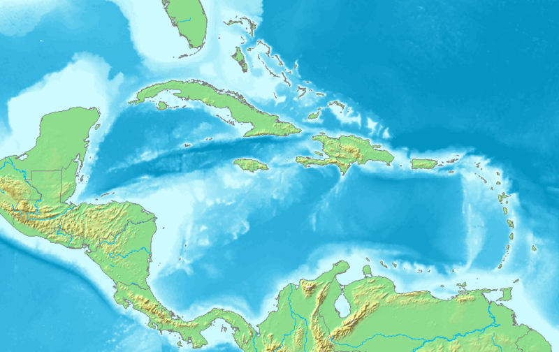
English: Map of the Caribbean and Central America.
Bounding box West -93°, South 7°, East -58°, North 28°. Center at 17°30′00″N 75°30′00″W / 17.50000°N 75.50000°W. |
| දිනය | |
| මූලාශ්රය | Demis map server |
| කර්තෘ | Demis map server |
| අනෙකුත් අනුවාදයන් | Derivative works of this file: La2-demis-caribbean gs.png |
This image is in the public domain because it came from the site https://www.demis.nl/products/web-map-server/examples/ and was released by the copyright holder. Permission is granted to copy, distribute and/or modify this map since it is based on free of copyright images from: www.demis.nl. See also approval email on de.wp and its clarification.
|
| This work has been released into the public domain by its copyright holder, www.demis.nl. This applies worldwide. සමහර රටවල මෙය අනීතික විය හැකිය. එසේ වුවහොත්; නීතියෙන් යම් කොන්දේසියක් පනවා ඇති නම් හැරෙන්නට කිසිදු කොන්දේසියකින් තොරව ඕනෑම ප්රයෝජනයක් සඳහා මෙම කාර්යය භාවිතා කිරීමේ අයිතිය www.demis.nl විසින් ලබා දෙයි.
|
ගොනු ඉතිහාසය
එම අවස්ථාවෙහිදී ගොනුව පැවැති ආකාරය නැරඹීමට දිනය/වේලාව මත ක්ලික් කරන්න.
| දිනය/වේලාව | කුඩා-රූපය | මාන | පරිශීලක | පරිකථනය | |
|---|---|---|---|---|---|
| වත්මන් | 05:10, 23 නොවැම්බර් 2018 | | 891 × 561 (149 කි.බ.) | Opencooper | rm watermark |
| 13:20, 2 සැප්තැම්බර් 2005 |  | 891 × 561 (170 කි.බ.) | LA2 | Map of the Carribean and Central America. Bounding box West -93°, South 7°, East -58°, North 28°. {{demis-pd}} category:maps of America |
ගොනු භාවිතය
පහත දැක්වෙන පිටු 2 ක් විසින් මෙම ගොනුව භාවිතා කෙරෙයි:
ගෝලීය ගොනු භාවිතය
පහත දැක්වෙන අනෙකුත් විකියන් මගින් මෙම ගොනුව භාවිතා කරයි:
- am.wikipedia.org හි භාවිතය
- ar.wikipedia.org හි භාවිතය
- كريستوفر كولومبوس
- تصنيف:أمريكا الشمالية
- كوبا
- بليز
- أمريكا الشمالية
- سورينام
- غيانا
- جامايكا
- غرينادا
- تصنيف:جامايكا
- مونتسرات
- سانت فينسنت والغرينادين
- ترينيداد وتوباغو
- أروبا
- مارتينيك
- تصنيف:ترينيداد وتوباغو
- دولار بربادوسي
- باربادوس
- دولار بهامي
- ناساو
- نشيد جزر البهاما الوطني
- اللغة الهولندية
- .an
- .aw
- البحر الكاريبي
- الكاريبي
- جزر الأنتيل
- جزر الأنتيل الكبرى
- جزر الأنتيل الصغرى
- هسبنيولا
- بورتوريكو
- ترينيداد
- أنتيغوا وباربودا
- .vi
- جزر الأنتيل الهولندية
- جزر العذراء
- جمهورية الدومينيكان
- هايتي
- غوادلوب
- جزر العذراء البريطانية
- جزر العذراء الأمريكية
- دومينيكا
- تصنيف:جمهورية الدومينيكان
- تصنيف:الكاريبي
- سانت لوسيا
- علم أروبا
- سانت كيتس ونيفيس
- بيزو كوبي
- إيان فلمنغ
මෙම ගොනුවේ තවත් ගෝලීය භාවිත බලන්න.