
ගොනුව:Lérida-loc.svg

Size of this PNG preview of this SVG file: 461 × 599 පික්සල. අනෙකුත් විභේදනයන්: 185 × 240 පික්සල | 369 × 480 පික්සල | 591 × 768 පික්සල | 788 × 1,024 පික්සල | 1,577 × 2,048 පික්සල | 512 × 665 පික්සල.
මුල් ගොනුව (SVG ගොනුව, නාමමාත්රිකව 512 × 665 පික්සල්, ගොනු විශාලත්වය: 378 කි.බ.)
සාරාංශය
| විස්තරය |
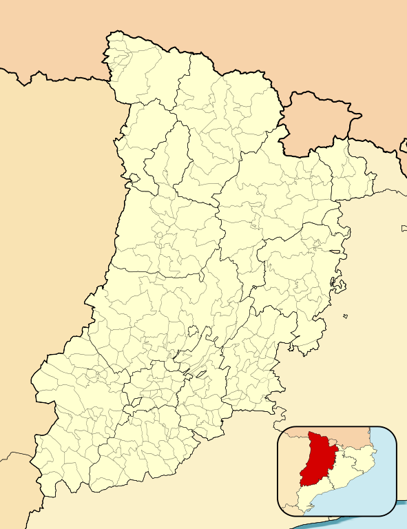
English: Location map of Province of Lleida
Equirectangular projection, N/S stretching 130 %. Geographic limits of the map:
Español: Mapa de localización de la Provincia de Lérida
Proyección equirrectangular (cilíndrica equidistante), N/S estirada 130 %. Límites geográficos del mapa:
|
|
| දිනය | ||
| මූලාශ්රය | Own work based on: EspañaLoc.svg by HansenBCN | |
| කර්තෘ | Miguillen | |
| SVG genesis | This locator map was created with Inkscape.
|
බලපත්රීකරණය
මෙම කෘතියෙහි හිමිකම් අයිතීන් දරන්නා වන Miguillen නමැති මම, පහත වරපත යටතේ එය ප්රකාශයට පත් කරමි:
මෙම ගොනුව ක්රියේටිව් කොමන්ස් Attribution-Share Alike 3.0 Unported වරපත යටතේ අවසර ලබා ඇත.
Attribution: Miguillen
- ඔබ නිදහස්:
- බෙදාහදා ගැනීමට – කාර්යය පිටපත් කිරීමට,බෙදා හැරීමට සහ සම්ප්රේෂණය කිරීමට
- නැවත සංකලනය කිරීමට – කාර්යයට අනුවර්තනය වීමට
- පහත කොන්දේසිවලට යටත්ව:
- attribution – වරපත වෙත බැඳියක්ද සපයමින් ඔබ විසින් සුදුසු කර්තෘභාරය ප්රදානය කල යුතු අතර, කිසියම් වෙනස්වීම් සිදුකලේ නම් එයද සඳහන් කල යුතු වෙයි. ඕනෑම සුදුසු ආකාරයට මෙය ඔබ විසින් සිදුකල හැකි මුත්, වරපත්දායකයා විසින් ඔබ හෝ ඔබගේ භාවිතය හෝ පිටසන් කරන බවට ඇඟවෙන ලෙසින් එය සිදු නොකල යුතු වෙයි.
- share alike – මෙම විෂය කාරණා භාවිතා කොට නැවත සංකලනය, ප්රතියෝජනය හෝ වැඩිදියුණුව කලේ නම්, ඉන්පසු ඔබගේ දායකත්වය ඔබ විසින් බෙදාහැරිය යුත්තේ මුල් වරපත හා සමාන හෝ සංගතික හෝ වරපතක් භාවිතා කරමිනි.
ගොනු ඉතිහාසය
එම අවස්ථාවෙහිදී ගොනුව පැවැති ආකාරය නැරඹීමට දිනය/වේලාව මත ක්ලික් කරන්න.
| දිනය/වේලාව | කුඩා-රූපය | මාන | පරිශීලක | පරිකථනය | |
|---|---|---|---|---|---|
| වත්මන් | 21:36, 16 ජනවාරි 2011 | | 512 × 665 (378 කි.බ.) | Miguillen | colores |
| 15:22, 8 දෙසැම්බර් 2010 |  | 512 × 665 (378 කි.බ.) | Miguillen | diferencio mejor colores | |
| 12:34, 28 නොවැම්බර් 2010 |  | 512 × 665 (378 කි.බ.) | Miguillen | trazo mapa de ubicación | |
| 12:09, 28 නොවැම්බර් 2010 |  | 512 × 665 (378 කි.බ.) | Miguillen | cambio color tierra de otra CCAA y cambio mapa de ubicación | |
| 15:47, 20 නොවැම්බර් 2010 |  | 512 × 675 (358 කි.බ.) | Miguillen | == {{int:filedesc}} == {{Information |Description={{en|Location map of Province of Lleida}} Equirectangular projection, N/S stretching 130 %. Geographic limits of the map: * N: ° N * S: ° N * W: ° E * E: ° E {{es|Mapa |
ගොනු භාවිතය
පහත දැක්වෙන පිටු 2 ක් විසින් මෙම ගොනුව භාවිතා කෙරෙයි:
ගෝලීය ගොනු භාවිතය
පහත දැක්වෙන අනෙකුත් විකියන් මගින් මෙම ගොනුව භාවිතා කරයි:
- ar.wikipedia.org හි භාවිතය
- ba.wikipedia.org හි භාවිතය
- ceb.wikipedia.org හි භාවිතය
- en.wikipedia.org හි භාවිතය
- Balaguer
- Tremp
- Tàrrega
- Mollerussa
- Taüll
- Les Borges Blanques
- Arbeca
- Fígols i Alinyà
- Organyà
- Ivars de Noguera
- Vilanova de la Barca
- Montornès de Segarra
- Vinaixa
- Cabó
- Alcarràs
- Civís
- Os de Civís
- Les Valls de Valira
- La Pedrera de Rúbies Formation
- Pedró dels Quatre Batlles
- Guissona
- Gerri de la Sal
- Bellver de Cerdanya
- Lles de Cerdanya
- Os de Balaguer
- La Tallada
- Bellvís
- Benavent de Segrià
- Castell de Mur
- Castellnou de Seana
- Montellà i Martinet
- Rialp
- Riu de Cerdanya
- Isona
- Module:Location map/data/Spain Province of Lleida/doc
- Amorós
- Module:Location map/data/Spain Province of Lleida
- Agulló
- Corçà, Àger
- Ainet de Besan
- Araós
- Àreu
- Besan, Pallars
- Norís
- Àrreu
- Borén
- Isavarre
මෙම ගොනුවේ තවත් ගෝලීය භාවිත බලන්න.