
ගොනුව:Iwate-ken géolocalisation relief.svg

Size of this PNG preview of this SVG file: 361 × 599 පික්සල. අනෙකුත් විභේදනයන්: 145 × 240 පික්සල | 289 × 480 පික්සල | 463 × 768 පික්සල | 617 × 1,024 පික්සල | 1,235 × 2,048 පික්සල | 1,720 × 2,852 පික්සල.
මුල් ගොනුව (SVG ගොනුව, නාමමාත්රිකව 1,720 × 2,852 පික්සල්, ගොනු විශාලත්වය: 3.31 මෙ.බ.)
සාරාංශය
| Camera location | | View this and other nearby images on: OpenStreetMap |
|---|
| විස්තරය |
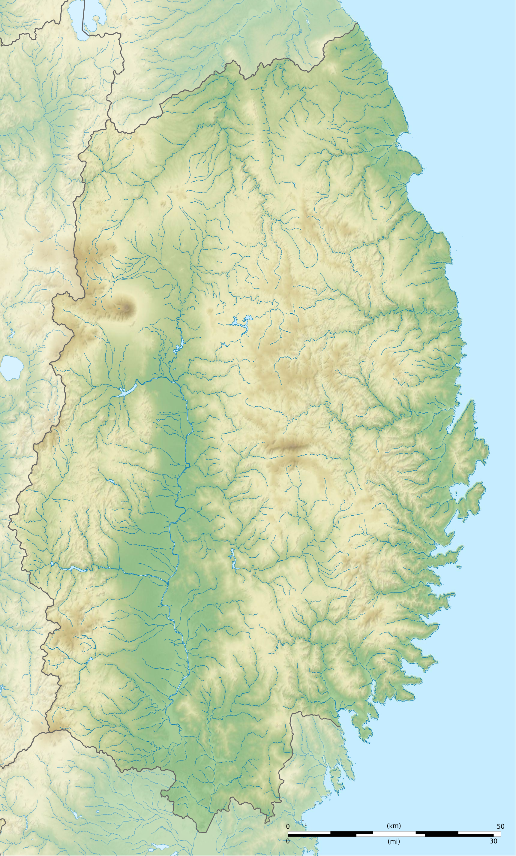
Français : Carte topographique vierge de la Préfecture d'Iwate, au Japon, destinée à la géolocalisation.
Deutsch: Topographische Karte der Präfektur Iwate.
English: Topographic blank map of the Iwate Prefecture, for geolocalisation purpose.
Español: Mapa topográfico de la Prefectura de Iwate.
Italiano: Mappa topografica della Prefettura di Iwate.
日本語: 岩手県の地図.
Português: Carta topográfica de la província de Iwate.
|
||
| දිනය | (UTC) | ||
| මූලාශ්රය |
Création personnelle ;
|
||
| කර්තෘ | © Bourrichon (talk) - fr:Bourrichon | ||
| අවසරය (මෙම ගොනුව නැවත භාවිතා කරමින්) |
|
||
| අනෙකුත් අනුවාදයන් | File:Iwate-ken géolocalisation.svg |

|
This SVG file contains embedded text that can be translated into your language, using any capable SVG editor, text editor or the SVG Translate tool. For more information see: About translating SVG files. |
This W3C-unspecified vector image was created with Inkscape .
බලපත්රීකරණය
මෙම කෘතියෙහි හිමිකම් අයිතීන් දරන්නා වන මම,පහත වරපත යටතේ එය ප්රකාශයට පත් කරමි:
මෙම ගොනුව නිර්මාණශීලී පොදුවූවන් Attribution-Share Alike 2.0 France බලපත්රය යටතේ අවසර ලබා ඇත.
Attribution: Bourrichon (atelier graphique)
- ඔබ නිදහස්:
- බෙදාහදා ගැනීමට – කාර්යය පිටපත් කිරීමට,බෙදා හැරීමට සහ සම්ප්රේෂණය කිරීමට
- නැවත සංකලනය කිරීමට – කාර්යයට අනුවර්තනය වීමට
- පහත කොන්දේසිවලට යටත්ව:
- attribution – වරපත වෙත බැඳියක්ද සපයමින් ඔබ විසින් සුදුසු කර්තෘභාරය ප්රදානය කල යුතු අතර, කිසියම් වෙනස්වීම් සිදුකලේ නම් එයද සඳහන් කල යුතු වෙයි. ඕනෑම සුදුසු ආකාරයට මෙය ඔබ විසින් සිදුකල හැකි මුත්, වරපත්දායකයා විසින් ඔබ හෝ ඔබගේ භාවිතය හෝ පිටසන් කරන බවට ඇඟවෙන ලෙසින් එය සිදු නොකල යුතු වෙයි.
- share alike – මෙම විෂය කාරණා භාවිතා කොට නැවත සංකලනය, ප්රතියෝජනය හෝ වැඩිදියුණුව කලේ නම්, ඉන්පසු ඔබගේ දායකත්වය ඔබ විසින් බෙදාහැරිය යුත්තේ මුල් වරපත හා සමාන හෝ සංගතික හෝ වරපතක් භාවිතා කරමිනි.

ගොනු ඉතිහාසය
එම අවස්ථාවෙහිදී ගොනුව පැවැති ආකාරය නැරඹීමට දිනය/වේලාව මත ක්ලික් කරන්න.
| දිනය/වේලාව | කුඩා-රූපය | මාන | පරිශීලක | පරිකථනය | |
|---|---|---|---|---|---|
| වත්මන් | 21:32, 3 ජූලි 2013 | | 1,720 × 2,852 (3.31 මෙ.බ.) | Bourrichon | |
| 21:27, 3 ජූලි 2013 |  | 1,720 × 2,852 (2.96 මෙ.බ.) | Bourrichon | == {{int:filedesc}} == {{Location|39|00|00|N|141|00|00|E|scale:10000}} {{Information |Description= {{fr|Carte topographique vierge de la fr:Préfecture d'Iwate, au Japon, destinée à la géolocalisation.}} {{de|Topographische Kart... |
ගොනු භාවිතය
පහත දැක්වෙන පිටු 2 ක් විසින් මෙම ගොනුව භාවිතා කෙරෙයි:
ගෝලීය ගොනු භාවිතය
පහත දැක්වෙන අනෙකුත් විකියන් මගින් මෙම ගොනුව භාවිතා කරයි:
- ar.wikipedia.org හි භාවිතය
- ceb.wikipedia.org හි භාවිතය
- ce.wikipedia.org හි භාවිතය
- de.wikipedia.org හි භාවිතය
- en.wikipedia.org හි භාවිතය
- Iwate Morioka Stadium
- Battle of Miyako Bay
- Battle of Kawasaki
- Morioka Castle
- Mōtsū-ji
- Kanjizaiō-in
- Chūson-ji
- Nakatsu River
- Mount Hayachine
- Sarugaishi River
- Waga River
- Ishibuchi Dam
- Mount Iwate
- Goishi Coast
- Scenic areas of Ihatov
- Genbikei
- Jōdogahama
- Geibikei
- Hayachine Quasi-National Park
- Ryūsendō
- Module:Location map/data/Japan Iwate Prefecture/doc
- Yuda Onsenkyō Prefectural Natural Park
- Fudō Falls
- Akkadō
- Goshono site
- Kunohe Castle
- Shiwa Castle
- Tokutan Castle
- Cape Todo
- Sakiyama Shell Mound
- Ayaorishinden Site
- Kabayama Site
- Hatten Site
- Ezuriko Kofun Cluster
- Hashino iron mining and smelting site
- Nanbu-Date border mounds
- Nakazawahama Shell Mound
මෙම ගොනුවේ තවත් ගෝලීය භාවිත බලන්න.