
ගොනුව:Isle of Wight UK relief location map.jpg

මෙම පෙරදසුනෙහි විශාලත්වය: 800 × 487 පික්සල. අනෙකුත් විභේදනයන්: 320 × 195 පික්සල | 640 × 390 පික්සල | 1,024 × 624 පික්සල | 1,280 × 780 පික්සල | 1,999 × 1,218 පික්සල.
මුල් ගොනුව (1,999 × 1,218 පික්සල, ගොනු විශාලත්වය: 158 කි.බ., MIME ශෛලිය: image/jpeg)
| විස්තරය |
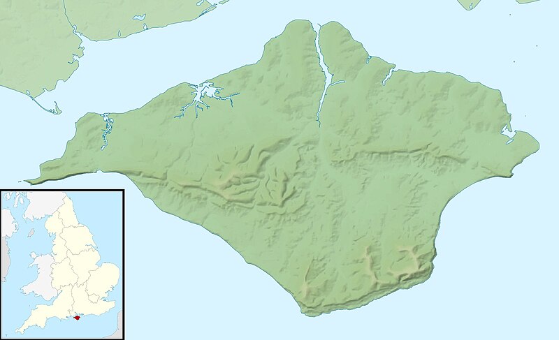
Relief map of the Isle of Wight, UK. Equirectangular map projection on WGS 84 datum, with N/S stretched 155% Geographic limits:
|
| දිනය | |
| මූලාශ්රය |
|
| කර්තෘ | Nilfanion, created using Ordnance Survey data |
| අවසරය (මෙම ගොනුව නැවත භාවිතා කරමින්) |
මෙම ගොනුව ක්රියේටිව් කොමන්ස් Attribution-Share Alike 3.0 Unported වරපත යටතේ අවසර ලබා ඇත. Attribution: Contains Ordnance Survey data © Crown copyright and database right
|
| අනෙකුත් අනුවාදයන් | File:Isle of Wight UK district map (blank).svg - Blank map |
.svg)
ගොනු ඉතිහාසය
එම අවස්ථාවෙහිදී ගොනුව පැවැති ආකාරය නැරඹීමට දිනය/වේලාව මත ක්ලික් කරන්න.
| දිනය/වේලාව | කුඩා-රූපය | මාන | පරිශීලක | පරිකථනය | |
|---|---|---|---|---|---|
| වත්මන් | 01:41, 29 නොවැම්බර් 2011 | | 1,999 × 1,218 (158 කි.බ.) | Nilfanion | {{Information |Description=Relief map of the Isle of Wight, UK. Equirectangular map projection on WGS 84 datum, with N/S stretched 155% Geographic limits: *West: 1.61W *East: 1.05W *North: 50.78N *South: 50.56N |Source=[[w:Ordnance S |
ගොනු භාවිතය
පහත දැක්වෙන පිටු 3 ක් විසින් මෙම ගොනුව භාවිතා කෙරෙයි:
ගෝලීය ගොනු භාවිතය
පහත දැක්වෙන අනෙකුත් විකියන් මගින් මෙම ගොනුව භාවිතා කරයි:
- ar.wikipedia.org හි භාවිතය
- bg.wikipedia.org හි භාවිතය
- ceb.wikipedia.org හි භාවිතය
- en.wikipedia.org හි භාවිතය
- St Boniface Down
- Module:Location map/data/United Kingdom Isle of Wight/doc
- Whale Chine
- Widdick Chine
- Scratchell's Bay
- Totland Bay
- Watcombe Bay
- Bembridge Lifeboat Station
- Yarmouth Lifeboat Station
- Ryde Inshore Rescue Service
- Freshwater Bay Independent Lifeboat Station
- Sandown and Shanklin Independent Lifeboat Station
- Module:Location map/data/United Kingdom Isle of Wight
- Module:Location map/data/Isle of Wight
- User:KnightStryker/sandbox/Freshwater Independent Lifeboat Station
- Isle of Wight Jewish Society
- Hunny Hill
- Woodlands Vale
- es.wikipedia.org හි භාවිතය
- fr.wikipedia.org හි භාවිතය
- ja.wikipedia.org හි භාවිතය
- kn.wikipedia.org හි භාවිතය
- la.wikipedia.org හි භාවිතය
- lv.wikipedia.org හි භාවිතය
- ml.wikipedia.org හි භාවිතය
- ms.wikipedia.org හි භාවිතය
- nl.wikipedia.org හි භාවිතය
- os.wikipedia.org හි භාවිතය
- pl.wikipedia.org හි භාවිතය
- pl.wikibooks.org හි භාවිතය
- sco.wikipedia.org හි භාවිතය
- simple.wikipedia.org හි භාවිතය
මෙම ගොනුවේ තවත් ගෝලීය භාවිත බලන්න.