
ගොනුව:Inverness UK location map.svg

Size of this PNG preview of this SVG file: 762 × 600 පික්සල. අනෙකුත් විභේදනයන්: 305 × 240 පික්සල | 610 × 480 පික්සල | 976 × 768 පික්සල | 1,280 × 1,008 පික්සල | 2,560 × 2,016 පික්සල | 1,425 × 1,122 පික්සල.
මුල් ගොනුව (SVG ගොනුව, නාමමාත්රිකව 1,425 × 1,122 පික්සල්, ගොනු විශාලත්වය: 1.59 මෙ.බ.)
| විස්තරය |
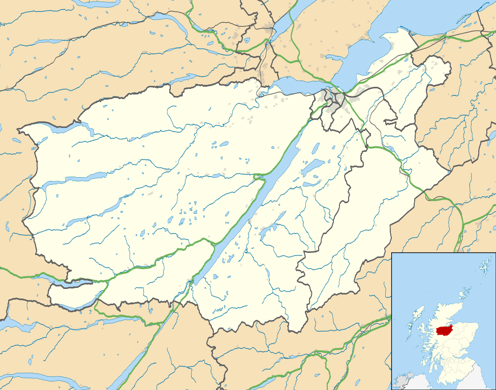
Map of the Inverness city management area, UK in 2011, with the following information shown:
Equirectangular map projection on WGS 84 datum, with N/S stretched 180% Geographic limits:
|
| දිනය | |
| මූලාශ්රය |
|
| කර්තෘ | Nilfanion, created using Ordnance Survey data |
| අවසරය (මෙම ගොනුව නැවත භාවිතා කරමින්) |
මෙම ගොනුව ක්රියේටිව් කොමන්ස් Attribution-Share Alike 3.0 Unported වරපත යටතේ අවසර ලබා ඇත. Attribution: Contains Ordnance Survey data © Crown copyright and database right
|
| අනෙකුත් අනුවාදයන් | File:Inverness UK blank map.svg - Blank map |
ගොනු ඉතිහාසය
එම අවස්ථාවෙහිදී ගොනුව පැවැති ආකාරය නැරඹීමට දිනය/වේලාව මත ක්ලික් කරන්න.
| දිනය/වේලාව | කුඩා-රූපය | මාන | පරිශීලක | පරිකථනය | |
|---|---|---|---|---|---|
| වත්මන් | 01:09, 22 පෙබරවාරි 2011 | | 1,425 × 1,122 (1.59 මෙ.බ.) | Nilfanion | {{Information |Description=Map of the Inverness city management area, UK in 2011, with the following information shown: *Ward boundaries *Coastline and lakes *Roads and railways *Urban areas Equirectangular map projection on WGS 84 datum, |
ගොනු භාවිතය
පහත දැක්වෙන පිටු 3 ක් විසින් මෙම ගොනුව භාවිතා කෙරෙයි:
ගෝලීය ගොනු භාවිතය
පහත දැක්වෙන අනෙකුත් විකියන් මගින් මෙම ගොනුව භාවිතා කරයි:
- ar.wikipedia.org හි භාවිතය
- ceb.wikipedia.org හි භාවිතය
- en.wikipedia.org හි භාවිතය
- Fort Augustus
- Fort George, Highland
- Culloden, Highland
- Urquhart Castle
- Invermoriston
- Caledonian Stadium
- Drumnadrochit
- Merkinch
- Raigmore Hospital
- Cawdor
- Aberarder
- Abriachan
- Achnaconeran
- South Kessock
- Beauly
- Millburn, Inverness
- Smithton, Highland
- Westhill, Highland
- Balloch, Highland
- Tomatin
- Cannich
- Cabrich
- Scorguie
- Tornagrain
- Balnain
- Ardendrain
- Ardnagrask
- Croy, Highland
- Talk:Smithton, Highland
- Kiltarlity
- Dores, Highland
- Moy, Highland
- Achnabat
- Allanfearn
- Aigas
- Aldourie
- Bunloit
- Foyers, Highland
- Balbeg, Highland
- Bunchrew
- Barnyards, Highland
- Gorthleck
- Crask of Aigas
- Leachkin
- Inverfarigaig
- Camault Muir
- Corrimony
- Wester Aberchalder
මෙම ගොනුවේ තවත් ගෝලීය භාවිත බලන්න.