
ගොනුව:Independent State Of Croatia 1943 Locator Map.png

මෙම පෙරදසුනෙහි විශාලත්වය: 610 × 600 පික්සල. අනෙකුත් විභේදනයන්: 244 × 240 පික්සල | 488 × 480 පික්සල | 781 × 768 පික්සල | 1,220 × 1,200 පික්සල.
මුල් ගොනුව (1,220 × 1,200 පික්සල, ගොනු විශාලත්වය: 257 කි.බ., MIME ශෛලිය: image/png)
සාරාංශය
| විස්තරය |
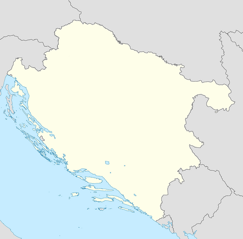
English: Locator Map of the Independent State Of Croatia in 1943 |
| දිනය | |
| මූලාශ්රය | ස්වයං නිර්මාණයකි |
| කර්තෘ | XrysD |
බලපත්රීකරණය
මෙම කෘතියෙහි හිමිකම් අයිතීන් දරන්නා වන මම,පහත වරපත යටතේ එය ප්රකාශයට පත් කරමි:
මෙම ගොනුව ක්රියේටිව් කොමන්ස් Attribution-Share Alike 3.0 Unported වරපත යටතේ අවසර ලබා ඇත.
- ඔබ නිදහස්:
- බෙදාහදා ගැනීමට – කාර්යය පිටපත් කිරීමට,බෙදා හැරීමට සහ සම්ප්රේෂණය කිරීමට
- නැවත සංකලනය කිරීමට – කාර්යයට අනුවර්තනය වීමට
- පහත කොන්දේසිවලට යටත්ව:
- attribution – වරපත වෙත බැඳියක්ද සපයමින් ඔබ විසින් සුදුසු කර්තෘභාරය ප්රදානය කල යුතු අතර, කිසියම් වෙනස්වීම් සිදුකලේ නම් එයද සඳහන් කල යුතු වෙයි. ඕනෑම සුදුසු ආකාරයට මෙය ඔබ විසින් සිදුකල හැකි මුත්, වරපත්දායකයා විසින් ඔබ හෝ ඔබගේ භාවිතය හෝ පිටසන් කරන බවට ඇඟවෙන ලෙසින් එය සිදු නොකල යුතු වෙයි.
- share alike – මෙම විෂය කාරණා භාවිතා කොට නැවත සංකලනය, ප්රතියෝජනය හෝ වැඩිදියුණුව කලේ නම්, ඉන්පසු ඔබගේ දායකත්වය ඔබ විසින් බෙදාහැරිය යුත්තේ මුල් වරපත හා සමාන හෝ සංගතික හෝ වරපතක් භාවිතා කරමිනි.
ගොනු ඉතිහාසය
එම අවස්ථාවෙහිදී ගොනුව පැවැති ආකාරය නැරඹීමට දිනය/වේලාව මත ක්ලික් කරන්න.
| දිනය/වේලාව | කුඩා-රූපය | මාන | පරිශීලක | පරිකථනය | |
|---|---|---|---|---|---|
| වත්මන් | 16:52, 7 මාර්තු 2020 | | 1,220 × 1,200 (257 කි.බ.) | XrysD | Changed map projection to UTM to be compatible with locator map standard |
| 10:05, 7 මාර්තු 2020 |  | 2,000 × 1,574 (462 කි.බ.) | XrysD | Updated to same standard as NDH Districts Map. | |
| 08:28, 3 ජනවාරි 2013 |  | 600 × 600 (98 කි.බ.) | XrysD | Removed German/Italian spheres of influence line | |
| 22:02, 2 ජනවාරි 2013 |  | 1,614 × 1,614 (90 කි.බ.) | XrysD | Added Kommissariat Suschak-Krk | |
| 10:22, 1 ජනවාරි 2013 |  | 600 × 600 (104 කි.බ.) | XrysD | User created page with UploadWizard |
ගොනු භාවිතය
පහත දැක්වෙන පිටු 2 ක් විසින් මෙම ගොනුව භාවිතා කෙරෙයි:
ගෝලීය ගොනු භාවිතය
පහත දැක්වෙන අනෙකුත් විකියන් මගින් මෙම ගොනුව භාවිතා කරයි:
- ar.wikipedia.org හි භාවිතය
- bs.wikipedia.org හි භාවිතය
- ceb.wikipedia.org හි භාවිතය
- en.wikipedia.org හි භාවිතය
- Operation Rösselsprung (1944)
- Russian Protective Corps
- Battle of Lijevče Field
- 392nd (Croatian) Infantry Division
- Mostar operation
- 373rd (Croatian) Infantry Division
- Module:Location map/data/NDH/doc
- Battle of Knin
- Yugoslav torpedo boat T7
- Yugoslav torpedo boat T8
- Module:Location map/data/NDH
- Sarajevo Operation
- Talk:The Holocaust in the Independent State of Croatia/Archive 1
- es.wikipedia.org හි භාවිතය
- hr.wikipedia.org හි භාවිතය
- kn.wikipedia.org හි භාවිතය
- pt.wikipedia.org හි භාවිතය
- sr.wikipedia.org හි භාවිතය
- tg.wikipedia.org හි භාවිතය
- tr.wikipedia.org හි භාවිතය
- uz.wikipedia.org හි භාවිතය
- war.wikipedia.org හි භාවිතය