
ගොනුව:Illinois Locator Map with US.PNG
මෙයට ඉහල විසර්ජනයක් ලබාගත නොහැක.
Illinois_Locator_Map_with_US.PNG (288 × 405 පික්සල, ගොනු විශාලත්වය: 13 කි.බ., MIME ශෛලිය: image/png)
සාරාංශය

|
This locator map image could be re-created using vector graphics as an SVG file. This has several advantages; see Commons:Media for cleanup for more information. If an SVG form of this image is available, please upload it and afterwards replace this template with
{{vector version available|new image name}}.
It is recommended to name the SVG file “Illinois Locator Map with US.svg”—then the template Vector version available (or Vva) does not need the new image name parameter. |
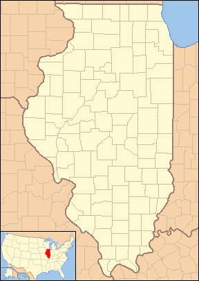
| විස්තරය | Locator Map of Illinois, United States |
| දිනය | |
| මූලාශ්රය | taken from US Census website [1] and modified by User:VerruckteDan, User:Ruhrfisch, User:Huebi, and User:Appraiser |
| කර්තෘ | US Census, User:VerruckteDan, User:Ruhrfisch, User:Huebi, and User:Appraiser |
| අවසරය (මෙම ගොනුව නැවත භාවිතා කරමින්) |
US Census / US Government work is public domain, my modifications licensed under the GNU Free Documentation License |
බලපත්රීකරණය

|
Free Software Foundation විසින් ප්රකාශිත GNU Free Documentation License බලපත්රයෙහි 1.2 හෝ ඊට අලුත් පිටපත්වල කොන්දේසිවලට යටත්ව මෙම ගොනුව පිටපත් කෙරුමට, නැවත බෙදාහාරුමට සහ/හෝ වෙනස් කෙරුමට අවසර දී ඇත; ඒ වෙනස් අංශ නොමැතිව, මුල් පිටු පෙළ නොමැතිව, පසු පිටු පෙළ නොමැතිවය. බලපත්රයේ පිටපතක් GNU Free Documentation License නම් අංශයේ දැක්වේ. |
| මෙම ගොනුව ක්රියේටිව් කොමන්ස් Attribution-Share Alike 3.0 Unported වරපත යටතේ අවසර ලබා ඇත. | ||
| Attribution: We, Ruhrfisch and Appraiser | ||
| ||
| GFDL බලපත්ර යාවත්කාල කෙරුමහි කොටසක් ලෙස මෙම ගොනුවට බලපත්ර ටැගය එක් කෙරිනි. |
මෙම ගොනුව නිර්මාණශීලී පොදුවූවන් Attribution-Share Alike 2.5 Generic බලපත්රය යටතේ අවසර ලබා ඇත.
- ඔබ නිදහස්:
- බෙදාහදා ගැනීමට – කාර්යය පිටපත් කිරීමට,බෙදා හැරීමට සහ සම්ප්රේෂණය කිරීමට
- නැවත සංකලනය කිරීමට – කාර්යයට අනුවර්තනය වීමට
- පහත කොන්දේසිවලට යටත්ව:
- attribution – වරපත වෙත බැඳියක්ද සපයමින් ඔබ විසින් සුදුසු කර්තෘභාරය ප්රදානය කල යුතු අතර, කිසියම් වෙනස්වීම් සිදුකලේ නම් එයද සඳහන් කල යුතු වෙයි. ඕනෑම සුදුසු ආකාරයට මෙය ඔබ විසින් සිදුකල හැකි මුත්, වරපත්දායකයා විසින් ඔබ හෝ ඔබගේ භාවිතය හෝ පිටසන් කරන බවට ඇඟවෙන ලෙසින් එය සිදු නොකල යුතු වෙයි.
- share alike – මෙම විෂය කාරණා භාවිතා කොට නැවත සංකලනය, ප්රතියෝජනය හෝ වැඩිදියුණුව කලේ නම්, ඉන්පසු ඔබගේ දායකත්වය ඔබ විසින් බෙදාහැරිය යුත්තේ මුල් වරපත හා සමාන හෝ සංගතික හෝ වරපතක් භාවිතා කරමිනි.
ඔබට අභිමත වරපත තෝරාගත හැක.
and
This image or file is a work of a United States Census Bureau employee, taken or made as part of that person's official duties. As a work of the U.S. federal government, the image is in the public domain.
|
 |
ගොනු ඉතිහාසය
එම අවස්ථාවෙහිදී ගොනුව පැවැති ආකාරය නැරඹීමට දිනය/වේලාව මත ක්ලික් කරන්න.
| දිනය/වේලාව | කුඩා-රූපය | මාන | පරිශීලක | පරිකථනය | |
|---|---|---|---|---|---|
| වත්මන් | 12:16, 24 ජූනි 2013 | | 288 × 405 (13 කි.බ.) | Zyxw | Same width & height as File:Illinois Locator Map.PNG for use with mapping templates. Inset is File:Map of USA IL.svg. Smaller file size. |
| 21:43, 8 මාර්තු 2008 |  | 292 × 409 (18 කි.බ.) | Appraiser | {{Information| |Description= Locator Map of Illinois, United States |Source= taken from US Census website [http://factfinder.census.gov/] and modified by User:Ruhrfisch, User:Huebi, and User:Appraiser |Date= March 2008 |Author= US Census, [[U | |
| 03:03, 3 මාර්තු 2008 |  | 288 × 405 (17 කි.බ.) | Appraiser | {{Information| |Description= Locator Map of Illinois, United States |Source= taken from US Census website [http://factfinder.census.gov/] and modified by User:Appraiser |Date= March 2007 |Author= US Census, Appraiser |Permission= US Census / US Gover |
ගොනු භාවිතය
පහත දැක්වෙන පිටු 2 ක් විසින් මෙම ගොනුව භාවිතා කෙරෙයි:
ගෝලීය ගොනු භාවිතය
පහත දැක්වෙන අනෙකුත් විකියන් මගින් මෙම ගොනුව භාවිතා කරයි:
- ar.wikipedia.org හි භාවිතය
- be-tarask.wikipedia.org හි භාවිතය
- ceb.wikipedia.org හි භාවිතය
- en.wikipedia.org හි භාවිතය
- es.wikipedia.org හි භාවිතය
- fa.wikipedia.org හි භාවිතය
- دلاوان، ایلینوی
- ایست مولین، ایلینوی
- ایست سنت لوئیس، ایلینوی
- ادواردزویل، ایلینوی
- ژنو، ایلینوی
- گرافتون، ایلینوی
- جکسونویل، ایلینوی
- جرزیویل، ایلینوی
- مندوتا، ایلینوی
- مانتیسلو، ایلینوی
- مونتکارمل، ایلینوی
- ناپرویل، ایلینوی
- نائوو، ایلینوی
- اوگلسبی، ایلینوی
- پئوریا، ایلینوی
- پرینستون، ایلینوی
- کوئینسی، ایلینوی
- سنت چارلز، ایلینوی
- تیلور ویل، ایلینوی
- ilo.wikipedia.org හි භාවිතය
- kbp.wikipedia.org හි භාවිතය
- sh.wikipedia.org හි භාවිතය
මෙම ගොනුවේ තවත් ගෝලීය භාවිත බලන්න.