
ගොනුව:Durham UK location map.svg

Size of this PNG preview of this SVG file: 800 × 524 පික්සල. අනෙකුත් විභේදනයන්: 320 × 210 පික්සල | 640 × 419 පික්සල | 1,024 × 671 පික්සල | 1,280 × 839 පික්සල | 2,560 × 1,678 පික්සල | 1,425 × 934 පික්සල.
මුල් ගොනුව (SVG ගොනුව, නාමමාත්රිකව 1,425 × 934 පික්සල්, ගොනු විශාලත්වය: 1.39 මෙ.බ.)
| විස්තරය |
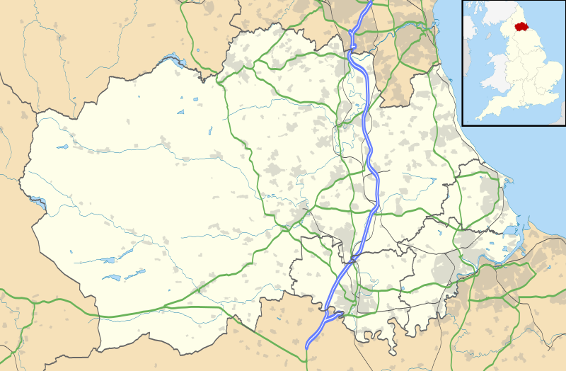
Map of County Durham, UK with the following information shown:
Equirectangular map projection on WGS 84 datum, with N/S stretched 170% Geographic limits:
|
| දිනය | |
| මූලාශ්රය |
|
| කර්තෘ | Nilfanion, created using Ordnance Survey data |
| අවසරය (මෙම ගොනුව නැවත භාවිතා කරමින්) |
මෙම ගොනුව ක්රියේටිව් කොමන්ස් Attribution-Share Alike 3.0 Unported වරපත යටතේ අවසර ලබා ඇත. Attribution: Contains Ordnance Survey data © Crown copyright and database right
|
| අනෙකුත් අනුවාදයන් | File:Durham UK district map (blank).svg - Blank map |
.svg)
ගොනු ඉතිහාසය
එම අවස්ථාවෙහිදී ගොනුව පැවැති ආකාරය නැරඹීමට දිනය/වේලාව මත ක්ලික් කරන්න.
| දිනය/වේලාව | කුඩා-රූපය | මාන | පරිශීලක | පරිකථනය | |
|---|---|---|---|---|---|
| වත්මන් | 19:04, 26 සැප්තැම්බර් 2010 | | 1,425 × 934 (1.39 මෙ.බ.) | Nilfanion | fixing dodgy layer |
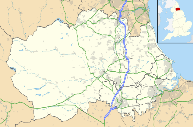
| 18:43, 26 සැප්තැම්බර් 2010 |  | 1,425 × 934 (1.39 මෙ.බ.) | Nilfanion | {{Information |Description=Map of County Durham, UK with the following information shown: *Administrative borders *Coastline, lakes and rivers *Roads and railways *Urban areas Equirectangular map projection on WGS 84 datum, with N/S s |
ගොනු භාවිතය
පහත දැක්වෙන පිටු 3 ක් විසින් මෙම ගොනුව භාවිතා කෙරෙයි:
ගෝලීය ගොනු භාවිතය
පහත දැක්වෙන අනෙකුත් විකියන් මගින් මෙම ගොනුව භාවිතා කරයි:
- ar.wikipedia.org හි භාවිතය
- azb.wikipedia.org හි භාවිතය
- bg.wikipedia.org හි භාවිතය
- ceb.wikipedia.org හි භාවිතය
- en.wikipedia.org හි භාවිතය
- Tanfield, County Durham
- Durham, England
- Barnard Castle
- Darlington
- Willington, County Durham
- Pity Me
- Chester-le-Street
- Hartlepool
- Stockton-on-Tees
- Bishop Auckland
- Seaham
- Sedgefield
- Peterlee
- Annfield Plain
- Easington, County Durham
- Consett
- Newton Aycliffe
- Catchgate
- Norton, County Durham
- Spennymoor
- Beamish Museum
- Stanley, County Durham
- Ferryhill
- Gainford, County Durham
- Billingham
- Eaglescliffe
- Ushaw College
- Lambton Castle
- No Place
- Burnhope
- Craghead
- Shotley Bridge
- Preston Hall, Preston-on-Tees
- Sacriston
- Cassop
- Teesside International Airport
- White-le-Head
- Tanfield Lea
- Quaking Houses
- South Moor
- Oxhill, County Durham
- Preston-on-Tees
- List of places in County Durham
- Lumley Castle
- East Kyo
මෙම ගොනුවේ තවත් ගෝලීය භාවිත බලන්න.