
ගොනුව:Derbyshire UK location map.svg

Size of this PNG preview of this SVG file: 406 × 599 පික්සල. අනෙකුත් විභේදනයන්: 162 × 240 පික්සල | 325 × 480 පික්සල | 520 × 768 පික්සල | 693 × 1,024 පික්සල | 1,387 × 2,048 පික්සල | 884 × 1,305 පික්සල.
මුල් ගොනුව (SVG ගොනුව, නාමමාත්රිකව 884 × 1,305 පික්සල්, ගොනු විශාලත්වය: 2.38 මෙ.බ.)
| විස්තරය |
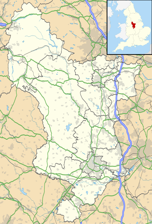
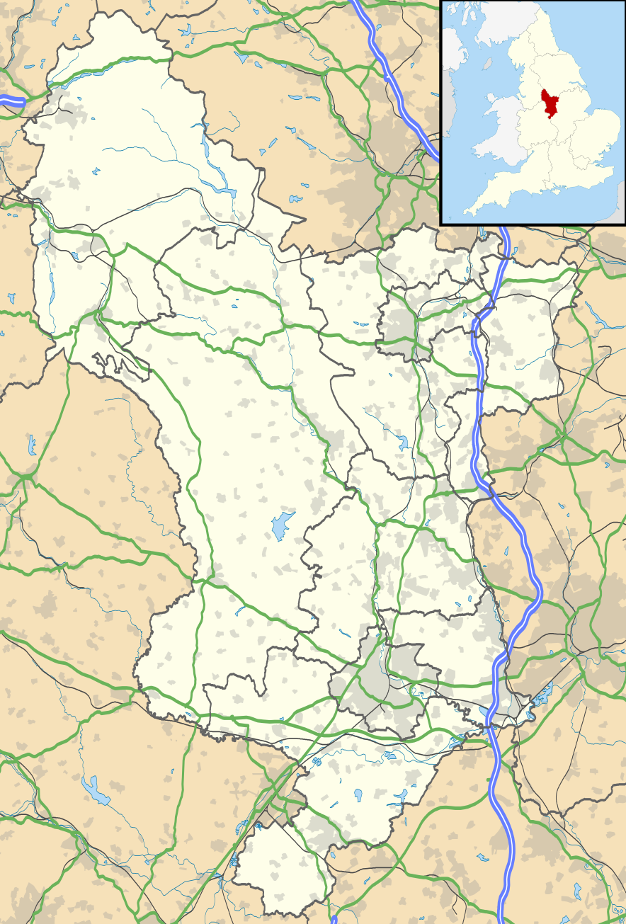
Map of Derbyshire, UK with the following information shown:
Equirectangular map projection on WGS 84 datum, with N/S stretched 165% Geographic limits:
|
| දිනය | |
| මූලාශ්රය |
|
| කර්තෘ | Nilfanion, created using Ordnance Survey data |
| අවසරය (මෙම ගොනුව නැවත භාවිතා කරමින්) |
මෙම ගොනුව ක්රියේටිව් කොමන්ස් Attribution-Share Alike 3.0 Unported වරපත යටතේ අවසර ලබා ඇත. Attribution: Contains Ordnance Survey data © Crown copyright and database right
|
| අනෙකුත් අනුවාදයන් | File:Devon UK district map (blank).svg - Blank map |
.svg)
ගොනු ඉතිහාසය
එම අවස්ථාවෙහිදී ගොනුව පැවැති ආකාරය නැරඹීමට දිනය/වේලාව මත ක්ලික් කරන්න.
| දිනය/වේලාව | කුඩා-රූපය | මාන | පරිශීලක | පරිකථනය | |
|---|---|---|---|---|---|
| වත්මන් | 18:46, 26 සැප්තැම්බර් 2010 | | 884 × 1,305 (2.38 මෙ.බ.) | Nilfanion | {{Information |Description=Map of Derbyshire, UK with the following information shown: *Administrative borders *Coastline, lakes and rivers *Roads and railways *Urban areas Equirectangular map projection on WGS 84 datum, with N/S stretch |
ගොනු භාවිතය
පහත දැක්වෙන පිටු 3 ක් විසින් මෙම ගොනුව භාවිතා කෙරෙයි:
ගෝලීය ගොනු භාවිතය
පහත දැක්වෙන අනෙකුත් විකියන් මගින් මෙම ගොනුව භාවිතා කරයි:
- ar.wikipedia.org හි භාවිතය
- bg.wikipedia.org හි භාවිතය
- ca.wikipedia.org හි භාවිතය
- ceb.wikipedia.org හි භාවිතය
- cs.wikipedia.org හි භාවිතය
- cy.wikipedia.org හි භාවිතය
- el.wikipedia.org හි භාවිතය
- en.wikipedia.org හි භාවිතය
- Derbyshire
- Chatsworth House
- Kedleston Hall
- Staveley, Derbyshire
- Glossop
- Buxton
- Calke Abbey
- Sudbury Hall
- Bolsover Castle
- Chesterfield, Derbyshire
- Thornhill, Derbyshire
- Newhaven, Derbyshire
- Gamesley
- Bretby Hall
- Birchinlee
- Ripley, Derbyshire
- Repton
- Eyam
- Edale
- Castleton, Derbyshire
- Hope, Derbyshire
- Hathersage
- Spondon
- Matlock, Derbyshire
- Matlock Bath
- Bolsover
- Ashbourne, Derbyshire
- Alfreton
- Heanor
- Pleasley
- Wirksworth
- Leam, Derbyshire
- Ilkeston
- Heage
- New Mills
- Long Eaton
- Littleover
- Mickleover
- Dronfield
- Tideswell
- Hartington, Derbyshire
මෙම ගොනුවේ තවත් ගෝලීය භාවිත බලන්න.