
ගොනුව:Cornwall UK location map.svg

Size of this PNG preview of this SVG file: 800 × 588 පික්සල. අනෙකුත් විභේදනයන්: 320 × 235 පික්සල | 640 × 471 පික්සල | 1,024 × 753 පික්සල | 1,280 × 941 පික්සල | 2,560 × 1,883 පික්සල | 1,425 × 1,048 පික්සල.
මුල් ගොනුව (SVG ගොනුව, නාමමාත්රිකව 1,425 × 1,048 පික්සල්, ගොනු විශාලත්වය: 1.66 මෙ.බ.)
| විස්තරය |
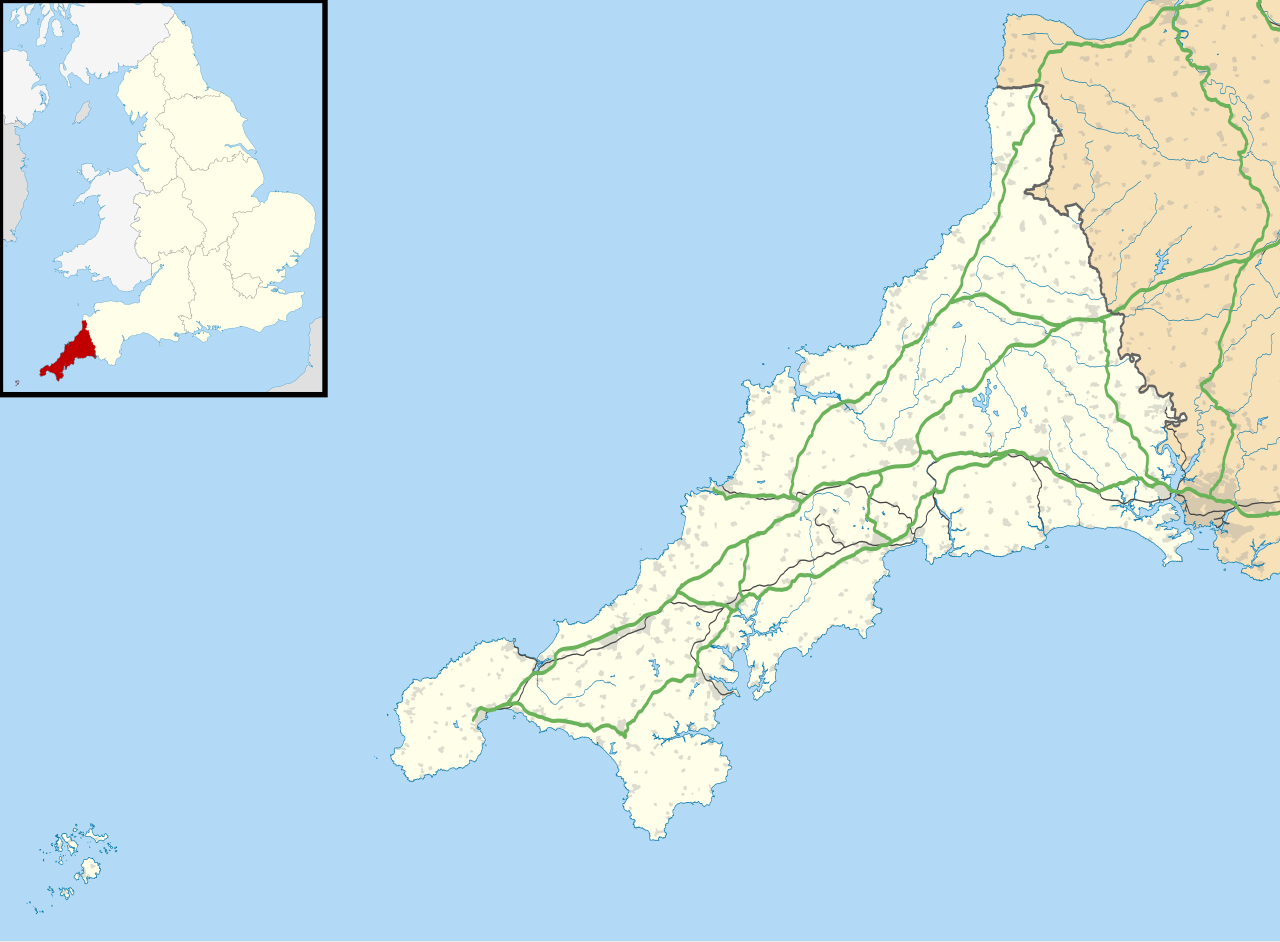
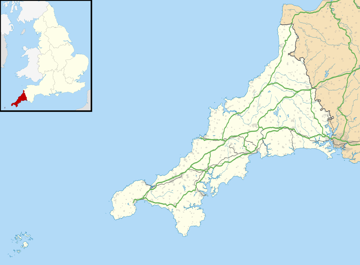
Map of Cornwall, UK with the following information shown:
Equirectangular map projection on WGS 84 datum, with N/S stretched 150% Geographic limits:
|
| දිනය | |
| මූලාශ්රය |
|
| කර්තෘ | Nilfanion, created using Ordnance Survey data |
| අවසරය (මෙම ගොනුව නැවත භාවිතා කරමින්) |
මෙම ගොනුව ක්රියේටිව් කොමන්ස් Attribution-Share Alike 3.0 Unported වරපත යටතේ අවසර ලබා ඇත. Attribution: Contains Ordnance Survey data © Crown copyright and database right
|
| අනෙකුත් අනුවාදයන් |
File:Cornwall UK district map (blank).svg - Blank map File:Cornwall UK mainland location map.svg - Without Isles of Scilly |
.svg)
ගොනු ඉතිහාසය
එම අවස්ථාවෙහිදී ගොනුව පැවැති ආකාරය නැරඹීමට දිනය/වේලාව මත ක්ලික් කරන්න.
| දිනය/වේලාව | කුඩා-රූපය | මාන | පරිශීලක | පරිකථනය | |
|---|---|---|---|---|---|
| වත්මන් | 18:43, 26 සැප්තැම්බර් 2010 | | 1,425 × 1,048 (1.66 මෙ.බ.) | Nilfanion | {{Information |Description=Map of Cornwall, UK with the following information shown: *Administrative borders *Coastline, lakes and rivers *Roads and railways *Urban areas Equirectangular map projection on WGS 84 datum, with N/S stretched 1 |
ගොනු භාවිතය
පහත දැක්වෙන පිටු 3 ක් විසින් මෙම ගොනුව භාවිතා කෙරෙයි:
ගෝලීය ගොනු භාවිතය
පහත දැක්වෙන අනෙකුත් විකියන් මගින් මෙම ගොනුව භාවිතා කරයි:
- ar.wikipedia.org හි භාවිතය
- bg.wikipedia.org හි භාවිතය
- ceb.wikipedia.org හි භාවිතය
- en.wikipedia.org හි භාවිතය
- List of lighthouses in England
- Tintagel Castle
- Chûn Castle
- Truro Cathedral
- Port Eliot
- Lanhydrock House
- Carn Brea, Redruth
- Runnel Stone
- RAF St Mawgan
- Jamaica Inn
- List of places in Cornwall
- Penryn Campus
- St German's Priory
- Rillaton Barrow
- Roseland Peninsula
- Pendennis Castle
- Tregenna Castle
- Tregothnan
- Picklecombe Fort
- Restormel Castle
- Redruth transmitting station
- St Bartholomew's Church, Lostwithiel
- Caradon Hill transmitting station
- Goldsithney
- Mount Wellington Tin Mine
- Brisons
- Penlee Battery
- Newquay Airport
- RNAS Culdrose (HMS Seahawk)
- Geevor Tin Mine
- Botallack Mine
- Camborne School of Mines
- Prideaux Place
- Cotehele
- Trerice
- The Hurlers (stone circles)
- Poldice mine
- Godolphin Estate
- RAF Davidstow Moor
- Levant Mine and Beam Engine
- Trelissick
- Antony House
- Mount Edgcumbe House
- Trengwainton Garden
- Trevenson
- St Ervan
- HMS Raleigh (shore establishment)
මෙම ගොනුවේ තවත් ගෝලීය භාවිත බලන්න.