
ගොනුව:Christchurch, New Zealand map.svg

Size of this PNG preview of this SVG file: 730 × 600 පික්සල. අනෙකුත් විභේදනයන්: 292 × 240 පික්සල | 584 × 480 පික්සල | 935 × 768 පික්සල | 1,246 × 1,024 පික්සල | 2,492 × 2,048 පික්සල | 948 × 779 පික්සල.
මුල් ගොනුව (SVG ගොනුව, නාමමාත්රිකව 948 × 779 පික්සල්, ගොනු විශාලත්වය: 94 කි.බ.)
| විස්තරය |
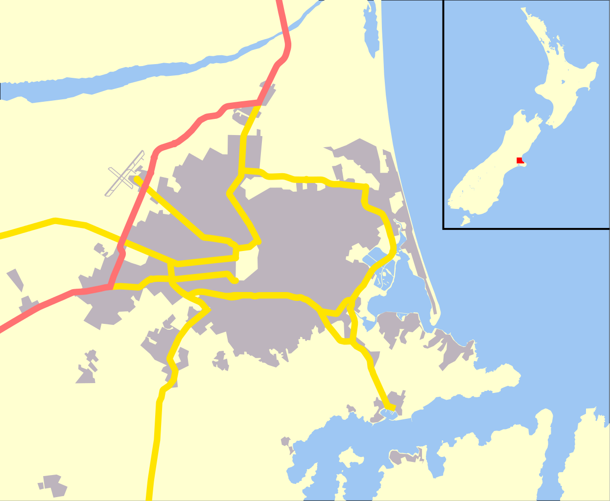
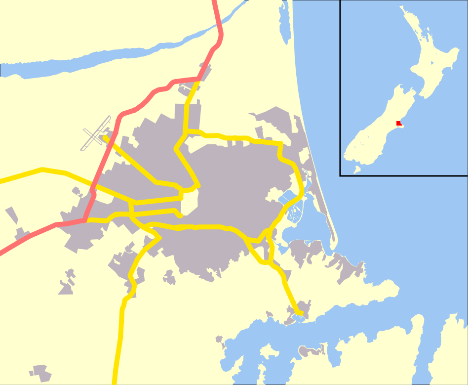
English: Map of Christchurch, New Zealand, derivative of OpenStreetMap. |
| දිනය | |
| මූලාශ්රය | ස්වයං නිර්මාණයකි |
| කර්තෘ | Benchill |
| අවසරය (මෙම ගොනුව නැවත භාවිතා කරමින්) |
මෙම ගොනුව නිර්මාණශීලී පොදුවූවන් Attribution-Share Alike 2.0 Generic බලපත්රය යටතේ අවසර ලබා ඇත.
|
| අනෙකුත් අනුවාදයන් | Derivative works of this file: Aidanfield map.jpg |
| SVG genesis |
ගොනු ඉතිහාසය
එම අවස්ථාවෙහිදී ගොනුව පැවැති ආකාරය නැරඹීමට දිනය/වේලාව මත ක්ලික් කරන්න.
| දිනය/වේලාව | කුඩා-රූපය | මාන | පරිශීලක | පරිකථනය | |
|---|---|---|---|---|---|
| වත්මන් | 01:13, 4 මැයි 2010 | | 948 × 779 (94 කි.බ.) | Benchill | {{Information |Description={{en|1=Map of Christchurch, New Zealand, derivative of OpenStreetMap.}} |Source={{own}} |Author=Benchill |Date=2010-05-04 |Permission={{cc-by-sa-2.0}} |other_versions= }} {{Created with Inkscape}} [[Category:Ma |
ගොනු භාවිතය
පහත දැක්වෙන පිටු 2 ක් විසින් මෙම ගොනුව භාවිතා කෙරෙයි:
ගෝලීය ගොනු භාවිතය
පහත දැක්වෙන අනෙකුත් විකියන් මගින් මෙම ගොනුව භාවිතා කරයි:
- ar.wikipedia.org හි භාවිතය
- bn.wikipedia.org හි භාවිතය
- br.wikipedia.org හි භාවිතය
- ceb.wikipedia.org හි භාවිතය
- da.wikipedia.org හි භාවිතය
- en.wikipedia.org හි භාවිතය
- Christchurch Airport
- Air Force Museum of New Zealand
- Cashmere High School
- Wigram Aerodrome
- Murray Aynsley Hill
- Cathedral of the Blessed Sacrament, Christchurch
- Sugarloaf (New Zealand)
- Module:Location map/data/New Zealand Christchurch/doc
- Christchurch Hospital
- 2011 Christchurch earthquake
- Cass Peak
- User:DeniseFord/sandbox
- Module:Location map/data/New Zealand Christchurch
- 1990 Eisenhower Trophy
- Christchurch mosque shootings
- Al Noor Mosque, Christchurch
- Linwood Islamic Centre
- Kennedy's Bush Scenic Reserve
- fa.wikipedia.org හි භාවිතය
- fr.wikipedia.org හි භාවිතය
- id.wikipedia.org හි භාවිතය
- ja.wikipedia.org හි භාවිතය
- kn.wikipedia.org හි භාවිතය
- ko.wikipedia.org හි භාවිතය
- pt.wikipedia.org හි භාවිතය
- sw.wikipedia.org හි භාවිතය
- th.wikipedia.org හි භාවිතය
- tr.wikipedia.org හි භාවිතය
- ur.wikipedia.org හි භාවිතය
- uz.wikipedia.org හි භාවිතය
මෙම ගොනුවේ තවත් ගෝලීය භාවිත බලන්න.