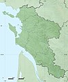
ගොනුව:Charente-Maritime department location map.svg
Appearance

Size of this PNG preview of this SVG file: 499 × 600 පික්සල. අනෙකුත් විභේදනයන්: 200 × 240 පික්සල | 399 × 480 පික්සල | 639 × 768 පික්සල | 852 × 1,024 පික්සල | 1,704 × 2,048 පික්සල | 942 × 1,132 පික්සල.
මුල් ගොනුව (SVG ගොනුව, නාමමාත්රිකව 942 × 1,132 පික්සල්, ගොනු විශාලත්වය: 425 කි.බ.)
ගොනු ඉතිහාසය
එම අවස්ථාවෙහිදී ගොනුව පැවැති ආකාරය නැරඹීමට දිනය/වේලාව මත ක්ලික් කරන්න.
| දිනය/වේලාව | කුඩා-රූපය | මාන | පරිශීලක | පරිකථනය | |
|---|---|---|---|---|---|
| වත්මන් | 02:43, 15 ඔක්තෝබර් 2008 |  | 942 × 1,132 (425 කි.බ.) | Sting | == Summary == {{Location|45|44|15|N|00|46|30|W|scale:1000000}} <br/> {{Information |Description={{en|Blank administrative map of the department of Charente-Maritime, France, for geo-location purpose, with distinct boundaries for |
ගොනු භාවිතය
පහත දැක්වෙන පිටු 2 ක් විසින් මෙම ගොනුව භාවිතා කෙරෙයි:
ගෝලීය ගොනු භාවිතය
පහත දැක්වෙන අනෙකුත් විකියන් මගින් මෙම ගොනුව භාවිතා කරයි:
- als.wikipedia.org හි භාවිතය
- ar.wikipedia.org හි භාවිතය
- ceb.wikipedia.org හි භාවිතය
- cs.wikipedia.org හි භාවිතය
- cy.wikipedia.org හි භාවිතය
- de.wikipedia.org හි භාවිතය
- en.wikipedia.org හි භාවිතය
- eo.wikipedia.org හි භාවිතය
- La Rochelle
- Saint-Trojan-les-Bains
- Île-d'Aix
- La Jarrie
- Esnandes
- Ŝablono:Informkesto ponto
- Ŝablono:Informkesto ponto/dokumentado
- Ponto de Oléron
- Rochefort (Charente-Maritime)
- Marennes (Charente-Maritime)
- Ŝablono:Situo sur mapo Francio Charente-Maritime
- Surgères
- Saint-Denis-d'Oléron
- Saint-Pierre-d'Oléron
- Saint-Georges-d'Oléron
- Hiers-Brouage
- Bourcefranc-le-Chapus
- Marsilly (Charente-Maritime)
- Lagord
- L'Houmeau
- Les Mathes
- Saint-Xandre
- La Brée-les-Bains
- Nieul-sur-Mer
- Puilboreau
- Charron (Charente-Maritime)
- Andilly (Charente-Maritime)
- Mornac-sur-Seudre
- Dompierre-sur-Mer
- Sainte-Soulle
මෙම ගොනුවේ තවත් ගෝලීය භාවිත බලන්න.


