
ගොනුව:Canada Southern Quebec location map.png
මෙයට ඉහල විසර්ජනයක් ලබාගත නොහැක.
Canada_Southern_Quebec_location_map.png (535 × 435 පික්සල, ගොනු විශාලත්වය: 133 කි.බ., MIME ශෛලිය: image/png)
සාරාංශය
| විස්තරය |
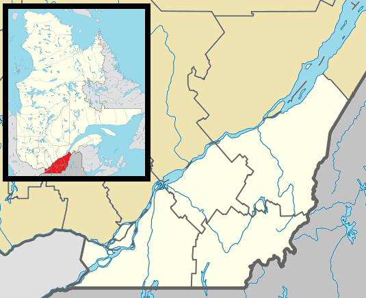
English: Map of southern Québec Province within Canada, for use in location map templates. Français : Carte du sud du Québec. |
| දිනය | (UTC) |
| මූලාශ්රය |
This file was derived from : Canada Quebec location map 2.svg:  |
| කර්තෘ |
|

|
This locator map image could be re-created using vector graphics as an SVG file. This has several advantages; see Commons:Media for cleanup for more information. If an SVG form of this image is available, please upload it and afterwards replace this template with
{{vector version available|new image name}}.
It is recommended to name the SVG file “Canada Southern Quebec location map.svg”—then the template Vector version available (or Vva) does not need the new image name parameter. |
බලපත්රීකරණය
මෙම කෘතියෙහි හිමිකම් අයිතීන් දරන්නා වන මම,පහත වරපත යටතේ එය ප්රකාශයට පත් කරමි:
| මම, මෙම කාර්යයේ ප්රතිරූපණ අයිති හිමිකරු, මෙම කාර්යය public domain වෙත නිදහස් කරමි. මෙය ලෝක ව්යාප්තව අදාළ වේ. සමහර රටවල මෙය අනීතික විය හැකිය. එසේ වුවහොත්; මම කිසිදු කොන්දේසියකින් තොරව,ඕනෑම අයෙකුට ඕනෑම කාර්යයක් සඳහා මෙය, නීතිමය බාධාවක් නොමැති වනතුරු, භාවිතා කිරීමේ අයිතිය ලබාදෙමි. |
ප්රකෘති පැටවුම් ලොගය
This image is a derivative work of the following images:
- File:Canada_Quebec_location_map_2.svg licensed with PD-self
- 2009-09-24T18:30:53Z Hanhil 2316x2822 (2687510 Bytes) {{Information |Description={{en|1=Québec Province within Canada.}} {{es|1=Provincia de Quebec en Canadá.}} |Source=Based on [[:Image:Canada_Quebec_location_map.svg]] |Author=~~~~ based on [[User:EOZyo|EOZyo]] |Date=2009-09-
Uploaded with derivativeFX
ගොනු ඉතිහාසය
එම අවස්ථාවෙහිදී ගොනුව පැවැති ආකාරය නැරඹීමට දිනය/වේලාව මත ක්ලික් කරන්න.
| දිනය/වේලාව | කුඩා-රූපය | මාන | පරිශීලක | පරිකථනය | |
|---|---|---|---|---|---|
| වත්මන් | 03:42, 2 මැයි 2013 | | 535 × 435 (133 කි.බ.) | Gordalmighty | boundary fix |
| 14:46, 1 මැයි 2013 |  | 535 × 435 (132 කි.බ.) | Gordalmighty | colour problem | |
| 05:25, 1 මැයි 2013 |  | 535 × 435 (133 කි.බ.) | Gordalmighty | uploaded proper file | |
| 04:47, 1 මැයි 2013 |  | 535 × 435 (102 කි.බ.) | Gordalmighty | boundary fix | |
| 19:12, 23 අප්රේල් 2013 |  | 520 × 420 (93 කි.බ.) | Gordalmighty | localized map to south of Saint Lawrence River & added colour | |
| 00:13, 15 දෙසැම්බර් 2012 |  | 600 × 400 (92 කි.බ.) | P199 | == {{int:filedesc}} == {{Information |Description={{en|1=Map of southern Québec Province within Canada, for use in location map templates.}} |Source={{Derived from|Canada_Quebec_location_map_2.svg|display=50}} |Date=2012-12-15 00:12 (UTC) |Author=*[[:... |
ගොනු භාවිතය
පහත දැක්වෙන පිටු 3 ක් විසින් මෙම ගොනුව භාවිතා කෙරෙයි:
ගෝලීය ගොනු භාවිතය
පහත දැක්වෙන අනෙකුත් විකියන් මගින් මෙම ගොනුව භාවිතා කරයි:
- ar.wikipedia.org හි භාවිතය
- ca.wikipedia.org හි භාවිතය
- ceb.wikipedia.org හි භාවිතය
- diq.wikipedia.org හි භාවිතය
- el.wikipedia.org හි භාවිතය
- en.wikipedia.org හි භාවිතය
- Longueuil
- Westmount
- Dorval
- Hampstead, Quebec
- Mount Royal, Quebec
- L'Île-Dorval
- Sainte-Anne-de-Bellevue
- Laval, Quebec
- Sherbrooke
- Stanstead, Quebec
- Saint-Jean-sur-Richelieu
- Granby, Quebec
- Châteauguay
- Lévis
- Victoriaville
- Saint-Hyacinthe
- Beaconsfield, Quebec
- Baie-D'Urfé
- Lennoxville, Quebec
- Pointe-Claire
- Thetford Mines
- Saint-Hubert, Quebec
- Saint-Georges, Quebec
- Boucherville
- Pointe-Fortune, Quebec
- Rigaud, Quebec
- Vaudreuil-Dorion
- Richmond, Quebec
- Greenfield Park, Quebec
- Saint-Lambert, Montérégie
- Brossard
- Dollard-des-Ormeaux
- Sorel-Tracy
- Sainte-Julie, Quebec
- Salaberry-de-Valleyfield
- Saint-Bruno-de-Montarville
- Saint-Constant, Quebec
- Kirkland, Quebec
- Chambly, Quebec
- Varennes, Quebec
- Beloeil, Quebec
- La Prairie, Quebec
- Sainte-Catherine, Quebec
- Magog, Quebec
මෙම ගොනුවේ තවත් ගෝලීය භාවිත බලන්න.