
ගොනුව:Buckinghamshire UK location map.svg

Size of this PNG preview of this SVG file: 507 × 600 පික්සල. අනෙකුත් විභේදනයන්: 203 × 240 පික්සල | 406 × 480 පික්සල | 649 × 768 පික්සල | 865 × 1,024 පික්සල | 1,731 × 2,048 පික්සල | 1,070 × 1,266 පික්සල.
මුල් ගොනුව (SVG ගොනුව, නාමමාත්රිකව 1,070 × 1,266 පික්සල්, ගොනු විශාලත්වය: 2.13 මෙ.බ.)
| විස්තරය |
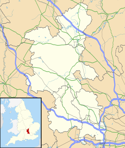
Map of Buckinghamshire, UK with the following information shown:
Equirectangular map projection on WGS 84 datum, with N/S stretched 160% Geographic limits:
|
| දිනය | |
| මූලාශ්රය |
|
| කර්තෘ | Nilfanion, created using Ordnance Survey data |
| අවසරය (මෙම ගොනුව නැවත භාවිතා කරමින්) |
මෙම ගොනුව ක්රියේටිව් කොමන්ස් Attribution-Share Alike 3.0 Unported වරපත යටතේ අවසර ලබා ඇත. Attribution: Contains Ordnance Survey data © Crown copyright and database right
|
| අනෙකුත් අනුවාදයන් | File:Buckinghamshire UK district map (blank).svg - Blank map |
.svg)
ගොනු ඉතිහාසය
එම අවස්ථාවෙහිදී ගොනුව පැවැති ආකාරය නැරඹීමට දිනය/වේලාව මත ක්ලික් කරන්න.
| දිනය/වේලාව | කුඩා-රූපය | මාන | පරිශීලක | පරිකථනය | |
|---|---|---|---|---|---|
| වත්මන් | 18:41, 26 සැප්තැම්බර් 2010 | | 1,070 × 1,266 (2.13 මෙ.බ.) | Nilfanion | {{Information |Description=Map of Buckinghamshire, UK with the following information shown: *Administrative borders *Coastline, lakes and rivers *Roads and railways *Urban areas Equirectangular map projection on WGS 84 datum, with N |
ගොනු භාවිතය
පහත දැක්වෙන පිටු 3 ක් විසින් මෙම ගොනුව භාවිතා කෙරෙයි:
ගෝලීය ගොනු භාවිතය
පහත දැක්වෙන අනෙකුත් විකියන් මගින් මෙම ගොනුව භාවිතා කරයි:
- ar.wikipedia.org හි භාවිතය
- bg.wikipedia.org හි භාවිතය
- ceb.wikipedia.org හි භාවිතය
- cs.wikipedia.org හි භාවිතය
- en.wikipedia.org හි භාවිතය
- Amersham
- Milton Keynes
- High Wycombe
- Aylesbury
- Buckingham
- Maids Moreton
- Southcourt
- West Wycombe
- Chesham
- Quarrendon
- Bedgrove
- Stoke Mandeville
- Great and Little Kimble cum Marsh
- Cheddington
- New Zealand, Buckinghamshire
- California, Buckinghamshire
- Aston Clinton
- Beaconsfield
- Bierton
- Wendover
- Broughton, Aylesbury
- Great and Little Hampden
- Winslow, Buckinghamshire
- Cliveden
- Amersham station
- RAF Halton
- Long Crendon
- Shabbington
- Addington, Buckinghamshire
- Adstock
- Monks Risborough
- Princes Risborough
- Calvert, Buckinghamshire
- Woughton (parish)
- Olney, Buckinghamshire
- Hughenden Valley
- Castlethorpe
- Watermead, Buckinghamshire
- Caldecote, Buckinghamshire
- Whiteleaf, Buckinghamshire
- Newport Pagnell
- Tylers Green
- Dorney
- Stowe, Buckinghamshire
මෙම ගොනුවේ තවත් ගෝලීය භාවිත බලන්න.