
ගොනුව:Bratislava Region - physical map.png

මෙම පෙරදසුනෙහි විශාලත්වය: 494 × 600 පික්සල. අනෙකුත් විභේදනයන්: 198 × 240 පික්සල | 560 × 680 පික්සල.
මුල් ගොනුව (560 × 680 පික්සල, ගොනු විශාලත්වය: 1.09 මෙ.බ., MIME ශෛලිය: image/png)
| විස්තරය |
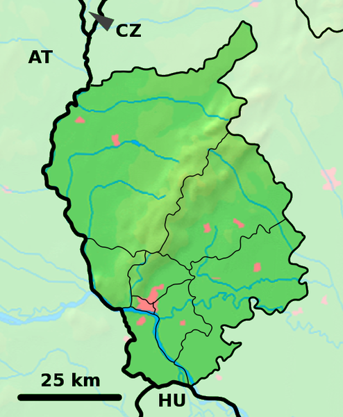
Background map of the Bratislava Region, Slovakia, ready for the Geobox template, calibrated at en:Template:Geobox locator Bratislava Region Outline map of the Bratislava Region, Slovakia, ready for the Geobox template, calibrated at en:Template:Geobox locator Bratislava Region |
| දිනය | (UTC) |
| මූලාශ්රය | |
| කර්තෘ |
|
| This is a retouched picture, which means that it has been digitally altered from its original version. Modifications: fusion. The original can be viewed here: Bratislava Region - outline map.svg:
|
මෙම ගොනුව ක්රියේටිව් කොමන්ස් Attribution-Share Alike 3.0 Unported වරපත යටතේ අවසර ලබා ඇත.
- ඔබ නිදහස්:
- බෙදාහදා ගැනීමට – කාර්යය පිටපත් කිරීමට,බෙදා හැරීමට සහ සම්ප්රේෂණය කිරීමට
- නැවත සංකලනය කිරීමට – කාර්යයට අනුවර්තනය වීමට
- පහත කොන්දේසිවලට යටත්ව:
- attribution – වරපත වෙත බැඳියක්ද සපයමින් ඔබ විසින් සුදුසු කර්තෘභාරය ප්රදානය කල යුතු අතර, කිසියම් වෙනස්වීම් සිදුකලේ නම් එයද සඳහන් කල යුතු වෙයි. ඕනෑම සුදුසු ආකාරයට මෙය ඔබ විසින් සිදුකල හැකි මුත්, වරපත්දායකයා විසින් ඔබ හෝ ඔබගේ භාවිතය හෝ පිටසන් කරන බවට ඇඟවෙන ලෙසින් එය සිදු නොකල යුතු වෙයි.
- share alike – මෙම විෂය කාරණා භාවිතා කොට නැවත සංකලනය, ප්රතියෝජනය හෝ වැඩිදියුණුව කලේ නම්, ඉන්පසු ඔබගේ දායකත්වය ඔබ විසින් බෙදාහැරිය යුත්තේ මුල් වරපත හා සමාන හෝ සංගතික හෝ වරපතක් භාවිතා කරමිනි.
ප්රකෘති පැටවුම් ලොගය
This image is a derivative work of the following images:
- File:Bratislava_Region_-_background_map.png licensed with PD-Demis
- 2007-10-28T23:14:11Z Caroig 560x680 (333118 Bytes) fixing alignment
- 2007-10-27T19:44:14Z Caroig 560x680 (335827 Bytes) == Summary == {{Information |Description=Background map of the Bratislava Region, Slovakia, ready for the [[:en:Template:Geobox|Geobox]] template, calibrated at [[:en:Template:Geobox locator Bratislava Region]] |Source=Made m
- File:Bratislava_Region_-_outline_map.svg licensed with Cc-by-sa-3.0,2.5,2.0,1.0, GFDL
- 2007-10-27T19:47:14Z Caroig 700x850 (120252 Bytes) == Summary == {{Information |Description=Outline map of the Bratislava Region, Slovakia, ready for the [[:en:Template:Geobox|Geobox]] template, calibrated at [[:en:Template:Geobox locator Bratislava Region]] |Source=self-made
Uploaded with derivativeFX
ගොනු ඉතිහාසය
එම අවස්ථාවෙහිදී ගොනුව පැවැති ආකාරය නැරඹීමට දිනය/වේලාව මත ක්ලික් කරන්න.
| දිනය/වේලාව | කුඩා-රූපය | මාන | පරිශීලක | පරිකථනය | |
|---|---|---|---|---|---|
| වත්මන් | 18:01, 19 සැප්තැම්බර් 2010 | | 560 × 680 (1.09 මෙ.බ.) | Adehertogh | {{Information |Description=Background map of the Bratislava Region, Slovakia, ready for the Geobox template, calibrated at en:Template:Geobox locator Bratislava Region Outline map of the Bratislava Region, Slovakia, ready for |
ගොනු භාවිතය
පහත දැක්වෙන පිටු 2 ක් විසින් මෙම ගොනුව භාවිතා කෙරෙයි:
ගෝලීය ගොනු භාවිතය
පහත දැක්වෙන අනෙකුත් විකියන් මගින් මෙම ගොනුව භාවිතා කරයි:
- bg.wikipedia.org හි භාවිතය
- en.wikipedia.org හි භාවිතය
- Pezinok
- Gajary
- Malacky
- Petržalka
- Modra
- Svätý Jur
- Dunajská Lužná
- Senec, Slovakia
- Vysoká pri Morave
- Jakubov
- Kostolište
- Suchohrad
- Jablonové, Malacky District
- Pernek
- Kuchyňa
- Rusovce
- Jarovce
- Blatné
- Rohožník, Malacky District
- Borinka
- Zohor
- Láb
- Lozorno
- Marianka
- Plavecké Podhradie
- Plavecký Mikuláš
- Plavecký Štvrtok
- Sološnica
- Studienka
- Veľké Leváre
- Závod, Slovakia
- Budmerice
- Báhoň
- Doľany, Pezinok District
- Dubová, Pezinok District
- Jablonec, Pezinok District
- Slovenský Grob
- Vinosady
- Limbach, Slovakia
- Viničné
- Vištuk
- Štefanová, Pezinok District
- Šenkvice
- Častá
- Bernolákovo
- Boldog, Slovakia
මෙම ගොනුවේ තවත් ගෝලීය භාවිත බලන්න.