
ගොනුව:Brandenburg relief location map.jpg

මෙම පෙරදසුනෙහි විශාලත්වය: 570 × 600 පික්සල. අනෙකුත් විභේදනයන්: 228 × 240 පික්සල | 456 × 480 පික්සල | 730 × 768 පික්සල | 973 × 1,024 පික්සල | 1,578 × 1,661 පික්සල.
මුල් ගොනුව (1,578 × 1,661 පික්සල, ගොනු විශාලත්වය: 794 කි.බ., MIME ශෛලිය: image/jpeg)
| විස්තරය |
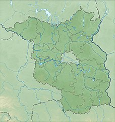
Quadratische Plattkarte, N-S-Streckung 160 %. Geographische Begrenzung der Karte:
Equirectangular projection, N/S stretching 160 %. Geographic limits of the map:
|
| දිනය | |
| මූලාශ්රය |
ස්වයං නිර්මාණයකි |
| කර්තෘ | Grundkarte NordNordWest, Relief Alexrk2 |
| අනෙකුත් අනුවාදයන් |
|


|
This map has been made or improved in the German Kartenwerkstatt (Map Lab). You can propose maps to improve as well.
|
බලපත්රීකරණය
මෙම කෘතියෙහි හිමිකම් අයිතීන් දරන්නා වන මම,පහත වරපත යටතේ එය ප්රකාශයට පත් කරමි:
මෙම ගොනුව ක්රියේටිව් කොමන්ස් Attribution-Share Alike 3.0 Unported වරපත යටතේ අවසර ලබා ඇත.
- ඔබ නිදහස්:
- බෙදාහදා ගැනීමට – කාර්යය පිටපත් කිරීමට,බෙදා හැරීමට සහ සම්ප්රේෂණය කිරීමට
- නැවත සංකලනය කිරීමට – කාර්යයට අනුවර්තනය වීමට
- පහත කොන්දේසිවලට යටත්ව:
- attribution – වරපත වෙත බැඳියක්ද සපයමින් ඔබ විසින් සුදුසු කර්තෘභාරය ප්රදානය කල යුතු අතර, කිසියම් වෙනස්වීම් සිදුකලේ නම් එයද සඳහන් කල යුතු වෙයි. ඕනෑම සුදුසු ආකාරයට මෙය ඔබ විසින් සිදුකල හැකි මුත්, වරපත්දායකයා විසින් ඔබ හෝ ඔබගේ භාවිතය හෝ පිටසන් කරන බවට ඇඟවෙන ලෙසින් එය සිදු නොකල යුතු වෙයි.
- share alike – මෙම විෂය කාරණා භාවිතා කොට නැවත සංකලනය, ප්රතියෝජනය හෝ වැඩිදියුණුව කලේ නම්, ඉන්පසු ඔබගේ දායකත්වය ඔබ විසින් බෙදාහැරිය යුත්තේ මුල් වරපත හා සමාන හෝ සංගතික හෝ වරපතක් භාවිතා කරමිනි.
ගොනු ඉතිහාසය
එම අවස්ථාවෙහිදී ගොනුව පැවැති ආකාරය නැරඹීමට දිනය/වේලාව මත ක්ලික් කරන්න.
| දිනය/වේලාව | කුඩා-රූපය | මාන | පරිශීලක | පරිකථනය | |
|---|---|---|---|---|---|
| වත්මන් | 18:13, 14 ඔක්තෝබර් 2009 | | 1,578 × 1,661 (794 කි.බ.) | Alexrk2 | {{Information |Description= {{de|Physische Positionskarte von Brandenburg, Deutschland}} Quadratische Plattkarte, N-S-Streckung 160 %. Geographische Begrenzung der Karte: * N: 53.7° N * S: 51.2° N * W: 11.1° O * |
ගොනු භාවිතය
පහත දැක්වෙන පිටු 3 ක් විසින් මෙම ගොනුව භාවිතා කෙරෙයි:
ගෝලීය ගොනු භාවිතය
පහත දැක්වෙන අනෙකුත් විකියන් මගින් මෙම ගොනුව භාවිතා කරයි:
- als.wikipedia.org හි භාවිතය
- ar.wikipedia.org හි භාවිතය
- ba.wikipedia.org හි භාවිතය
- bg.wikipedia.org හි භාවිතය
- bn.wikipedia.org හි භාවිතය
- ceb.wikipedia.org හි භාවිතය
- cs.wikipedia.org හි භාවිතය
- de.wikipedia.org හි භාවිතය
- Benutzer Diskussion:Ahoerstemeier
- Talsperre Spremberg
- Burg Ziesar
- Zauche
- Burg Blankenburg
- Griebnitzsee
- Mittelturm (Königs Wusterhausen)
- Hagelberg
- Scharmützelsee
- Kleiner Ravensberg
- Pfingstberg (Potsdam)
- Werbellinsee
- Burg Rabenstein (Fläming)
- Neuer Garten
- Schermützelsee
- Klostersee (Lehnin)
- Park Babelsberg
- Fahrlander See
- Heiliger See (Potsdam)
- Kutschenberg
- Heidehöhe
- Sacrower See
- Weißer See (Potsdam)
මෙම ගොනුවේ තවත් ගෝලීය භාවිත බලන්න.