
ගොනුව:Australia Victoria Mitchell Shire location map.svg

Size of this PNG preview of this SVG file: 533 × 498 පික්සල. අනෙකුත් විභේදනයන්: 257 × 240 පික්සල | 514 × 480 පික්සල | 822 × 768 පික්සල | 1,096 × 1,024 පික්සල | 2,192 × 2,048 පික්සල.
මුල් ගොනුව (SVG ගොනුව, නාමමාත්රිකව 533 × 498 පික්සල්, ගොනු විශාලත්වය: 551 කි.බ.)
| විස්තරය |
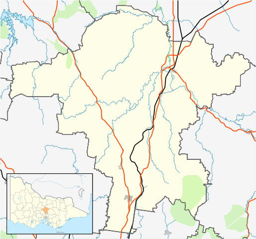
English: Blank map of w:Mitchell Shire, Victoria, Australia, with the following information shown:
Geographic limits:
|
||
| මූලාශ්රය | ස්වයං නිර්මාණයකි | ||
| කර්තෘ | Cassowary |

ගොනු ඉතිහාසය
එම අවස්ථාවෙහිදී ගොනුව පැවැති ආකාරය නැරඹීමට දිනය/වේලාව මත ක්ලික් කරන්න.
| දිනය/වේලාව | කුඩා-රූපය | මාන | පරිශීලක | පරිකථනය | |
|---|---|---|---|---|---|
| වත්මන් | 20:14, 17 පෙබරවාරි 2011 | | 533 × 498 (551 කි.බ.) | Cassowary | {{Information |Description ={{en|1=Blank map of Melbourne, Victoria, Australia, with the following information shown: * LGA boundaries * Coastline, lakes and rivers * Roads and railways * Urban areas * Parks Geographic lim |
ගොනු භාවිතය
පහත දැක්වෙන පිටු 2 ක් විසින් මෙම ගොනුව භාවිතා කෙරෙයි:
ගෝලීය ගොනු භාවිතය
පහත දැක්වෙන අනෙකුත් විකියන් මගින් මෙම ගොනුව භාවිතා කරයි:
- ar.wikipedia.org හි භාවිතය
- ceb.wikipedia.org හි භාවිතය
- en.wikipedia.org හි භාවිතය
- Shire of Mitchell
- Seymour, Victoria
- Avenel, Victoria
- Kilmore, Victoria
- Wallan
- Beveridge, Victoria
- Puckapunyal
- Wandong
- Mia Mia, Victoria
- Broadford, Victoria
- Tallarook
- Pyalong
- Flowerdale, Victoria
- Tooborac
- Emu Flat, Victoria
- Template:Towns in Mitchell Shire
- Heathcote Junction, Victoria
- Clonbinane
- Kilmore East, Victoria
- Mangalore, Victoria
- Module:Location map/data/Australia Victoria Shire of Mitchell/doc
- Trawool
- Mount Fraser (Australia)
- Glenaroua
- Upper Plenty
- Northwood, Victoria
- Moranding
- Reedy Creek, Victoria
- Tyaak
- Waterford Park, Victoria
- Willowmavin
- Module:Location map/data/Australia Victoria Shire of Mitchell
- Sugarloaf Creek, Victoria
- Heathcote South, Victoria
- Sunday Creek, Victoria
- Hume's Pass
- User:Viatori/sandbox
- User:ThylacineHunter/LGA
- fa.wikipedia.org හි භාවිතය
- kn.wikipedia.org හි භාවිතය
- simple.wikipedia.org හි භාවිතය
- tr.wikipedia.org හි භාවිතය
- uz.wikipedia.org හි භාවිතය
- war.wikipedia.org හි භාවිතය
මෙම ගොනුවේ තවත් ගෝලීය භාවිත බලන්න.